Monthly Archives: March 2026

From Space to the Sea: Oceanography Across Multiple Spatiotemporal Scales

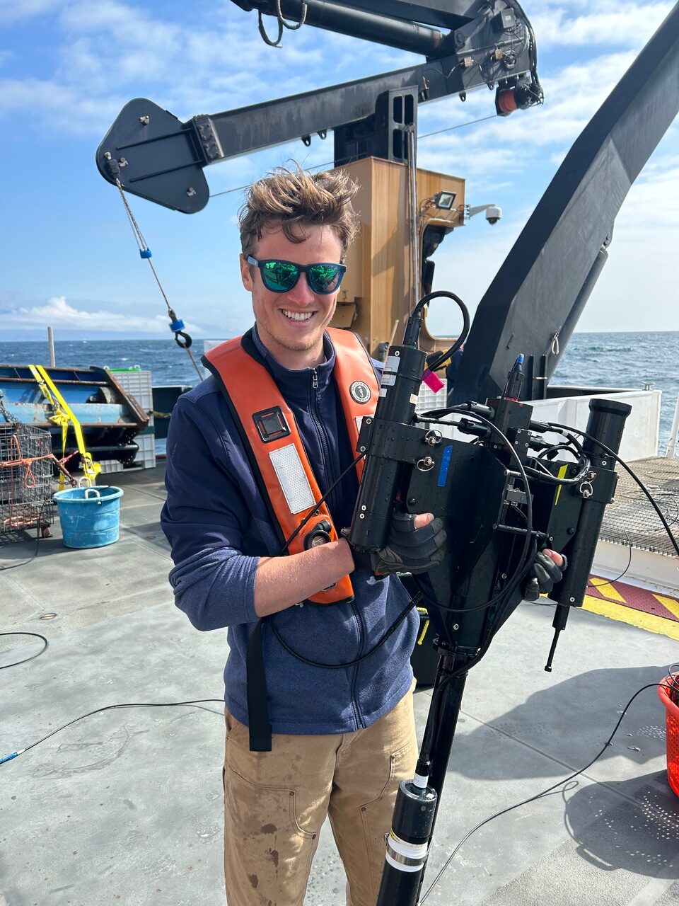
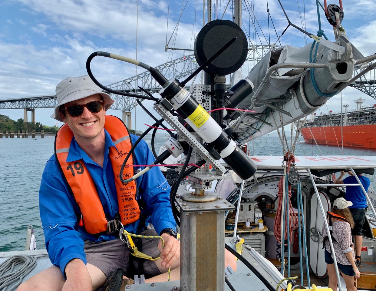
One of the greatest modern day science tools is satellite imagery. The remote capture of images from space allows researchers to understand spatial ecology better than ever before. However, it’s imperative to know that what you can glean from remote sensing is accurate to what’s occurring at the ground (or sea) level. In fact, if you were looking at a satellite image the minute it’s taken, and zoomed all the way in, you might see a research vessel with Alexander Bailess on board.

Alexander is a second-year Ph.D. student in the College of Earth, Ocean, and Atmospheric Sciences, joint-advised by Dr. Maria Kavanaugh and Dr. Andrew Barnard. Part of his doctoral research is ground-truthing, or verifying, remote sensing data by sailing the seas and collecting data at the same time that satellites are.

 Alexander holding an underwater camera system for satellite matchups aboard the R/V Ruben Lasker.

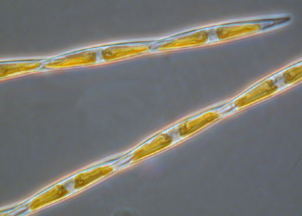
At sea, Alexander is also looking for a phytoplankton called Pseudo-nitzschia. Almost half of Pseudo-nitzschia species produce a potent neurotoxin called domoic acid (DA) which can cause a disorder in humans called amnesic shellfish poisoning. Harmful algae blooms (HABs) occur during dense aggregations of Pseudo-nitzschia, poisoning organisms with DA across the trophic web. Work like Alexander’s is important because it can help establish monitoring and management systems for HABs, allowing recreational and commercial fisheries to avoid toxic conditions. Fishermen citizen scientists also assist in this research by collecting water at-sea for researchers, like Alexander, to analyze.

A photo of a Pseudo-nitzschia (credit: Wikipedia).

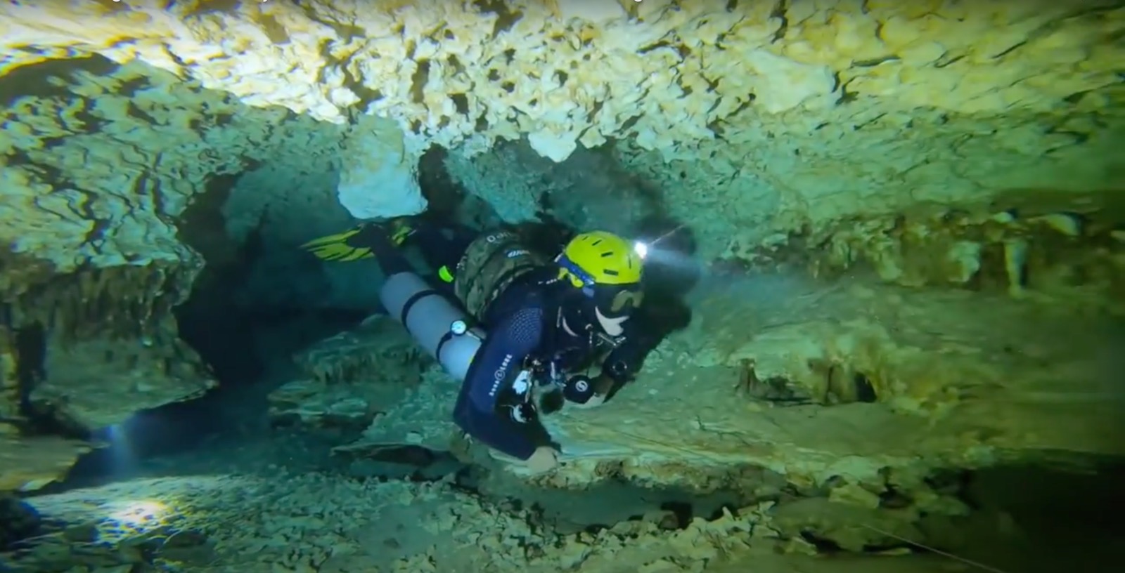
Alexander’s work has taken him on dozens of research cruises all along the U.S. west coast. He is also a Scientific Diver and Divemaster, meaning his work often takes him below the sea surface as well — conducting surveys that connect what satellites see from above to what is living in the water below.

Alexander collecting water samples in an underground aquifer.
Alexander on the S/V Tara, working with a new prototype for measuring ocean color.

Written by: Taylor Azizeh

Entering Tsunami Hazard Zone

Look out the window of a car driving along Oregon’s coastal highway 101 and you will see many roadside signs indicating the boundaries of the coastal tsunami zone. Natural phenomena can cause massive amounts of damage to the communities that happen to lie in their paths, the effects of which can last days, months, and even years beyond the actual event. In the wake of disaster, people are often unable to access necessary resources or are left stranded waiting for help. Community design and engineering don’t always take into account the personal lived needs of those within the community, therefore a human centered approach is needed to compliment quantitative disaster projections and more accurately predict the most effective plan for community recovery.

This is where engineering and social science collide. Our guest this week is Amina Meselhe, a 2nd year PhD student in the School of Civil and Construction Engineering. Amina’s current PhD project involves simulating the damage and recovery trajectories for the Cascadia Subduction Zone in the event of a tsunami. Her self-described research goal is to “create tangible outcomes for people to hold onto”. Her acute awareness for disaster preparedness comes from the fact that she grew up in Louisiana seeing the damage that hurricanes can cause and the lasting effects they have on people.

Tune into KBVR 88.7 FM at 7:00 pm PST on March 8th to hear Amina talk about what she is doing to improve the preparedness of communities along the Oregon coast, the research methods used by engineers to incorporate social science into their designs, and why “natural disaster” is a taboo term in the field.

When the Party’s Over: The Effects of Megafire on Oregon’s Forest Ecosystems

Every year, wildfires ravage the American West. According to NOAA and the National Interagency Fire Center (NIFC), in 2025 alone 72,068 fires burned across more than 5 million acres in the US*. In the wake of these fires, a question looms: what now? Careful forest management could help prevent future fires in a post-burn area, but this requires balancing removal of fuel sources with maintaining crucial habitat. This week’s guest, Noelle Foster, is searching for this Goldilocks method of management. Noelle is a first year graduate student in the Department of Fisheries, Wildlife and Conservation Sciences, studying the effects of megafire on wildlife in Western Oregon. She focuses on how burn severity, time since fire, and habitat characteristics shape how an ecosystem recovers after a wildfire.

One of the major management practices Noelle has been researching is timber salvage after wildfire. Salvage logging after wildfire is a complex decision that involves ecological, economic and logistical considerations. For private land owners, salvage logging can recover some of the economic value of a burned stand, reduce heavy fuels and improve safety around homes and roads. However, even burned timber can provide crucial habitat for recovering wildlife. So, with all these stakeholders at play, what’s the best course of action?

To hear all about the globe-trotting, softball playing, bird loving Noelle, tune in to KBVR 88.7FM at 7PM PST on March 1st for the live show, or check out the show on our podcast pages.


*NOAA National Centers for Environmental Information, Monthly Wildfires Report for Annual 2025, published online January 2026, retrieved on March 1, 2026 from https://www.ncei.noaa.gov/access/monitoring/monthly-report/fire/202513. DOI: https://www.ncei.noaa.gov/access/metadata/landing-page/bin/iso?id=gov.noaa.ncdc:C00774