by Deepa Dwyer, Ph.D. Student, Marine Geology and Geophysics
A Ph.D. can mean many things, each valued differently by those who strive for it. As a woman of color from an underrepresented community, born and raised in India, for me, a Ph.D. has come to be a way to help inspire the next generation of community members and world leaders.
My lab at sea: I had an opportunity to sail for a week abord the Oceanus during summer of 2020 collecting sediment cores from the OR-WA margin.
I have long been dedicated to science outreach and education. Exploring the mysteries of science became a passion at a very young age, a passion introduced by my mother, but pursuing scientific research didn’t become a focus until my undergraduate research advisor took a risk on me. After earning my undergraduate and master’s degrees, I was a manager of STEM programs at Liberty Science Center in New Jersey, where I collaborated with teachers and educators to develop an inquiry-based, hands-on learning experience for K-12 students. Through this position, I was able to offer students an opportunity to question and explore the mechanisms that make their world tick.
My commitment to inspiring the next generation of scientists continued when I am reminded of a treasured annual high school summer research project that I managed called Partners in Science. The program’s goal is to pair students with researchers as they forma a collaborative relationship that takes them to a deeper dive through an attainable research goal. Through this program I gained the experience and fertilized the passion to help inspire students and teachers to appreciate scientific endeavors beyond the scope of a middle school or a high school science research project.
This project motivated me to pursue my Ph.D. My current research explores the mysteries hidden in marine sediment cores from the Gulf of Alaska with the aim to solve them by studying imprints of the Earth’s magnetic field on the sediments. I was driven to this project because of my undergraduate and graduate work, inspired by a group of female scientists, when my research focused on sediments from Antarctica and meteorite from Mars. I enjoy my lab time but miss the impact of outreach initiatives from my previous job, and realized that for me, research alone is not enough. In November of 2021, my committee and I met to discuss transforming one of my dissertation chapters into an education and outreach chapter.
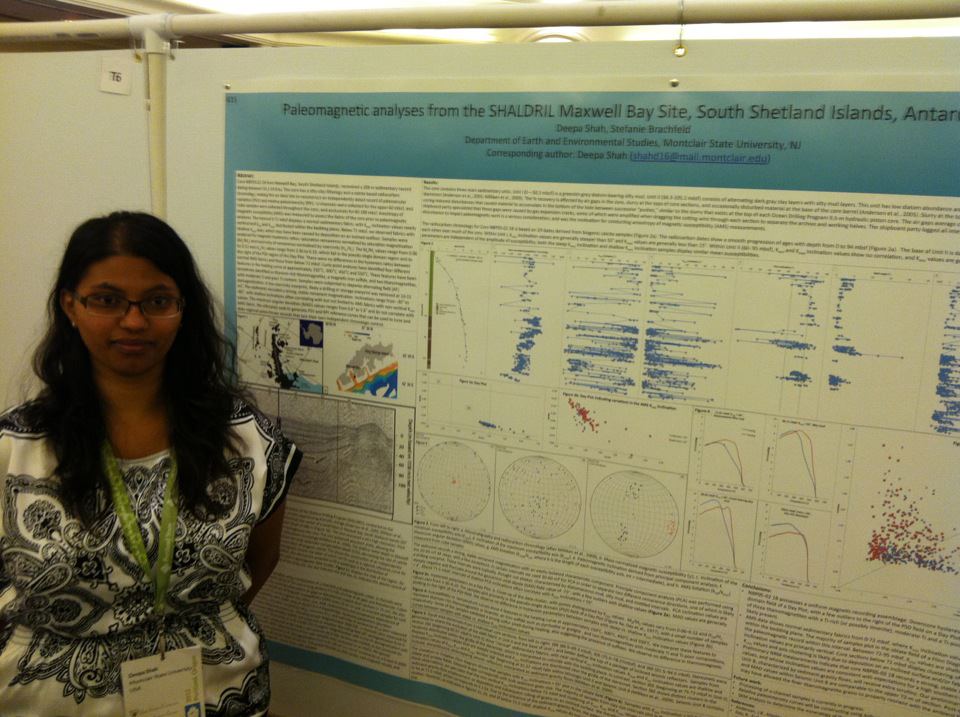
Graduate Student poster at Scientific Committee of Antarctic research I presented the culminating research from my undergraduate and graduate work on a sediment core from Antarctica, June of 2013.
Today, effectiveness of research is measured by the questions it attempts to answer and future research it stimulates, but it should also be measured by the educational impact it can make, doors it can open, and people it can inspire. Inspiring others takes effort; it’s a risk and a gamble. That’s how I came to be where I am now: I was inspired by many mentors, from my mother to my graduate advisors. The risks they took on my behalf fueled my passion to introduce the full scope of scientific research to high school students during a course of a summer. And now it will fuel my research efforts for the education and outreach chapter of my thesis.
Moving forward, post Ph.D., I will be focusing my efforts on introducing the rigors and wonders of scientific research to middle school and high school teachers and students. I aim to develop a series of annual programs where students, teachers and researchers actively collaborate in efforts to question and answer the mechanisms that make our world tick.
Blog by Meghan King, PhD student, Oregon State University College of Earth, Ocean, and Atmospheric Sciences
Me in front of a glacially carved U-shaped valley in the Maroon Bells Wilderness in Colorado.
Growing up on the north shore of Long Island, it was inevitable that my life would be shaped by water and sediment. As a child I wandered the rocky beach near my house with my magnifying glass for hours on end, examining everything from sand grains to boulders. In the fourth grade I learned how my little island came to be: a product of repeated glacial advances and retreats that created terminal moraines and outwash plains. At nine years old I became obsessed with understanding Earth’s history through sedimentary deposits, so it’s no surprise that I ended up at Oregon State for a Ph.D. in the field of stratigraphy!
Stratigraphy: it’s all about the layers
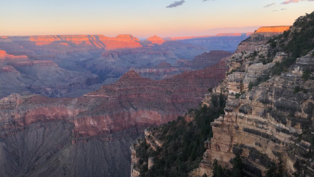
Stratigraphy is a branch of geology that studies the order of layered sedimentary rocks (strata) and their relationship to each other and the geologic time scale. Stratigraphy is fascinating because it is essentially an archive of Earth’s history at a specific geographic location. Some more well-known examples are the Grand Canyon and Death Valley, both of which were covered by an ancient shallow sea during the Paleozoic (542-251 Ma). The strata were originally deposited horizontally within that shallow sea and are different from each other in color, composition, grain size, etc.
The Grand Canyon was eventually carved over a short period of time by the Colorado River. Photo credit: Meghan KingDeath Valley stratigraphy has since been uplifted and tilted. Photo credit: Meghan King
My love of water, sediment, and large changes in Earth’s climate converge in my Ph.D. research. The strata in shallow marine environments (like those pictured) physically record how sea level fluctuated in response to glacial-interglacial periods. This is because sea level alters the type and characteristics of deposited sediments. Sea-level response to ice sheet change is typically thought of in the form of a “bathtub” model: When ice starts to melt, the water in the ocean will rise uniformly everywhere like a bathtub. However, this isn’t the whole picture of global sea level.
As ice sheets grow during a glacial period, they push down on the crust beneath them and create a raised bulge around the periphery, just like sitting on a mattress. The opposite happens during the intervals between ice ages. This concept is called glacial isostatic adjustment (GIA). GIA causes sea level to vary at different points on the Earth such that sea level doesn’t change at the same rate/magnitude everywhere. A few other processes contribute to this phenomenon as well. For example, ice sheets are large enough that they exert a gravitational pull on the oceans and draw water towards them, causing sea level to be higher near the ice sheets!
modeling, but for the rocks
What I’m most interested in for my Ph.D. is how GIA alters the stratigraphic preservation of glacial-interglacial cycles. Is there a geographic pattern to this alteration? If so, can we disentangle the signal of GIA from the rest of the stratigraphic record? While we have other records of glacial-interglacial cycles, they tend to exist for only a portion of recent Earth history, so for older deposits, stratigraphy offers consistent insight.
How have I approached this problem? Modeling! The rich history of field and lab work in the geosciences tends to get a lot of the attention (a lot of cool examples in previous blog posts though), but recently models have become an equally important tool! Modeling may not be as exciting to some, but it’s really fascinating to think about all the questions we can begin to answer with just a few – or in my case – a lot of lines of code!
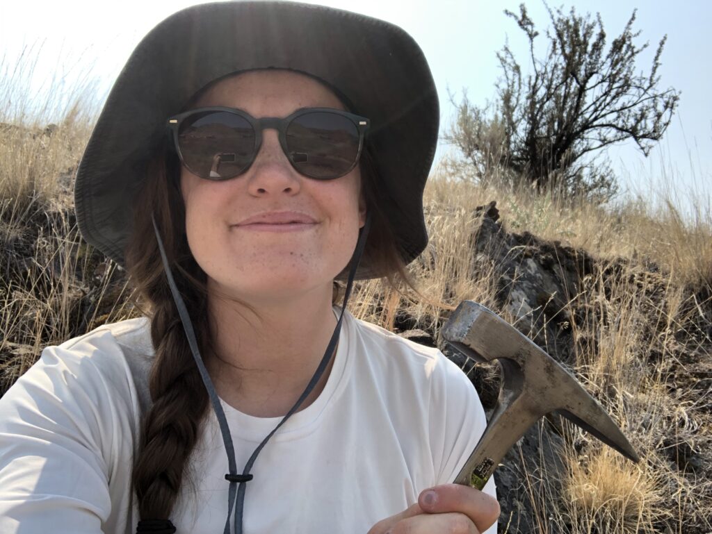
A photo of me in front of my computer with MATLAB open isn’t as exciting, so here I am with my rock hammer while TA’ing GEO 495 last summer.
Over the past three years I’ve developed some programs in MATLAB which allow me to combine sea level histories and sedimentation histories to build projected stratigraphic records from scratch. The output ends up looking something like the pictures above. I can then correlate, or compare, these records across space to help us understand how GIA is affecting the preservation of glacial-interglacial signals inputted into the models.
I’ve already completed a project using these models on Quaternary (2.6 Ma – present) glacial-interglacial cycles for the West Coast, and now I’m working on expanding the project in a variety of directions. I’ll be incorporating other inputs to make the models more robust. For example, I can vary the model’s ice histories, earth models and tectonic histories, and apply the model to more globally distributed locations in the Pliocene (5.3 – 2.6 Ma).
There is more to understand about sea-level change in the face of our warming climate, so I hope that these models can be altered and applied to a range of other projects as well. Maybe the next generation of inquisitive nine-year-olds hold the key?
Blog by Layla Ghazi, PhD student, Oregon State University College of Earth, Ocean, and Atmospheric Sciences
Twitter: @biogeoghazi
Layla Ghazi, PhD Student at Smith Rock State Park in Terrebonne, Oregon.
Biogeochemistry is the study of how matter moves through the biological and physical world. The field focuses especially on the biologically interlinked chemical cycles of elements such as carbon, nitrogen, sulfur, and phosphorus. During the spring semester of my junior year of college, I stumbled into the field of biogeochemistry, and I have not looked back. My research questions continue to expand, but they relate most directly to the carbon cycle. What is so sweet about the subject is that I can follow the questions that may develop along the way and end up in an entirely different biogeochemical cycle (ask me about my nitrogen cycle to molybdenum cycle rabbit hole).
Carbon is the fourth most abundant element in the universe. It occurs in many natural forms, ranging from gases like methane (CH4), chlorofluorocarbons (CFCs), and carbon dioxide (CO2) to solids like a diamond or the graphite at the tip of a pencil. Carbon is necessary to keep life as we know it on Earth going, but I’ll give credit for maintenance of the universe as a whole to hydrogen and helium.
A range of processes govern the movement (cycling) of carbon, which is heavily intertwined with Earth’s living and non-living worlds, including volcanic activity (which is rad). I’m most interested in a particular part of the carbon cycle that focuses on the oxidation of old organic carbon stored in sedimentary rocks (also known as petrogenic organic carbon, or OCpetro) in a process called geologic respiration or georespiration. Yes, rocks can “breathe.”
Maybe that prefix of “petro” is familiar? Like petroleum? Petro is the Greek prefix for rock, so petrogenic organic carbon is organic carbon that is released from rocks. The precise way the organic carbon is released through the rocks remains unclear, but some preliminary work shows that the main controls on georespiration are the processes of weathering (chemical or physical breakdown of material) and erosion (removal of material from one place to another).
How can you begin to measure how much CO2 is released from a rock that is being exposed to oxygen? The scale of that work would be absurd! Enter the trace element, rhenium (Re), which has become an important player in helping to quantify georespiration in certain rivers around the world. Re is believed to mostly be associated with the petrogenic organic carbon in sedimentary rocks through some sweet, sweet organic carbon-metal bonds. When ample oxygen is present, those bonds break, and two products are created synchronously: CO2 and Re. The CO2 is released once the petrogenic carbon meets oxygen, and Re is released from rock to solution phase as a soluble, negatively charged ion.
If you are wondering how this big question of “how do rocks breathe?” gets answered in real time with real data, the key places to look are in the rivers, in the bedrock, in the soils, in the rainwater, and anything else in between. What that means for me is that for the first time in my life, I get to conduct field work. I study georespiration in the Umpqua River of southwestern Oregon and the Eel River of northwestern California, which means my study sites are located in some of the most sublime scenery in the United States. The amount of material that the Eel and Umpqua each transport from the land to the ocean annually are also typical of small mountainous rivers all over the world, which makes what we learn about georespiration from them likely applicable at a global scale.
One of the sampling stations along the Eel River (Credit: Miguel Goñi, Brian Haley, or Julie Pett-Ridge).This photo was taken this past summer in an additional sampling campaign in the Umpqua River to collect erosion rates.
Identifying the chemical composition of the bedrock, the soil, the weathered materials, the sediment in the river water, and the petrogenic organic carbon is important to be able to paint a complete picture of the environment we are using to measure georespiration, which means I also work in a wet chemistry lab. As I begin my third year, I’ll be conducting a new (to me) kind of analytical chemistry work to further constrain the chemical and geological identity of the material in the Eel and Umpqua Rivers. These measurements will be combined with previous data of the river water chemistry to evaluate and refine Re as a way to quantify georespiration in the Eel and Umpqua Rivers.
This is one of the multi-collector inductively coupled mass spectrometers (MC-ICP-MS) housed within CEOAS at the Keck Collaboratory. My advisor, Julie Pett-Ridge, is a part of the advisory committee of this world-class analytical geochemical facility.One of the analyses I’m conducting is on the isotopic composition of the solid materials, like bedrock, soil, sediment, to understand their origin. These columns are used to extract the strontium from a solution, and it can later be analyzed by MC-ICP-MS.Column chemistry is like following a cooking recipe. Here, I am probably adding some deionized water to the columns while I’m trying to remove some waste before collecting the strontium.Here, I am using a hot plate for two different tasks at the same time. I’m drying down some river water samples to switch the acid they are in for a different type of analysis, and I am concentrating five beakers of rainwater into one.
Note: Rachel originally wrote this blog entry while at sea on a research cruise in the Northern California Current system in May and June 2021. It was originally published on the GEMM Lab blog at https://blogs.oregonstate.edu/gemmlab.
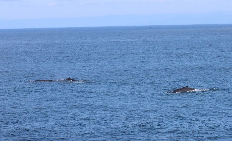
Hello from the R/V Bell M. Shimada! We are currently sampling at an inshore station on the Heceta Head Line, which begins just south of Newport and heads out 45 nautical miles west into the Pacific Ocean. We’ll spend 10 days total at sea, which have so far been full of great weather, long days of observing, and lots of whales.
Dawn (left) and Rachel (right) in matching, many-layered outfits, 125 miles offshore on the flying bridge of the RV Bell M. Shimada.
Run by NOAA, this Northern California Current (NCC) cruise takes place three times per year. It is fabulously interdisciplinary, with teams concurrently conducting research on phytoplankton, zooplankton, seabirds and more. The GEMM Lab will use the whale survey and the krill and oceanographic data to fuel species distribution models as part of Project OPAL. I’ll be working with this data for my Ph.D. with Dr. Leigh Torres and Dr. Kim Bernard, and it’s great to be getting to know the region, study system and sampling processes.
I’ve been to sea a number of times and always really enjoyed it, but this is my first time as part of a marine mammal survey. The type and timing of this work is so different from the many other types of oceanographic science that take place on a typical research cruise. While everyone else is scurrying around deploying instruments and collecting samples at a “station” (a geographic waypoint in the ocean that is sampled repeatedly over time), we– the marine mammal team– are taking a break because we can only survey when the boat is moving. While everyone else is sleeping or relaxing during a long transit between stations, we’re hard at work up on the flying bridge of the ship, scanning the horizon for animals.
Top left: marine mammal survey effort (black lines), and oceanographic sampling stations (red diamonds). Top right: humpback whale sighting locations. Bottom left: fin whale sighting locations. Bottom right: pacific white-sided dolphin sighting locations.
During each “on effort” survey period, Dawn Barlow and I cover separate quadrants of ocean, each manning either the port or starboard side. We continuously scan the horizon for signs of whale blows or bodies, alternating between our eyes and binoculars. During long transits, we work in chunks – forty minutes on effort, and twenty minutes off effort. Staring at the sea all day is surprisingly tiring, and so our breaks often involve “going to the eye spa,” which entails pulling a neck gaiter or hat over your eyes and basking in the darkness.
Dawn has been joining these NCC cruises for the past four years, and her wealth of knowledge has been a great resource as I learn how to survey and identify marine mammals. Beyond learning the telltale signs of separate species, one of the biggest challenges has been learning how to read the sea better, to judge the difference between a frothy whitecap and a whale blow, or a distant dark wavelet and a dorsal fin. Other times, when conditions are amazing and it feels like we’re surrounded by whales, the trick is to try to predict the positions and trajectory of each whale so we don’t double-count them.
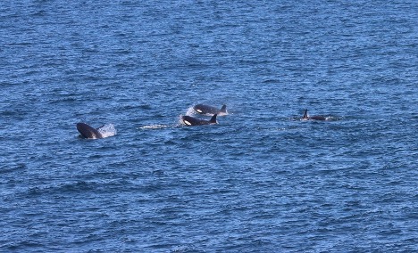
Over the last week, all our scanning has been amply rewarded. We’ve seen pods of dolphins play in our wake, and spotted Dall’s porpoises bounding alongside the ship. Here on the Heceta Line, we’ve seen a diversity of pinnipeds, including Northern fur seals, Stellar sea lions, and California sea lions. We’ve been surprised by several groups of fin whales, farther offshore than expected, and traveled alongside a pod of about 12 orcas for several minutes, which is exactly as magical as it sounds.
Killer whales traveling alongside the Bell M. Shimada, putting on a show for the NCC science team and ship crew. Photo by Dawn Barlow.
Notably, we’ve also seen dozens of humpbacks, including along what Dawn termed “the humpback highway” during our transit offshore of southern Oregon. One humpback put on a huge show just 200 meters from the ship, demonstrating fluke slapping behavior for several minutes. We wanted to be sure that everyone onboard could see the spectacle, so we radioed the news to the bridge, where the officers control the ship. They responded with my new favorite radio call ever: “Roger that, we are currently enamored.”
A group of humpbacks traveling along the humpback highway. Photo by Dawn Barlow.
A humpback whale fluke slapping. Photo by Dawn Barlow.
Species
Number of sightings
Total number observed
California Sea Lion
2
6
Dall’s Porpoise
3
25
Fin Whale
11
18
Humpback Whale
140
218
Killer Whale
3
21
Northern Fur Seal
9
9
Northern Right Whale Dolphin
2
8
Pacific White-sided Dolphin
13
145
Steller Sea Lion
3
3
Unidentified Baleen Whale
104
127
Unidentified Dolphin
6
28
Unidentified Whale
2
2
Even with long days and tired eyes, we are still constantly enamored as well. It has been such a rewarding cruise so far, and it’s hard to think of returning back to “real life” next week. For now, we’re wishing you the same things we’re enjoying – great weather, unlimited coffee, and lots of whales!
by Nicole Coffey, Ph.D. Student in Ocean, Earth, and Atmospheric Sciences
When I tell people that I study chemistry, often they imagine me standing over bubbling beakers in a lab. However, I study chemistry in the ocean, which means that my approaches need to break from that stereotype. What happens when the work you want to do can’t be done from a land-based lab? What if you have to go out to sea to do get the samples that you need?
Preparing to go to Sea
My advisor (Dr. Rene Boiteau), our collaborators at USC and UCLA, and I are interested in iron transport off the Oregon shelf. Iron is important in the oceans – it plays a role in chemical reactions in the water, and is required for key functions of marine organisms, such as photosynthesis. However, there is not a lot of iron available to critters in the ocean, since iron does not like to be dissolved in seawater and organisms cannot use iron unless it is dissolved. We wanted to investigate how iron moves throughout the ecosystem off the Oregon coast, and how organisms might be using the small amount of iron that is dissolved in the water. We can’t do this work from land – we needed water samples from offshore. So, we set sail on R/V Oceanus at the end of March on a scientific adventure!
Science can be tricky to do on land – and only gets more challenging when you go out to sea. For me, one of the most stressful parts of a research expedition is packing. On land, if you run out of supplies, you may be able to quickly borrow some from a neighboring lab, or buy more and have them delivered within a few days. At sea, if you run out of supplies you can’t get more. Your science has to stop. It’s very important that you pack everything you need (and not a bad idea to bring more than what you think you need, if you have the space to pack it). Packing for this trip involved a lot of spreadsheets and lists developed with my advisor, and triple-checking every box to make sure we had everything we would need out at sea.
We pack far in advance of a cruise to allow us time to figure out if we are missing any supplies. To be as safe as possible for this cruise, everyone going on the ship had to quarantine for two weeks, so we had to be ready to go even earlier. It was a lot of work, but everyone was prepared to board the ship and get set up to do some science at sea the day we reached R/V Oceanus!
Setting up Aboard R/V Oceanus and Science at Sea
R/V Oceanus in port in Newport, OR
Loading a ship with supplies for a successful cruise can be difficult. But we don’t have to carry every piece of equipment up the gangplank by hand. We use a crane to lift all of gear from the dock, assisted by the helpful ship’s crew. Once the gear was onboard, we spent the rest of the day organizing our spaces and setting up our equipment. Having our gear organized, and boxes labelled with their contents, helped this go smoothly! Out on the water, the ship rocks with the waves, meaning anything not held in place may slide around. To avoid an unsafe workspace, all of our gear had to be tied down or screwed into place. I secured the bottles and pump I would use to filter particles from my water samples to a benchtop with bungee cords and ratchet straps while other graduate students built a “bubble” of plastic sheeting to keep their workspace free from dust or potential contaminants. After a hard day’s work, we were all ready to leave port the next morning and get started collecting our samples.
Sample processing setup aboard R/V Oceanus; samples were filtered from the bottles on the left into bottles on the right, then loaded onto solid phase extraction (SPE) columns (in front of bottles on the left).
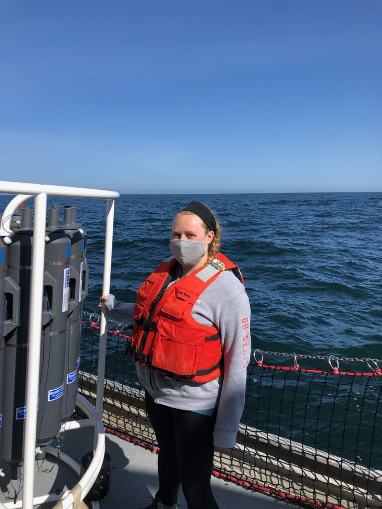
Once we left port and arrived at our first sampling site, we used a piece of equipment called a CTD (which measures conductivity (to help determine salinity), temperature, and depth) to profile the water from the surface to near-bottom. We also measured how much oxygen was in the water. This information helped us to choose what depths we wanted to sample water from. As the CTD returned to the surface, we used a computer to tell bottles attached to the instrument to close, bringing us water from below the surface. Once the CTD was back on board, it was a flurry of action to collect our samples and get to work in the lab! First, we filter our samples to remove particles. Then, we use a technique called solid phase extraction (SPE) to remove salts and concentrate the sample. The samples are analyzed back on land.
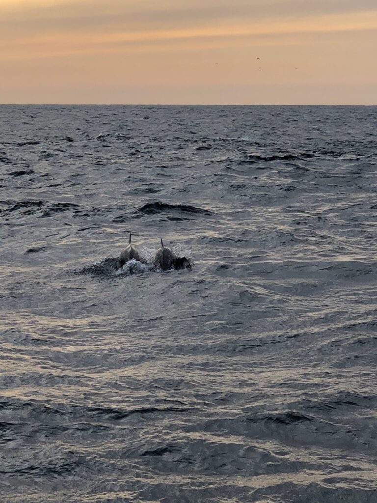
In our downtime, we sometimes would go out on deck to take in the sight of water all around us. Sometimes, we had some visitors – over the course of the trip, we saw sea lions, albatross, gray whales, and dolphins! You never know what you’ll see when you’re out on the water (though fantastic sunsets are always a given).
Dolphins swimming near R/V Oceanus along the Newport Hydrographic LineA life preserver aboard R/V Oceanus at sunset.
After about a week on board, R/V Oceanus began to have some mechanical problems, and we were forced to return to port. It was disappointing to leave some objectives unfinished, but it was better to be safe rather than risk having worse problems down the line. Though our cruise was cut short, we collected some great samples during our time at sea. We’re all looking forward to analyzing the data to see what we might have found, and for our follow-up trip in July to learn more about iron dynamics on the Oregon shelf.
Follow Nicole on Twitter: @ChemNicoleOcean
See content from this cruise and our upcoming trip with this hashtag on Twitter: #FeTSh2021
by Margaret Conley, PhD student in Ocean, Earth, and Atmospheric Sciences
Margaret tying off a ground line for a bottom mooring in a side channel of the Yaquina Bay estuary in Newport, Oregon. Photo by Jim Lerczak.
I study estuaries, the beautiful, mucky, and sometimes smelly mixing zones where river and ocean meet. Estuaries are exciting because they are always changing. Of course, every place has its seasons. Here in Oregon, we have summer sun and winter rain, spring flowers and fall leaves. But in an estuary, these changes are amplified: On top of seasonal changes, there is the daily drama of the tide, alternately flooding and exposing mud flats and marshes. The tide and the seasons also bring changes we can’t directly see — how warm and salty the water is, for example. These invisible characteristics are critical for the creatures that make estuaries their home, including oysters.
Low tide reveals a complex network of muddy banks and channels that are invisible during high tide at King Slough (top row) and Paddle Park (bottom row), two spots along the Yaquina Bay estuary, Newport, Oregon.
Oysters are used to a certain degree of change. But how will they, and their estuarine home, respond to the larger changes that human-caused climate change will bring? This is what my fellow researchers and I are trying to figure out, and we’re starting by better understanding the dynamics of one of the most basic water characteristics: temperature. We are studying water temperature in the Yaquina Bay estuary in Newport, OR to figure out how it changes with tides, storms, and seasons. Once we better understand the current range of temperature changes, we can start to predict how the estuary might change in the future, and how all this change affects the plants and animals that live in the estuary.
We are measuring the temperature of estuary water at many locations, from far upriver where the water is fresh to the salty water at the estuary mouth. By looking all along the channel, we can witness the battle between ocean and river, pushing each other back and forth as the strength of the tides and the river flow change over time. We’re also measuring the mucky places, like tidal flats where the water comes and goes and side channels called sloughs. All these water sources, plus heat from the sun, combine to determine the temperature of the water in the estuary. By recording the temperature changes from tide to tide and season to season, we hope to identify which factors are most important in determining temperature at each location along the estuary. We also want to figure out how these conditions influence where oysters grow best.
A calm morning at Cannon Quarry Park, Lincoln County, Oregon.
Besides the changing waters, the assortment of plants and animals that live in the Yaquina Bay estuary also changes over time. Baby salmon travel through estuaries on their way to the sea, and birds use the Yaquina as a rest stop during migration or as a summer or winter vacation home. Just like me, these animals are temporary visitors, and they never see the full range of estuary conditions. But there are also those who make this changing place their permanent home. Just like the residents of waterside towns, organisms like oysters set up shop on a particular spot and stay put. To understand why oysters live where they do, we have to become permanent residents too.
That’s where the scientific instruments come in. These little machines let us become residents of the estuary. While we return home to Corvallis after each field trip, the instruments stay behind, quietly recording the changing waters. While we work in our offices, they brave winter storms, floating logs, encroaching mud, and curious creatures. With luck, plus lots of knots and tape, they are still there when we return, and they report back on what they’ve seen. Each time we visit, the instruments look like they’ve been claimed by the estuary, coated in brown goop to match the muddy bank, sprinkled with baby barnacles just like the nearby rocks. Crabs move into our bottom moorings as they slowly sink into the muck. If we didn’t return soon enough, they might just disappear entirely.
A sensor that measures temperature and conductivity, before and after cleaning.
Using these measurements, we plan to figure out what the oysters themselves already know: How does the temperature of the water change over time? After several months of measurements, we can already start to put together a story. We see the winter rainstorms that push ocean water down the estuary back towards the sea, changes in the coastal ocean that creep their way up the estuary with the tides, and solar-powered heating. Once we know how temperature in the estuary changes, we can try to predict how it will be impacted by climate change. This temperature change also contributes one piece of the puzzle in understanding how oysters, intrepid inhabitants of this changing place, will respond.
Sunset and a falling tide at Hatfield Marine Science Center in Newport, Oregon, looking towards the Yaquina Bay Bridge.
A scientific conference attended by Giancarlo and colleagues pre-pandemic. From right to left: Giancarlo, Dr. Lorenzo Ciannelli (my advisor), Dr. Caren Barcelo, and Jennifer Wong-Ala (lab mate).
by Giancarlo M. Correa, PhD Student in Ocean Ecology and Biogeochemistry
Have you ever thought about how you got to where you are now academically? In my case, three clear events got me to where I am. I think every outcome is a product of something, and that something might be destiny or it might be perseverance.
Finding an ideal career by chance
When I was in school I loved math, and honestly, I was pretty good at it. I participated in many regional math competitions and I succeeded in some of them. I assumed that studying anything related to engineering after school would be the right path for me, and I left my amazing school life with that thought in mind. In Peru, where I was born and raised, there is a very competitive exam students need to take in order to be admitted into the very few good (and free) public universities, so applicants typically take classes at special centers (popularly called “academies”) after school during some months to be prepared to take that exam. I signed up in a center called Pamer to study for exams allowing me to apply to the industrial engineering program at San Marcos National University, the oldest university in America.
By then, I needed to review math and verbal concepts, but also subjects such as chemistry, biology (which I hated), and physics. So, one sunny Saturday, I made a mistake and I attended a biology class to which I was not assigned. The professor was renowned in Pamer for his way of teaching. And here is when destiny, for the first time, played a role in my academic formation. That Saturday I fell in love with biology in just two hours of class. The way this professor taught biology was extremely engaging and thought-provoking; I never realized how interesting biology was until that moment. I did not need to think twice — I knew at that moment that biology was going to be my future career. A few months later I was admitted to San Marcos National University to study biological sciences, and that was one of the best decisions of my life.
As a student in biological sciences, I had to travel a lot around my country. I will never forget the amazing places and people that I met. This is the most famous waterfall in Peru: Gocta, located in the Amazonas region.
My first opportunity in research
The first months of my undergraduate life were difficult for me, as adapting to university life was not immediate and I needed some time to adjust to working on my own and not having a professor pushing me. I wanted to specialize in molecular biology, which was a popular choice among most students by then, and I was quite good at my molecular biology classes. In the fourth year of study, every student must select a specialization to follow during the last two years, and there were three choices: zoology, botany, and hydrobiology and fisheries. I was unsure which path to take. Most students took zoology or botany since there were more professors and researchers to work with in those disciplines. However, I do not usually follow the herd so I chose hydrobiology and fisheries, beginning my fourth year at the university somewhat unsure about this decision.
A year later, I needed to look for a laboratory or institution in which to get mandatory research experience, and to do an undergraduate thesis. That was a critical moment in my academic life. I asked one of my professors about internship opportunities at the Marine Institute of Peru (IMARPE), and she introduced me to the leader of the Population Dynamics and Stock Assessment Unit, who accepted me to do a research internship for a few months (that was the plan at the beginning, but those months became years). Then came the second crucial moment in my academic life: I started to study the population dynamics of fish populations using statistical and mathematical methods, an amazing field that I am still in love with.
The first scientific survey I participated in taught me how hard and enjoyable can be working onboard. An unforgettable experience. This is one of the main research vessels of the Marine Institute of Peru (IMARPE): the BIC Jose Olaya Balandra.
An international jump
I worked for almost five years at IMARPE, gaining invaluable knowledge and experience. During that time, I undertook a master’s program in applied math, I participated in my first research cruise, and I published my first paper. I also participated in international conferences and met great scientists in Peru and abroad, and some of them were the source of inspiration for my next big step: pursuing a doctoral degree abroad.
Applying to American universities is not an easy task for international students; it demands time and money, but I was determined. I researched all the requirements, and soon identified the most important ones: passing the TOELF exam (to prove that I am proficient in English), taking the GRE, finding an academic advisor and getting funding. I passed the TOELF exam with a score that was good enough. Next I took the GRE, and I got an outstanding score in the math section, a not-bad verbal score, and a quite bad score in the written part. However, I struggled to find an academic advisor. I made a list of all the professors that I would have liked to work with, and I emailed them asking for opportunities. Sixty percent did not reply, 20% were not accepting new students at that time, 15% did not have funding sources, and 5% (one professor) invited me for an interview and ended up supporting my application to Oregon State University, although funding was not guaranteed. And here is the third crucial moment in my academic life: I only applied to one university and I was admitted. Was I lucky? Who knows, but this outcome was a consequence of perseverance and I am proud of it. Since fall 2018, I live in a small city in the Pacific Northwest (Corvallis), working with Dr. Lorenzo Ciannelli on projects related to population dynamics of the Pacific cod in the eastern Bering Sea. I have no words to describe how much I have learned during the last years and how beautiful is this area of the world.
When I applied to Oregon State University, I was not aware of how astonishing the Pacific Northwest is. I am truly lucky of living in this area. Here is a viewpoint in Newport, a city relatively close to Corvallis.
What about you?
Have you thought about the crucial moments that brought you to where you are now? Were they products of destiny or perseverance? Identify them and be thankful and proud of them. There is no better or worse place to be, there is only the right one, where you are now. Are you excited about which events will define your academic life? I am, and I have no doubt that I will make the right decision. Enjoy this moment and do not stop persisting to achieve your academic and life goals. Destiny might play an important role at some point, but it will need to be complemented by your perseverance.
by Ashley Peiffer, M.S. student in Marine Resource Management
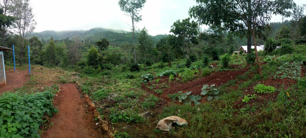
In the foreground, a school garden built by my community counterpart and fellow science teacher, Iddi. My tin-roofed house is in the background and Mshangai village lies in the valley below.
Upendo is the Swahili word for “love” and the name of one of my best friends in the Mshangai village of Tanzania where I lived as a Peace Corps volunteer from 2017-19. When I first arrived in Tanzania, I thought I knew what the village needed. It was only after getting to know my neighbors, like Upendo and her daughter, Rosie, that I realized my role as a volunteer was to drop all my preconceived notions and become part of the community first. Over the two years I spent in Mshangai, Upendo and Rosie taught me how much time and upendo it takes to build relationships and a sense of community. When I came back home to start my master’s degree at Oregon State University, I used those lessons, discovering that even without being physically present in a community, it’s still possible to maintain meaningful relationships with people across the globe.
Upendo, Rosie and I dressed up in our best batik (a hand-dyed fabric) for a local wedding.
One of the first moments I recognized that working in the village had nothing to do with imposing ideas of what “should” be and everything to do with building relationships was when Upendo started asking me to babysit Rosie. The simple gesture of asking me to fill a role that was normally taken by other women in the community brought me the humbling, heart-opening feeling of belonging. I found a deep sense of joy through the connections I made while taking on tasks such as babysitting, washing dishes with other women at local events, and chatting with village Bibi’s (“grandmas”) in an attempt to learn the three local dialects in my area that were often meshed with Swahili. Staying present in these day-to-day activities helped me to build meaningful relationships and listen to the concerns of my friends.
I often carried Rosie around the village center so she could avoid the mud with her bare feet.One of my favorite pastimes: Chatting with my neighbor, Mama Sophia, and her sister near a shop in the village.
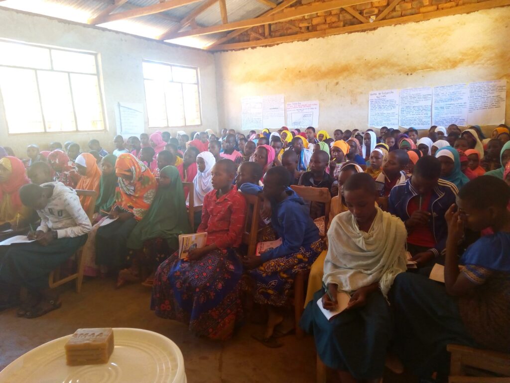
Without taking the time to get to know my neighbors, I would have never discovered that a major concern of the community was the amount of time girls and women missed out on their daily activities due to a lack of menstrual hygiene products. Nearing the end of my time as a volunteer, I found myself knee-deep in grant writing and event planning to host health seminars for hundreds of students and women in the community with my friend and fellow teacher, Rachel. We planned three seminars to teach about sexual and reproductive health and give away reusable menstrual pad kits from the HURU (“Freedom”) International program.
Rachel and I often wore matching khangas (colorful cloth printed with Swahili idioms) for community events.
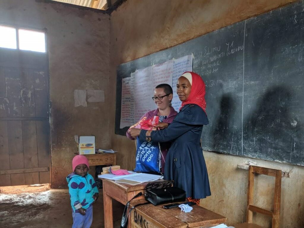
On the last day of the event, my friends from Mshangai and nearby villages came to receive their HURU kits, some walking over 5 miles one way just to reach the event. I was moved to tears by the community of women gathered with me. I held Rosie as Rachel gave the health lectures and all of the women, including my dear friend Upendo, took notes and asked questions. After the seminar, girls and women from the community paraded around the village with their colorful HURU kits, and Rachel saved the extras and all the education materials for incoming classes of students in future years.
Secondary school girls jotting down notes during a HURU seminar. Rachel and I hand-made the educational posters on the walls around the classroom.Keeping one eye on Rosie while Rachel explains what would be found inside each HURU kit: reusable menstrual pads, underwear, and soap.Secondary school girls proudly showing off their new HURU kits!
The importance of community remains a focus of my life and a source of inspiration for my master’s thesis. Through the Marine Resource Management program and my advisor, Dr. Michael Harte, I was connected with the non-profit Secure Fisheries, a program of One Earth Future focused on empowering coastal communities in the Somali region to sustain and manage their fisheries resources and promote peace-building. Their work includes developing cooperative fisheries management in coastal communities, creating a system of region-wide catch data collection in partnership with universities and governments, and enhancing fisheries value chains to ensure communities derive as much value as possible from their fisheries resources. With staff located in both the Somali region and the United States, Secure Fisheries uses both community knowledge and scientific research to boost local capacity for fisheries management.
Photo from a Secure Fisheries’ hosted oceanographic mapping exercise in a Somali coastal community.
The COVID-19 pandemic brought my initial research plans– a gender and small-scale fisheries project in the Somali region–to a standstill. While in quarantine, I realized much of Secure Fisheries’ field work was significantly delayed because of the pandemic. Even so, staff members on both sides of the globe found creative ways to continue and even improve ongoing projects by switching to remote communication with communities and collecting GPS fisheries data. I was inspired by how the organization maintained strong relationships within communities, even with our new norm of social distancing. This inspiration led me to change my thesis research. I wanted to understand how Secure Fisheries and similar organizations adapted to extraordinary circumstances alongside the communities they work in, sustaining relationships with communities they could no longer visit in-person.
Living and working in Tanzania allowed me to learn first-hand how building trust and relationships can lead to great things. Through my research so far, I have seen how Secure Fisheries exemplifies those same values. Without community relationships and an appreciation for local knowledge, Secure Fisheries may not have been able to identify means of adapting their work to the pandemic, like seeking alternatives to data collection or communication.
As I wrap up my research, I find myself reflecting back to my days in Mshangai, remembering what it was like to hand HURU kits to my neighbors and friends, knowing that they were receiving sorely-needed supplies. I have found a sense of belonging here in Oregon with the Marine Resource Management program and with Secure Fisheries (through Zoom!), and I feel overwhelmed with gratitude for Upendo and Rosie, who opened up their homes and hearts to me and who patiently taught me what it means to build community.
Saying goodbye to Upendo and Rosie. Upendo sent me back to the U.S. with a matching piece of fabric called kitenge.
by Johna Winters, M.S. student in Marine Resource Management
Johna Winters supporting OOI mooring operations in small boat off of the R/V Sikuliaq in 2018
As a marine technician, I’ve been to the North Pole, the equator, and the Great Lakes. I’ve worked with many oceanographers, limnologists (scientists that study freshwater systems like lakes), and ship’s crew to accomplish science missions from deploying scientific moorings off the coast of Oregon, to deep sea net trawls in the sea of California, to mud grabs in the deepest part of Lake Superior to look for evidence of invasive mussels. As a technician, my main job was to make sure that the scientists had what they needed to complete their projects: streams of data, sampling equipment, and expertise to deploy that equipment safely. In the process, I also obtained a U.S. Coast Guard rating which qualifies me to work as ship’s crew.
An improvised science contraption Johna made out of a Tupperware container and spare parts, circa 2014. Photo Credit: Johna Winters.
But sometimes I used “people skills” as much as technical skills. Sometimes my job involved greasing the wheels of collaboration between scientists and crew. This role found me making an effort to communicate with each of these groups in their own language and then translating. Sometimes sampling methods didn’t make a lick of sense to the crew and sometimes scientists didn’t comprehend ship operations. In communicating with both groups, the techs were able to make data collection more efficient and higher quality. I didn’t see one group as superior to the other, only as serving different but important roles in our mission to study the ocean.
From technician to social scientist
It never occurred to me that I would one day be designing a study about research vessels for my master’s thesis work. While my degree in chemistry and my tech skills were useful for gathering accurate physical science data, they did nothing to help me wrap my head around these workplace interactions. I needed new models, frameworks, theories, and methodologies which the social sciences provided in abundance.
Johna on a cruise in the Arctic near the North Pole* aboard the USCG Cutter Healy in 2015. *The North Pole does not have an actual pole. Photo Credit: Croy Carlin
I got an inkling that these things could in fact be studied when an aquatic scientist gave me a paper called “Scientists and Mariners at Sea” (Bernard 1976). I was mystified that someone had written an academic paper about my strange profession. The crux of the paper is a discussion of some statistical methodology that was quite obscure to me at the time, but the other material in the paper was what was interesting to me. Research vessels today are quite different than they were in 1976. For example, alcohol is no longer permitted in the U.S. academic research fleet, there are many more women working in science (unacceptably, the proportion of non-white scientists in the geosciences has changed very little), and legal rights for LGBTQ+ people have advanced, but some of the themes of the Bernard paper are still relevant. Bernard writes about a dual hierarchy and the different cultures and value systems of scientists and mariners that, without the existence of research vessels, would never interact.
Johna evaluating a sensor for damage on a rosette water sampler aboard the USCG Cutter Healy 2015. Photo Credit: Cory Mendenhall, USCG
A glass ceiling in ocean sciences
The longer I was a technician the more I realized that women in leadership roles were few and far between and it became obvious that I was treated differently because of my gender. Switching jobs did not alter this pattern. There were more women in the science parties that I interacted with, biology in particular, but in deck-work focused science parties, like mooring groups, and in the ship’s crew, not so much. I began to wonder, Did the unique environment of a research vessel have an influence over the cultural and historical momentum of sexism? Policies such as Title 9 and Title 7 had existed for decades, but how did policies designed to eliminate sexual harassment function in this unique environment?
Johna leading deck operations during a mooring deployment aboard the R/V Oceanus in 2016. Photo Credit: Mounted GoPRO
In 2016 or 2017, I came across another paper that has influenced my research direction: “SAFE: Survey of Academic Field Experiences” (Clancy et al. 2014). This study was originally designed for anthropologists but the researchers added other discipline categories when some geologists requested that they be included. The study found that a large proportion of respondents reported incidents of sexual harassment, gender-based discrimination and assault in field sites and identified structural aspects of academia, such as high power differentials between students and more senior academics, as contributors to this dynamic. When I came across this paper, I thought, “Someone should do this in oceanography!” It was two years later that my master’s thesis project solidified around this topic, with the help and encouragement of my committee members.
Expanding Horizons
In order to answer my research questions, I had to break through my past bias against the social sciences. As a younger person I dismissed anything that in my mind was “not science.” I attribute this narrow way of thinking to many influences around me, from my B.S. in chemistry to a comic by xkcd, an attitude that was also perpetuated by my STEM professors during my undergraduate education.
Comic highlighting perceptions of different fields in science. Edits in red are Johna’s. Note that the sociologist didn’t even get a conversation bubble until Johna added one in. Source: xkcd.com/435
Today I find the notion of a hierarchy of disciplines ridiculous. Different questions require different tools. And the research questions for my thesis couldn’t be answered with the tools that I knew from my B.S. in chemistry or from being a technician, so I applied to the Marine Resource Management program at Oregon State University.
My journey through my master’s course work in Marine Resource Management has included a core of oceanography classes, as well as qualitative and quantitative social science methods and marine policy as well as elective classes in women’s and gender studies, accounting, and environmental politics. It is this combination of approaches and tools that will help me to carry out my research objectives and hopefully offer something of value to the research vessel community, by disrupting the patterns that keep talented women from reaching leadership roles as crew, scientists, and technicians.
As Johna says, “You can lubricate a winch with a grease gun, but you can’t solve sexism with a salinometer.” Photo Credit: Shannon Zellerhoff
Jenna Epifanio, Ph.D. student in Ocean, Earth and Atmospheric Sciences
Jenna in the field. Credit: Ian Van Coller
What would you see if you looked into a time capsule from 1.5 million years ago? If the time capsule contained air before it was sealed up, you would find out a lot about the Earth’s climate. Between October and January of last year, I had the opportunity to join a team of researchers to go find some of that air, trapped in a natural time capsule: An Antarctic ice sheet.
using ice to understand earth’s past
Ice on our planet’s polar ice sheets has been preserving records of climate for hundreds of thousands of years, and in the case of Antarctica, a lot longer than that. Antarctica is thought to have first become covered in ice about 30 million years ago, which means if we sample ice at the correct locations on the continent, we might be able to discover some of that extremely old ice.
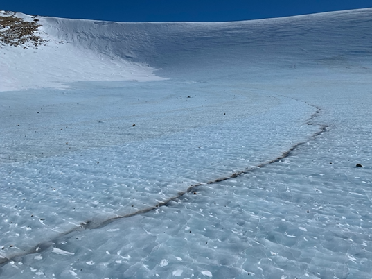
Bubbly ice from the Allan Hills, Antarctica
What makes polar ice a great archive for climate science is the direct nature of what it preserves. Not only do the water chemistry and particles trapped in the ice tell us about the past climate, but ice also collects tiny air bubbles that preserve an undisturbed record of the Earth’s atmosphere. Because ice is formed by layers and layers of snow that become packed down over thousands of years, all of the bubbles that are trapped in the ice sheet are preserved in chronological order – the deeper down in the ice sheet, the older the ice and the air trapped in it. Climate scientists can drill a long ice core and analyze it to determine the chemistry of the ice as well as the composition of atmospheric air in the ice bubbles.
Even though Antarctica glaciated over 30 million years ago, we probably won’t ever find ice that old on the continent. Because ice moves quickly (geologically speaking) and is subject to stress, melting and flow, most of the extremely old ice in Antarctica has already been destroyed. Currently, the oldest record of past climate contained in an ice core goes back 800,000 years. Recently, however, there has been a push to identify ice older than this because of an interesting question about the climate system that we want to answer.
Between 1.2 million and about 900,000 years ago, the Earth went through a dramatic shift in ice age cycles. During what’s known as the Mid Pleistocene Transition (MPT), the Earth changed from having ice ages every 40,000 years to having much colder and longer ice ages every 100,000 years. We know this from ocean sediment records of climate that contain indirect clues – proxies – describing climate conditions. However, an ice core record that covers that period would be invaluable: Instead of using proxy records of climate recorded in the ocean sediments, we would have a sample of the atmosphere itself to measure and answer questions about the climate from that period.
A visible layer of volcanic ash trapped in the ice sheet, near the Allan Hills, Antarctica.
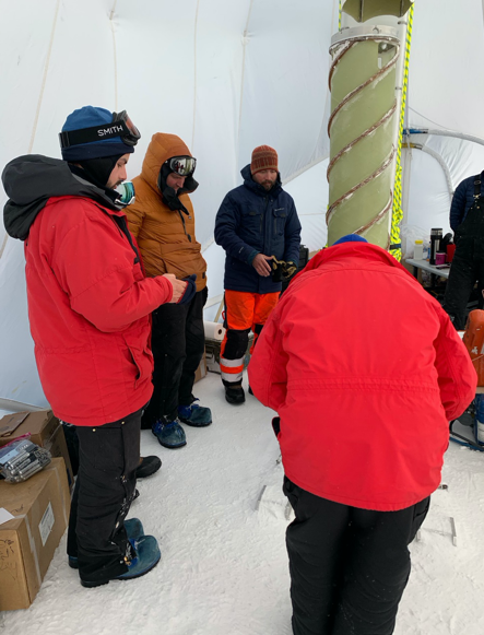
Recently, scientists collected ice that was dated to be 1.5 million to about 2.7 million years old at a location in Antarctica called the Allan Hills. Situated about 140 miles from the U.S Antarctic base, McMurdo station, the Allan Hills is known as a “blue ice area,” and when you see it for the first time, there is no question as to why it bears the name. Blue ice areas (BIAs) are created when winds scour the ice sheet, removing the top layer of uncompressed snow and exposing the blue ice. At the Allan Hills, this process is combined with other physical factors that allow very old ice to be found near the surface. That extremely old ice near the surface is what I, and a few wonderful people from around the country, were there to sample.
The primary goal of the field season was to re-drill an ice core at a location that had been identified to have ice that is 2.7 million years old. The original ice core, collected a few years ago, was fairly small, and has mostly been consumed as samples were chipped off of it in the process of understanding its age. One secondary goal of the expedition was to drill some reconnaissance samples in locations that were good candidates for old ice. Over the seven weeks, we successfully drilled three 150-m ice cores, one of which will very likely contain ice that is 2.7 million years old.
Field work at the bottom of the world
Just arriving in Antarctica is an ordeal. A commercial flight to Christchurch, New Zealand takes about 18 hours. I was the only representative from Oregon State University on the team, so meeting some new and also some familiar faces was the first order of business when I arrived. Along with the other researchers, I met our camp manager, Anna, an impressive and ferocious mountaineering woman on her tenth season in Antarctica. I also met Elizabeth (‘E’) and Tanner, both professional ice core drillers (yep, that’s a real job!), who have a ridiculous amount of experience between the two of them. These tough-as-nails people would teach me how to drill ice cores in one of the most extreme places on the planet. To get from New Zealand to the icy continent, the team and dozens of other researchers and personnel boarded a US Air Force C-17, a gigantic military plane. The trip took five loud, and quite cramped hours, until we landed on the airfield located on the ice near McMurdo station.
Drilling 2.7 million-year-old ice with the Blue Ice Drill.
We spent ten days at McMurdo Station collecting camp gear, planning meals and food needs, and training in snow survival skills, and then we flew to our remote field site. Multiple Twin Otter flights from McMurdo Station to the Allan Hills were needed to deliver nine people, two ice core drilling rigs, and all of our camping gear. Two other researchers and I were on the last flight, which was delayed due to high winds and poor visibility at the Allan Hills.
The first order of business was to finish setting up camp, and begin setting up our drilling equipment. The next few days were grueling work, lugging gear to different drill sites, drilling anchors in the ice to secure our tents and equipment, and testing the electrical generators that would power the blue ice drill, a 9.5-inch diameter ice core drill that we would use to extract literal TONS of ice over the next seven weeks. The exhaustion that set in at the end of each very long day made sleeping in a tent during 24 hours of daylight some of the easiest sleeping I’d ever done.
Scott tents and living quarters on a beautiful day at the Allan Hills, Antarctica.
It is amazing how quickly you can adapt to harsh conditions. Our team was in the field for seven weeks. That’s seven weeks of waking up in a tent every morning to freezing temperatures, getting dressed, grabbing some warm tea and a quick breakfast, then heading out to our drill sites to continue the drilling from the day before. Drinking water was made by melting ice that we chipped out of the ice sheet at a special “sterile” location. There were no showers, and all my baby-wipes were frozen into a solid block of ice before I got to my tent that first night in the field. The sun never set, and if the wind would stop howling in the middle of the night, I would wake up, disturbed by the sudden change. Those nights were special, though, because you could hear the ice sheet cracking. Loud pops echoed across the ice sheet and reminded you of how incredible it was that you were there.
Science during a pandemic
I should be in Antarctica right now, sleeping in a Scott tent, enjoying the company of some amazing scientists and ice core drillers. The Allan Hills ice core drilling project was funded for two field seasons. Because of the COVID-19 pandemic, the field work has been delayed, and I’m sitting in Corvallis, Oregon, remembering that dramatic place. I don’t feel sorry for myself for missing out on a second season; being there once was the experience of a lifetime, and I’m grateful to have had it. Living through this pandemic does highlight how dramatically nature can change our lives, giving a little bit of perspective as to why understanding climate change is important. Understanding what is natural, normal, and possible for the Earth’s climate system is key to understanding how it will change in the future. Understanding the nature of that change can prepare us for what comes next.
Most of the team at the Allan Hills ice core drilling project.