A Week at the National Science Foundation Ice Core Facility

Olivia Williams | 4th-year PhD Candidate in Geology

Holding a round section of the blue ice drill core from the Allan Hills 2023-2024 field season. Photo: Curt La Bombard

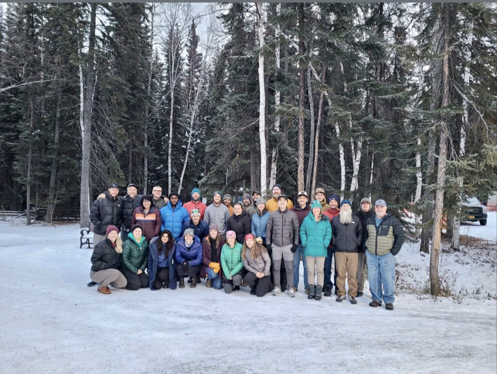
The week of April 8th 2024, I traveled to the NSF Ice Core Facility (ICF) in Lakewood, Colorado to help process ice cores from this year’s field season. Together with Liam Kirkpatrick (PhD student, University of Washington) and Fairuz Ishraque (PhD student, Princeton), I had a fun, fascinating, and very cold week experiencing the logistics that make ice core science possible.

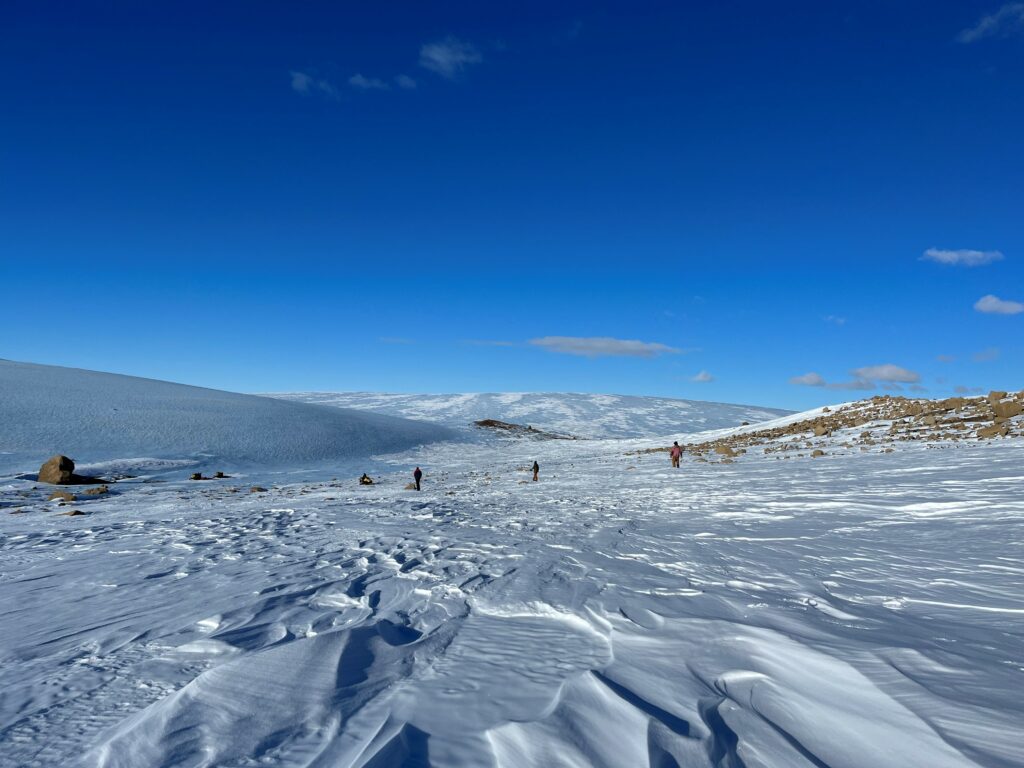
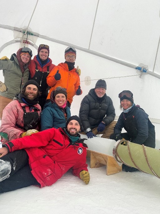
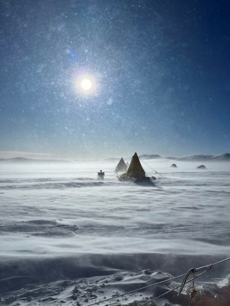
The reason for our trip was to help wrangle samples for the Center for Oldest Ice Exploration (COLDEX). This multi-university center is helping to extend our ice core record of past climate beyond our current 800-thousand-year timeline. The ’23-’24 field season—COLDEX’s second—saw researchers and drilling technicians return to the Allan Hills, a fascinating site where very old ice has been forced closer to the surface by underlying topography. They drilled about 140 meters of 9.5-inch-diameter cores with a blue ice drill, plus 90 meters with the 3-inch Eclipse drill and several more boxes of hand-augured ice. This ice was bagged, labeled, and packed in boxes of fresh Antarctic snow for the long journey back to the United States.

The door into the freezer work room at ICF.

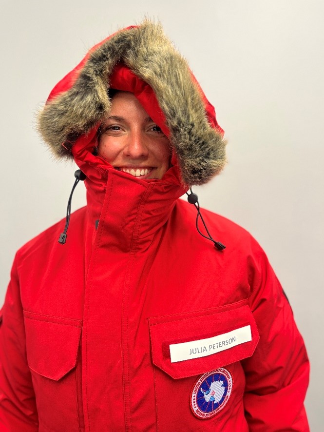
Now that it has arrived at the ICF, the ice needs to be cut up into smaller samples and shipped to labs across the US to determine things like its age and gas content. Three CEOAS early-career researchers who were on the field team (Julia Marks Peterson, Asmita Banerjee, and Abby Hudak) will be among those measuring carbon dioxide and methane content, dust particle count, and water isotopes. However, before any processing can take place, the ice must be unpacked and archived properly at ICF. This was the purpose of our visit.

Each morning, we left our rental and drove to the federal campus in Lakewood. Passing through the security checkpoint, coffee balanced in my lap as I flashed my passport and explained we were scientists visiting the Ice Core Facility, I felt like I was in a TV show. Then we’d drive on, past mysterious unlabeled structures and parking lots full of police and logistical vehicles, until we arrived at an enormous building with rippling vaulted roofs. I’m told it was initially a munitions factory. Among other things, it holds the USGS Core Research Lab, which in turn manages the ICF. We’d park and head inside to drop our stuff by the folding tables set up in the large warehouse space and go over our plan for the day.

The first order of business: bundling up. The storage room where we would retrieve boxes and shelve cores was -36°C (-33°F), and the work room where we spent most of the day was a comparatively balmy -25°C (-13°F). ICF has a variety of freezer gear to loan. However, like most people I know in this field, I like to travel with my own tried and true base layers. Over my t-shirt and leggings, I would don long underwear, a wool-blend sweater, and a thick second pair of socks. Then I’d put on the ICF-issue insulated coveralls and work boots. I brought my own glove liners, beanie, and muffler, and borrowed thick gloves and a faux fur-trimmed hat with ear flaps. The only skin left exposed was around my eyes—and that would be red and stinging like a mild sunburn by the end of the day.

A selfie in the – 36°C (-33°F) core storage room.

Once we were physically and mentally prepared to enter the freezer, some of us would head to the back storage room with a list of which core depth intervals were in which boxes. After we located the right boxes and lifted them onto dollies, we could wheel them out to the work room and open them up, undoing the tight straps used to secure them on their long trip north.

Each box held several pieces of ice core, each in their own labeled plastic bag. Some of them were the full meter-long pieces we prefer to drill. Others were smaller, fractured segments that had broken apart during drilling. The ice at the Allan Hills can be challenging to drill in whole pieces due to its unusual stratigraphy and physical properties. Either way, the pieces were packed in now-solidified snow, so we would hack and chip at the icy chunks until we could peel them out and get at the samples below.

Digging ice core bags out of snow with ICF Assistant Curator Richard Nunn. Photo: Curt La Bombard.

It was a challenge to dent the snow without chipping or damaging the ice it contained. Excavating the core sections felt like doing one of those children’s paleontology kits where you dig “fossils” from a hard sandy matrix with a dowel. Remember, we were working in a freezer, so any snow that ended up on the floor would become a slip hazard until it was swept up. We had to keep snow in rolling bins that we emptied in the parking lot at the end of each day.

Once retrieved, the ice could be arranged on the counters of the work room in depth order, ready to be re-shelved in the back room for easy access during upcoming sampling.

On days when I wasn’t doing the physical labor of slinging core boxes, I was learning how to use Liam’s instrument for electrical conductivity measurements (ECM). This technique involves dragging a pair of electrodes down a length of core to measure changes in the direct current (DC) and alternating current (AC) conductivity, which are affected by changes in the ions present in the ice. AC is sensitive to a wider range of ions, and DC largely measures acidity. Ionic content can reflect the presence of volcanic ash, dust, or other impurities. By measuring multiple tracks across the width of the core, you can see whether layers are horizontal or angled. This gives us critical information about how to align sampling and how much we can trust the stratigraphic order at particular depths.

Being the ECM assistant mostly meant babysitting the electrodes to make sure they made good contact with the ice. I had to flag any places where they went over a crack or chip so that Liam wouldn’t interpret the decrease in conductivity as a “real” signal. I also learned how to use the PlayStation controller rigged up to the instrument to tell it where the corners of the slab were. There was a fun issue where pressing anything besides the joysticks would cause Liam’s program to crash—something I did more than once because I’ve only played Xbox and that controller is configured differently.

Working with Liam Kirkpatrick on the ECM setup. Photo: Curt La Bombard

While heavy lifting in the freezer isn’t exactly fun, it’s certainly preferable to standing still. Every time I had to take my gloves off to enter metadata for the next slab I could feel my mental timer ticking down faster towards break time. After 30 minutes or so of watching the ECM I felt the concrete floor draining the warmth out of my feet through my boots. At a certain point the sensation switches from cold to a pure ache that radiates up the bones of your shin. When that ache starts to fade, you’re overdue for a break; as the ICF folks frequently say, “don’t accept numbness!” One especially high-focus day I accidentally let some toes go numb. It felt like I had a few cold little pebbles in the toe of my boot. Down that road lies frostbite.

The more you try to push through the cold, the longer a break you have to take. Pacing helps, as does dancing. A few times I looked up from boogying next to the ECM to see that someone on their break was laughing at me through the window. It’s still better than standing still, which is what your brain tries to convince you to do. The energy preservation instinct is strong.

Freezer work also spikes your appetite. Right outside the freezer door sit jellybeans, gummy worms, pringles, and oreos to grab by the handful whenever you step out. I destroyed some lunches that would normally be two meals for me, including an incredible plate of fried chicken and jalapeno cheddar waffles at the end of the week.

We made great time on our goals. Although I’m not officially a part of COLDEX research, it felt nice to know that we were making things easier for the folks who will be there for the summer core processing line. It’s a huge privilege to handle ice that could be upwards of 6 million years old, looking at the little bubbles and knowing that they contain atmospheric air from so long ago. I also learned a ton about how the ICF staff manages new ice arrivals, sample requests, archival priority, and all the little administrative questions at the back end of ice core research. I certainly appreciate all the logistical support that goes into projects like mine.

A successful week in the freezer! From left to right: ICF Curator Curt La Bombard, Olivia Williams, Liam Kirkpatrick, Fairuz Ishraque, and Theo Carr.

Despite the chill and the chapped lips, I would absolutely return to ICF in the future for more ice processing. The staff are outstanding at their jobs and great company. And, of course, it’s a perfect opportunity to snoop on several decades of archived ice!

A Deep Dive into the Sea, Science, and Soul

Dexter Davis | Master’s Student in OEAS

The Logistics

AT50-20 research cruise aboard the R/V Atlantis with HOV Alvin at 9.50°N East Pacific Rise (EPR) from January 11th (San Diego, CA, USA) to February 12th (Golfito, Costa Rica). Part of two NSF Research Grants: EPR Biofilms 4 Larvae – OCE-1948580 (Arellano), OCE-1947735 (Mullineaux), OCE-1948623 (Vetriani), and Inactive Sulfides – OCE-2152453 (Mullineaux & Beaulieu), OCE-2152422 (Sylvan & Achberger).

Chief Scientist for AT50-20 was Dr. Shawn Arellano (WWU). The purpose of the EPR Biolfilms 4 Larvae project is to study the relationship between microbial biofilms and larval settlement at hydrothermal vents. The Inactive Sulfides project aims to explore the life at “inactive vents” off the main axis of the EPR.

Inside the Submersible

Dr. Costa Vetriani (left), Alvin pilot Tony Tarantino (Center) and myself inside Alvin, preparing for a dive!

The hatch closes with a thud. I sink against the edges of the 2-meter titanium sphere with a clipboard and iPad in my arms. I look over to the port side and see Dr. Costa Vetriani, one of the PIs for this project and my fellow observer for the dive, also settling in the for the long haul. Between us, Alvin pilot Tony Tarantino flips buttons, checks sensors, and relays protocols to his team. In an hour and a half, we will be at the seafloor, 2,500 meters (around 1.5 miles) below us. My mind races with images of hydrothermal vents, deep-sea animals, the instrumentation on the sub, and the list of objectives for this dive. This is unreal.

32 days at sea aboard the R/V Atlantis studying active and inactive hydrothermal vents at the East Pacific Rise (EPR) were full of unforgettable and transformative experiences. While this cruise was not directly related to my Master’s research here at OSU, where I’m studying a methane seep in Antarctica, working in remote chemosynthetic habitats unites them. In fact, these two sites couldn’t be more opposite. A high-temp, deep-sea, vent system near the equator to a cold-temp, shallow, seep system under the ice near the South Pole. Yet the skills I learned, the challenges I faced, and the patterns I observed are transferable in making me a better scientist and taught me critical thinking in understanding complex ecosystems.

A view of the dense hydrothermal cent community from the Alvin submersible!

From living isolated at sea and talking with peers and experts, to physically visiting the seafloor and sorting samples all day, deep-sea research cruises are one of the most intensive learning and self-realizing experiences. I learned my limits, my questions, my passions and my strengths, while fostering community, engaging in hands-on learning and being exposed to the remarkable progress of human ingenuity. I mean, humans going to the deep, dark, bottom of the ocean surrounded by immense pressure and toxic, superheated water as a hairless land-ape, is an incredible feat.

The Dream Team

Deep-sea research is inherently collaborative. Reaching sites hundreds of meters deep, and kilometers offshore is not cheap, nor quick. These expeditions are a joint effort between multiple institutions from different countries, with all sorts of disciplines, to make the most of every expedition. On this cruise we had scientists from 8 different universities across 3 countries that were biologists, ecologists, chemists, microbiologists, and geologists. If you had a question about the region, someone on board could answer it. Yet, at the same time, the appeal of deep-sea research is that there are so many unknowns. Just on this cruise we got to visit and name new sites that had only been seen through mapping data, and on the last cruise we discovered new species living at nearby inactive vents.

The incredible scientists on board the AT50-20 expedition in the tropical sunshine!

Being on board felt like such a privilege. While I was out at sea, I tried my best to talk to everyone to take advantage of this melting pot of experts, peers, and crew. I spoke with the captain about fishing over breakfast, prominent vent ecologists about the future of deep-sea mining over lunch, and with my peers about roommate horror stories over dinner. You live and work with these people for over a month, all working under the same goal, and develop close relationships. Some of these turn into friendships, others into future collaborations. Maybe I’ll see them at a conference, a talk, or another cruise. Everyone on board has a unique story of how they got there, what their day-to-day lives are like, and their life mottos. Spending this much time at sea takes a certain kind of person. Some of the crew and Alvin technicians spend 8 months out of the year on the water. While I find being in the middle of the ocean cathartic as a break from societal pressures, chores, and cooking, it’s also difficult to miss out on life achievements, communicate with friends and family, and only have 150 feet in one direction to walk.

Finding my Purpose in the Sea

This cruise was a unique one to me.  I was invited to return to sea with my previous undergraduate advisor, and boss, Dr. Shawn Arellano. I had been her research technician for the past two years, but now as a Master’s student in Dr. Andrew Thurber’s Lab, I thought I had moved on to do new things. Having been on the project’s previous cruise to the same site in 2022, I felt like I had a strong understanding of the project and the at-sea protocols for the lab. I was welcomed back by familiar faces and introduced to new ones. I felt like an asset to the team, where I could lead teams, mentor new students, and contribute ideas from my past experiences.

Small organisms we found attached to our experimental plates. Photos by Dr. Tanika Ladd.

While incredible, the difficulty of these expeditions is often glossed over. Sure, there are lulls in the workload as different instruments are deployed or days of transit with nothing to do, but generally it’s exhausting. The effort required for a successful research expedition means we try to do as much as we can while we’re at each study site. At the end of this cruise, me and a few other scientists sorted under the microscope for 12 hours a day, for 8 days straight. This was necessary to collect any animals that had attached to our deployed polycarbonate (plastic) plates before handing them to our microbiologist collaborators. They would then do microbial analyses on these plates back on shore to assess the bacterial and archaeal groups present. My back might never recover from this microscope work combined with the small, flat, bunk beds we sleep in on the ship. We worked 100-hour work weeks with 20 Alvin dives, sorted 231 of these plates, dissected hundreds of mussels, filtered hundreds of liters of water, and coordinated outreach efforts. It was not easy. The pressures of life outside the ship, being overworked, over socialized, never feeling clean, and limited alone time, can be overwhelming. It’s intensive, but also so rewarding.

As a scientist, I want to understand how it all works, how it became, and what it means, but as an artist, I also just want to share the beauty.

Dexter Davis

It was all worth it because being surrounded by so much discovery and science is inspiring. As we bring up giant tube worms to dissect, put deep-sea larvae into pressurized behavioral chambers, dissolve basalt rocks into solution and swab vent chimneys to culture bacteria, I can’t help but become captivated with the ocean. The uniqueness of these habitats, the adaptations required of the animals that live there, and the complex interactions between them invoke wonder and appreciation. As a scientist, I want to understand how it all works, how it became, and what it means, but as an artist, I also just want to share the beauty. These animals are unlike anything I’ve seen before; with jungle-forming clusters, vivid iridescence scales and tissues, and terrifying mouths and eyes, or lack thereof; each species feels like its own horror movie star or Pokémon design. Through drawing, photography, videography, blogging, or other media, I don’t want to hold on to them for myself, I want to share these incredible creatures and locations with others.

Some of the colorful worms (Polychaetes) common at these hydrothermal vents

Overall, this cruise was incredible, and I thank Dr. Thurber for advocating for me, and Dr. Arellano for inviting me and supporting me to get back out there. If you want to read more about the research that we conducted out there, I would check out Dr. Thurber’s blog that I updated regularly throughout the journey, or Dr. Arellano’s blog and website. If you have any questions, want to talk more about the deep-sea, or share at-sea stories please send me an email!  davisdex@oregonstate.edu. Follow me on Instagram @djdavis123!

Underwater photographs belong to Shawn Arellano, Chief scientist, Western Washington University; Alvin Operations Group; National Science Foundation; © Woods Hole Oceanographic Institute. EPR Biofilms4Larvae project is a multi-institutional NSF grant: OCE-1948580 (Arellano), OCE-1947735 (Mullineaux), OCE-1948623 (Vetriani). Also find us on Instagram @larvallab, #Biofilms4Larvae.

The Inactive Sulfides project is a multi-institutional NSF grant: OCE-2152453 (Mullineaux & Beaulieu), OCE-2152422 (Sylvan & Achberger). Also find us on Instagram @jasonsylvan, #LifeAfterVents.

Geospatial Science from a Military Perspective

Gabrielle LaRochelle, 2Lt, USAF | MS Student in Geography

Walking off the runway post helicopter incentive ride

Military Geography Origins

Remote sensing has its roots in military history, beginning with photos taken from hot air balloons and cameras strapped to pigeons as a means of reconnaissance during World War I. It wasn’t until 20 years after World War II that remote sensing technology was adapted to the commercial and academic applications we are familiar with today. 

As seen in the news on current conflicts around the world, the use of aerial and satellite imagery is still indispensable for monitoring unfolding events from afar. And the technology and techniques have gotten a whole lot better. 

The importance of remote sensing in data collection today is exemplified by the National Geospatial-Intelligence Agency (NGA). The NGA uses state-of-the-art technology and methods to deliver geospatial intelligence that provides a decisive advantage to policymakers, military service members, intelligence professionals, and first responders at home and abroad.  

I only visited the NGA once for a military-academic conference, so I can’t say too much about it other than that the cafeteria is pretty good. 

Disembarking from the UH-1N Huey incentive ride.

My Experiences So Far

However, I would like to share my experience at Los Alamos National Laboratory, where we studied the use of LiDAR as a new method for monitoring potential nuclear weapons testing. Through this story I hope to provide insight into one of the many applications of geography for national defense and highlight some of the differences I noticed on my journey between the military and civilian worlds. 

Discovering Geography

My GIS Mentor and I in the JSC Mission Control Viewing Room

I first discovered geography during an internship at NASA’s Johnson Space Center in Houston, Texas. I worked under the supervision of a retired Navy sailor who taught me about geographic information systems (GIS). She set me to work creating an interactive map for recovery from disasters, which in Houston typically means hurricanes. I gathered information on elevation, flooding, NASA employee zip codes, buildings in need of priority backup power, evacuation routes, etc. — all while working two floors above Mission Control! It was an intimidating project for my first foray into the world of geography, but it became incredibly gratifying when Hurricane Harvey later hit my hometown. The Federal Emergency Management Agency (FEMA), NASA, and other government agencies used my map to support operations during and after the storm. Having seen how beneficial the project was, I sought out the best undergraduate education in geospatial science and found myself at the United States Air Force Academy. 

Military Geography

In the military, I gained access to information and opportunities not available to the academic or commercial sectors. Before I even commissioned as an officer, I spent a summer at Los Alamos National Laboratory in New Mexico where I learned about the history of Los Alamos, its projects, and the surrounding geography. If you watched the movie Oppenheimer you know that the town was created at the direction of Robert Oppenheimer for the atomic bomb project. Fun fact: many of those original buildings are still standing and can be visited on a guided tour. 

Receiving the Thomas D. Moore Aware for research I completed at Los Alamos.

However, the United States (US) banned its own nuclear weapons testing in 1992 to reduce the threat of nuclear war. The United Kingdom and Soviet Union had completed their last known tests a few years earlier and after the US signed on other nuclear capable countries followed suit. Today most of the world’s countries have agreed with and abide by the Comprehensive Nuclear-Test-Ban Treaty. So, what was I doing at Los Alamos? I was working to ensure that the moratorium on nuclear weapons testing continues to be upheld.  

Right after I jumped into the fountain in the Air Gardens at the Air Force Academy, signifying my completion of undergraduate studies

Before the complete ban there was a partial one, which prohibited all but underground testing. By nature, underground testing is hard to see and easier to hide if a nation wants to continue its own tests. The question my team sought to answer was simple: can we develop digital elevation models (DEMs) from remote sensing that are so accurate and precise that they can detect one-to-two-centimeter disturbances of Earth’s surface that have resulted from underground explosions? The team proved the concept with drone collected orthoimagery, but the process was tedious and long. My task was to streamline that workflow. I beta tested a software to correct the flight angles of drone-collected LiDAR data (think echolocation with lasers). From the corrected data we were able to create a DEM of comparable accuracy and precision 30 to 60 times faster than the orthoimagery workflow. Through conducting this research, I enabled my team to collect, analyze, and classify minute changes on Earth’s surface rapidly after an underground explosion, therefore advancing monitoring capabilities for nuclear weapons testing. 

A tale of two perspectives

Shaking the President’s hand at graduation

Interning at both NASA as a civilian and Los Alamos as a military member were incredibly enlightening experiences (although National Labs are not part of the Department of Defense). My worldview expanded significantly between accepting those internships, and I’ve seized many more opportunities to learn more and grow since then. For example, I competed for a graduate school slot straight out of undergrad instead of starting my assigned military job with the rest of my classmates. Actually – serendipitously – experiencing the monsoonal season (which I didn’t know existed in the US) in New Mexico planted the seed for my master’s thesis which explores associations among changing climate patterns, plant cover, and wildfire trends.

I urge everyone to go confidently in the direction of their dreams but stay open to a life they might never have imagined – you never know where the adventure might lead. 

Gabrielle LaRochelle

The best thing about geography is the breadth of possibilities, which have been even further expanded through my military service. I’m not a recruiter and the decision I made to join the military was nuanced, like that of every other service member. Being at OSU has made me appreciate my military training, but it has also given me a valuable connection to the civilian and academic world that I didn’t realize I had been missing. I urge everyone to go confidently in the direction of their dreams but stay open to a life they might never have imagined – you never know where the adventure might lead. 

All views expressed in this article are my own and not representative of the Air Force or DOD

#AGU2023 through graduate eyes

Twenty-two graduate students represented CEOAS at the American Geophysical Union Conference in December 2023. From first timers to seasoned attendees, here are some of their experiences.

Bareera Mirza, PhD Student, presenting “Evaluating Diverse Data Streams for Snow Depth Estimation in Data Assimilation Systems”

Attending AGU in 2023 was my first foray into the world of academic conferences. The event served as an unparalleled platform for both intellectual growth and networking. AGU not only broadened my understanding of cutting-edge scientific endeavors but also provided a glimpse into the diverse and fascinating research being conducted around the world. The conference left an indelible impression on me, emphasizing the global importance and collaborative spirit within the scientific community. – Bareera Mirza, PhD Student in Geography

“Meeting current and future collaborators from around the world. Running into old friends in the massive poster hall and enjoying San Francisco. Celebrating research and collaborative science.” – Kelsey Lane, PhD Student in OEB

PhD Student, Suhail Alhejji presenting “The Origin of Younger Volcanism in Western Saudi Arabia”

AGU 2023 was important to me since I did my first in-person oral presentation at a large international conference like AGU. The valuable feedback I received after the presentation was truly beneficial for my current research. – Suhail Alhejji, PhD Student in Geology

I had a great experience back at AGU in San Francisco! As chaotic as it is, AGU is one of the best places to feel at home in a sea of strangers. When you scurry from room to room or poster to poster, you’ll always have something interesting to overhear or see along the way. AGU has also started to really emphasize scientific engagement with the population and local communities, and you could tell at AGU 2023 that accessibility, outreach, broader impacts of science communication, and K-12 engagement were priorities of the organization, in addition to the important science that advances our understanding of the earth. – Layla Ghazi, PhD Student in Geology

I had researchers I admire ask me for my opinion on new concepts

Deepa Dwyer

Attending AGU as a late-state PhD student feels like a totally different ball game. I got so much more out of the networking and I felt like I could really engage with all the presentations I attended. All in all, it was a great time! – Olivia Williams, PhD Student in Geology

Ashraful Islam, M.S. Student in Geography, presenting “How speckle filtering approaches and kernel sizes affect land cover classification: Sentinel-1 pre-processing parameter selection insights”

AGU 2023 was a great opportunity to share the progress I’ve made on my dissertation research. It was also wonderful to catch up with old friends, and to help undergraduate students I have been mentoring prepare for their first conference! – Sami Cargill, PhD Student in Geology

Attending my very first AGU was phenomenal. It’s a tsunami of scientists and research: overwhelming and electrifying in the magnitude of people you interact with and ideas you absorb and generate. It’s also one giant hype-fest for nerds (some are old friends, some are new) and reminded me why I love what I do. – Jonas Donnenfield, PhD Student in Marine Geology & Geophysics

AGU is one of the best places to feel at home in a sea of strangers

Layla Ghazi, PhD Student, pictured above.

This was by far the best AGU experience I had so far. I co-chaired 2 sessions, and gave 2 talks; one pertaining to my PhD work and another on IODP Expedition 395 that I sailed on during summer of 2023. What made it really amazing for me is feeling that I not only had a lot to learn (as before), but I also had a lot to contribute to conversations. I was able to build and foster collaborations for future projects. Most amazingly, I had researchers I admire ask me for my opinion on new concepts. The combination of this made me truly feel part of the community. – Deepa Dwyer, PhD Student in Marine Geology & Geophysics

At AGU 2023, I picked up some cool stuff! I learned about using Earth Engine Vertex AI and how to manage data better with tools like SHAP and COCALC. Meeting people from Google Earth Engine and learning about job opportunities at Berkley Lab was awesome. Additionally, the discussions on innovative projects like the mangrove study and advancements in image processing using Generative Adversarial Networks for super-resolution were particularly captivating. Understanding hypergraphs in mathematics as a complex extension of traditional graphs added another layer to my learning experience. – Ashraful Islam, MS Student in Geography

Lucy Wanzer (left) and Meghan Sharp (right), PhD Students in Geophysics, presenting posters side by side.

I felt somewhat starstruck at AGU, especially wandering around the exhibit hall and meeting representatives from amazing companies and organizations- as big as NASA and as small as new environmental NGO start ups! As far as my research, the conversations I had between sessions and at my poster gave me a new context for the larger questions and how my research fits into that. It was almost the opposite of imposter syndrome. On top of all of that, this was my first AGU and first time networking with so many people. I realized that networking was similar to making new friends and rekindling old friendships, but it is exhausting and scheduling in some time to refresh yourself socially is extremely worthwhile! – Meghan Sharp, PhD Student in Geophysics

PhD Student Sarah Beethe (center), getting goofy with OSU Alumni, Josh Love (third from right), and collaborators from GEOMAR, Lamont-Doherty Earth Observatory, and University of Hamburg.

AGU2023 – both an exhausting whirlwind and invigorating experience. From meeting long-time inspirations, to connecting with global collaborators, what initially felt like an impossibly large conference center began to feel like a network of the greatest scientists I’ve had the pleasure of meeting. Presenting new methods and findings from a new study area than my past research breached my comfort zone allowing me to grow not just as a scientist, but as a human. – Sarah Beethe, PhD Student in Geology

Featured Presentation Titles (alphabetical by first name)

  • Ashraful Islam: “How speckle filtering approaches and kernel sizes affect land cover classification: Sentinel-1 pre-processing parameter selection insights”
  • Bareera Mirza: “Evaluating the relative value of MODIS snow cover and Sentinel-1 Observations for Snow Water Equivalent Estimation within a Data Assimilation System”
  • Deepa Dwyer: “Glacial fans as archives of the paleo-geomagnetic field: A case study from IODP Exp 341 in the Gulf of Alaska for the 14-50 kyr interval. Presentation # 2: New Records of Geomagnetic Instabilities During the Brunhes Chron From IODP Expeditions 384, 395C and 395 in North Atlantic Ocean”
  • Jonas Donnenfield: “Disentangling mechanisms of persistent benthic hypoxia in the NE Pacific from the late Pleistocene to late Holocene”
  • Kelsey Lane: “Combining molecular, morphometric, and trace element geochemical analysis for a single foraminifera shell: a promising workflow for species with cryptic diversity”
  • Layla Ghazi: “Understanding the phase associations and weathering behavior of rhenium to assess the use of Re as a tracer of georespiration”
  • Meghan Sharp: “Drivers and Mechanisms of Rift Propagation: Initial Observations on Thwaites Eastern Ice Shelf, West Antarctica”
  • Olivia Williams: “Development of a new noble gas extraction method in ice cores”
  • Sami Cargill: “A Multi-Proxy Approach to Develop a Chronological Framework on the Cascadia Margin Using Radiocarbon and Paleomagnetic Secular Variation Constrained by Chemical, Magnetic, and Physical Properties”
  • Sarah Beethe: “After the Minoan: New Radiocarbon Ages of Recently Uncovered Eruptions in the Santorini Caldera”
  • Suhail Alhejji: “The Origin of Younger Volcanism in Western Saudi Arabia”

Dreaming of Summer Field Season from Corvallis Winter

Icy Corvallis winter makes the tales of summer field season that much sweeter. Follow four graduate students during their summer field experiences across the globe, from Yaquina Bay to the Arctic Circle.

Bird-eye view of the R/V Tarajoq in transit across an icy sea from Iceland to Greenland. See Haley Carlton’s post below to learn more! Photo credit: Alex Rivest

BAFFIN BAY || JONAS DONNENFIELD || PhD Student in MG&G

The first ice sighting had the night-shift scientists shouting and scrambling to the ship railings. The small, white form glided towards us on the glassy-smooth surface of the water. Incredulous exclamations sputtered from our lips, intermixed with moments of silence that left the air thrumming with palpable excitement and awe. Sailing north along the west coast of Greenland in Baffin Bay, this first glimpse of sea ice and still ocean was a precursor to the breathtaking environment that awaited us on the rest of our 33-day voyage.

Jonas Donnenfield watching the sunrise during night shift aboard the R/V Armstrong.

Our mission: unravel the history of the substance we were so captivated by, ice, over 20,000 years ago during the last greatest extent of Earth’s ice sheets. Our question: what atmospheric or oceanographic mechanism led to the retreat of the Greenland Ice Sheet? Our method: marine sediment cores, lovingly called mud, which we miraculously retrieve from the sea floor using pipes and wires, ingenuity and improvisation, and a whole lot of teamwork. When we finally docked in Nuuk, Greenland, we had almost 50 gravity or piston sediment cores aboard from across Greenland’s western continental slope. They now reside in the Oregon State University Marine Geology Repository, waiting patiently to reveal secrets of ice long melted.

YAQUINA BAY || MARLENA PENN || Master’s Student in MRM

Yaquina Bay estuary at high-tide.

Last summer I spent one day a week visiting study sites in Yaquina Bay, Oregon. I have been monitoring the growth of native Olympia oysters at five locations since July 2022. In May, we decided to increase our sampling frequency from monthly to bi-weekly and add a second cohort of Olympia oysters. Every visit to Yaquina includes extensive cleaning of aquaculture cages and instruments, weighing every individual oyster (>750 oysters!), taking pictures of every oyster to later analyze for shell dimensions, and water samples from every site. This is a very meticulous process, and it would not have been feasible without the support from several dedicated undergraduate students (Alaina Houser, Drew Moreland and Tyler Wildman).

You’d never guess, but this is the same estuary pictured above at low tide!

One of my favorite parts of field days is seeing the ebb and flow of the estuary. If you were to visit some of these sites at low tide and return at high tide, they would be unrecognizable due to the change in water level. Being able to watch these cycles is such a great reminder of how nature continues on, regardless of our own busy lives.

BAFFIN BAY || KATIE STELLING || PhD Student in MG&G

Katie Stelling (center), and a group of shipboard scientists holding up their “Order” for crossing the Arctic Circle.

This past summer I spent 5 weeks at sea aboard the R/V Neil Armstrong as part of the Baffin Bay Deglacial Experiment (BADEX). Our primary objectives were to create maps and retrieve sediment cores from multiple trough mouth fan systems along the continental slope of the west Greenland Margin, with the larger goal of understanding the oceanographic conditions surrounding the retreat of the Greenland Ice Sheet following the Last Glacial Maximum. Some of my favorite memories are of our Blue Nose ceremony after crossing the Arctic Circle (pictured), the surreal feeling of sailing into a pack of sea ice for the first time, and gathering on the bridge with nearly everyone on the ship to see a sleeping polar bear.

THE ARCTIC||HALEY CARLTON||PhD Student in OEB

Haley Carlton holding a larval fish aboard the R/V Tarajoq. Photo Credit: Alex Rivest

I spent a month in the Arctic last summer with a large, interdisciplinary team studying glacial-fjord ecosystem dynamics! We sailed on the Greenland Institute of Natural Resources’ (GINR) new ship, the R/V Tarajoq, from Iceland to Sermilik fjord in southeast Greenland. We spent two weeks at sea deploying bongo nets and trawls in search of larval fish and zooplankton, cast CTDs to collect water samples and define water masses, and deploy and recover several moorings throughout the fjord. We even spent a few days with a local schoolteacher who came aboard to learn about the science we were doing in their community and visited his village Tiilerilaaq. After two weeks at sea, we returned to Iceland for a few days before I flew to Nuuk to sort and identify some of the zooplankton we collected with collaborators at GINR. 

Krill Intentions: Bringing Lessons Home from a Winter of Fieldwork

RACHEL KAPLAN, PHD STUDENT IN ATMOSPHERIC SCIENCES

Over the last six months, I’ve existed in a kind of parallel universe to that of my normal life in Oregon. I spent May until October at Palmer Station, Antarctica as part of a team studying Antarctic krill (Euphausia superba) – a big change from the Oregon krill species I typically study, and one that taught me so much.

My work is part of a project titled “The Omnivore’s Dilemma: The effect of autumn diet on winter physiology and condition of juvenile Antarctic krill”. Through at-sea fieldwork and experiments in the lab, we spent the field season investigating how climate-driven changes in diet impact juvenile and adult krill health during the long polar night. Winter is a crucial time for krill survival and recruitment, and an understudied season in this remote corner of the world.

Recently collected Antarctic krill (Euphausia superba) await identification and measuring.

During the field season, we were part of two great research cruises along the Western Antarctic Peninsula (check out this great blog post by CEOAS undergraduate Abby Tomita!), and spent the rest of the time at Palmer Station, running long-term experiments to learn how diet influences krill winter growth and development.

There were so many wonderful parts to our time in Antarctica. While at sea, I was constantly aware that each new bay and fjord we sampled was one of the most beautiful places I would ever have the privilege to visit. I was also surprised and thrilled by the number of whales we saw – I recorded over one hundred sightings, including humpbacks, minke, and killer whales. As consumed as I was by looking for whales during the few hours of daylight, it was also rewarding to broaden my marine mammal focus and learn about another krill predator, the crabeater seal, from a great team researching their ecology and physiology.

In between our other work, I processed active acoustic (echosounder) data collected during a winter 2022 cruise that visited many of the same regions of the Western Antarctica Peninsula. Antarctic krill have been much more thoroughly studied than the main krill species that occur off the coast of Oregon, Euphausia pacifica and Thysanoessa spinifera, and it has been amazing to draw upon this large body of literature.

The active acoustic data I’m working with from the Western Antarctic Peninsula, pictured here, was collected along a wiggly cruise track in 2022, giving me the opportunity to learn how to process this type of survey data and appreciate the ways in which a ship’s movements translate to data analysis.

Working with a new flavor of echosounder data has presented me with puzzles that are teaching me to navigate different modes of data collection and their analytical implications, such as for the cruise track data above. I’ll never take data collected along a standardized grid for granted again!

I’ve also learned new techniques that I am excited to apply to my research in the Northern California Current (NCC) region. For example, there are two primary different ways of detecting krill swarms in echosounder data: by comparing the results of two different acoustic frequencies, and by training a computer algorithm to recognize swarms based on their dimensions and other characteristics. After trying a few different approaches with the Antarctic data this season, I developed a way to combine these techniques. In the resulting dataset, two different methods have confirmed that a given area represents krill, which gives me a lot of confidence in it. I’m looking forward to applying this technique to my NCC data, and using it to assess some of my next research questions.

A combination of krill detection techniques identified these long krill aggregations off the coast of the Western Antarctic Peninsula.

Throughout it all, the highlight of the field season was being part of an amazing field team. I worked alongside CEOAS professor Kim Bernard and undergraduate Abby Tomita, who actually started her senior year at OSU remotely from Palmer. From nights full of net tows to busy days in the lab, we became a well-oiled machine, and laughed a lot along the way. Working with the two of them always made me confident that we’d be able to best any difficulties that come up.

After a long, busy, and productive field season, our final challenge was to wrap up our last lab work, pack up equipment and samples, and say goodbye to this beautiful place. Leaving Antarctica is always heartbreaking – you never really know if you’ll be back. But, it’s been amazing to come home to Oregon: I have loved hugging my friends, eating salad, and beginning to apply what I learned in Antarctica to the rest of my graduate school journey.

Anticipating Antarctica

Julia Marks Peterson, 4th year OEAS PhD student (MG&G)

I sent in my United States Antarctic Program deployment packet this week, and suddenly returning to the field for another season feels right around the corner. Memories from last year sporadically surfaced as I answered the prompts asked in the packet.

“What dates will you need a hotel in Christchurch, NZ?” I filled out the same hopeful answer as before: The first two days of November, while reminiscing about the two weeks we were unexpectedly stuck there as McMurdo Station tried to reign in a COVID outbreak. “What size parka would you like?” brought me back to seeing my Big Red for the first time, with my name on the pocket and the reality sinking in that we were going to a very, very cold place.

I am heading back to Antarctica as a member of the COLDEX project. COLDEX (the Center for OLDest ice EXploration) is a National Science Foundation Science and Technology Center with the driving research goal of finding the oldest ice in Antarctica. Currently, this quest is a two-pronged effort, being carried out by an exploration team and an ice core drilling team. The exploration team is composed of geophysicists who will fly over a section of the ice sheet in a plane outfitted with airborne radar to collect high-resolution imagery of the ice sheet interior. The goal is to use these images to select a site to drill a deep ice core that extends back 1.5 million years.

Simultaneously, the ice core drilling team will continue to drill shallow cores from a place called the Allan Hills Blue Ice Area, where the oldest ice ever dated has been collected. The Allan Hills are in East Antarctica, just on the other side of the Transantarctic Mountains from McMurdo Station. Unlike the parts of an ice sheet where winter snowfall is preserved (like high points such as domes), the Allan Hills Blue Ice Area loses surface mass over the year due to high winds and sublimation, the process whereby ice turns directly to gas without passing through a liquid water state. This net loss is balanced by ice flow from an accumulation area upstream, causing uplift of ice that was formerly in the ice sheet interior. Scientists have had a hunch that the ice in this area was old for a long time because meteorites collected nearby were determined to have terrestrial ages of up to ~400,000 years.  And they were right! For the past decade, research teams have drilled ice cores at the Allan Hills BIA and progressively extended the ice core record further back in time. Though the flow and uplift of old ice causes the layers in the ice to be distorted, leading to a discontinuous record, ice as old as 4 million years has been found.

As a member of the ice drilling team, I will return to the Allan Hills BIA where we hope to collect even older ice. Like last year, we will fly to Christchurch, New Zealand where the U.S. Antarctic Program transports people to and from the largest base on the continent: McMurdo Station. Once at McMurdo, we will go through required trainings, including how to safely live away from station in the “deep field.” After about 10 days, we will be flown to the Allan Hills in a small aircraft that flies so low that you feel like you’re weaving through the mountains. We will then set up camp and live at the Allan Hills, drilling ice for eight weeks before returning to McMurdo and then back home via Christchurch.

Antarctic fieldwork is a funny thing; every memory is an initial flood of positive emotions followed by a slightly uncomfortable aftertaste. It’s easy to remember all the fun camp games, the ridiculous jokes upon jokes, the stunning landscape, the products of our hard work, and the beautiful friendships built. However, married to all these memories are the strenuous parts of life in the field. How gross your hair can get after weeks of living in a desert without a shower. How a task you could accomplish in one minute in your normal life would take you 20 (e.g., if you suddenly realize you really have to pee it’s already too late). How cold it would feel to open your sleeping bag in the morning and put on clothes that have equilibrated with Antarctic temperatures. How it would feel when the propane tank fueling the heater depleted and your only path back to warmth was the long and onerous task of replacing the tank. Oh, and the constant wind! So much wind.

As I write this, remembering the negative parts of Antarctica while sitting in peak Corvallis summer temperatures, it becomes hard to imagine returning to that way of life. But these memories are never the first that come to mind. It actually takes work to remind myself of these tough details because the fond parts so easily eclipse them. I think that is what might be most remarkable about Antarctic fieldwork, that it is this incredible showcasing of how adaptable we can be. And it’s this realization that makes me so excited to return for another season.

Science is Timeless

Chuck Lewis, Geology PhD Student

Scientists in the Field

Driving up the Altiplano-Puna makes you feel, well, tiny. As the tops of the massive volcanoes built on ~60-70 km of crust come into reach the air also gets thin, and frankly, you’re far enough away from anywhere that you wonder if mapping these volcanic deposits matters at all. Then you run into a goat herder along a quebrada that hosts destroyed native villages destroyed during an eruption from Lascar.

Our group in the field on the international highway between Chile and Argentina in 2019. The air is thinner than it looks!

My trip to the Andes as an undergrad in 2019 was the first time I left the USA for scientific motivations. My advisor, two other undergrads I’m proud to call friends, new colleagues (hi Nancy!), and I spent a few weeks in the field around the San Pedro de Atacama region. Unbeknownst to me, this trip would be the first time I put eyes on one of the volcanoes that would later encapsulate years of my life as PhD student.

In fact, there were a lot of firsts on this trip. It was the first time I put lines on a map in a ‘real’ scenario and the first time I would make colleagues outside of my Alma Mater. Importantly, it was the first time my advisor referred to me as a colleague—to a Chilean farmer along the Rio Salado just North of Valle del Arcoiris. In part due to the farmer’s respect and enthusiasm for our work, I realized in that moment that there’s a little more to constraining the timing of volcanic eruptions in foreign countries than there is at the surface. It reminded me of days past where my contribution to humanitarian work was a small brick in a much larger fortification that is built on collective efforts of others.

A Radioactive Chain

A zircon crystal with spot analyses and ages annotated. The core is inherited from very old crust and grown over during subsequent magmatic intrusion.

Most of my work over the last year has been focused on dating tiny crystals called zircon to understand the volcanic and magmatic history of the extinct Cerro Chaxas near San Pedro. Dating these crystals allows us to constrain the eruption age by the most recently formed crystal and to reconstruct the history of magma flux into the upper crust prior to eruption. In an attempt to achieve this, I’ve reformulated the method on how to best conduct uranium-lead analyses using Laser-Ablation-Inductively-Coupled-Plasma-Quadrupole-Mass-Spectrometry (LA-ICP-Q-MS). Said in another way, I will be the first person to describe a very specific data analysis and reduction scheme. By characterizing the data differently and using a bit of statistical thinking, we’ve managed to turn a method that is usually regarded as imprecise (relative to far more complicated instruments) into something more precise, with a slight increase in accuracy to boot!  Not bad for a long-haired undereducated punk kid from southwest Florida if I do say so myself!

To my knowledge, the first written report regarding Chaxas was done by John Guest, a PhD committee member of my own advisor. Guest described Chaxas as a series of domes hosting an ‘explosion crater’. Chaxas eruptions wouldn’t be dated until the 1980s by my advisor, who described Chaxas more simply as a series of extrusive lava domes that later collapsed by gravity or subsequent eruption. At the time, the ages suggested Chaxas was active from eight to two million years ago. As it turns out, my work shows Chaxas was only active from two to five million years ago, and my current field observations suggest that the Chaxas domes were indeed partially collapsed by subsequent eruptions.

You probably notice a trend here: critique and refinement of old hypotheses as knowledge and techniques get updated. Indeed, it is likely that someone will come along and prove me wrong on half of what I put out there too. That’s how science works!

The Scientist’s Place in Society

The domes of Chaxas, in Chile (low hills in the front), with Licancabur in the background. The apparent layers near the base of the domes are old eruptive products and mass flows that have been tilted by later volcanic activity.

My success as a scientist hinges on the complementary relationship between my work ethic and the ability of my advisors and mentors to steer me in the right direction. I can tell you I’m in good hands. As pointed out above, my primary advisor has a network that transcends national boundaries and indeed, has a direct influence on the success of students from underrepresented countries and communities. His students frequently go on to do service-oriented jobs (education) or work in the US geological survey for the volcano science center and thus directly impact the safety and livelihood of populations near active volcanoes. It sounds ridiculous, but during their PhDs they too simply described field relationships and dated some crystals and became someone who could do something good for society.

My other mentors can say the same, and I think they all would agree that the most impactful part of their job is bolstering society by helping people be better members of our world. If you want an example, you can stop by the Keck Lab, the Microprobe Lab, or any other lab this week and find a mentor going out of their way to facilitate someone’s growth and, hopefully, eventual prosperity.

But this isn’t a new phenomenon. Guest probably had a good mentor, and he mentored my advisor, who contributes largely to my growth as a scientist. If done correctly, the impact of the scientist to society is far more timeless than their latest age data or, for that matter, anything else that the next generation will prove wrong. A scientists most important impact is what they do for the next generation.

A colleague in front of a block and ash flow erupted from Chaxas. The large blocks in the ashy matrix (up to the size of a human torso) are clearly destructive.

NASA SnowEX: Science Below Zero Degree C

Bareera Mirza (A first-year Geography Ph.D. student)

To Learn More About NASA SnowEx, visit https://snow.nasa.gov/

I am Bareera Mirza, a Pakistani Muslim woman who lived all her life near the coast, far from the mountains. Despite that, I developed my love for snow/glaciers when I first visited Skardu (a city in the Himalayas of Pakistan) in April 2018; and that was my first time seeing snow and glaciers. After the initial exposure, I revisited the Himalayas multiple times to gain a deeper understanding of the lifestyles of the local populace. It was a life-changing experience to talk to local people, learning about their struggles living near the mountains and their dependency on changing nature and climate. It was the combination of these visits, the exposure gained in classes, and the lessons learned from my professors that inspired me to pursue my current trajectory. 

Pre-Field Trip:

In October 2022, I participated in the National Aeronautics and Space Administration (NASA) SnowEx 2023 Tundra and Boreal Forest campaign in Fairbanks, Alaska, a multi-year field campaign to observe snow and come up with the best remote sensing technologies to accurately predict snow throughout the season in various environments. SnowEx is part of an effort of NASA’s upcoming special snow satellite, which can help predict the amount of water available in snowpack for better water management use.

NASA SnowEx was nothing less than a dream come true. However, I could feel the nervousness among my family and loved ones (out of safety concerns) because it is unusual for Pakistani women to do such kind of fieldwork in the extreme weather of Fairbanks, Alaska. Not to mention an unfamiliar territory (I didn’t even know the types of gear I would need – like what on earth is gaiter?). I am incredibly thankful to my advisor Dr. Mark Raleigh and the team at NASA Goddard, who helped me with field trip preparation and made the process manageable and easy to navigate.

Science Talk:

My collaborative team, consisting of 40 scientists from NASA and different institutions, reached Fairbanks, Alaska, to observe five different test sites. I was assigned a Boreal Forest test site, Bonanza Creek – one of the largest forested biomes on Earth, covering 17 million km2 of the Northern Hemisphere and accounting for approximately one-third of Earth’s total forest area. 

Photo: Team of Bonanza Creek
Photo Credit: Carrie Vuyovich

I spent a couple of days at Farmer’s Loop site, a site in the town which can be a good analog testbed to compare snow measurements in wetlands, ponds, and swamp forest environments. We processed different measurements (Snow Water Equivalent (SWE), snow depth, temperature, stratigraphy, and soil samples) by digging snow pits in a 5x5m plot. 

Along with the ground samples, the team of NASA was doing airborne LiDAR (Light Detection and Ranging) surveys as an eventual goal of the ground surveys to validate data of airborne surveys. The campaign was 12 days long, with 7 days in the field and 5 days of training  (including travel). 

Let’s not forget the fun moments!

The trip was mostly for snow science, but science is fun, isn’t it? Firstly, it was breathtakingly beautiful, deep in the forest, as a 5’2” tall individual, surrounded by tussocks 10 inches tall. Walking in unknown terrain is an adventurous experience; our group was unaware of what was beneath us because it was all snow-covered. It can be a lake, pond, or a tall tussock (literally every 10m or less). Branches of trees are hitting our faces as we migrate through a dense forest, wearing snow gear and holding our measurement tools.

But none of it felt overwhelming because snow is beautiful to gaze upon, and whenever I felt tired, I just looked around me to admire the peaceful visage. Among some of the more exciting experiences, I saw moose for the first time and ate my cold salad sandwich in the forest. Not to brag, but being a newbie, a team that included me, Kelly Elder, and Wyatt Reis, we ended up doing 7 snow pits in a day (our usual was 3 to 4). Working with experienced people who had been doing this for years, learning from them, and testing my thresholds was one of the most memorable experiences. Moreover, on the last day, we went to see the Permafrost tunnel. I would equate it to time traveling as some of the features were 40,000 years old. Most importantly, trying some local foods especially waffles with Carrie Vuyovich, Megan Mason, and Joachim Meyer were so much fun. Finally, talking to people about the Himalayas and my experience as the first Pakistani woman to work in SnowEx campaigns was spectacular.

Overall, I loved this 12-day trip where I worked as a snow scientist. I made many connections, learned a lot, and experienced a whole different life. I plan to continue pursuing snow science and exploring new frontiers. The snow community is very new, and there are few women of color who are aware of the efforts, so with my experience and knowledge, I would love to inspire more women to be part of this community.

Team of NASA SnowEX Field Campaign October 2022
Bareera’s Research Lab at Oregon State University

twitter handle https://twitter.com/BareerahMirza 

research lab page: https://markraleigh.com 

github:https://github.com/mbareera

An Analytical and Symbolic Test Drive

Ben Riddell-Young, 5th Year OEAS PhD (OEB)
Me next to a pretty good looking glacier. I love ice if you couldn’t already tell. This glacier is called Grenzgletscher and is near Zermatt, Switzerland. I went here as part of an excursion for an international Ice Core conference that happens once every 4 years. It was an incredible experience!

With the light at the end of the long PhD tunnel beginning to show itself, the uncertainty and anticipation of my next steps are also coming into view. Much of my apprehension stems from worries that I’m not prepared for the unknown, that I’ve grown too comfortable and dependent on my OSU network, that I’ll be overwhelmed by the independence of what lies beyond. Recently, I got a taste of what life might be like “on the other side.”

It began with a long and uncomfortably snowy drive down to the Desert Research Institute (DRI) in Reno, NV. Here, I tested a new analytical system with the ice core team at the DRI. This spring, we’re planning to take this system and a similar one operated by the DRI folks to Summit Station, Greenland to analyze ice cores as soon as they are drilled. This will test if the way that cores are handled on their way back to the US might impact analyses–specifically the analysis of methane and carbon monoxide, which is what my system measures.

In addition to being an important test drive for my analytical system, the trip also began to feel like a test drive for my career as a truly independent scientist. The solitary drive down to Reno gave me plenty of unsolicited thinking time to let the responsibility I was about to take on set in. I was to be the only expert in ice core trace gas analysis in Reno, and the only one for thousands of miles when deployed on the Greenland ice sheet. A lot was riding on my back, and for the first time, I didn’t have my advisor just a couple of doors down. The fact that I was alone and had all my hard work in the trunk of my own car added to the symbolism of it all. For me, the new responsibilities and independence associated with this trip represented the start of the next, more independent step in my life and career.

Me with my main analytical system back at OSU. This system is designed to measure the stable isotopes of methane in ice cores. Although these measurements are incredibly exciting, it can be very solitary and patient work. The trip to the DRI and the work ahead in the field will be a refreshing change.

Symbolism aside, with the exception of a couple of hiccups, the testing went really well. It was great to see all of my hard work come to fruition and eased some of my worries about using the system in the field when the stakes will be much higher. The system we were working with enables what is called Continuous Flow Analysis (CFA), where we melt sticks of ice cores at a continuous rate, and the meltwater and gas is routed to various instruments that measure chemical and physical properties in real time. Given that I’m used to measuring samples where you don’t get to see the data until it is retroactively processed, it was very exciting to see the data in real time. Further, my lab work back at OSU is typically very solitary, whereas sample measurement for CFA often involves several scientists working together. Excited preliminary interpretations and chatter were common as the data were quite literally “flowing” in. Knowing that the system works outside the comfort of OSU, my nerves began to turn into excitement for the upcoming Greenland field season.

The drive back, which was also uncomfortably snowy (La Niña, amirite?), this time provided welcome time to reflect–and to get symbolic again. This trip allowed me to peer into the murky abyss of post-graduate life. This glimpse gave me a taste of what might be to come and taught me some valuable lessons. It taught me that there will always be new relationships and communities to be build and new and old faces to support me along the way. Perhaps more importantly, it taught me that I’m ready for the next steps and that I really do have the capability to function as an independent scientist. The whole experience was very empowering. As the departure date for field deployment steadily approaches, I’m feeling more ready than ever for the unknowns, challenges, and adventures to come.