Anticipating Antarctica

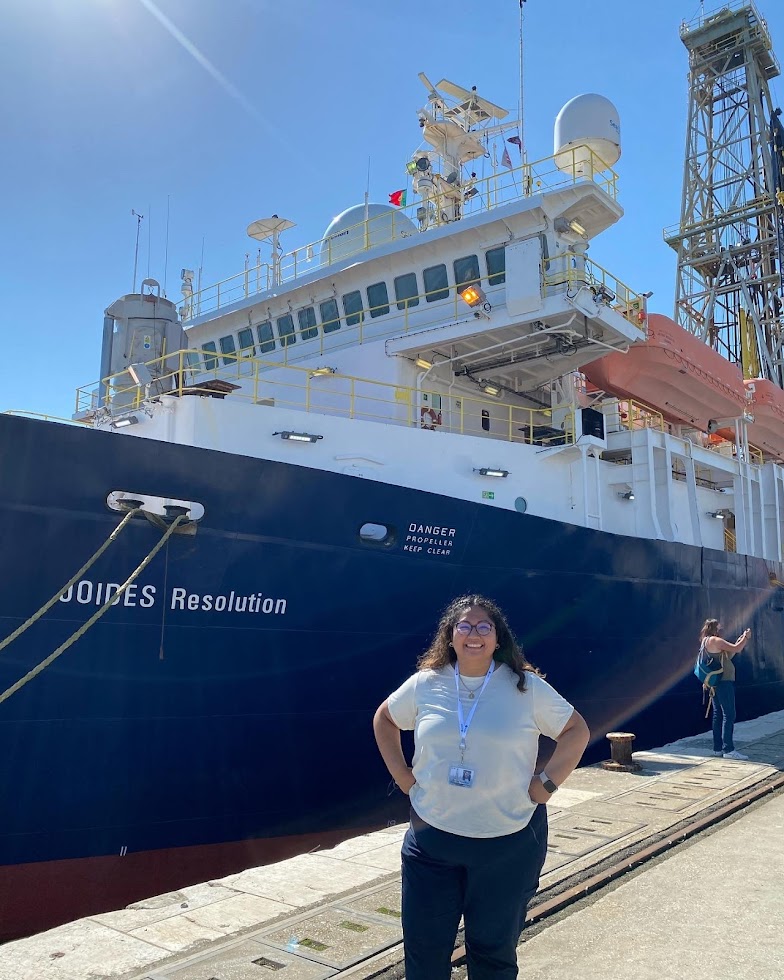
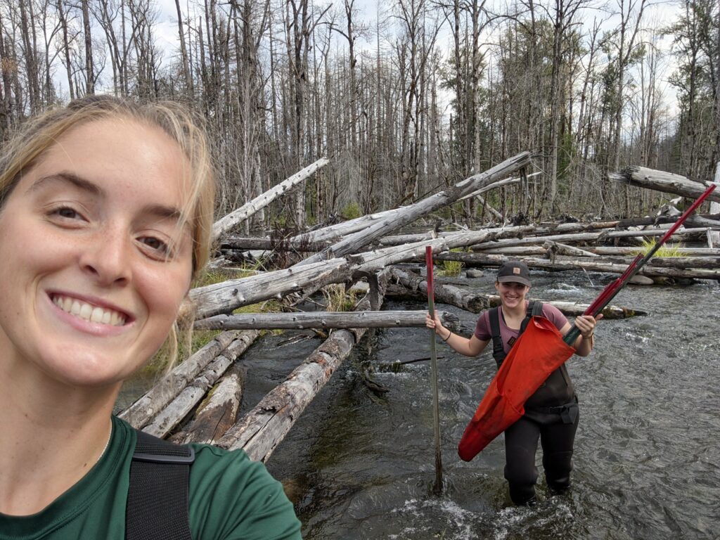
Julia Marks Peterson, 4th year OEAS PhD student (MG&G)

I sent in my United States Antarctic Program deployment packet this week, and suddenly returning to the field for another season feels right around the corner. Memories from last year sporadically surfaced as I answered the prompts asked in the packet.

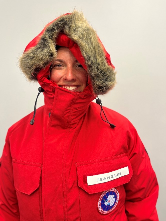
“What dates will you need a hotel in Christchurch, NZ?” I filled out the same hopeful answer as before: The first two days of November, while reminiscing about the two weeks we were unexpectedly stuck there as McMurdo Station tried to reign in a COVID outbreak. “What size parka would you like?” brought me back to seeing my Big Red for the first time, with my name on the pocket and the reality sinking in that we were going to a very, very cold place.

I am heading back to Antarctica as a member of the COLDEX project. COLDEX (the Center for OLDest ice EXploration) is a National Science Foundation Science and Technology Center with the driving research goal of finding the oldest ice in Antarctica. Currently, this quest is a two-pronged effort, being carried out by an exploration team and an ice core drilling team. The exploration team is composed of geophysicists who will fly over a section of the ice sheet in a plane outfitted with airborne radar to collect high-resolution imagery of the ice sheet interior. The goal is to use these images to select a site to drill a deep ice core that extends back 1.5 million years.

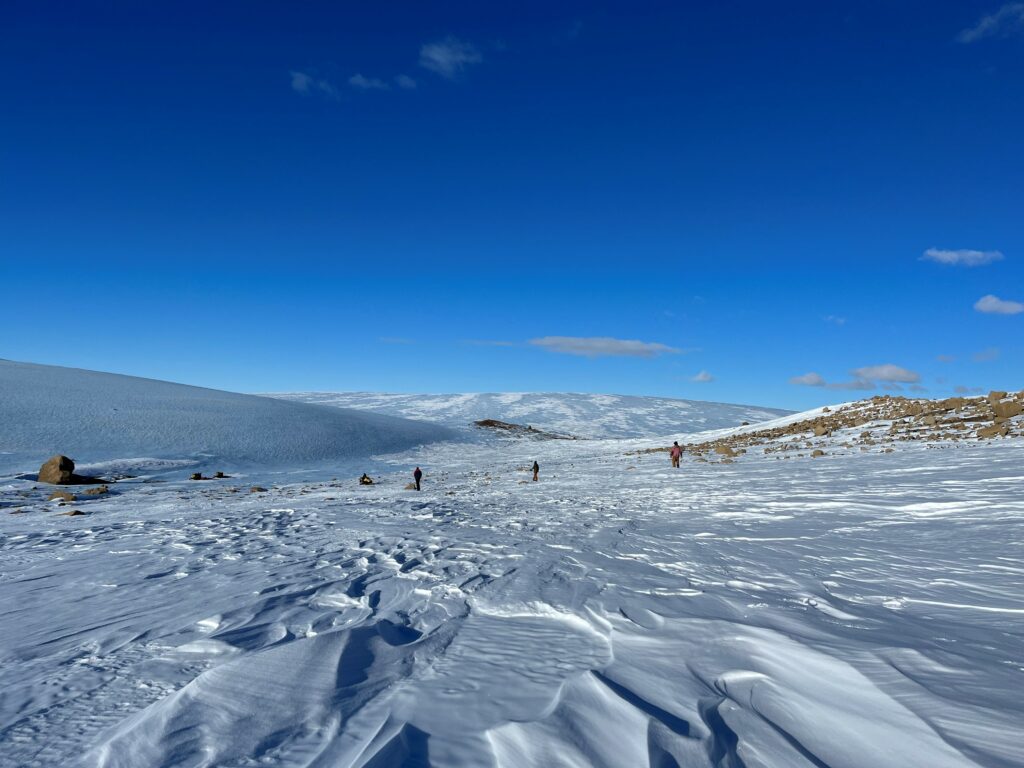
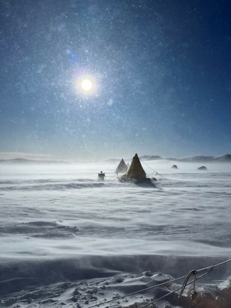
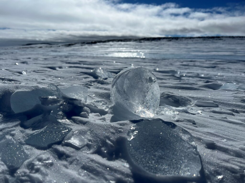
Simultaneously, the ice core drilling team will continue to drill shallow cores from a place called the Allan Hills Blue Ice Area, where the oldest ice ever dated has been collected. The Allan Hills are in East Antarctica, just on the other side of the Transantarctic Mountains from McMurdo Station. Unlike the parts of an ice sheet where winter snowfall is preserved (like high points such as domes), the Allan Hills Blue Ice Area loses surface mass over the year due to high winds and sublimation, the process whereby ice turns directly to gas without passing through a liquid water state. This net loss is balanced by ice flow from an accumulation area upstream, causing uplift of ice that was formerly in the ice sheet interior. Scientists have had a hunch that the ice in this area was old for a long time because meteorites collected nearby were determined to have terrestrial ages of up to ~400,000 years.  And they were right! For the past decade, research teams have drilled ice cores at the Allan Hills BIA and progressively extended the ice core record further back in time. Though the flow and uplift of old ice causes the layers in the ice to be distorted, leading to a discontinuous record, ice as old as 4 million years has been found.

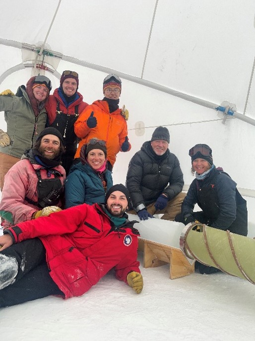
As a member of the ice drilling team, I will return to the Allan Hills BIA where we hope to collect even older ice. Like last year, we will fly to Christchurch, New Zealand where the U.S. Antarctic Program transports people to and from the largest base on the continent: McMurdo Station. Once at McMurdo, we will go through required trainings, including how to safely live away from station in the “deep field.” After about 10 days, we will be flown to the Allan Hills in a small aircraft that flies so low that you feel like you’re weaving through the mountains. We will then set up camp and live at the Allan Hills, drilling ice for eight weeks before returning to McMurdo and then back home via Christchurch.

Antarctic fieldwork is a funny thing; every memory is an initial flood of positive emotions followed by a slightly uncomfortable aftertaste. It’s easy to remember all the fun camp games, the ridiculous jokes upon jokes, the stunning landscape, the products of our hard work, and the beautiful friendships built. However, married to all these memories are the strenuous parts of life in the field. How gross your hair can get after weeks of living in a desert without a shower. How a task you could accomplish in one minute in your normal life would take you 20 (e.g., if you suddenly realize you really have to pee it’s already too late). How cold it would feel to open your sleeping bag in the morning and put on clothes that have equilibrated with Antarctic temperatures. How it would feel when the propane tank fueling the heater depleted and your only path back to warmth was the long and onerous task of replacing the tank. Oh, and the constant wind! So much wind.

As I write this, remembering the negative parts of Antarctica while sitting in peak Corvallis summer temperatures, it becomes hard to imagine returning to that way of life. But these memories are never the first that come to mind. It actually takes work to remind myself of these tough details because the fond parts so easily eclipse them. I think that is what might be most remarkable about Antarctic fieldwork, that it is this incredible showcasing of how adaptable we can be. And it’s this realization that makes me so excited to return for another season.

Science is Timeless

Chuck Lewis, Geology PhD Student

Scientists in the Field

Driving up the Altiplano-Puna makes you feel, well, tiny. As the tops of the massive volcanoes built on ~60-70 km of crust come into reach the air also gets thin, and frankly, you’re far enough away from anywhere that you wonder if mapping these volcanic deposits matters at all. Then you run into a goat herder along a quebrada that hosts destroyed native villages destroyed during an eruption from Lascar.

Our group in the field on the international highway between Chile and Argentina in 2019. The air is thinner than it looks!

My trip to the Andes as an undergrad in 2019 was the first time I left the USA for scientific motivations. My advisor, two other undergrads I’m proud to call friends, new colleagues (hi Nancy!), and I spent a few weeks in the field around the San Pedro de Atacama region. Unbeknownst to me, this trip would be the first time I put eyes on one of the volcanoes that would later encapsulate years of my life as PhD student.

In fact, there were a lot of firsts on this trip. It was the first time I put lines on a map in a ‘real’ scenario and the first time I would make colleagues outside of my Alma Mater. Importantly, it was the first time my advisor referred to me as a colleague—to a Chilean farmer along the Rio Salado just North of Valle del Arcoiris. In part due to the farmer’s respect and enthusiasm for our work, I realized in that moment that there’s a little more to constraining the timing of volcanic eruptions in foreign countries than there is at the surface. It reminded me of days past where my contribution to humanitarian work was a small brick in a much larger fortification that is built on collective efforts of others.

A Radioactive Chain

A zircon crystal with spot analyses and ages annotated. The core is inherited from very old crust and grown over during subsequent magmatic intrusion.

Most of my work over the last year has been focused on dating tiny crystals called zircon to understand the volcanic and magmatic history of the extinct Cerro Chaxas near San Pedro. Dating these crystals allows us to constrain the eruption age by the most recently formed crystal and to reconstruct the history of magma flux into the upper crust prior to eruption. In an attempt to achieve this, I’ve reformulated the method on how to best conduct uranium-lead analyses using Laser-Ablation-Inductively-Coupled-Plasma-Quadrupole-Mass-Spectrometry (LA-ICP-Q-MS). Said in another way, I will be the first person to describe a very specific data analysis and reduction scheme. By characterizing the data differently and using a bit of statistical thinking, we’ve managed to turn a method that is usually regarded as imprecise (relative to far more complicated instruments) into something more precise, with a slight increase in accuracy to boot!  Not bad for a long-haired undereducated punk kid from southwest Florida if I do say so myself!

To my knowledge, the first written report regarding Chaxas was done by John Guest, a PhD committee member of my own advisor. Guest described Chaxas as a series of domes hosting an ‘explosion crater’. Chaxas eruptions wouldn’t be dated until the 1980s by my advisor, who described Chaxas more simply as a series of extrusive lava domes that later collapsed by gravity or subsequent eruption. At the time, the ages suggested Chaxas was active from eight to two million years ago. As it turns out, my work shows Chaxas was only active from two to five million years ago, and my current field observations suggest that the Chaxas domes were indeed partially collapsed by subsequent eruptions.

You probably notice a trend here: critique and refinement of old hypotheses as knowledge and techniques get updated. Indeed, it is likely that someone will come along and prove me wrong on half of what I put out there too. That’s how science works!

The Scientist’s Place in Society

The domes of Chaxas, in Chile (low hills in the front), with Licancabur in the background. The apparent layers near the base of the domes are old eruptive products and mass flows that have been tilted by later volcanic activity.

My success as a scientist hinges on the complementary relationship between my work ethic and the ability of my advisors and mentors to steer me in the right direction. I can tell you I’m in good hands. As pointed out above, my primary advisor has a network that transcends national boundaries and indeed, has a direct influence on the success of students from underrepresented countries and communities. His students frequently go on to do service-oriented jobs (education) or work in the US geological survey for the volcano science center and thus directly impact the safety and livelihood of populations near active volcanoes. It sounds ridiculous, but during their PhDs they too simply described field relationships and dated some crystals and became someone who could do something good for society.

My other mentors can say the same, and I think they all would agree that the most impactful part of their job is bolstering society by helping people be better members of our world. If you want an example, you can stop by the Keck Lab, the Microprobe Lab, or any other lab this week and find a mentor going out of their way to facilitate someone’s growth and, hopefully, eventual prosperity.

But this isn’t a new phenomenon. Guest probably had a good mentor, and he mentored my advisor, who contributes largely to my growth as a scientist. If done correctly, the impact of the scientist to society is far more timeless than their latest age data or, for that matter, anything else that the next generation will prove wrong. A scientists most important impact is what they do for the next generation.

A colleague in front of a block and ash flow erupted from Chaxas. The large blocks in the ashy matrix (up to the size of a human torso) are clearly destructive.

An Analytical and Symbolic Test Drive

Ben Riddell-Young, 5th Year OEAS PhD (OEB)
Me next to a pretty good looking glacier. I love ice if you couldn’t already tell. This glacier is called Grenzgletscher and is near Zermatt, Switzerland. I went here as part of an excursion for an international Ice Core conference that happens once every 4 years. It was an incredible experience!

With the light at the end of the long PhD tunnel beginning to show itself, the uncertainty and anticipation of my next steps are also coming into view. Much of my apprehension stems from worries that I’m not prepared for the unknown, that I’ve grown too comfortable and dependent on my OSU network, that I’ll be overwhelmed by the independence of what lies beyond. Recently, I got a taste of what life might be like “on the other side.”

It began with a long and uncomfortably snowy drive down to the Desert Research Institute (DRI) in Reno, NV. Here, I tested a new analytical system with the ice core team at the DRI. This spring, we’re planning to take this system and a similar one operated by the DRI folks to Summit Station, Greenland to analyze ice cores as soon as they are drilled. This will test if the way that cores are handled on their way back to the US might impact analyses–specifically the analysis of methane and carbon monoxide, which is what my system measures.

In addition to being an important test drive for my analytical system, the trip also began to feel like a test drive for my career as a truly independent scientist. The solitary drive down to Reno gave me plenty of unsolicited thinking time to let the responsibility I was about to take on set in. I was to be the only expert in ice core trace gas analysis in Reno, and the only one for thousands of miles when deployed on the Greenland ice sheet. A lot was riding on my back, and for the first time, I didn’t have my advisor just a couple of doors down. The fact that I was alone and had all my hard work in the trunk of my own car added to the symbolism of it all. For me, the new responsibilities and independence associated with this trip represented the start of the next, more independent step in my life and career.

Me with my main analytical system back at OSU. This system is designed to measure the stable isotopes of methane in ice cores. Although these measurements are incredibly exciting, it can be very solitary and patient work. The trip to the DRI and the work ahead in the field will be a refreshing change.

Symbolism aside, with the exception of a couple of hiccups, the testing went really well. It was great to see all of my hard work come to fruition and eased some of my worries about using the system in the field when the stakes will be much higher. The system we were working with enables what is called Continuous Flow Analysis (CFA), where we melt sticks of ice cores at a continuous rate, and the meltwater and gas is routed to various instruments that measure chemical and physical properties in real time. Given that I’m used to measuring samples where you don’t get to see the data until it is retroactively processed, it was very exciting to see the data in real time. Further, my lab work back at OSU is typically very solitary, whereas sample measurement for CFA often involves several scientists working together. Excited preliminary interpretations and chatter were common as the data were quite literally “flowing” in. Knowing that the system works outside the comfort of OSU, my nerves began to turn into excitement for the upcoming Greenland field season.

The drive back, which was also uncomfortably snowy (La Niña, amirite?), this time provided welcome time to reflect–and to get symbolic again. This trip allowed me to peer into the murky abyss of post-graduate life. This glimpse gave me a taste of what might be to come and taught me some valuable lessons. It taught me that there will always be new relationships and communities to be build and new and old faces to support me along the way. Perhaps more importantly, it taught me that I’m ready for the next steps and that I really do have the capability to function as an independent scientist. The whole experience was very empowering. As the departure date for field deployment steadily approaches, I’m feeling more ready than ever for the unknowns, challenges, and adventures to come.

A Day in the life of a Shipboard Scientist

Saray Sanchez, 3rd year OEAS PhD (MG&G)

From October 2022 to December 2022, I was onboard the iconic International Ocean Discovery Program (IODP) JOIDES Resolution. We were drilling into the ocean floor just off the coast of Portugal. Our goal was to recover sediment from 4 sites that held promising evidence for records of large-scale climate change. To reach our goals, the ship worked 24/7 for 8 weeks, with most people being assigned to day (noon to midnight) or night (midnight to noon) shifts. I was assigned to the night shift. Here’s what most of my days looked like.

Exp 397 Locations . Figure provided by the International Ocean Discovery Program (IODP)

“Morning” (10pm-12am)

My mornings began just two hours shy of midnight. I would wake up and take a short three-minute commute to the gym on board. The gym was surprisingly fully equipped with many cardio machines, free weights, and even a rock climbing finger board. Typically, the gym was rather empty at this time and I could connect my phone to the Bluetooth speaker and blast Beyonce’s Renaissance album while I strut on the treadmill.

After my workout, I would head back to my room and begin getting ready for the day. A few steps in my routine I would never miss were (1) taking my vitamin D pills to make up for the lack of sun I saw, (2) putting on my gold hoops that reminded me of my family and my culture, and (3) putting out my laundry so it was done by the time my shift was over.

Finally, with about 20 minutes left I would rush upstairs to the galley (cafeteria) and quickly eat cereal before reporting to the lab.

During Shift (12am – 12pm)

I sailed as a scientist and was assigned to be a physical properties specialist. I had many duties on board including running cores through multiple instruments, writing reports, and taking samples of the cores. However, before I could even start with any of my duties we would begin every shift with a crossover meeting with folks from the last shift. We would update each other on how many cores we had drilled, any issues that came up, and any resolutions found during the shift. After the crossover meeting, I would pick up where the day shift left off. During the majority of my shift I would be lifting core sections that were 1.5 meters long and about 15- 20 lbs and moving them on and off the rack to different instruments. Truthfully, during the first week I felt so sore that my arms would pulse in pain while trying to sleep. Towards the end of the expedition though, I was strong and lifting cores felt like second nature to me.

During shift we were always well fed. We had snack breaks every three hours which featured an array of drinks and freshly baked goods. At the six-hour mark we would have lunch and the menu was different every day. A few of my favorite dishes served included peanut butter chicken with rice, lentil dahl, and pulled pork burgers. The best part of every week was Sunday lava cakes. It reminded us that another week has passed on the ship. The lava cake was adored by all on the ship so much that there was a dedicated countdown clock for the lava cake. I really miss the lava cakes.

My favorite part of the shift had to be the short 10 minutes when many scientists would gather outside to watch the sunrise together. I saw some of the most beautiful sunrises in my life on this expedition. It was breathtaking being able to see the sunrise in the open ocean with no trees, buildings, or mountains obscuring my view. So many shades of purple, pink, blue, fiery red, and orange danced across wispy and fluffy clouds. One time I even saw the infamous “green flash” which is an optical phenomenon in which the sun changes color to green for just one moment at sunrise or sunset.

After sunrise I knew the end of my shift was close, and I would begin to write down in my daily report what happened during shift for the next crossover meeting.

After shift (12pm- 2am)

Immediately after shift I would eat dinner with the rest of the scientists and technicians from my shift. I would try to have a light dinner as I would often be trying to sleep within the next two hours, and it’s a little hard to sleep with a full stomach on a rolling ship. Sometimes a group of scientists would gather in the movie room and watch a film. The movies we would watch depended on the shift. If the shift was slow because we were waiting to drill due to weather, then we would watch a high-energy action movie. If the shift was full of constant movement and a little more tiring than usual, then we would watch a comedy or something more light-hearted.

I would often have time after my shift to call home. Luckily, all scientists were given internet access on one personal device. I chose to have my phone as my device so I could text and call my loved ones throughout the day easily.

After our shifts was when we would celebrate holidays, birthdays, and expedition milestones. We were able to celebrate both Halloween and Thanksgiving onboard with themed meals. We sang karaoke and had dance parties. I would give haircuts and paint people’s nails. We would try our hand at photography with cool 360° cameras. It was a great time to get closer to the other scientists on board and really humanized scientists for me.

Last thoughts

Overall, I really enjoyed my experience on Expedition 397. It provided a unique environment for me to interact and live with people from around the world. The scientific team was lovely, and the staff onboard were knowledgeable and inclusive. I would highly recommend any graduate student interested in deep sea drilling to apply to an IODP cruise!

Follow more of Saray’s science on Twitter at @paleosanchez and of the IODP Expedition 397 cruise under the hashtag #Exp397.

Changing Light in the Arctic

Anna Simpson, 6th year POA PhD Candidate

www.annaesimpson.com

Imagine a time when you’ve watched the sun sink just below the horizon and the sky and clouds reflect spectacular shades of oranges, yellows, pinks and lavenders. Now imagine this scene playing out for hours because the sun is moving in a wide, low arc just above or below the horizon. This is what the sky looks like at latitudes above the Arctic Circle around late fall/early winter when the sun sets for a few months. I experienced this multi-hour sunrise/sunset for the first time in the Beaufort Sea in November 2022, while participating in fieldwork onboard the R/V Sikuliaq. 

As I was preparing for the cruise, I knew it was going to be dark for much of the time due to the proximity to winter, but I thought the transition would be distinct, taking place  over a short period of time. While most of the time was dark, we experienced exquisite twilight with slow sunrises transitioning into slow sunset for a few hours a day. This time was magical, watching the shifting light and clouds across the ice, sea and mountain scapes. Most of the science crew had a daily routine of going outside to brave the bitter, cold winds to observe this magic.

Photo Credit Amanda Kowalski
Photo Credit Lloyd Pikok

The science crew was composed of many different research groups, all collecting data to understand various parts of the Arctic ocean system. My primary responsibilities involved monitoring and downloading data from instruments called chipods that measure temperature changes really quickly (100x/second). We use this data and some theory to compute turbulent dissipation rates. Higher dissipation rates indicate places where there is greater turbulent mixing. For example, if we have a cup of coffee and pour cream into it, it will eventually mix and combine together. If we take a spoon and stir the liquid in that cup, this causes higher amounts of turbulence which will combine the coffee and cream more quickly. Our spoon is the “event” that causes greater amounts of turbulence. Measuring turbulent dissipation rates helps us to understand the distribution and transport of heat, nutrients, and contaminants in the ocean.

I also spent a bit of time observing and capturing the shifting light, the reflections across the land-sea-sky-scape through watercolor painting. In my “normal,” land-based life, I pay attention to the way in which the light shifts in the spaces I occupy throughout the days and seasons. This careful attention has helped me develop a strong seasonal sense of the light and shadows in my own home and neighborhood. I am particularly drawn to the light at the edges of the day – sunrises and sunsets. In the mid-latitudes, the sunrise and sunset are fleeting, with the golden glow lasting for a short period of time. In the Arctic, this time is prolonged, providing me an opportunity to explore and practice capturing this special light through watercolor painting. 

Painting and other creative pursuits have been an integral part of my identity from my childhood. Only recently, I have realized the extent to which my identities as a scientist and artist are deeply intertwined. I enjoy using painting as a tool to explore my surroundings, record my observations, capture details, and describe my overall big picture feelings or moments. This creative practice fuels my curiosity and perception, both integral parts of being a scientist.

A new field, new country, and new data

Abby Hudak (She/her), 1st Year OEAS PhD Student
Seeing the Fagradalsfjall eruption in Iceland on my way to Denmark!

I have found that change, risks, and being outside your comfort zone is where the magic happens in life. As Alan Watts said, “The only way to make sense out of change is to plunge into it, move with it, and join the dance.” After leaving my comfortable and steady job as a data analyst this past summer, I dove into a series of changes as I started my journey as a Ph.D. student.

Embarking on my new adventure of starting a Ph.D. program, fortunately, began with an exciting opportunity to travel internationally, help colleagues with their research, and get my first hands-on experience with paleoclimate research. Both my master’s and bachelor’s degrees were in biology, but after learning about paleoclimate several years ago, I decided to change gears (and dive head first) into a new field of research for my Ph.D. Beginning my doctoral experience with hands-on lab work in a country I had never been to was really exciting.

Ice core science is commonly an international effort due to the challenging logistics of retrieving and storing polar ice cores and the variety of skills required to analyze them. The OSU Ice Core & Quaternary Geochemistry Lab has close colleagues at the University of Copenhagen at the Niels Bohr Institute Physics of Ice Climate and Earth. I had the opportunity to help those folks with an extensive gas measurement “campaign” (i.e., an extended period of time collecting measurements) and also learn a lot about the lab techniques I will use in my own research.

The ice used in the campaign was from Northeast Greenland in an area of fast-moving ice called an ice stream. Collecting ice from this region allows researchers to uncover how the ice stream may contribute to sea level rise and reveal past climate. The gas extracted from the ice core is derived from small bubbles locked in the ice, revealing past atmospheric conditions. (For more information on the project, check out the EastGRIP website). During the campaign, we had a team of 5-8 scientists running a continuous analysis of the dust and gas content of the core and also collected meltwater from the ice to examine the water chemistry at a later date.

An ice core melting on a hot plate continuously. Meltwater is collected through a series of tubing and instruments which can then extract the gas, count dust particles, and collect meltwater.

The campaign needed lots of hands on deck to take measurements continuously throughout the day. This approach allows for precise and high-resolution measurements. Ice was prepared and continuously melted on a heated platform. The meltwater then flowed through a series of systems that measured dust and gas and exported the meltwater to be analyzed later. Our time was spent diagnosing issues with a complicated and specialized system, cutting and preparing ice in a -15°C freezer, monitoring the measurements, and collecting discrete meltwater samples.

Serendipitously, while I was there doing ice core science, the University of Copenhagen celebrated the 100th birthday of Willi Daansgard, a Danish pioneer in ice core science. The university held a three-day symposium hosting ice core science talks and celebrating Daansgard’s achievements in ice core science. I was really excited and thankful to learn about the rich history of this field I have just joined.

Aside from the research, Copenhagen taught me the joy of commuting by bike, and I immediately bought a bike first thing when I got back to the U.S. Exploring castles and palaces, and biking around exploring the city was a fun way to spend the evenings. This trip was a great adventure experiencing a new country and learning about the new field I am so excited to now be a part of.

Find Abby on Twitter @AbigailHudak

From Panama to the North Pole

Maria Cristina Alvarez Rodriguez, OEB M.S. Student

Since I was a child, I have been drawn to science. I always imagined myself working in a chemistry laboratory and participating in research; unfortunately, this is a hard dream to have if you come from Panama, where research opportunities are few or non-existent. But I was lucky enough to receive a national scholarship to study sciences related to water resources internationally, and I used it to study ocean sciences at OSU. It was here that I was introduced to the different aspects of oceanography, and I learned that I could get involved in research.

After my undergraduate degree, I was accepted into the College of Ocean, Earth, and Atmospheric Sciences to get my master’s degree under the supervision of Laurie Juranek, a badass chemical oceanographer. As part of the NSF-funded Synoptic Arctic Survey, an international effort to collect data to detect ongoing and future climate change, I embarked on a two-month-long journey that took me to the North Pole!

Figure 1. Synoptic Arctic Survey scientists on the Healy during ice liberty. Photo credit: Deborah Cordone.

My role in this exploration is to study dissolved oxygen concentrations in the Arctic basin. Aboard the ship Healy, we worked from Monday to Sunday for two months straight, collecting a variety of data. During what we called a “long station,” we conducted CTD (Conductivity, Temperature, and Depth) casts and deployed VPR (video plankton recorders), bongo nets, Van Veen grabs, HAPS Cores, and multicores at deeper stations.

When we did full CTD casts, we sampled from 24 bottles, each containing 12 liters of Arctic water, to be shared by multiple teams. The dissolved oxygen team, all from OSU (Laurie, Genevieve Coblentz-Strong and myself), sampled first in order to limit environmental contamination in our water. Laurie trained us to properly sample from the water, always watching out for bubbles — we don’t want bubbles! The first thing we need to do is to take the draw temperature, which is the temperature of the water when we first open the Niskin bottle. This is an important step for density calculations at the time the sample is taken. I rinse the flask and start filling it up with water, watching out for any bubbles, then I hand my co-worker the flask so she can “pickle” the water with chemicals that will “fix” the oxygen concentrations of the sample – keep it the same for later analysis. She gives the flask a good shake to mix all the chemicals. Once we finish, we fill the neck of the flask with deionized water to prevent any oxygen from entering the sample. After 30 minutes and a second shake of the flasks, we are ready to leave them in the dark so they can come up to room temperature.

Figure 2. Left to right: Emily Shimada (STARC), Maria Cristina Alvarez (OSU), Laurie Juranek (OSU), Genevieve Coblentz-Strong (OSU)

After us, the CO2 people always have their turn, then the methane group, then the biologists. In the end, everyone has taken some water to do their analysis. While the CTD team is sampling there is other science happening on the other side of the ship. Plankton nets are deployed to vertically sample from the water column. The biologists deploy the VPR, which is a camera that takes pictures of the microorganisms in the water column. There are pumps to filter water to collect particulate organic carbon in the water column – the pumps need to be under water for four hours!

Lastly comes the benthic (bottom) sampling, which uses different coring instruments to get samples of sediment from the ocean floor along with the organisms in it. At this point, it is already midnight, and the cores will take hours to process, extending to the early morning of the next day, when the O2 team starts doing Winkler titrations to get discrete oxygen concentrations from our samples. With my data, I hope to find patterns of changes occurring in the Arctic Basin, and since this is an area with scarce data, I will also be contributing to creating a baseline study of the transformation of this ecosystem for comparison with future data.

Figure 3. Maria Cristina performing Winkler titrations. Photo credit: Leonard Sussman

At the top of the world, the Healy crew organized what they call “ice liberty” which was the event in which everyone on the ship gets to go walk in the ice at the North Pole. The ice experts made sure the thickness was safe and they determined a perimeter in which we could hang out for two hours in the snow. We all got dressed up in our mustang suits, multiple layers of clothes below the suit, scarves, face coverings, beanies, and gloves. We made a line and walked down to the ice. It was a magical moment that I never thought I would ever experience. A Panamanian from Central America in one of the coldest places on Earth?

During this trip, we got to experience most of the items on the “bucket list for the Arctic.” On our way back, we saw a beautiful young female polar bear! She looked in great condition and the smell of the ship attracted her to the boat. It was incredible to see this magnificent animal, using the snow to clean herself. We also got to see the northern lights three times! One was incredibly intense, the green flashes of light dancing around the sky like a river flowing through the air. On open waters, we saw many bowhead whales and walruses. During these moments of awe and wonder, I felt an immense gratitude towards everything, and everyone involved in this exploration. Every single person in the Healy did their best to make the science happen. We felt joy during our work, made good friends, and learned from each other about what it means to be a human, a scientist, and a student.

Figure 4. Polar bear sighted during the expedition. Photo credit: Leonard Sussman

Photo credits: All pictures were taken during NSF-funded Synaptic Arctic Survey (SAS), Healy 2202 Research Cruise.

Transboundary Cooperation in the BuPuSa Basin

Zoe Rosenblum, 2nd Year Geography PhD Student

“Go build partnerships.” This is the assignment that I received from my advisor when our collaborators invited us to tour our study area and present a joint session at the WaterNet 2022 Conference in South Africa.

My advisor could not make it because he had to meet with the Dalai Lama (what an excuse!).

My journey started with the 1:50 AM Groome shuttle to PDX on October 4. Too many hours later, after risking health on flights that no longer require passengers to wear masks, I arrived in Johannesburg, South Africa at about 6:30 PM local time on October 5. I was greeted at the airport by a young man holding a sign with my name on it, and we discussed foods, languages and jobs on the short drive to my hotel in Pretoria. The hotel lobby was crowded by a Mozambican youth gymnastics team who had a competition nearby. I checked in with ease and then, too tired to eat, showered and headed to bed with the lullaby of cars honking melodically to the beat of the music blasting at the corner market.

Sunrise in Pretoria

My first day in the country, I walked to our partners’ offices and was delighted to find that Global Water Partnership and International Union for the Conservation of Nature, the two organizations I work with on a transboundary rivers project, have offices side-by-side in the same building. They hosted a delicious lunch catered by a local restaurant, as a way of welcoming their partners (colleagues also joined from IUCN Headquarters in Switzerland). As soon as we sat down to eat, the ideas started rolling out:

“You must not let my colleague forget to tell you about our idea to send students from the basin to study at OSU.”

“Can we publish a book on the basin?”

“You must come back again and bring Aaron.”

So, on Day 1 I learned the hospitality of my hosts, the importance of meeting in-person to informally discuss project ideas, and the cultural significance of eating in someone’s home (or office) before discussing business.

All smiles after a productive kick-off meeting. Photo credit: Leticia Ngorima, GWPSA.

The next day, seven of us flew from Johannesburg to Harare, and then drove in two rental cars to Mutare, the third largest city in Zimbabwe, a few kilometers from the border with Mozambique. Here we had two packed days of touring the transboundary basins through the eyes of the Catchment Managers and Hydrologic Engineers that work for the Zimbabwe National Water Authority. There are three river basins we focus on: the Buzi, Pungwe and Save Basins, known together as the BuPuSa Basin.

Map from USAID showing transboundary river basins in the area; the BuPuSa basin is the most northeast.

Perhaps I should take a moment to recognize that I am a geographer with a captive audience. Check out this map! River basins are outlined in dark blue. Notice how they pay no mind to the very straight dashed black lines that denote country borders? European colonizers generally did not consider ecosystems when drawing country borders. The work of transboundary water cooperation is to bring together countries that share water resources to share the burdens and benefits of water management. The BuPuSa Basin spans Mozambique and Zimbabwe. The project with GWP and IUCN centers around strengthening capacity of the two countries to establish protocols for sharing data, water, and more.

Save River at Birchenough Bridge, Zimbabwe.

From Mutare we drove south to the Save River, where we observed low flows (it was the end of the dry season) and sedimentation. It’s hard to imagine the flooding event described by engineers which washed away eight bridges in the basin. Much of the basin tour focused on visiting places where the floodwaters washed away monitoring equipment, bridges, and even houses and humans.

Copa Village, Zimbabwe, 2022

Two key observations of the river. The obvious one was the heavy siltation and turbidity, caused by illegal gold panning upstream. The second observation was not so obvious to me. This part of the river looks like many in Oregon – a river channel dotted by boulders. However, in Oregon, the boulders were washed down by the Missoula Floods. In Zimbabwe, such a site is unusual. The boulders were washed down river by floods in the wake of Cyclone Idai. With the floodwaters, houses and hundreds of people were washed away as far as into Mozambique.

Project partners in the basin are improving monitoring and developing early warning systems for such flooding. Now, water level dataloggers send an automatic alert to an engineer’s phone when certain flow thresholds are reached, and the engineer then alerts a WhatsApp group that includes engineers on the Mozambican side to warn of flash flooding potential. These dataloggers are located at multiple sites, so the engineers can measure how fast the floodwaters are moving. Improvements may include a more reliable battery/power system for the dataloggers, raising awareness about flood risk and preparedness, and installing flag systems to communicate river level and flood warnings.

The next day we traveled north to the source of the Pungwe, where, we were told, the water is clean enough to drink. My observation of the surrounding monocultures of banana, avocado and macadamia left me skeptical of this statement, but I did reach down and touch the water, and could certainly imagine cooling off in the river on a hot day.

Team discussion on the bank of the Pungwe River.
Banana plantation near the Pungwe River.
Fun fact: past hydrologists used this zipline to measure the flow of the river, carrying heavy equipment and dangling it down into the river – pretty risky! Also, this is about as close as I got to Mozambique (it’s just across the river) during the trip.

After a week of tours and meetings in Zimbabwe, we returned to South Africa for our engagement at the WaterNet Conference. The conference presents research and projects from across the Southern African Development Community, drawing together policymakers, academics and practitioners. Our session reflected on the use of data in transboundary water negotiations. Highlights of our session included engaging keynote addresses from Dominic Mazvimavi, Professor Emeritus at the University of the Western Cape and Professor Melissa McCracken from Tufts University, an insightful panel discussion, a presentation of the Transboundary Freshwater Diplomacy Database by CEOAS Ph.D. candidate Alexandra Caplan, and stories of data challenges in the BuPuSa Basin from Mr. Elisha Madamombe, Regional Coordinator for the BuPuSa Project at GWPSA. You can learn more about this topic in a blog about our online training with GWP, which we held the morning after my return to the US.

Co-facilitating our joint session with GWP and IUCN at WaterNet 2022.

There were many more aspects of the trip I would love to share. The observation that informal environments often are the best for productive discussions. How well my partners took care of me in the region – Pinnie guiding me through a questionable border crossing, Tariro stopping every 20 minutes for me to vomit on a long drive when I had food poisoning, Cebo making all of my transitions between hotels and airports as easy as possible. Ask me anything. I’ll leave you with these photos of South African wildlife and signage about water:

Is South Africa running out of water? If you’re confused by this question, just Google “Cape Town Day Zero” to learn a little. I will say, all of the hotels I stayed in Johannesburg area had signs like this one about reducing water consumption. However, none of the places I stayed in Cape Town had such signs. While one Uber driver told me there is definitely a water crisis and that a project is being considered to pipe water from Zimbabwe to South Africa, another driver casually assured me, “There is no water shortage here.”

Returning to my roots: Exploring groundwater resource vulnerability and water scarcity in Quintana Roo, Mexico

Maria Jose Iglesias-Thome, M.S. Student, Water Resources Science

My passion for water started at a very young age. When I look back at my childhood, the things that interested me growing up, and where I stand today, I can’t help but think that this trajectory makes sense. When my thesis advisors gave me the chance to propose a research project, I jumped at the opportunity to study groundwater in my hometown. 

I grew up in Puerto Morelos, Mexico, a small coastal town situated a few yards from the Caribbean ocean, nestled between vine-covered sand dunes and dense marshy mangrove forests and sitting on top of an ancient underground network of “rivers”. For locals, the idea that underneath lies a hyper-connected and inherently sensitive groundwater system, is part of the traditional knowledge passed on through generations. As the region continues to grow and develop, the abstract ideas of how the local aquifer flows, are replaced with an erroneous notion that clean water will always be accessible and will never cease to exist.

The place: Complexity hidden beneath our feet

Figure 1. Map of Quintana Roo. Tony Burton (2010)

The whole Yucatan peninsula sits on a flat limestone platform, built on top of millenia of fossilized calcified skeletons from creatures past. The carbonate rock that was left behind is highly soluble and vulnerable to rainwater dissolution. Throughout the years, heavy rainfall, common in this tropical environment, has carved a series of conduits, revealing a contiguous coastal aquifer and a landscape virtually devoid of rivers and non-groundwater dependent surface water systems. This process is known as karstification and the topography it leaves behind is known as karst. Scattered across the Yucatan peninsula are larger dissolution conduits: caves and sinkholes that have collapsed to form what are locally referred to as cenotes, derived from the Mayan ts’onot, that give us a direct look into the aquifer. Other important hydrogeologic features include major faults systems and regional-scale flow patterns from the center towards the marginal ends of the Peninsula, the coast. Inside these coastal karst aquifers, a thin freshwater lens (5-7 meters deep) lays atop an intruding saltwater layer, known as the “cuña salada”, penetrating 10-15 meters into the subsurface. This shallow layer provides most of the water for an increasingly growing population across the entire peninsula.

The problem: Chaotic population sprawl 

The complexity of this groundwater system results in an inherently vulnerable resource, especially to anthropogenic sources of disturbance. Likewise, it is unclear how patterns of water use may be depleting groundwater quantity and/or degrading groundwater quality and how these changes are affecting water availability to local communities and ecosystems in the region. Extreme urbanization and population growth may be a large driver of water insecurity and scarcity.  In 2017, the state of Quintana Roo hosted over 17 million tourists and sustained an average hotel occupancy of around 83%. The number of tourists visiting Quintana Roo has more than doubled in the last 10 years, with a 120% increase in yearly tourists between 2009 and 2019. Similarly, the population in the area has grown around 40% over the past 10 years. Spatially, development in the region follows an overall gradient from north to south, while the population is currently concentrated in northern communities, southern communities are experiencing higher rates of population growth. In other words, development is quickly spreading south.

As urbanization continues to sprawl across the coastline, concerns about saltwater intrusion, deep-aquifer contamination through wastewater injection, and shallow-aquifer contamination through septic tank leaks and fertilizer application continue to grow.

Understanding the relationships between social and ecological systems through their shared reliance on groundwater resources is important for evaluating water security and subsequent water scarcity issues. It may also prove critical in examining how coastal communities that rely on water for their livelihoods may be disproportionately affected by ongoing changes in water resources in the region.

Figure 2. Situation map for a hypothetical aquifer in Quintana Roo, showcasing transformations (yellow diamonds), flows (arrows) and storages (white boxes).

The methods: Mixed methodology and an evolving plan

Mixed research methods are useful tools in studying complex social-ecological system problems, like those in Quintana Roo. Qualitative interviews are a central component of my research methodology. This summer I had the privilege of conducting semi-structured interviews with large and small water users, water managers and water protectors. Interviewees included hotel representatives, domestic users, NGO and civil society leaders, and local government officials. My interviews covered a variety of topics and were rooted in concepts related to water scarcity, resilience theory and social-ecological systems frameworks. The data collected with these interviews will allow me to understand important exposure to water scarcity and other hazards, social vulnerabilities and sensitivities that affect how individuals and groups respond to water stress and aid in evaluating adaptive capacity from varying degrees of scale. Synthesizing important hydrogeological knowledge as well as the data collected through interviews, will allow for a holistic approach to understanding and measuring  water scarcity through an integrated assessment model-framework (IAMF). The model aims to integrate biophysical aspects of water scarcity, such as seasonality, water source, quantity and quality, with socioeconomic aspects of water scarcity, such as accessibility, reliability and social vulnerability.  It also hopes to include nuances that are often overlooked in water security models and water scarcity assessments. 

It is fascinating to research a place and a problem that are so dynamic and often evolving. One of the reasons why I am so deeply interested in natural resource management and specifically water resource science is because I grew up seeing the landscape around me change. I feel infinitely privileged to be working in a place I love and know, and hope to continue to contribute to what is known about it.

Playing in Nature: Graduate Student Edition

Aleah Hahn, Marine Resource Management Student

Flashback to my childhood: I am maybe 8 years old, wearing some worn out hand-me-down clothes from my brothers. I put on my trusty light blue crocs and callout to my mom, “I’m going to go play in the woods!” Stumbling through the leaf litter and sticks and fallen trees, the cold, wet, yuckiness of a Michigan fall does not phase me. I climb up the hill to my favorite spot. The sun decides to come out and light up my small patch. The birds are excited about the sun, too, so I sit and watch them play. I get distracted by a worm wriggling into the ground and giggle in awe of all the life around me. I am in my own slice of paradise.

I have always found myself connected to the outdoors. Whether swimming in the nearest body of water, going for a hike in the woods, or catching a bluegill in the creek, nature is where I am happiest.

Now, I am 22 years old, and for the past year I have been playing in a river –I mean, working on data collection for my master’s thesis.

My research site is east of Eugene, OR and sits below Cougar Dam. I am looking at a new approach to river restoration and trying to understand how different habitat qualities might impact the spawning and rearing of Chinook salmon. Before treatment, the river was not connected to its floodplain, the nursery habitat for juvenile Chinook. Treatment reconnected the river once again to its floodplain. The model I am using requires me to understand how fast the water moves and how deep it is before and after treatment. A team of five undergraduates and I collected that data, monitoring an untreated section of river upstream of the treatment area and regions in the treated area.

I have traded in my crocs and hand-me-downs for wading boots and thick neoprene waders. The waders were helpful when bushwhacking through stinging nettle, blackberries, salmonberries and virtually everything pokey in the world. If it is pokey, I found it, I probably grabbed it, and I most definitely learned my lesson.

My fieldwork involved walking on large wood placed throughout the river. When I began the work, I was slow and cautious, but by the end of the summer, I had to remind myself to slow down so my undergraduate helpers could keep up.

The weather and field conditions were not always the most pleasant to work in. I don’t recommend trying to get through stinging nettle taller than yourself –their radiating sting is unpleasant. Sticking my arms and face in the chilly water to retrieve sensors and replace them, doing my best, unsuccessfully, to keep the water from pouring into my waders, is, again, not recommended.

But during all the unpleasantness, I was truly living my best life. Some of the most uncomfortable parts of life can be the most enjoyable; it is all about perspective. I would rather have a bad day in the field and breathe in the fresh (well, sometimes smoky) air, see the life booming around me, and connect with nature, than have a mediocre day in the office. My favorite memories are of the times when we simply stopped and let the view in. The treated area was always busy with birds, butterflies, and fish. I would pull a rock out of the river and show my students the different macroinvertebrates crawling around. The ability to find life in all corners and crevices of the site excited my inner child.

Being at my study site reminded me of those days in the woods as a kid. It was MY place, my little slice of paradise. It also showed me that I didn’t have to do research to go out to the woods and frolic. So even though my field season has ended for my master’s project, you will always be able to find me revitalizing my soul out in the woods somewhere.