In early July, the Cormorant Oceanography Project seabird team, myself (Alexa Piggott), Adam Peck-Richardson, and Rachael Orben, traveled to the Columbia River Estuary, at the border of Oregon and Washington, to capture and tag adult Brandt’s cormorants. Our goal was to test the performance our latest GPS/GSM biologging tags made by Ornitela.
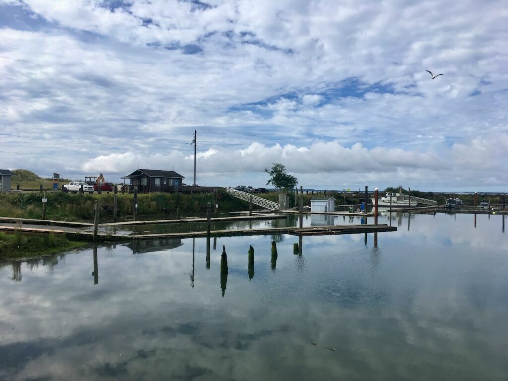
Chinook Harbor, WAEngines acting upView of Baker BayDespite some initial setbacks from engine trouble (and a brief switch in profession to boat mechanics), we were soon out on the water with the sun shining.
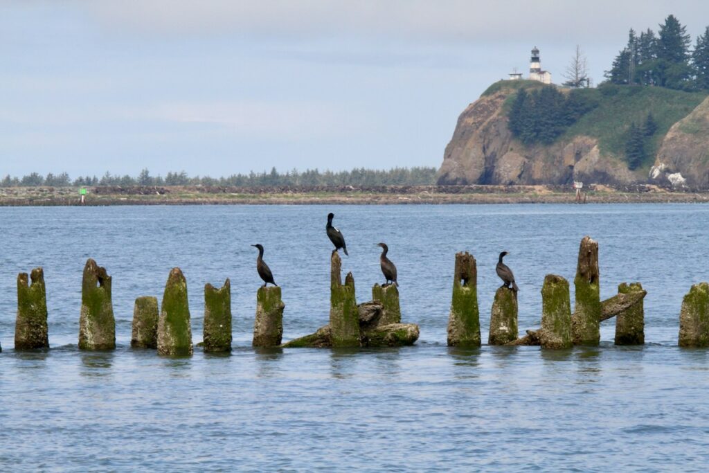
Brandt’s cormorants’ nest, roost, and forage near the mouth of the Columbia River. We were specifically targeting cormorants roosting on estuary channel markers, as these can be relatively easy locations to catch birds during the day. Over two days, we successfully deployed 6 biologging tags. Preliminary data, shows the cormorants moving and foraging near the mouth of the estuary and spending time at Cape Disappointment, WA.
We also spotted one of our newly tagged birds on the second day, resting on pilings with other cormorants and close to actively foraging Brandt’s and double-crested cormorants.
These tagged cormorants will collect detailed location and movement data, along with high quality profiles of water temperature, bottom soundings, surface currents (based on bird drift), and IMU data used to recover wave statistics. The data collected by these cormorants will be used to estimate bathymetry and circulation in the estuary and help calibrate and improve nearshore modeling.
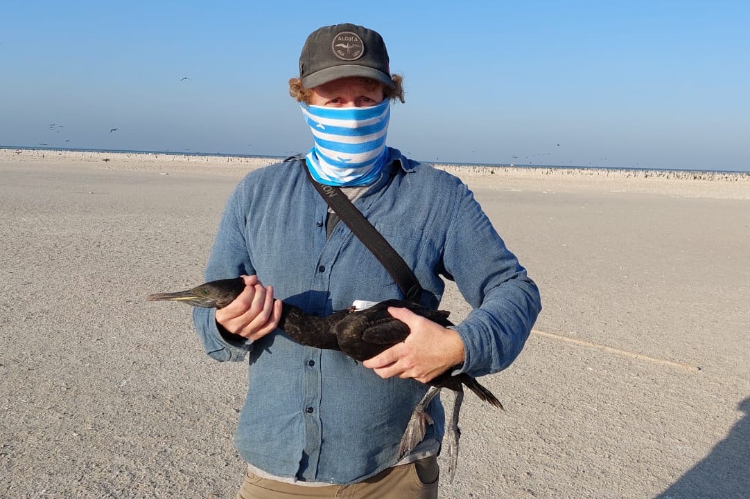
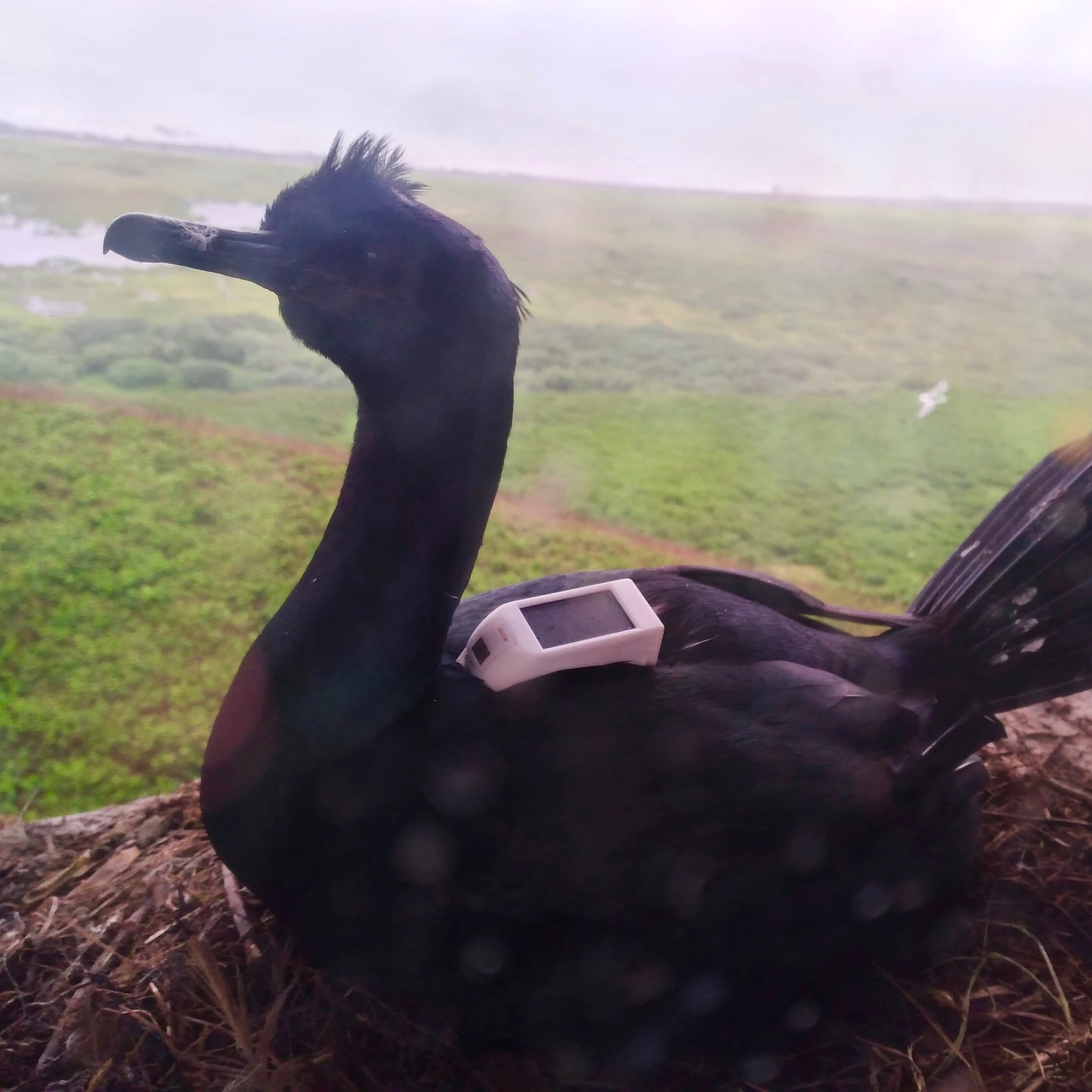
The Cormorant Oceanography Project made its first visit to the Hawar Islands, in the northern Arabian Gulf, in early December 2021. Myself (Adam Peck-Richardson) and collaborator Dr. Sabir Bin Muzaffar (United Arab Emirates University) spent four days visiting the Socotra cormorant colony at Rubd Al Shariqiya, a 1.5 km wide desert island surrounded by expansive shallow seagrass beds (and the world’s largest dugong aggregation). Unfortunately, the timing of our visit was later than originally planned and most of the cormorant chicks (10s of thousands) were very large and very mobile. This made it difficult to capture and tag adults at nests, but we were able to deploy four tags and gained valuable insights for further tagging work in 2022.
Two adult Socotra cormorants attend their nests at the Hawar Islands colony as large juvenile cormorants mass in distance (photo: Adam Peck-Richardson).
Data from the four tags immediately began streaming back to us (data are transmitted through cell phone network connections) and we are using this preliminary deployment to further improve tag design and performance. These GPS/GSM biologging tags, made by Ornitela (Vilnius, Lithuania), collect location and movement data and take detailed water temperature and depth measurements when the cormorants dive. Meanwhile, our oceanographer teammates at Oregon State University, led by Dr. Doruk Ardağ, have been spinning up a model of water temperature and circulation in the Arabian Gulf. The oceanographic data collected by cormorants are now being used to help calibrate and improve these complex regional models.
Scenes from the Hawar Islands, Bahrain, clockwise from top-left: local fishing boats at dawn; an adult Socotra cormorant feeds a pair of juveniles; a small group of adults still attending nests with eggs; Sabir waits patiently to capture a cormorant to tag; Adam with a tagged Socotra cormorant; the BBC team scouts potential shots with the colony in focus.
In 2022, we are planning to deploy additional oceanographic tags on Socotra cormorants at several colony sites throughout the region. These deployments will provide valuable data on population movements of Socotra cormorants and improve oceanographic modelling in the Arabian Gulf.
Juvenile Socotra cormorants gather and wait for adults to return from foraging in the northern Arabian Gulf (photo: Adam Peck-Richardson).
The Cormorant Oceanography project is based at Oregon State University and funded by the Office of Naval Research. Our work in Bahrain is made possible by logistical support from Dr. Abdulqader Khamis (University of Barcelona) and Dr. Humood Nasser (University of Bahrain), and administrative support from H. E. Sh. Ebrahim Alkhalifa and Rawan Suleiman (UNESCO – Arab Regional Centre for World Heritage). Local travel and logistics were coordinated with Sam Rowley and Nick Green (BBC – Natural History Unit) who are scouting for an upcoming project, Asia. Check out the brief clip below, from BBC’s Planet Earth, for an overview of how the Hawar Socotra cormorant colony fits into the Arabian Gulf’s desert-marine ecosystem.
We are drafting this blog during our last few days on Middleton Island. Our field season here flew by and this year’s chicks are beginning to fledge. We tagged 21 pelagic cormorants nesting on the seabird research tower and data are streaming in through the cell phone data network. For background on the seabirds and researchers that call Middleton Island home, and for an introduction to our work, check out our previous blog post: “A field season on Middleton Island: Tracking pelagic cormorants in the Gulf of Alaska.”
Getting to Know Pelagic Cormorants
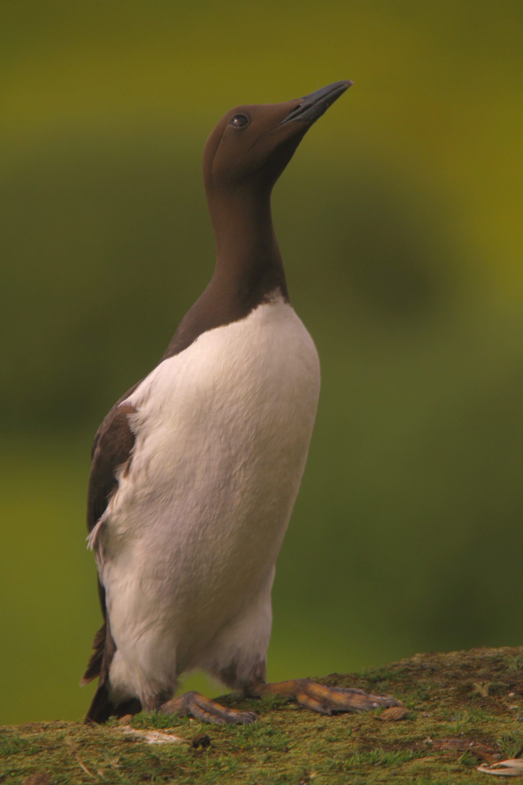
Pelagic cormorants are medium-sized, piscivorous seabirds that inhabit rocky coasts from the Baja Peninsula into northern Alaska, and across the Aleutian Island Chain to Siberia. The second smallest of the six extant species of cormorant in North America, pelagic cormorants weigh between 1.5 and 2 kilograms with a wingspan of about 1 meter. Generally thought of as having all black plumage, they are quite colorful when viewed up close. During the breeding season their feathers shimmer with iridescent green, blue, and purple tones and the exposed skin around their eyes and bill becomes bright red.
Pelagic cormorants mostly forage along the nearshore seafloor and nest either singly or in large colonies, typically on steep cliffs above the water. The majority of the North American pelagic cormorants nest in Alaska, with an estimated population of 50,000 pairs. In the 1980s and 90s Middleton Island was home to the largest pelagic cormorant colony in the state with 2,300 pairs. However, the 1964 earthquake uplifted the island and the cliffs have since eroded into sloping bluffs. This loss of nesting habitat lead cormorant numbers to decline steeply. Today, fewer than 200 pairs nest on the island.
Four pelagic cormorant chicks at their nest at a window in the research tower
Building on a Research Legacy
Despite their broad distribution, pelagic cormorants are relatively poorly understood. Prior tagging studies on Middleton have shed some light on pelagic cormorants’ foraging behavior by examining dive depth, duration, and frequency (Kotzerka et al. 2011, Stothart et al. 2016). We are expanding on this knowledge by deploying GPS tags with integrated depth, temperature, motion, and salinity sensors. By examining where and how deep cormorants dive, we can make useful inferences about their ecology and about the places they inhabit.
Previous work has shown that cormorants breeding here spend the winter in southeast Alaska and northern British Columbia. One bird banded here in 2005 was even resighted in 2008 on Galiano Island in the Salish Sea (Hatch et al. 2011). We will continue to track a portion of our tagged cormorants through their post-breeding migration. Long term GPS tracking is made possible by solar panels integrated into the tags.
Cormorants as Oceanographers
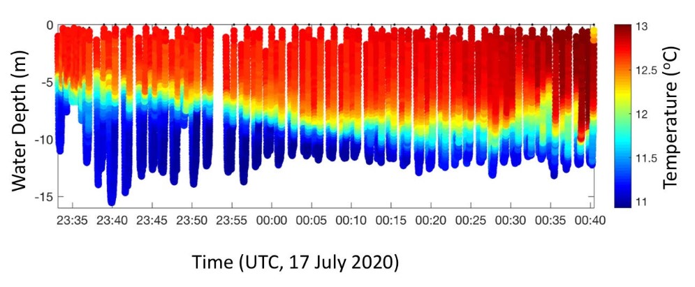
A primary goal of our cormorant tagging work is to push the limits of what is possible for a seabird tracking project. In addition to studying cormorant behavior, we are also focused on collecting high-resolution oceanographic data as the birds swim, dive, and forage in coastal marine waters. To do this successfully we need reliable tags with specialized sensors. The newest tag models, which we are currently testing, include fast response thermometers and conductivity sensors (CTDs). If successful, these sensors will allow us to collect water temperature and salinity measurements. When paired with pressure (depth) data, we can use a series of cormorant dives to construct 3D visualizations of the temperature and salinity structure through the water column (see figures below).
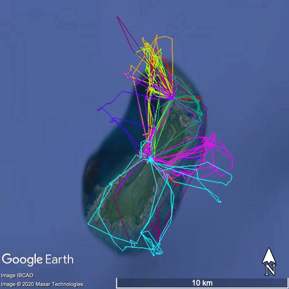
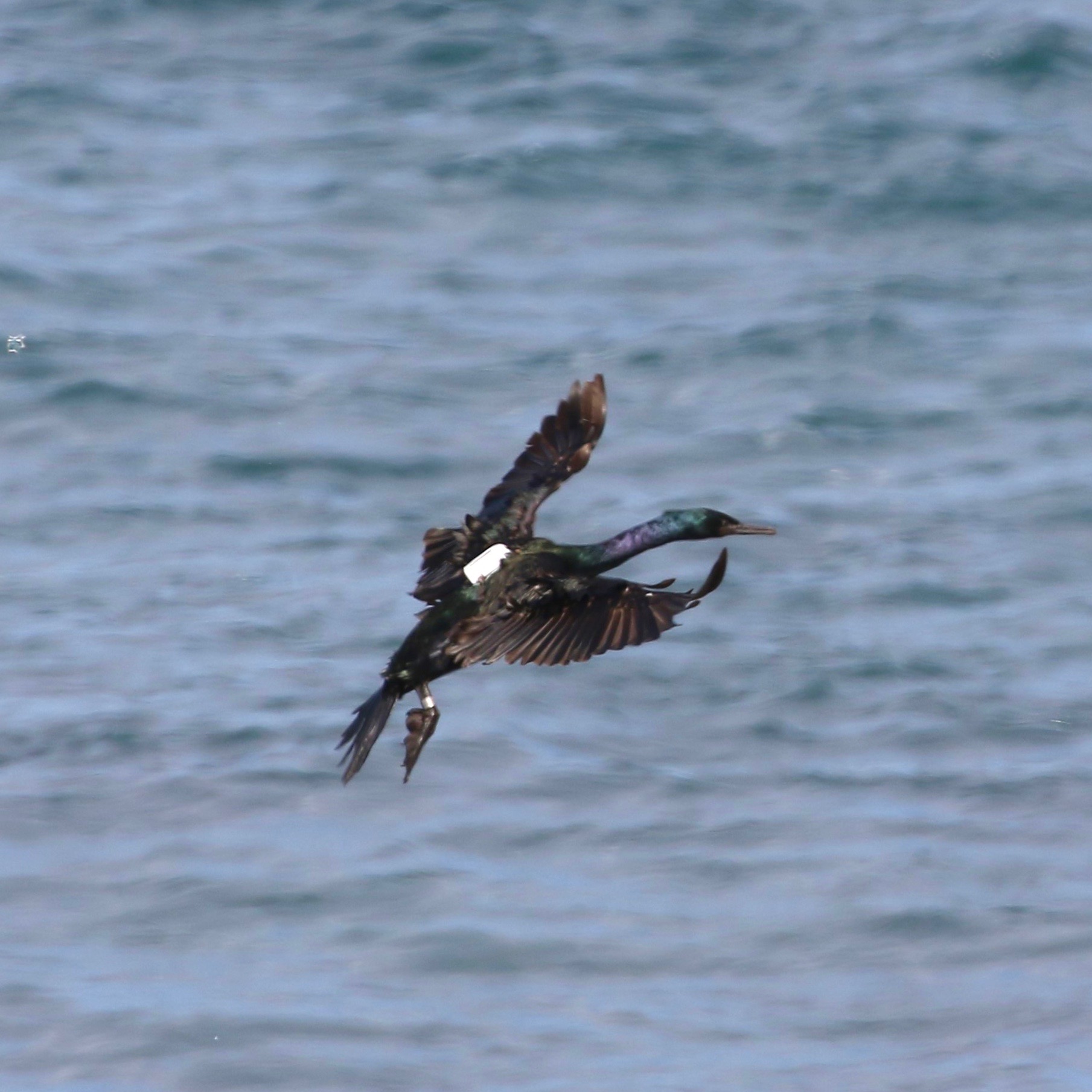
Temperature measurements collected by a pelagic cormorant across a series of dives reveal the internal temperature structure of the coastal waters (top; credit Dr. Jim Lerczak). Colored tracks reveal movements of several tagged cormorants around Middleton Island through the first few days of tracking (bottom-left). A tagged pelagic cormorant makes its way to the popular feeding area off the Island’s northern tip (bottom-right, photo by Brendan Higgins).
Tag Effects
It is a challenge to study the effect that researchers have on an animal by capturing and fitting it with a tag. In particular cliff nesting cormorants can be challenging to capture at their nests, recapture, or observe. The lab-like setting of the colony on Middleton Island and the nesting population of color-banded individuals (from years of previous research) offered us a rare opportunity to closely monitor individuals after we captured and tagged them.
Our approach
We assess tag effects by comparing the behavioral responses of the individuals that we captured and tagged with a control group of birds that had not been captured in 2020. We approached this in three different ways. First, we will compare the productivity of tagged nests versus untagged nests. We intensively monitored a subset of tagged and untagged nests during daylight hours (3:30 am to midnight). By recording the time each parent spends attending the nest, and how often they feed their chicks, we will compare the contribution of tagged to untagged parents. Our third angle of inquiry is based on nest attendance. We checked tagged nests and control nests five times a day to record which pair member is attending the nest. These data will add to our knowledge of how our study species is affected by our handling and tagging activities and better inform future research efforts.
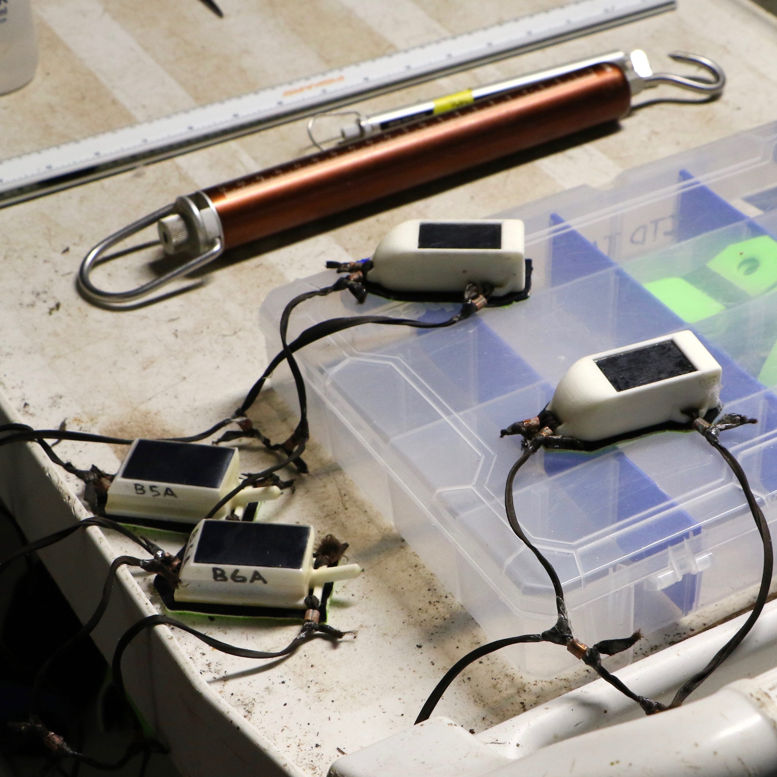
2020 Pelagic cormorant tagging at Middleton Island (clockwise from top-right): the tools of the seabird tagging trade; a tagged pelagic cormorant alights at one of the popular foraging areas; another tagged cormorant broods its chicks at its nest ledge; two of the authors, Adam and Jillian, carefully measure an adult pelagic cormorant. Photos by Brendan Higgins
Future Research – Scaling Up
Middleton Island is an ideal venue to test our tags and tagging techniques. The tower provides a unique opportunity to reliably capture and tag cormorants, observe tagged individuals, and recover tags. The lessons learned from this season’s effort will help us refine our tagging methods, streamline our data management and analysis techniques, and assess how well our oceanographic GPS tags are performing in the wild. We will then apply these lessons to the next study location.
In late 2020 and early 2021 we will be working with collaborators at the United Arab Emirates University to tag Socotra cormorants nesting in the UAE and in Bahrain. Our work will focus on the movement ecology of this incredible species and water circulation processes in the Arabian Gulf.
Some of the other seabird summer residents on Middleton Island (clockwise from top-right): black-legged kittiwake on its nest; kittiwake with chicks; kittiwakes and cormorants on wreck of the S.S. Colebrook; adult common murre; adult tufted puffin. Photos by Adam Peck-Richardson
References
Hatch, S. A., V. A. Gill, and D. N. Mulcahy. 2011. Migration and wintering sire of Pelagic Cormorants determined by satellite telemetry. Journal of Field Ornithology 82: 269-278.
Kotzerka, J., S. A. Hatch, and S. Garthe. 2011. Evidence for foraging site fidelity and individual foraging behavior of Pelagic Cormorants rearing chicks in the Gulf of Alaska. The Condor 113: 80-88.
Stothart, M. R., K. H. Elliot, T. Wood, S. A. Hatch, and J. R. Speakman. 2016. Counting calories in cormorants: dynamic body acceleration predicts daily energy expenditure measured in pelagic cormorants. Journal of Experimental Biology 219: 2192-2200.
By Brendan Higgins, Jillian Soller, and Adam Peck-Richardson
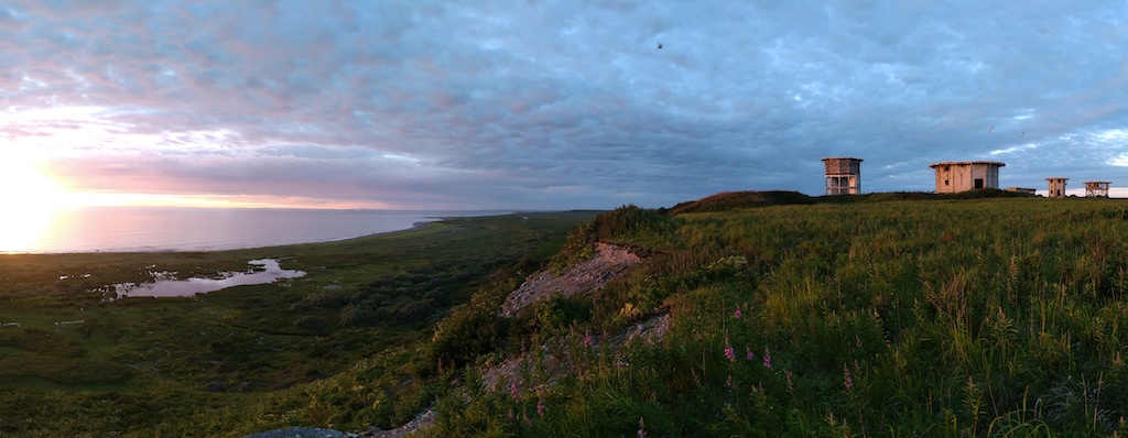
Sunset over the seabird tower. Middleton Island, Alaska.
Greetings from Middleton Island, Alaska! This unique island in the Gulf of Alaska will be our home for six weeks as we investigate one of its common residents, the pelagic cormorant. We arrived on Middleton June 29th onboard a chartered nine-seat plane after a whirlwind shopping trip in Anchorage. The one-hour flight afforded us great views of Prince William Sound and the Kenai Ice field. Middleton Island, a treeless, 3.5-mile-long island is home to a variety of seabirds. This includes black-legged kittiwakes, rhinoceros auklets, common murres, tufted puffins, glaucous-winged gulls, and most importantly, pelagic cormorants. Middleton’s unique history has created an unprecedented opportunity for seabird researchers to obtain close-up access to ledge-nesting birds.
Field Work During A Pandemic
We arrived on Middleton while following a carefully considered COVID-19 mitigation strategy. The plan was approved by Oregon State University, and met the requirements laid out by the State of Alaska, and the Institute for Seabird Research and Conservation (ISRC) who operates the long-term seabird studies on the island. Before traveling, our team members, two from Alaska and one from Oregon, self-quarantined for two weeks to minimize the risk of spreading the virus.
While traveling we followed all the recommended precautions to reduce risk of transmission (infection) including wearing face-masks, social distancing, and using hand sanitizer. Travel happened in a single day (even from Oregon). Upon arrival we began a second two-week quarantine period on the island. This reduced the risk to the small crew on the island. Our careful planning worked and we are beginning our fourth week on Middleton symptom free.
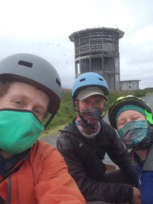
Blog authors and seabird field biologists in a time of Covid-19.
Middleton Island History
The first biological surveys of Middleton Island occurred in 1956. Historically, the island was used for a variety of other purposes. In the late 1800’s, arctic foxes were introduced to Middleton Island and fox farming occurred here through the 1920’s. Up to 250 foxes roamed the island and fed primarily on nesting seabirds.
During the Cold War, ownership of the island transferred to the U.S. Air Force. The Air Force constructed a dock, followed by an airstrip, expansive housing, and several different radar towers. The infrastructure was fully operational by 1958. By 1963, the Air Force was completely gone. However, the radar towers remain. The maritime climate of the island has not been kind to the Air Force buildings. Today they are well on their way to being reclaimed by the salmonberries and fireweed. Additionally, rusting fuel drums and exposed skeletons of buildings are scattered abundantly around the island. Seabirds have made themselves perfectly at home nesting among the dilapidated structures.
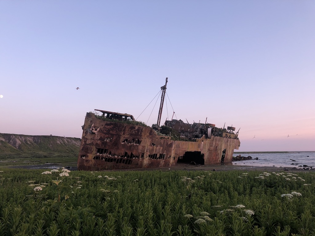
The wreck of the S/S Coldbrook. The ship ran aground on the reefs surrounding Middleton Island in 1942 and was subsequently raised out of the ocean during the uplift from the 1964 earthquake. It now serves as a home for hundreds of nesting pelagic cormorants and black-legged kittiwakes.
Conversion from radar to seabirds
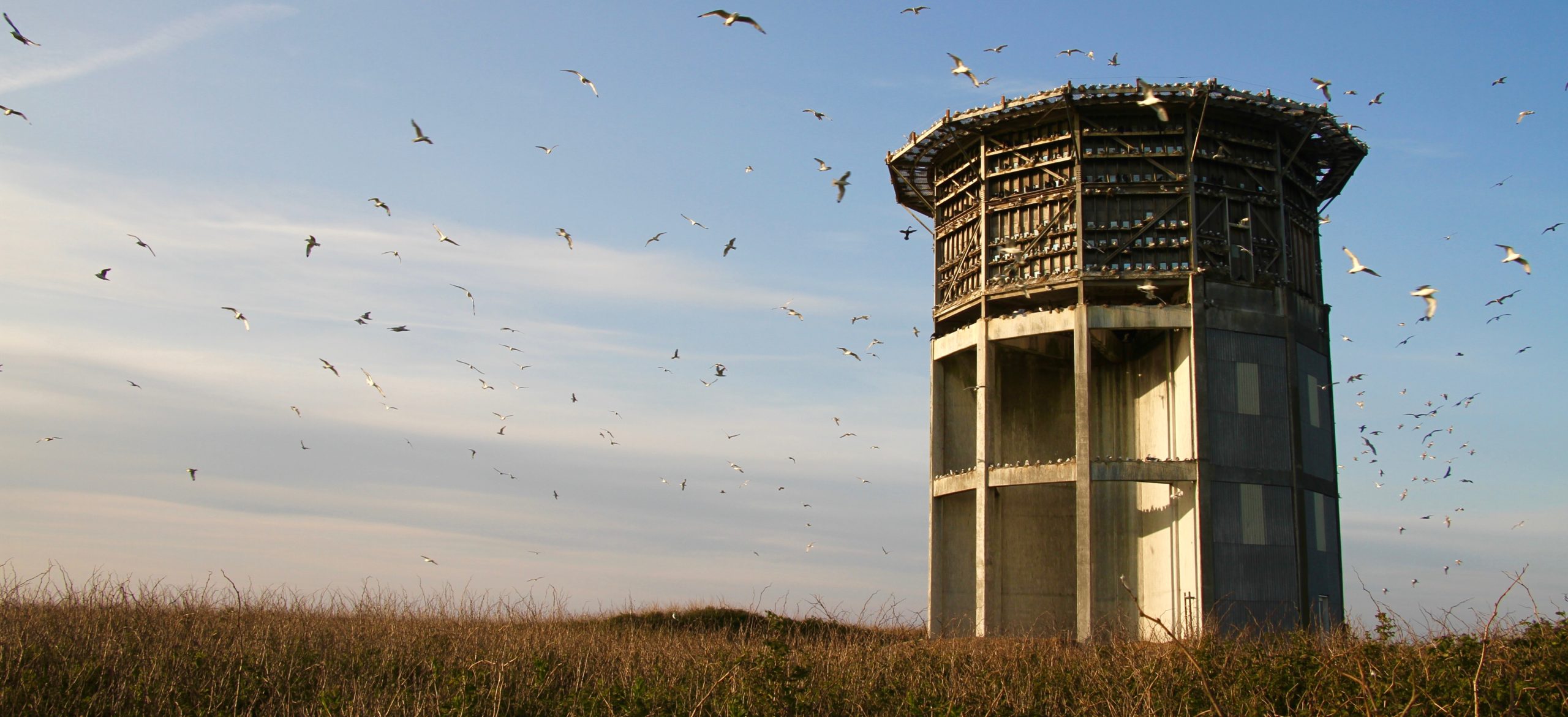
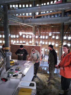
In 1993, Dr. Scott Hatch (ISRC) began converting the largest of the radar towers into the cornerstone of a seabird research station. Today, close to 900 artificial ledges and windows allow kittiwakes, cormorants, and their nests to be directly observed and accessed in a laboratory like setting. Easy access to these cliff-nesting birds makes Middleton island an ideal place for studies like ours.
Inside the tower, featuring the ISRC crew black-legged kittiwake chick growth.
An up close view of a black-legged kittiwake brooding its chicks.
The Middleton Island seabird tower.
Another bird friendly adaptation to the island built by Dr. Hatch, a “kittiwake wall” on the side of an old Air Force building.
Cormorant Oceanography
Our goal is to place tags on pelagic cormorants to obtain detailed tracks of their foraging trips in the marine waters surrounding Middleton Island. Additionally, the tags collect oceanographic data. The data from the tags will be processed to provide measurements of ocean waves, seafloor bathymetry, surface currents, water temperature and salinity.
So far, we are focusing on reconnaissance and preparations for the capture and tagging effort. The bulk of our work has been setting up and testing a cellphone network booster system that will communicate with the tags. The system consists of multiple receiving and broadcasting antennas that pickup and amplify the signal coming from a tower in Prince William Sound over 50 miles away. Luckily, the network booster is working well and the tags are connecting and downloading data. Our oceanography team is monitoring the tags from Oregon. They will start processing data as it is collected!