
By Brendan Higgins, Jillian Soller, and Adam Peck-Richardson
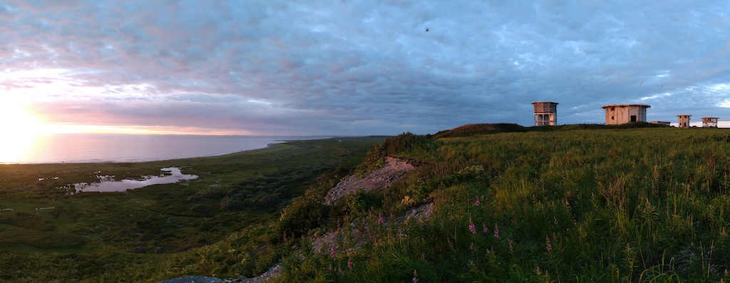
Greetings from Middleton Island, Alaska! This unique island in the Gulf of Alaska will be our home for six weeks as we investigate one of its common residents, the pelagic cormorant. We arrived on Middleton June 29th onboard a chartered nine-seat plane after a whirlwind shopping trip in Anchorage. The one-hour flight afforded us great views of Prince William Sound and the Kenai Ice field. Middleton Island, a treeless, 3.5-mile-long island is home to a variety of seabirds. This includes black-legged kittiwakes, rhinoceros auklets, common murres, tufted puffins, glaucous-winged gulls, and most importantly, pelagic cormorants. Middleton’s unique history has created an unprecedented opportunity for seabird researchers to obtain close-up access to ledge-nesting birds.
Field Work During A Pandemic
We arrived on Middleton while following a carefully considered COVID-19 mitigation strategy. The plan was approved by Oregon State University, and met the requirements laid out by the State of Alaska, and the Institute for Seabird Research and Conservation (ISRC) who operates the long-term seabird studies on the island. Before traveling, our team members, two from Alaska and one from Oregon, self-quarantined for two weeks to minimize the risk of spreading the virus.
While traveling we followed all the recommended precautions to reduce risk of transmission (infection) including wearing face-masks, social distancing, and using hand sanitizer. Travel happened in a single day (even from Oregon). Upon arrival we began a second two-week quarantine period on the island. This reduced the risk to the small crew on the island. Our careful planning worked and we are beginning our fourth week on Middleton symptom free.
Middleton Island History
The first biological surveys of Middleton Island occurred in 1956. Historically, the island was used for a variety of other purposes. In the late 1800’s, arctic foxes were introduced to Middleton Island and fox farming occurred here through the 1920’s. Up to 250 foxes roamed the island and fed primarily on nesting seabirds.
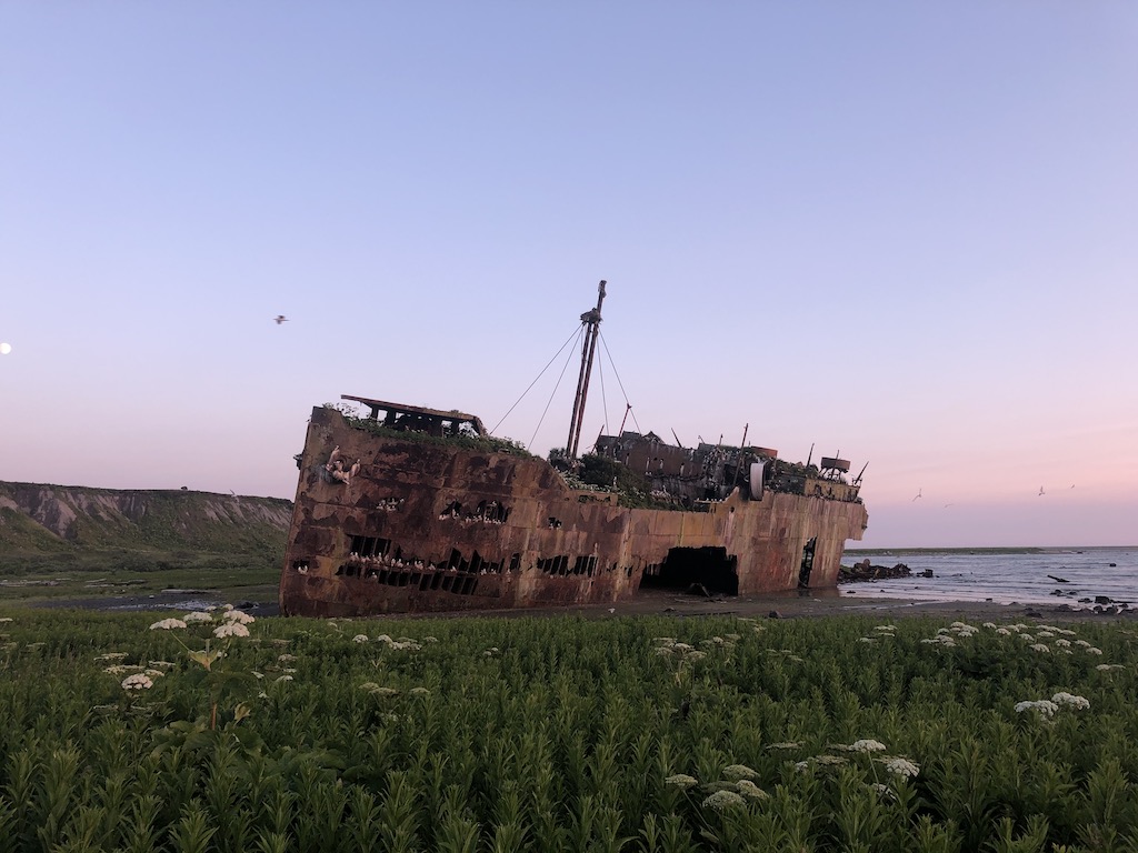
During the Cold War, ownership of the island transferred to the U.S. Air Force. The Air Force constructed a dock, followed by an airstrip, expansive housing, and several different radar towers. The infrastructure was fully operational by 1958. By 1963, the Air Force was completely gone. However, the radar towers remain. The maritime climate of the island has not been kind to the Air Force buildings. Today they are well on their way to being reclaimed by the salmonberries and fireweed. Additionally, rusting fuel drums and exposed skeletons of buildings are scattered abundantly around the island. Seabirds have made themselves perfectly at home nesting among the dilapidated structures.
Conversion from radar to seabirds
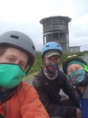
In 1993, Dr. Scott Hatch (ISRC) began converting the largest of the radar towers into the cornerstone of a seabird research station. Today, close to 900 artificial ledges and windows allow kittiwakes, cormorants, and their nests to be directly observed and accessed in a laboratory like setting. Easy access to these cliff-nesting birds makes Middleton island an ideal place for studies like ours.
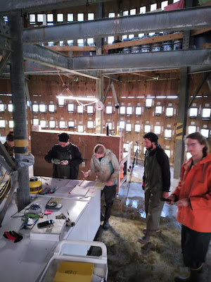
Inside the tower, featuring the ISRC crew black-legged kittiwake chick growth.

An up close view of a black-legged kittiwake brooding its chicks.

The Middleton Island seabird tower.

Another bird friendly adaptation to the island built by Dr. Hatch, a “kittiwake wall” on the side of an old Air Force building.
Cormorant Oceanography
Our goal is to place tags on pelagic cormorants to obtain detailed tracks of their foraging trips in the marine waters surrounding Middleton Island. Additionally, the tags collect oceanographic data. The data from the tags will be processed to provide measurements of ocean waves, seafloor bathymetry, surface currents, water temperature and salinity.
So far, we are focusing on reconnaissance and preparations for the capture and tagging effort. The bulk of our work has been setting up and testing a cellphone network booster system that will communicate with the tags. The system consists of multiple receiving and broadcasting antennas that pickup and amplify the signal coming from a tower in Prince William Sound over 50 miles away. Luckily, the network booster is working well and the tags are connecting and downloading data. Our oceanography team is monitoring the tags from Oregon. They will start processing data as it is collected!