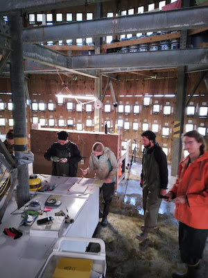
By Jayden Washington Samuels, 2025 Tufted Puffin Photography Technician
The puffin is arguably one of the most iconic and recognizable seabird species on the planet. It’s one of the very few bird species that crosses over that imaginary chasm out of the birder world into the mainstream, where even those who aren’t in any way interested in birds, know what a puffin is. However, it isn’t exactly common knowledge that there are nesting populations of puffins in the Pacific Northwest. People typically associate the word puffin with only the Atlantic Puffin species, which is not found anywhere near the West coast. Here in Oregon, we have the Tufted Puffin, which happens to be the largest of the four technical puffin species (Tufted, Horned, Atlantic, and Rhinoceros Auklet).
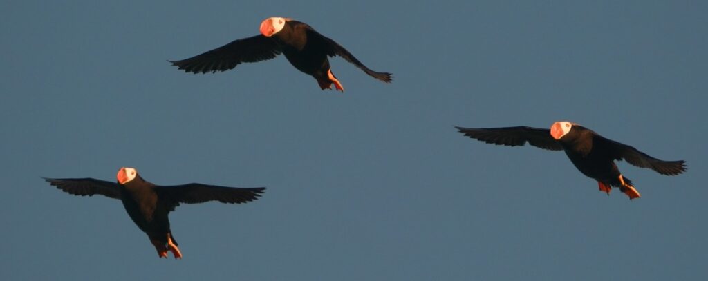
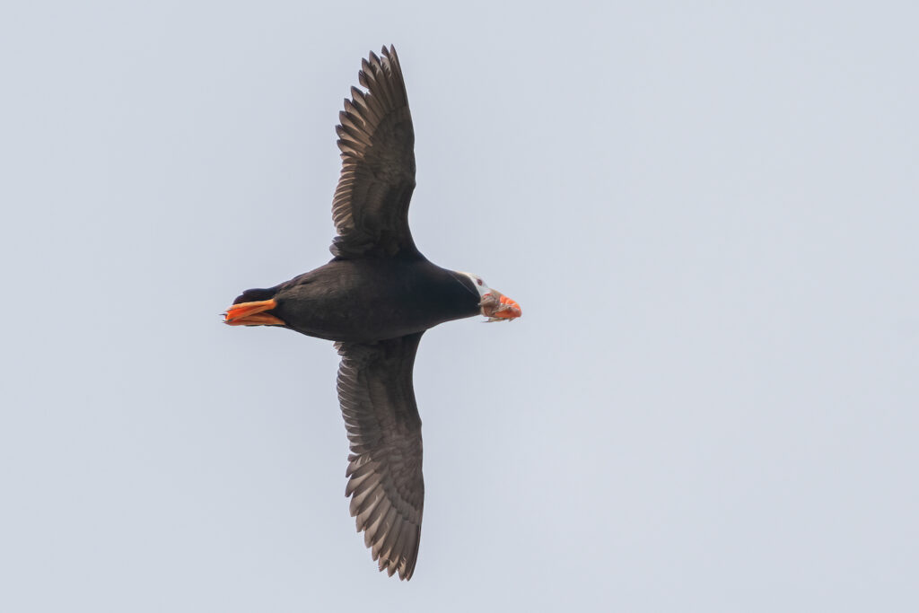
A trio of tufted puffins flying by Haystack Rock, Oregon
The Tufted Puffin is a pretty widespread bird, as its range stretches from the islands and open ocean off of California all the way up to the coasts of Alaska, Russia, and northern Japan. Cannon Beach—a major stronghold for the population in Oregon—is one of the most accessible locations to observe Tufted Puffins, as they utilize burrows they’ve created in the grassy top of Haystack Rock. Unfortunately, the southern population of Tufted Puffins has seen a sharp decline, and due to their typical clutch size of one egg per season, it’s incredibly hard to bolster their populations.
Many individuals—ranging from conservation biologists to local volunteers—have lended a helping hand in observing the Cannon Beach Tufted Puffin population, in order to understand the rate of decline and breeding success. The data gathered from these projects helps spread awareness for the vulnerable status of the Tufted Puffins
This is where I come in! I am a senior studying Ecology and Evolutionary Biology at the University of California, Santa Cruz (UCSC). I have been a birder and wildlife photographer for almost seven years now, and in my years at UCSC I have focused my studies and fieldwork on birds, and I have been able to be a part of incredible bird research endeavors like remote work in the Sierra Nevada mountain range focused on Sierra Nevada Gray-Crowned Rosy Finches, Peregrine Falcon breeding success and toxicology in the Greater Bay Area, and songbird banding at Younger Lagoon.
The goal of this specific project is to figure out the diet composition of Tufted Puffins in Oregon in order to have a better idea of what prey species they depend on, and if there’s any sort of linkage between their diet to their diminishing population status.
The “How” of this project lies within a combination of having the proper gear to capture these amazing birds in flight—with fish in their bills (called a “bill load”), and in my eyes, a bit of luck to be present for said moment. The Sony A9 with the matching 200-600mm lens + the 1.4x Teleconverter gave me an excellent combination of industry leading autofocus and frames per second with the reach needed to see the puffins up close. My experience preceding this project with a similar camera setup allowed me to settle in pretty quickly; so the only variables that controlled my success was the amount of puffins returning fish to their young and tide/weather variation.
This project has been ongoing for three years prior to me, and in two of those three years the average number of bill loads per season was just over 100. Last year had the most bill loads being almost three times these typical numbers. This season, I ended up not getting anywhere near as many bill loads as prior years. According to Tim Halloran, a long time volunteer who has done Tufted Puffin burrow counts for over a decade, many burrows appeared to be left unused or unsuccessful this season, meaning less chicks and in turn, less bill load photo opportunities for me.
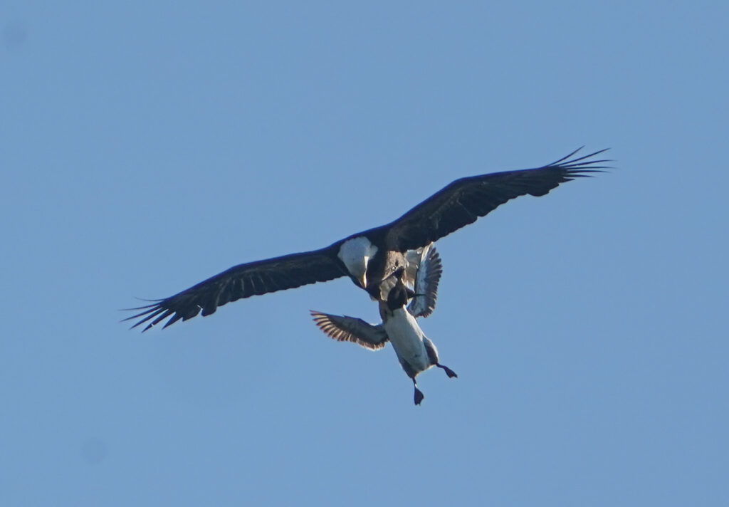
In previous seasons the mornings seemed more productive for bill load photos. This year the evenings were significantly more productive, especially an hour or two right before sunset. My highest number of bill loads in a day ended up being 10 bill loads on a mid-July evening, and my lowest were a couple 1-3 day stretches with zero bill loads sighted. If I had to give at least one reason why there would be a lower occurrence of bill loads, I think that the Bald Eagles might have at least some effect. While I never observed one catching a Tufted Puffin, they did repeatedly go for, and catch the Common Murres which also call the rock home. I would say 80-90% of my mornings and evenings out on the beach I at least observed two Bald Eagles, and I documented 12 separate “disturbances” to the colony linked to them attempting to prey on birds sitting on the rock.
A bald eagle holds onto a common murre while in flight.
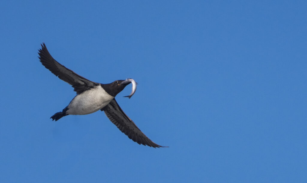
A key part of this project that I enjoyed was the public interaction. I was able to engage with many visitors and locals alike, and I loved educating the public on the Tufted Puffins. My conversations ranged from giving out tips for telling the difference between puffins and murres in flight, to giving people their first look at some on the rock by lending them my binoculars. Even though this project focuses on Tufted Puffins, I was able to get a pretty decent number of Common Murre bill loads, as they also return full prey to their colonies! Something interesting about the murres is that they only carry one fish in each bill load, which is in stark contrast to the puffins who can have countless fish in their bills at once.
A common murre with a single fish.
I am incredibly grateful to have been selected to be a part of this project, blending two of my greatest passions—birds and photography—into a research endeavor. I never thought I would personally be able to use my skills in Wildlife Photography in a dedicated research setting!
I would like to sincerely thank Dr. Rachael Orben and Will Kennerley for this incredible opportunity.
Acknowledgments: In 2025, the Tufted Puffin Internship was supported by the Oregon Conservation and Recreation Fund. The Friends of Haystack Rock supported this project by providing intern housing in Seaside and Cannon Beach.
By Cherish Lyda, Seabird Monitoring Technican, OSU Seabird Oceanography Lab
Hello everyone!
My name is Cherish Lyda, and I’m a senior at Oregon State University, majoring in Fisheries, Wildlife, and Conservation Sciences with a focus on avian conservation and management. This summer, I’m the Yaquina Seabird Monitoring Technician for the Seabird Oceanography Lab. This is my first season working with seabirds – and it has been amazing so far!
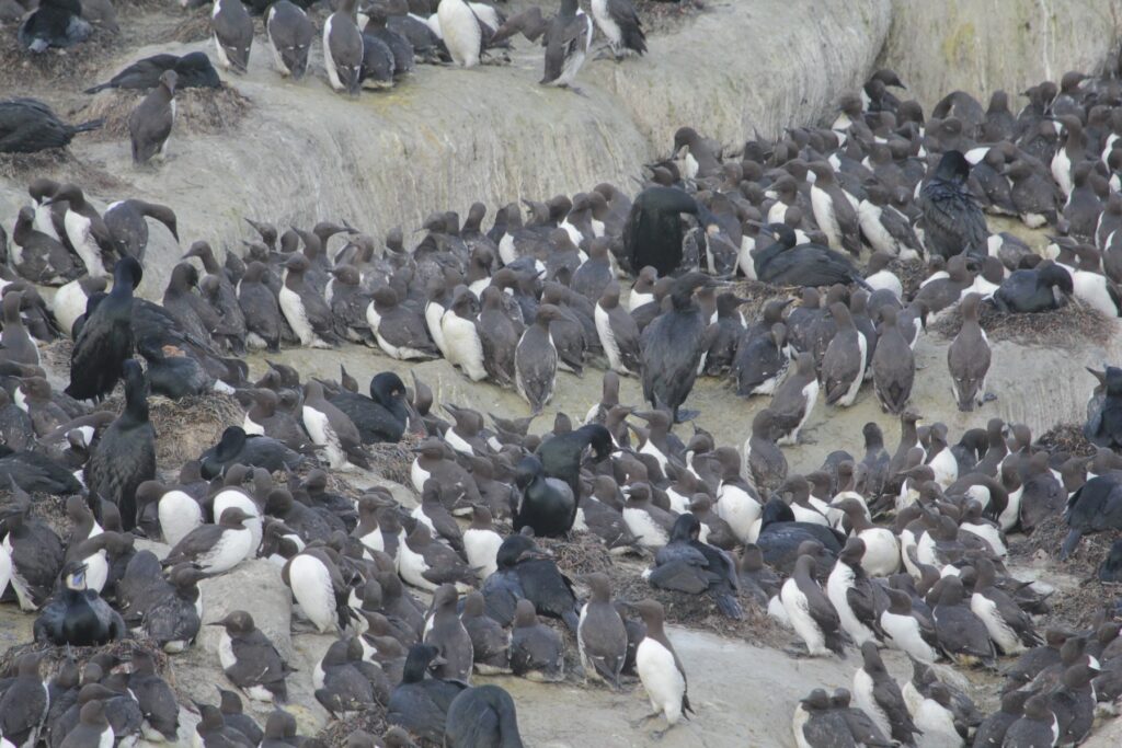
Despite frequent Bald Eagle disturbances, Yaquina Head Outstanding Natural Area is once again bursting with new life! Although nesting started late this year, the birds have shown resilience and are beginning to proudly display their chaotic nests and adorable chicks. We are currently monitoring 13 plots and following 93 Common Murre nests, 36 Brandt’s Cormorant nests, 28 Pelagic Cormorant nests, and 13 Western Gull nests.
Western Gulls hatched first and are already wrapping up the season with seven successfully fledged nests. (Take a look at the top of Colony Rock and you’ll see these brown spotted fluff balls wandering around!) Brandt’s Cormorants started hatching on July 2nd and 21 nests have hatched so far with more on the way. Pelagic Cormorants have taken up their usual spots at Smuggler’s Cove and Whale Rock, and we saw our first chick on July 9th.
Common Murres and Brandt’s Cormorants at Pirate Cove, Depoe Bay. Note the chick in the center cormorant nest.
As for the Common Murres, their season started out tough but is now looking very promising. Frequent early-season eagle activity hit the south half of Colony Rock and top of Whale Rock hard, clearing multiple plots of eggs. For a couple days, two immature Bald Eagles were seen perching continuously on the rocks. However, as eagle activity dropped off in late June, the murres regrouped and began laying again (along with lots of Brandt’s Cormorants) in the center and south parts of Colony Rock. The decrease in disturbances seems to have bolstered the murres’ courage, and they are starting to stay on their eggs during disturbances. Instead of flushing in panic, they’re standing their ground. It’s risky, but it seems to be paying off with fewer eggs being lost to the surrounding gulls.
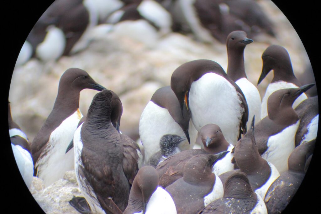
We confirmed our first murre chicks on July 14th and we are now up to 25+ hatched with many more on the way. The parents are now busy bringing fish to colony, and it’s been cute watching the murres attempt to feed their eggs small fish – a sign that they are getting close to hatching!
Young Common Murre chick at Depoe Bay
As for other avian species, Tufted Puffins continue to make occasional, delightful fly-bys. We’ve seen both single birds and a pair flying loops and heading north. The noisy Black Oystercatchers have been busy with nests at both field sites and Pigeon Guillemots are on their nests tucked deep into the cliffs of Smuggler’s Cove. Listen for their high-pitched, squeaky whistles coming from the rocks!
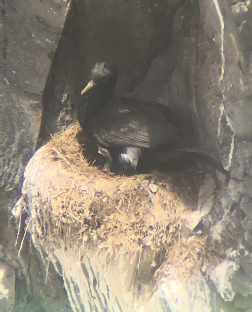
In addition to Yaquina Head, we have been keeping a close eye on Pirate Cove in Depoe Bay. With almost no eagle disturbance (none since mid-June), the birds have been doing great. As of this writing, 42 of our 97 murre nests have hatched. Amazingly, every one of our 31 Brandt’s Cormorant nests have hatched chicks! Although our Pelagic Cormorants have been nesting in some hard-to-see cliffs, we were able to confirm their first hatches this last week as well.
Pelagic Cormorant with its first chick nesting at Smuggler’s Cove, Yaquina Head.
Now that murre chicks have arrived, we’ll soon be conducting all-day nest watches to observe how often adults deliver food to their chicks. We’re also continuing to collect bill load photos of their prey items for diet analysis.
Working alongside Dr. Rachael Orben, the interns, and other researchers on this project has been amazing. I’ve gained so much knowledge about seabird life history and current research from our conversations and time together in the field and lab. Being able to wake up each morning at sunrise to the salty wind in my hair, the raucous calls of the murres, and the flaring brilliant blue throats of the cormorants has been an incredible way to spend my summer.
I can’t wait to see what the rest of the season brings — stay tuned!
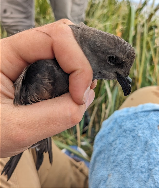
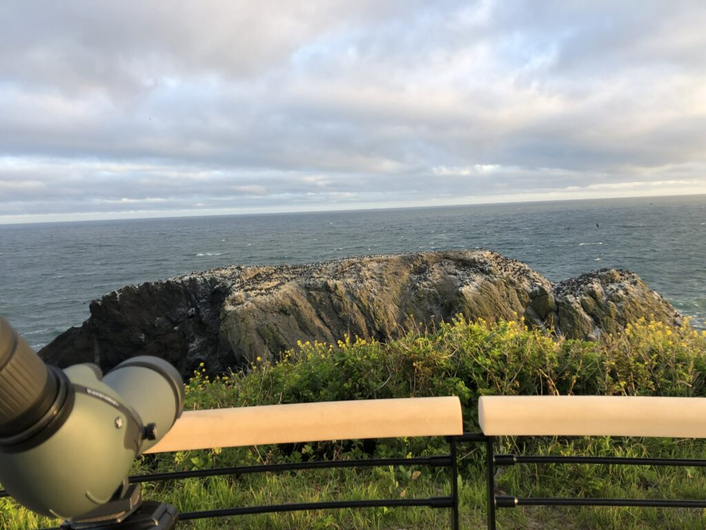
The southern Oregon coast, between Port Orford to the north and Brookings to the south, hosts the largest colonies of Leach’s Storm-Petrels (Hydrobates leucorhous) in the lower-48. Goat Island, half a mile offshore from Harris Beach State Park, is estimated to host more than 100,000 of these small, dusky-colored seabirds. But looking at the island from the shore, you might never know that they’re there.
Leach’s Storm-Petrels
One of Goat Island’s many Leach’s Storm-Petrels.
Leach’s Storm-Petrels, which top out at just under 50 grams at the heaviest, return to their colonies only at night, and nest in underground burrows hidden beneath mats of long grass. Beachgoers who are in the know might be made aware of the colony from the distinctive, musky odor that petrels are famous for—which is strong enough to waft ashore—but otherwise, the colony is practically invisible from more than a few inches above the ground.
LHSPs feed on zooplankton and other planktonic creatures far out to sea, and only return to their colonies under the cover of darkness. During the breeding season, members of breeding pairs will take turns incubating their single egg or chick in the burrow, sometimes remaining underground for four or five days, while the other member of the pair forages. This cryptic, nocturnal behavior likely provides protection against diurnal avian predators. Southern Oregon’s LHSP colonies are close enough to shore, however, that nocturnal mammalian predators can pose a threat.
Project Goals
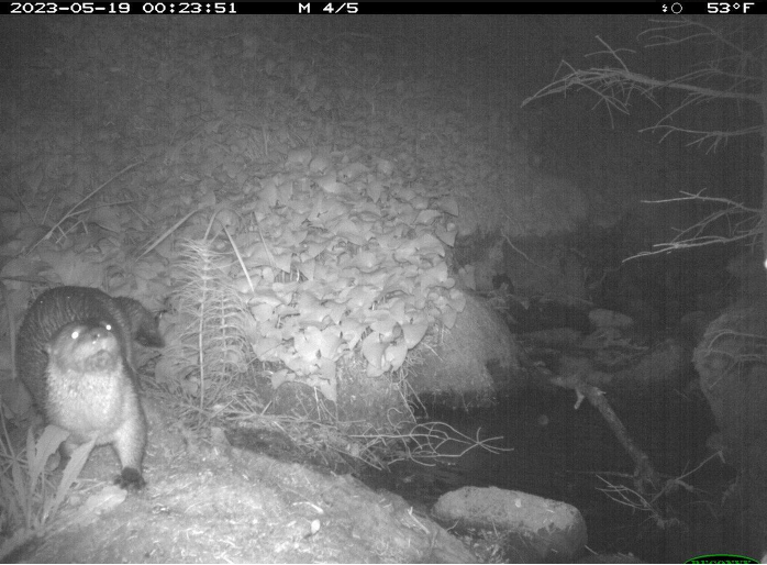
In collaboration with the U.S Fish and Wildlife Service, Luke Stuntz (MSc student, Seabird Oceanography Lab) and I (Eleanor Gnam, seasonal field tech) are investigating the impact of mammalian predators (mainly North American River Otters Lontra canadensis) on southern Oregon’s Leach’s Storm-Petrels.
We’re seeking to understand how, where, when, and to what extent these predators use petrels as a food source—knowledge that will help inform potential predator management in the future. River otters tend to operate either in loose social groups of unrelated males or in family units of a mother and her cubs. We’re hoping that our research will help us understand the social organizations of the river otters that are using these islands, as well.
A river otter captured via game camera on Goat IslandA river otter captured via game camera on the mainland.
Field Work (May-June)
Luke began fieldwork for this project in May, with trips to our focal islands to survey for predator sign and set up motion-activated game cameras. Two of the four islands showed definite signs of predator activity (trampling, scat, and prey remains). Cameras on Goat Island quickly revealed activity from multiple social groups of river otters, including a pair of adults and a female with cubs. Because river otters commute between these islands and the mainland, surveys along the coastline are also important for monitoring their activity.
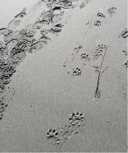
Luke’s initial surveys in May and early June revealed quite a bit of predator activity along the beaches and creeks near these colonies. River otters tend to deposit scat in shared, regularly-used locations called latrines, which aid territory marking and scent-based communication between individuals. They also need to return to freshwater sources frequently, especially after swimming in the ocean, both to drink and to groom their fur. The scat found in the latrines near our focal islands definitely contained digested storm-petrel remains—obvious from the distinct odor.
A game camera deployed over a creek near one of our latrine sitesLuke at one of our latrine sites
On June 15th, we moved into OSU’s Port Orford Field Station to commence full-time fieldwork on the project. Our first step was to revisit the coastline sites near our colony islands and to check out some new sites with the potential to be good river otter habitat. We were surprised by how little fresh river otter activity we found at some of our sites that were very active in May and early June. We’re also seeing them on our game cameras less often than before.
We found evidence of recent activity in several new locations, though, and we continue to see a lot of activity on the beach closest to Goat Island. This raises questions about how frequent and how seasonal these island-going behaviors might be. We’re also starting to wonder about the impact of Route 101 and its associated culverts on river otters’ use of coastal streams. Continuing predator sign surveys throughout the summer, both along the coast and on our colony islands, will help fill in our picture of this predator-prey dynamic and will help us understand how much of a problem it might be for these seabird colonies. We’re planning to expand our predator sign surveys up some of the larger creeks and rivers in the area, as well, using an inflatable sea kayak.
Some river otter tracks, and our tracks, along the beachOur research kayak (nicknamed the R.V Lontra) ready to go on Hunter Creek
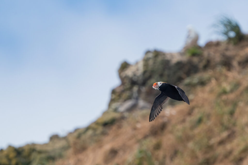
The tufted puffins of Oregon are spread thin among the grassy-topped rock formations that are suitable locations for their burrows. Tufted puffin populations have plunged from above 5000 breeding birds to an estimated 500 breeding birds in 2021 (USFWS coast-wide survey). Understanding this drastic decline, and what prey are currently supporting the population, is imperative for the conservation of these unique alcids. Noah Dolinajec (OSU, FWCS PSMFWA graduate student) is aiming to provide the first comprehensive diet information on the composition of the bill loads from tufted puffins in Oregon. This information will help managers place tufted puffins into the context of the marine food webs they depend on.
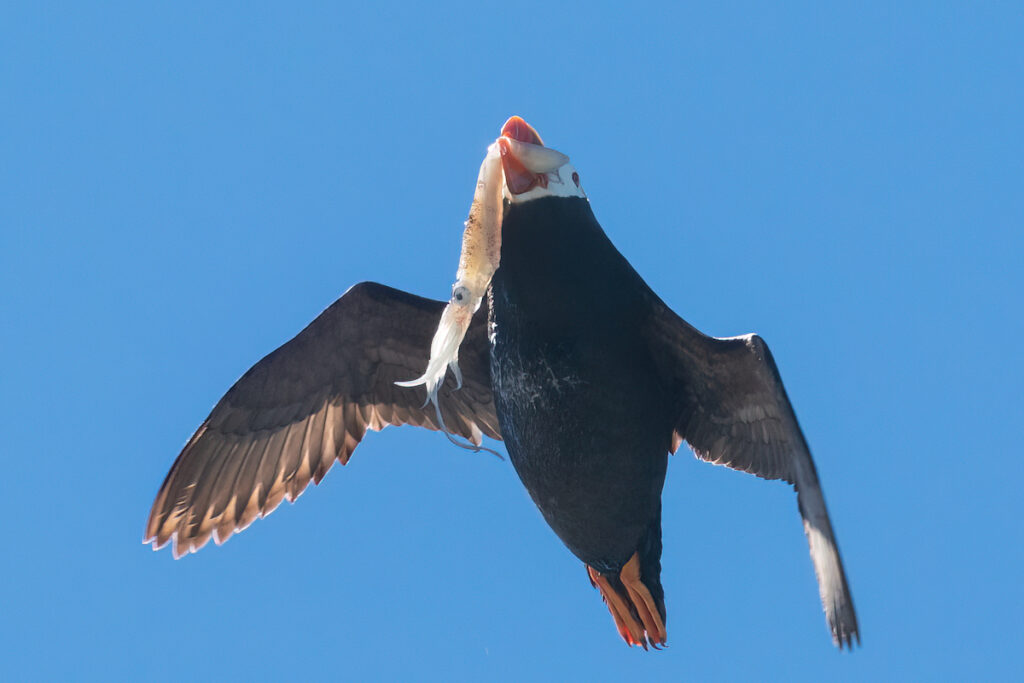
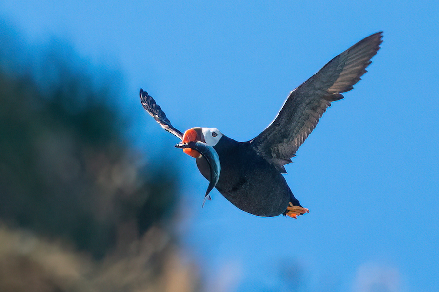
A tufted puffin with a bill load of larval fishes near Haystack Rock, Oregon
Bill load studies often involve netting of birds as they return to their burrows, but while that may work for other locations, it would be hard to accomplish on the small and rugged off-shore sea stacks on the Oregon coast. Another less invasive option is photographing the bill loads of puffins – if there is an easily accessible location where birds can be observed.
In the summer of 2021, Noah spent days on Cannon Beach photographing bill loads of the breeding common murres and tufted puffins of Haystack Rock trialling the approach. It seemed promising, but a 300mm lens wasn’t enough. But, it was enough to plan for a second tufted puffin photography season at this iconic tourist destination.
This summer I (Sam Eberhard) was tasked with taking over the job of photographing bill loads at Haystack Rock. We got a modern mirrorless camera with great autofocus and paired it with some big glass (a 200-600mm zoom with a 1.4x teleconverter). As someone with both a passion for bird research and wildlife photography, I was hopeful that I could capture clear pictures of a large number of tufted puffin bill loads.
My first days at Haystack Rock I got a feel for how frequently the puffins would arrive with fish for their newly hatched chicks, and how to reliably pick them out of the nearly constant stream of common murres. This knowledge became something that I would often end up sharing with the many tourists on the beach who also were excited to spot tufted puffins.
Low tides allowed me to get closer to the 235 foot tall rock, but these low tides didn’t always coincide with the morning, which was when the puffins were most active and the light was best. I didn’t anticipate that I would be using my waders at Haystack, but they proved to be quite helpful in making the uncooperative tides manageable.
This year the tufted puffins attending the rock were in lower numbers than last year, a year that was by no means puffin-filled itself. My time on the beach was spent standing around and waiting for a black football furiously beating its wings to appear. Sometimes it would take up to an hour between puffin arrivals. That said, some days were relatively packed with puffin bill loads. My sixth day on the beach yielded 22 photos of tufted puffins with fish.
Some days seemed to have a combination of factors that aligned to lead to numerous bill loads, while many days the opposite seemed to occur. Of the 32 mornings on the beach I spent this summer, 13 days I photographed 1 or 0 puffins with fish. Two good mornings and a healthy collection average ones allowed me to assemble a data set of 139 bill load pictures this summer. Considering the puffin numbers this year, I think this result is encouraging for continuing this type of data collection.
I am incredibly happy that I was able to spend my summer on such an incredible project. I was able to combine two of my passions and contribute to the understanding of a very special species. It’s hard to imagine a better summer than that.
This project was funded by the Oregon Wildlife Foundation, Friends of Haystack Rock, and the OSU Marine Studies Initiative.
The Seabird Oceanography Lab is almost midway through the field season here at Yaquina Head Outstanding Natural Area. The murres have not been able to incubate eggs this year and we are expecting a year of no reproductive success. We are continuing our monitoring effort and are anticipating starting diet photography efforts soon at the small colony located in Depoe Bay.
When observation began in late May at Yaquina Head, we saw the murres repeatedly flushed from the main nesting site Colony Rock by eagles. Often two sub adult and two adult eagles would also flush Lion’s Head, Seal, and Stegosaurus Rock, and the murres would not return to these areas as quickly. By June, later then we expected, murres began to settle and we spotted birds with eggs on Colony Rock. Although the majority of Colony Rock was covered with birds, two locations at the eastern side closest to eagle’s roost remained unoccupied.
About a week later the avian predator disturbances spiked again. The first one that led to considerable undoing of nesting progress was on June 13th, when three separate groups of turkey vultures flushed murres from the colony. Only one of these groups of vultures was accompanied by bald eagles. These disturbances allowed western gulls to opportunistically take over 30 murre eggs – even dropping some on the ground around the lighthouse. The gull flock continued to grow as on the 17th, we estimated over 50 gulls flying overhead. From then on – apart from the chaotic observation day on June 22nd — it only took one disturbance each observation period for the murres to be completely cleared off. Each time their numbers on colony rock dwindled. When they were present on the rock many were standing and not in their nesting position.
In early July we typically have murre chicks, but this year Colony Rock has been devoid of adult murres and eggs for over a week now. Murres are continuing to raft in the water nearby the colony. There have been some murres attending Stegosaurus Rock and South Headland however they aren’t nesting. Normally, eagle disturbances decline through June, but this year they have been continuing. Additionally, winter conditions persisted through May and upwelling was delayed until June. This likely contributed to the inability of the murres to settle and incubate eggs. Upwelling brings cold nutrient-rich water to the surface that fuels primary productivity and the forage fish murres depend on. Upwelling typically initiates in mid-April prior to when murres lay their eggs.
A subadult bald eagle attacking a murre adult on Colony Rock. Photo: Sofia Franco Cruz
Unfortunately, the number of nesting Brandt’s and Pelagic cormorants are low this year. Eagles do not disturb them like they do the murres though many gulls roost on Flat Rock where the Brandt’s are nesting. Flat Rock has quite the dynamic rise and fall in nests; On July 6th we had spotted 35 nests. On June 29th we realized that almost half of these had been abandoned – mostly on the Western and top half of the rock. We are currently following 17 active Brandt’s nests. Additionally, we have two Pelagic cormorant nests on Stegosaurus Rock and we are following 15 Pelagic cormorant nests on South Headland.
The rocks at Yaquina Head, Oregon.
On the bright side there are three healthy looking chicks on South Headland and we are expecting more on Flat Rock. We’ll make sure to monitor these chicks and keep an eye out for murres though.
See you again for our next update in August!
Brandt’s cormorants feeding a chick on South Headland (July 8th). Photo: Yaya Callahan
This was the rainiest and windiest conditions we’ve experienced at Midway over the years. Despite the weather, the albatross field crew of myself (Scott Shaffer), Henri Weimerskirch, Sarah Youngren, and Dan Rapp deployed nearly 80 data logging devices on Laysan and black-footed albatrosses over two weeks during the last half of January 2022. Our primary goal was to record albatross and fishing vessel interactions using GPS loggers enabled with radar detection sensors.
A Laysan albatross pair. The bird on the right is carrying at GPS data logger enabled with marine radar detection. The tags are taped to the feathers with a water-proof tape and are easily removed when the bird is recaptured.
Preliminary data show one Laysan albatross passing within range (but not interacting) of a fishing vessel upon its return to Midway after 10 days at sea. Stay tuned for more updates as we start analyzing the rest of the dataset. We plan to cross-reference the vessel detections with the AIS dataset amassed by Global Fishing Watch to better understand when and where albatrosses are encountering fishing vessels.
Sunset on Midway Atoll (Pihemanu).
A few images from Midway in January. We were incredibly lucky to be able to get a field team out to the island!
black-footed albatross nestLaysan albatross, no egg.rainScott and Henri deploying a tag. Dan and Sarah deploying a tag.A black-footed albatross chick. Henri & ScottMidway January 2022
This project is funded by the National Fish and Wildlife Foundation with support from NOAA to support the mission of conserving natural resources of the Papahānaumokuākea Marine National Monument, Northwest Hawaiian Islands. Photos were taken under permit: PMNM-2021-012. All field personnel were vaccinated against covid-19 and underwent a period of quarantine on arrival to Midway.
By Alastair Baylis, South Atlantic Environmental Research Institute
A globally significant wildlife wonder spot
The Falkland Islands, located on the southeast Patagonian Shelf, are a self-governing UK Overseas Territory (UKOT), and a globally significant wildlife wonder spot. Home to 75% of the global population of Black-browed albatross, 50% of the global population of South American fur seals, 30% of the global population of Rockhopper and Gentoo penguins, to list but a few. This means that population trends of Falklands seals and seabirds disproportionately influence the global population trends and conservation status of these species.
Marine Managed Areas & IUCN Key Biodiversity Areas
In recognition of the importance of the Falkland Islands environment to both wildlife and the community, and striving toward holistic marine management, the Falkland Islands Government started a process of Marine Spatial Planning. This included identifying marine areas for enhanced protection as Marine Managed Areas (MMAs)– a broad term that includes Marine Protected Areas (Esch 2006). MMAs focussed on marine wilderness areas – areas that have irreplaceable biodiversity and are near-pristine due to low fishing impact, but presently do not have a legal framework for protection. Through stakeholder engagement, several areas were chosen as proposed MMAs. These areas included seaward extensions of globally important breeding colonies of seabirds and seals where animals are known to congregate (Granadeiro et al. 2008).
To inform the Falkland Islands MMA process, we identified important at-sea areas for seals and seabirds to understand how these predators use the proposed MMAs. One overarching aim of our paper was to place the conservation value of the proposed MMAs into a global context. Hence, we also identified IUCN Key Biodiversity Areas (KBAs) – (marine) areas that “contribute significantly to the persistence of global biodiversity”, which are a widely adopted approach to help inform systematic conservation planning, and compared these to proposed MMAs.
Proposed Marine Managed Areas (MMAs) within the Falkland Conservation Zone including seaward extensions of globally significant breeding colonies of seals and seabirds at the Jason Islands group, Bird Island, Kidney Island, and Beauchene Island.
Our KBA journey
Much of this blog is focussed on our KBA journey, which is one component of the paper. In-part, because using tracking and survey data to identify KBAs are of particular interest locally. But, in general, we found limited discussion regarding challenges. This is perhaps, a good point to emphasize the distinction we make throughout the paper and again here, between the KBA concept (which we do not critique), versus methods used to identify polygons to assess against KBA criteria.
Looking out over the Jason Islands. Photo: R. Orben
Our methods
Briefly, our methods went something like this – we collated tracking data (1999-2019) and used a several approaches to identify areas for assessment against KBA criteria (for those wanting the details, a combination of kernel density estimation methods originally designed to identify Important Bird and Biodiversity Areas (IBAs) and model-based predictions).
Here is what we found:
1. The Patagonian Shelf is vast and vastly important for marine predators.
It should come as no surprise that much of the Patagonian Shelf around the Falkland Islands is important (see also Augé et al. 2018, Baylis et al. 2019). In fact, depending on the methods used, over 70% of the Falkland Islands EEZ could qualify as a KBA. This is because the Falklands are home to numerous and globally significant populations of seals and seabirds – many species of which breed almost ubiquitously around the Falklands. We will touch briefly on how this could influence management later in this piece (see point 4). In terms of overlap with proposed MMAs, depending on methods used, up to 45 % of KBAs were overlapped with proposed MMAs. But this comparison and indeed the significance of findings, are a little clouded by caveats associated with methods (see point 2 and 3).
2. Threshold-based criteria of KBAs are standardized, repeatable, and globally applicable – which is worth celebrating. For tracking data, the methods used to identify areas to assess against KBA criteria are not standardized.
Given KBAs might be considered for potential protected areas, it would be useful to understand and quantify uncertainty in areas selected to be assessed against KBA criteria. This is because as scientists, we want to provide decision makers with reliable data and robust science narrative, which ensure the areas identified as important are well supported.
A couple of challenges that we encountered when following popular methods, are as follows. Firstly, common to all tracking datasets, tracking data were inevitably imperfect and biased by tracking effort. This isn’t a deal breaker, but our potential KBAs reflected colonies from which seals and seabirds were tracked from, but not necessarily where they occur. For example, tracking data from one colony, might not represent important areas for other colonies.
A second widely recognized challenge is that current methods based on kernel density estimation are sensitive to often arbitrarily selected values. Indeed, areas identified for KBA assessment can vary by thousands of km, depending on model values selected. Ideally, with a bit of common sense and knowledge of species biology, you can make some informed decisions about what values are sensible to use, but it isn’t always clear, and this can create uncertainty in which areas are most appropriate to assess against KBA criteria. One approach to address these limitations was to use models to predict the distribution of animals from all colonies around the Falklands. But then the entire Patagonian Shelf around the Falklands is potentially a KBA (point 1).
3. IUCN KBA guidelines continue to be refined and updated.
Too right! It is important that the guidelines continue to evolve to ensure KBA guidelines are applied rigorously. The most recent guidelines (IUCN 2020) clarify that species must predictably aggregate at a site to trigger KBA criterion D1a (just one of several criteria, but the one we felt best suited our data). However, predictability is scale dependent and we don’t yet know how this definition will apply to tracking data for wide-ranging marine predators that forage on patchily distributed prey. Hence, a range of challenges exist with current methods and the motivation for highlighting these challenges are to stimulate discussion on how we can continue to improve methods that better serve the globally standardized KBA criteria.
4. Fixed boundary approach to marine conservation (MMAs, KBAs etc).
Moving away from challenges associated with methods, it is clear that the proposed Falkland Islands MMAs are imperfect in the context of encompassing the entire foraging ranges of wide-ranging marine predators. So where does this leave species that forage across vast areas of the ocean, and for which KBAs might also encompass vast marine areas? It might be that a fixed area approach to management may not be feasible or the most effective way to manage and conserve species, and we should look to combine fixed area management with other approaches.
The good news is that, in addition to existing large-scale regulations that are not area-specific (e.g., bycatch mitigation), other innovative options exist, which could potentially be used in combination with MMAs. For example, Dynamic ocean management, could achieve similar protection to fixed-boundary spatial management in a smaller area, as it tracks the temporal shifts in the distribution of species and their threats, rather than having to encompass the entire temporal variability in a species range, within a fixed area (Maxwell et al. 2015). For some examples of this implemented in the USA check out TurtleWatch, WhaleWatch, and EcoCast.
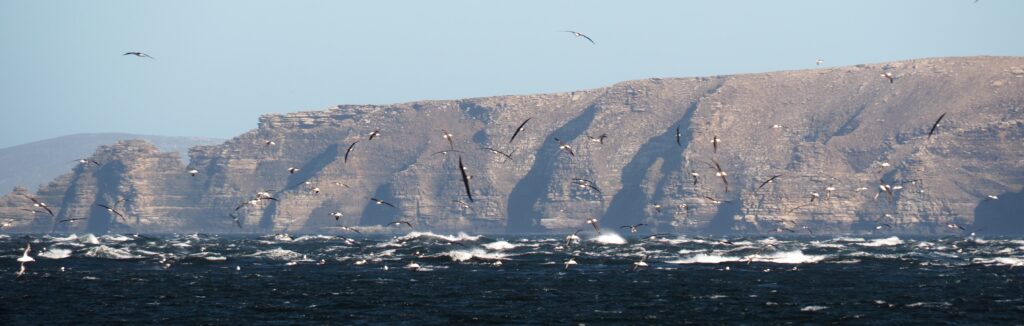
A mixed flock of sooty shearwaters and imperial shags near Big Shag Island, East Falklands. Photo: R. Orben
Falkland Islands proposed MMAs
Despite limitations there is much to celebrate. The Falkland Islands proposed MMAs are an incredibly exciting development for marine management and conservation in the South Atlantic. The proposed MMAs include much of the Falkland Islands kelp forests, which play an important role in nutrient cycling, carbon sequestration and are crucial to larval life history phases of squid and fish, important to both fisheries and higher marine predators. They protect near-pristine benthic habitats and encompass the foraging ranges of many marine predators, while benefiting others by providing a buffer around breeding colonies.
In total, these areas would protect about 15% of the Falkland Islands Conservation Zones (i.e., Exclusive Economic Zone), allowing the Falkland Islands to make great strides towards contributing to the 2010 Aichi Biodiversity Target of 10% ocean protection (and the proposed 2030 Target of 30%).
The proposed MMAs, if designated, would also establish the policy and legislative framework for marine protection, which will pave the way for any future designations, facilitate the management and conservation of globally significant populations of marine predators, and usher in a new era of ecosystem-based management. However, there is more work to be done to support and refine this process. We are currently exploring how innovative methods, such dynamic ocean management, could compliment fixed area management to help conserve wide-ranging marine predators at relevant spatial scales.
Baylis, A.M.M., de Lecea, A.M., Tierney, M., Orben, R.A., Ratcliffe, N., Wakefield, E., Catry, P., Campioni, L., Costa, M., Boersma, P.D., Galimberti, F., Granadeiro, J.P., Masello, J.F., Pütz, K., Quillfeldt, P., Rebstock, G.A., Sanvito, S., Staniland, I.J. and Brickle, P. (2021), Overlap between marine predators and proposed Marine Managed Areas on the Patagonian Shelf. Ecological Applications. Accepted Author Manuscript e02426. https://doi.org/10.1002/eap.2426
This research was funded by the UK Government through The Darwin Initiative, The Falkland Islands Government, & the Winifred Violet Scott Estate Trust.
References
Augé, A., M. P. Dias, B. Lascelles, A. M. M. Baylis, A. Black, P. D. Boersma, P. Catry, S. Crofts, F. Galimberti, J. P. Granadeiro, A. Hedd, K. Ludynia, J. F. Masello, W. Montevecchi, R. A. Phillips, K. Pütz, P. Quillfeldt, G. A. Rebstock, S. Sanvito, I. J. Staniland, A. Stanworth, D. Thompson, M. Tierney, P. N. Trathan, and J. P. Croxall. 2018. Framework for mapping key areas for marine megafauna to inform Marine Spatial Planning: The Falkland Islands case study. Marine Policy 92:61–72.
Baylis, A. M. M., M. Tierney, R. A. Orben, V. Warwick-Evans, E. Wakefield, W. J. Grecian, P. Trathan, R. Reisinger, N. Ratcliffe, J. Croxall, L. Campioni, P. Catry, S. Crofts, P. D. Boersma, F. Galimberti, J. Granadeiro, J. Handley, S. Hayes, A. Hedd, J. F. Masello, W. A. Montevecchi, K. Pütz, P. Quillfeldt, G. A. Rebstock, S. Sanvito, I. J. Staniland, and P. Brickle. 2019. Important At-Sea Areas of Colonial Breeding Marine Predators on the Southern Patagonian Shelf. Scientific Reports 9:1–13.
Esch, G. . (Ed). 2006. Marine Managed Areas : Best Practices for Boundary Making. NOAA Coastal Services Cente.
Granadeiro, J. P., L. Campioni, and P. Catry. 2018. Short Communication Albatrosses bathe before departing on a foraging trip : implications for risk assessments and marine spatial planning: Bird Conservation International, 28:208–215.
IUCN. 2020. Guidelines for using A Global Standard for the Identification of Key Biodiversity Areas. Version 1.1. Prepared by the KBA Standards and Appeals Committee of the IUCN Species Survival Commission pp.220.
Maxwell, S. M., E. L. Hazen, R. L. Lewison, D. C. Dunn, H. Bailey, S. J. Bograd, D. K. Briscoe, S. Fossette, A. J. Hobday, M. Bennett, S. Benson, M. R. Caldwell, D. P. Costa, H. Dewar, T. Eguchi, L. Hazen, S. Kohin, T. Sippel, and L. B. Crowder. 2015. Dynamic ocean management: Defining and conceptualizing real-time management of the ocean. Marine Policy 58:42–50.
We are excited to share with you an update on our nest monitoring of the common murres and cormorants at Yaquina Head Outstanding Natural Area (YHONA). Although our updates were on hiatus in 2020, we are happy to report were able to conduct monitoring. However, there was colony wide reproductive failure as a result of high rates of predator disturbance (bald eagles, 0.58/hour). At one point 15 bald eagles simultaneously hunting at Yaquina Head; a group size that has not been recorded at the site before or since.
This year, we began monitoring efforts in late May. In early July we were monitoring 161 common murre nests, 93 of which had eggs, and 11 of which had chicks. The first chicks hatched on June 28th on Lower Colony Rock and Satellite Rock.
Main colony rock at Yaquina Head Outstanding Natural Area, Newport, Oregon
Eagle Disturbances
As observed in recent years, bald eagle disturbances were fairly frequent within our Colony Rock nesting plots during the months of May and June. Beginning in July we have seen a noticeable decrease in disturbances. From June 2 – 30 June, 2021 we recorded 41 disturbances. Murres nesting in larger colonies appear to be holding their ground in all plots except for the top eastern half of Colony Rock where adult/sub-adult bald eagles perch periodically, allowing for gulls and turkey vultures to pillage unattended eggs. Flat Top Rock has remained nearly empty for the duration of the breeding season and was not included in this year’s monitoring efforts.
Cormorants
Along with common murre monitoring, we are also monitoring Brandt’s and pelagic cormorants. We are currently monitoring 22 Brandt’s cormorant nests and 37 pelagic cormorant nests. Chicks began hatching the week of July 5th and the majority of our nests for both species now have chicks.
We look forward to updating you on the success of our nests in August.
NSF REU Intern, Laney Klunis monitoring at Yaquina Head on a foggy morning.
This year, we’re delighted to have the addition of several new (and returning) lab members including Laney Klunis, a 2021 Research Experience for Undergraduates Intern from California State University Monterey Bay; Edward Kim, the 2021 Intern at Bureau of Land Management; Alyssa Nelson, USFWS Intern and former undergraduate lab member; and Noah Dolinajec, student in the Graduate Certificate in Wildlife Management (OSU) program are conducting field work for the 2021 YHONA season. We are pleased to be up and running with a full field team this year!
By Brendan Higgins, Jillian Soller, and Adam Peck-Richardson
Sunset over the seabird tower. Middleton Island, Alaska.
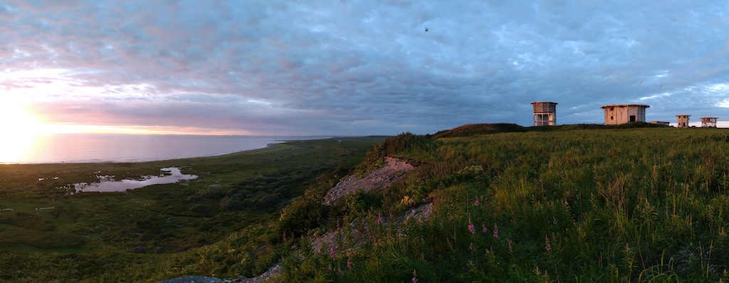
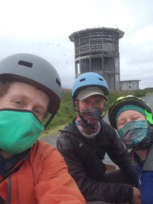
Greetings from Middleton Island, Alaska! This unique island in the Gulf of Alaska will be our home for six weeks as we investigate one of its common residents, the pelagic cormorant. We arrived on Middleton June 29th onboard a chartered nine-seat plane after a whirlwind shopping trip in Anchorage. The one-hour flight afforded us great views of Prince William Sound and the Kenai Ice field. Middleton Island, a treeless, 3.5-mile-long island is home to a variety of seabirds. This includes black-legged kittiwakes, rhinoceros auklets, common murres, tufted puffins, glaucous-winged gulls, and most importantly, pelagic cormorants. Middleton’s unique history has created an unprecedented opportunity for seabird researchers to obtain close-up access to ledge-nesting birds.
Field Work During A Pandemic
We arrived on Middleton while following a carefully considered COVID-19 mitigation strategy. The plan was approved by Oregon State University, and met the requirements laid out by the State of Alaska, and the Institute for Seabird Research and Conservation (ISRC) who operates the long-term seabird studies on the island. Before traveling, our team members, two from Alaska and one from Oregon, self-quarantined for two weeks to minimize the risk of spreading the virus.
While traveling we followed all the recommended precautions to reduce risk of transmission (infection) including wearing face-masks, social distancing, and using hand sanitizer. Travel happened in a single day (even from Oregon). Upon arrival we began a second two-week quarantine period on the island. This reduced the risk to the small crew on the island. Our careful planning worked and we are beginning our fourth week on Middleton symptom free.
Blog authors and seabird field biologists in a time of Covid-19.
Middleton Island History
The first biological surveys of Middleton Island occurred in 1956. Historically, the island was used for a variety of other purposes. In the late 1800’s, arctic foxes were introduced to Middleton Island and fox farming occurred here through the 1920’s. Up to 250 foxes roamed the island and fed primarily on nesting seabirds.
During the Cold War, ownership of the island transferred to the U.S. Air Force. The Air Force constructed a dock, followed by an airstrip, expansive housing, and several different radar towers. The infrastructure was fully operational by 1958. By 1963, the Air Force was completely gone. However, the radar towers remain. The maritime climate of the island has not been kind to the Air Force buildings. Today they are well on their way to being reclaimed by the salmonberries and fireweed. Additionally, rusting fuel drums and exposed skeletons of buildings are scattered abundantly around the island. Seabirds have made themselves perfectly at home nesting among the dilapidated structures.
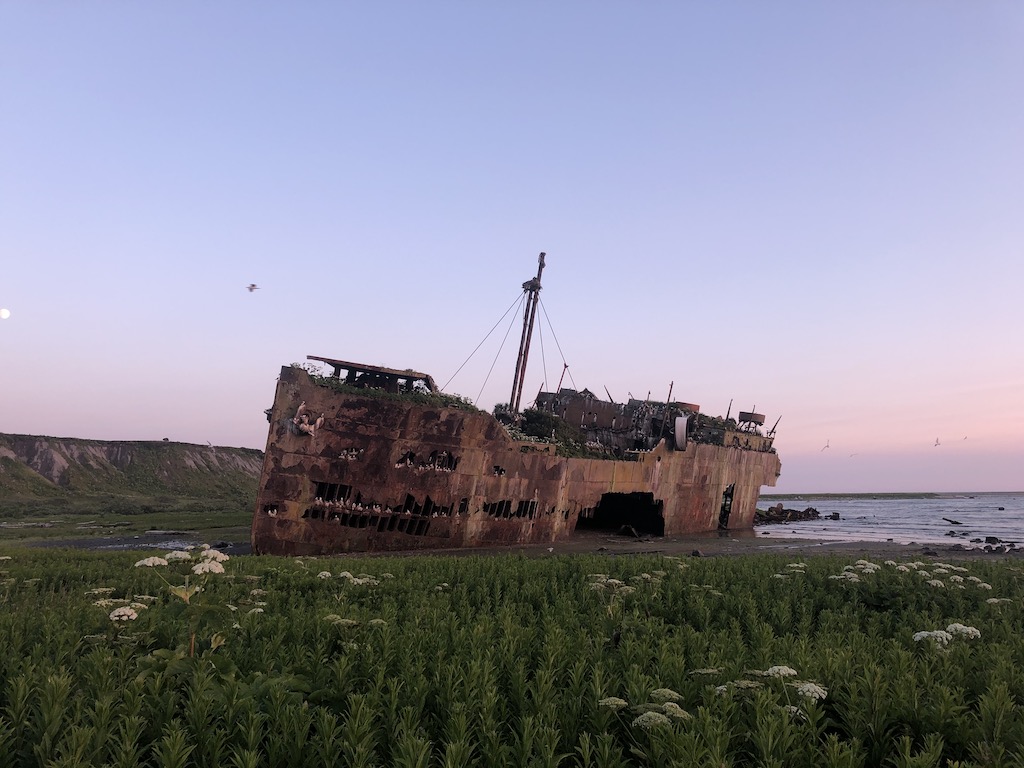
The wreck of the S/S Coldbrook. The ship ran aground on the reefs surrounding Middleton Island in 1942 and was subsequently raised out of the ocean during the uplift from the 1964 earthquake. It now serves as a home for hundreds of nesting pelagic cormorants and black-legged kittiwakes.
Conversion from radar to seabirds
In 1993, Dr. Scott Hatch (ISRC) began converting the largest of the radar towers into the cornerstone of a seabird research station. Today, close to 900 artificial ledges and windows allow kittiwakes, cormorants, and their nests to be directly observed and accessed in a laboratory like setting. Easy access to these cliff-nesting birds makes Middleton island an ideal place for studies like ours.
Inside the tower, featuring the ISRC crew black-legged kittiwake chick growth.
An up close view of a black-legged kittiwake brooding its chicks.
The Middleton Island seabird tower.
Another bird friendly adaptation to the island built by Dr. Hatch, a “kittiwake wall” on the side of an old Air Force building.
Cormorant Oceanography
Our goal is to place tags on pelagic cormorants to obtain detailed tracks of their foraging trips in the marine waters surrounding Middleton Island. Additionally, the tags collect oceanographic data. The data from the tags will be processed to provide measurements of ocean waves, seafloor bathymetry, surface currents, water temperature and salinity.
So far, we are focusing on reconnaissance and preparations for the capture and tagging effort. The bulk of our work has been setting up and testing a cellphone network booster system that will communicate with the tags. The system consists of multiple receiving and broadcasting antennas that pickup and amplify the signal coming from a tower in Prince William Sound over 50 miles away. Luckily, the network booster is working well and the tags are connecting and downloading data. Our oceanography team is monitoring the tags from Oregon. They will start processing data as it is collected!
Welcome to the blog of the Seabird Oceanography Lab. We engage in seabird science research along the Oregon coast, and worldwide. This blog will be used to provide updates on fieldwork, research, and anything seabird related! We may occasionally discuss seals. Please visit us again!
Previous Blog Posts
Over the past few years, our members periodically wrote blogs about our research for other venues. Follow the links below to blog posts written by members of the Seabird Oceanography Lab.
A series of blog posts written in collaboration with the Seabird Youth Network about red-legged kittiwakes (link). Followed by updates by Seabird Youth Network interns that includes resighting banded red-legged kittiwakes (link). Our recent project with red-legged kittiwakes occurred during three years of successively worse breeding success. This blog posted in 2017, was written by Rachael Orben as she contemplated why the red-legged kittiwakes nesting on St. George Is., AK did not lay eggs.
A blog describing Stephanie Loredo’s research on common murre movements on the Oregon coast.
The common murre capture crew from 2017.
Thoughts on western gull foraging preferences by Stephanie Loredo (link), along with a summary of western gull at-sea distributions relative to coastal marine reserves authored by Rob Suryan (link).
A tagged western gull sits on its nest after eluding the noose carpets placed strategically near-by.
Midway Atoll is home to the largest albatross colony in the world. A visit there can be more than overwhelming. Here are links to two blogs written by Rachael Orben after two, two-week visits to study albatross foraging ecology. Blog one and blog two.