by M. Kelsey Lane, Ph.D. student in Ocean, Earth and Atmospheric Sciences
Our eight-person team woke early to the clear blue skies of Catalina Island off the coast of Los Angeles, California. The beautiful island is a popular vacation destination, but we had other priorities as we jumped into another busy day of fieldwork. Someone hustled down to the laboratory before 7:00 AM to turn on the UV lights that mimicked the sun, suspended over the rows and rows of jars holding microscopic plankton called foraminifera, or forams, that we were growing. Three of us headed to the dock to take a boat offshore and tow the depths for more plankton. Everyone worked in the lab taking care of the forams in their tiny seawater jars. The tasks would keep us busy into the evening as we worked to farm forams for our climate research.
Figure 1. Dr. Jennifer Fehrenbacher (OSU) observing a foraminifera in culture. Behind are jars and jars of other forams. Each foram gets its’ own jar.
Forams are storytellers of a forgotten time. Their shells record the conditions that they live in, making them “proxies” or analogs for measuring climate change. Foram shell chemistry changes with changing temperatures, salinities, ocean pH, and many other parameters, including some we’re still exploring. The forams we study live as plankton drifting in the open ocean and grow shells out of calcium carbonate. They have intricate, beautiful chambered shells, many with spines to help catch food. When forams die, their dense shells sink to the sea floor and are often preserved as fossils, providing scientists with a unique opportunity to investigate the past by studying the foram fossil record going back millions of years. So, we can look at a 50-million-year-old foram fossil and say something about the ocean conditions at the time and place it grew.
Figure 2. Upper image – Foraminifera living in culture. The long spines surrounding the foram are covered in glowing dots that are symbiotic algae. Lower image – Foraminifera feeding on a brine shrimp. Note the difference in size between the foram and the shrimp.
The best way to establish these relationships is to grow foraminifera in controlled conditions and see how it changes their shell geochemistry. It’s a lot of effort to grow these small organisms, each about the size of a grain of sand and kept in their own individual jar, but they’re well worth the effort. Our multi-institution team came to the University of Southern California Wrigley Marine Science Center to help develop and improve climate proxies from modern foraminifera. It took a big team to capture, process and keep the hundreds of forams alive. The group from Columbia University and Vassar College explored how ocean acidification and warming temperatures are recorded in foraminifera shells. Our team from Oregon State University looked at how forams might incorporate trace metals to tell us more about ocean productivity, and I explored how the microbes living inside forams might be altering their shell geochemistry.
Figure 3. The field season team, including from left to right in the upper image: Laura Haynes (Vassar College) Bärbel Honisch (Columbia University), Jennifer and Kate Fehrenbacher (OSU), Ingrid Izaguirre and Yoon Kim (Columbia University), Elise Poniatowski (Vassar College) and Kelsey Lane (OSU). Not pictured: Madelyn Woods (University of Maine).
It felt strange to be so invested in the life cycle of a tiny, single-celled organism. We spent hours feeding each foram tiny brine shrimp, food that was often larger than the foram itself, and we all cheered when the hungry foram fed. We carefully watched as they grew chambers and spines, writing it all down in detailed logs. Some forams would die in culture or get pale and unhappy. If things we went well, the foram would reach its full size after a couple of weeks, then start to die and go ‘gam’ or gametogenic, the final stage of its life cycle. Although it was sad to watch them die, it was also exciting, because that was one more successful foram that had grown in our laboratory. We delicately extricated the foram and put the shell in a tiny slide, a precious data point that might help us understand more about the ocean’s past.
Figure 4. View of USC Wrigley Marine Science Center.
The month-long field season went quickly. Around the long hours in the lab or out on the water, we built a great community. We ended each workday swimming off the dock, exploring the island, kayaking nearby bays, or watching The New Girl and working through a massive puzzle (we got through about one a week!) Farming forams can be a busy job, but we had fun, too. Now we will spend the next few months at our home institutions processing all that data…
Follow more of Kelsey’s science on Twitter at @mkelsea and on the Foraminarium website
by Margaret Conley, PhD student in Ocean, Earth, and Atmospheric Sciences
Margaret tying off a ground line for a bottom mooring in a side channel of the Yaquina Bay estuary in Newport, Oregon. Photo by Jim Lerczak.
I study estuaries, the beautiful, mucky, and sometimes smelly mixing zones where river and ocean meet. Estuaries are exciting because they are always changing. Of course, every place has its seasons. Here in Oregon, we have summer sun and winter rain, spring flowers and fall leaves. But in an estuary, these changes are amplified: On top of seasonal changes, there is the daily drama of the tide, alternately flooding and exposing mud flats and marshes. The tide and the seasons also bring changes we can’t directly see — how warm and salty the water is, for example. These invisible characteristics are critical for the creatures that make estuaries their home, including oysters.
Low tide reveals a complex network of muddy banks and channels that are invisible during high tide at King Slough (top row) and Paddle Park (bottom row), two spots along the Yaquina Bay estuary, Newport, Oregon.
Oysters are used to a certain degree of change. But how will they, and their estuarine home, respond to the larger changes that human-caused climate change will bring? This is what my fellow researchers and I are trying to figure out, and we’re starting by better understanding the dynamics of one of the most basic water characteristics: temperature. We are studying water temperature in the Yaquina Bay estuary in Newport, OR to figure out how it changes with tides, storms, and seasons. Once we better understand the current range of temperature changes, we can start to predict how the estuary might change in the future, and how all this change affects the plants and animals that live in the estuary.
We are measuring the temperature of estuary water at many locations, from far upriver where the water is fresh to the salty water at the estuary mouth. By looking all along the channel, we can witness the battle between ocean and river, pushing each other back and forth as the strength of the tides and the river flow change over time. We’re also measuring the mucky places, like tidal flats where the water comes and goes and side channels called sloughs. All these water sources, plus heat from the sun, combine to determine the temperature of the water in the estuary. By recording the temperature changes from tide to tide and season to season, we hope to identify which factors are most important in determining temperature at each location along the estuary. We also want to figure out how these conditions influence where oysters grow best.
A calm morning at Cannon Quarry Park, Lincoln County, Oregon.
Besides the changing waters, the assortment of plants and animals that live in the Yaquina Bay estuary also changes over time. Baby salmon travel through estuaries on their way to the sea, and birds use the Yaquina as a rest stop during migration or as a summer or winter vacation home. Just like me, these animals are temporary visitors, and they never see the full range of estuary conditions. But there are also those who make this changing place their permanent home. Just like the residents of waterside towns, organisms like oysters set up shop on a particular spot and stay put. To understand why oysters live where they do, we have to become permanent residents too.
That’s where the scientific instruments come in. These little machines let us become residents of the estuary. While we return home to Corvallis after each field trip, the instruments stay behind, quietly recording the changing waters. While we work in our offices, they brave winter storms, floating logs, encroaching mud, and curious creatures. With luck, plus lots of knots and tape, they are still there when we return, and they report back on what they’ve seen. Each time we visit, the instruments look like they’ve been claimed by the estuary, coated in brown goop to match the muddy bank, sprinkled with baby barnacles just like the nearby rocks. Crabs move into our bottom moorings as they slowly sink into the muck. If we didn’t return soon enough, they might just disappear entirely.
A sensor that measures temperature and conductivity, before and after cleaning.
Using these measurements, we plan to figure out what the oysters themselves already know: How does the temperature of the water change over time? After several months of measurements, we can already start to put together a story. We see the winter rainstorms that push ocean water down the estuary back towards the sea, changes in the coastal ocean that creep their way up the estuary with the tides, and solar-powered heating. Once we know how temperature in the estuary changes, we can try to predict how it will be impacted by climate change. This temperature change also contributes one piece of the puzzle in understanding how oysters, intrepid inhabitants of this changing place, will respond.
Sunset and a falling tide at Hatfield Marine Science Center in Newport, Oregon, looking towards the Yaquina Bay Bridge.
Jenna Epifanio, Ph.D. student in Ocean, Earth and Atmospheric Sciences
Jenna in the field. Credit: Ian Van Coller
What would you see if you looked into a time capsule from 1.5 million years ago? If the time capsule contained air before it was sealed up, you would find out a lot about the Earth’s climate. Between October and January of last year, I had the opportunity to join a team of researchers to go find some of that air, trapped in a natural time capsule: An Antarctic ice sheet.
using ice to understand earth’s past
Ice on our planet’s polar ice sheets has been preserving records of climate for hundreds of thousands of years, and in the case of Antarctica, a lot longer than that. Antarctica is thought to have first become covered in ice about 30 million years ago, which means if we sample ice at the correct locations on the continent, we might be able to discover some of that extremely old ice.
Bubbly ice from the Allan Hills, Antarctica
What makes polar ice a great archive for climate science is the direct nature of what it preserves. Not only do the water chemistry and particles trapped in the ice tell us about the past climate, but ice also collects tiny air bubbles that preserve an undisturbed record of the Earth’s atmosphere. Because ice is formed by layers and layers of snow that become packed down over thousands of years, all of the bubbles that are trapped in the ice sheet are preserved in chronological order – the deeper down in the ice sheet, the older the ice and the air trapped in it. Climate scientists can drill a long ice core and analyze it to determine the chemistry of the ice as well as the composition of atmospheric air in the ice bubbles.
Even though Antarctica glaciated over 30 million years ago, we probably won’t ever find ice that old on the continent. Because ice moves quickly (geologically speaking) and is subject to stress, melting and flow, most of the extremely old ice in Antarctica has already been destroyed. Currently, the oldest record of past climate contained in an ice core goes back 800,000 years. Recently, however, there has been a push to identify ice older than this because of an interesting question about the climate system that we want to answer.
Between 1.2 million and about 900,000 years ago, the Earth went through a dramatic shift in ice age cycles. During what’s known as the Mid Pleistocene Transition (MPT), the Earth changed from having ice ages every 40,000 years to having much colder and longer ice ages every 100,000 years. We know this from ocean sediment records of climate that contain indirect clues – proxies – describing climate conditions. However, an ice core record that covers that period would be invaluable: Instead of using proxy records of climate recorded in the ocean sediments, we would have a sample of the atmosphere itself to measure and answer questions about the climate from that period.
A visible layer of volcanic ash trapped in the ice sheet, near the Allan Hills, Antarctica.
Recently, scientists collected ice that was dated to be 1.5 million to about 2.7 million years old at a location in Antarctica called the Allan Hills. Situated about 140 miles from the U.S Antarctic base, McMurdo station, the Allan Hills is known as a “blue ice area,” and when you see it for the first time, there is no question as to why it bears the name. Blue ice areas (BIAs) are created when winds scour the ice sheet, removing the top layer of uncompressed snow and exposing the blue ice. At the Allan Hills, this process is combined with other physical factors that allow very old ice to be found near the surface. That extremely old ice near the surface is what I, and a few wonderful people from around the country, were there to sample.
The primary goal of the field season was to re-drill an ice core at a location that had been identified to have ice that is 2.7 million years old. The original ice core, collected a few years ago, was fairly small, and has mostly been consumed as samples were chipped off of it in the process of understanding its age. One secondary goal of the expedition was to drill some reconnaissance samples in locations that were good candidates for old ice. Over the seven weeks, we successfully drilled three 150-m ice cores, one of which will very likely contain ice that is 2.7 million years old.
Field work at the bottom of the world
Just arriving in Antarctica is an ordeal. A commercial flight to Christchurch, New Zealand takes about 18 hours. I was the only representative from Oregon State University on the team, so meeting some new and also some familiar faces was the first order of business when I arrived. Along with the other researchers, I met our camp manager, Anna, an impressive and ferocious mountaineering woman on her tenth season in Antarctica. I also met Elizabeth (‘E’) and Tanner, both professional ice core drillers (yep, that’s a real job!), who have a ridiculous amount of experience between the two of them. These tough-as-nails people would teach me how to drill ice cores in one of the most extreme places on the planet. To get from New Zealand to the icy continent, the team and dozens of other researchers and personnel boarded a US Air Force C-17, a gigantic military plane. The trip took five loud, and quite cramped hours, until we landed on the airfield located on the ice near McMurdo station.
Drilling 2.7 million-year-old ice with the Blue Ice Drill.
We spent ten days at McMurdo Station collecting camp gear, planning meals and food needs, and training in snow survival skills, and then we flew to our remote field site. Multiple Twin Otter flights from McMurdo Station to the Allan Hills were needed to deliver nine people, two ice core drilling rigs, and all of our camping gear. Two other researchers and I were on the last flight, which was delayed due to high winds and poor visibility at the Allan Hills.
The first order of business was to finish setting up camp, and begin setting up our drilling equipment. The next few days were grueling work, lugging gear to different drill sites, drilling anchors in the ice to secure our tents and equipment, and testing the electrical generators that would power the blue ice drill, a 9.5-inch diameter ice core drill that we would use to extract literal TONS of ice over the next seven weeks. The exhaustion that set in at the end of each very long day made sleeping in a tent during 24 hours of daylight some of the easiest sleeping I’d ever done.
Scott tents and living quarters on a beautiful day at the Allan Hills, Antarctica.
It is amazing how quickly you can adapt to harsh conditions. Our team was in the field for seven weeks. That’s seven weeks of waking up in a tent every morning to freezing temperatures, getting dressed, grabbing some warm tea and a quick breakfast, then heading out to our drill sites to continue the drilling from the day before. Drinking water was made by melting ice that we chipped out of the ice sheet at a special “sterile” location. There were no showers, and all my baby-wipes were frozen into a solid block of ice before I got to my tent that first night in the field. The sun never set, and if the wind would stop howling in the middle of the night, I would wake up, disturbed by the sudden change. Those nights were special, though, because you could hear the ice sheet cracking. Loud pops echoed across the ice sheet and reminded you of how incredible it was that you were there.
Science during a pandemic
I should be in Antarctica right now, sleeping in a Scott tent, enjoying the company of some amazing scientists and ice core drillers. The Allan Hills ice core drilling project was funded for two field seasons. Because of the COVID-19 pandemic, the field work has been delayed, and I’m sitting in Corvallis, Oregon, remembering that dramatic place. I don’t feel sorry for myself for missing out on a second season; being there once was the experience of a lifetime, and I’m grateful to have had it. Living through this pandemic does highlight how dramatically nature can change our lives, giving a little bit of perspective as to why understanding climate change is important. Understanding what is natural, normal, and possible for the Earth’s climate system is key to understanding how it will change in the future. Understanding the nature of that change can prepare us for what comes next.
Most of the team at the Allan Hills ice core drilling project.
By Lila Ardor Bellucci, Ph.D Student in Ocean, Earth and Atmospheric Sciences
Lila Ardor Bellucci sampling deep sea mud. Image courtesy of Marley Parker.
Introduction
Methane seeps are places where methane gas escapes from reservoirs below the seafloor into the overlying waters. These seeps support unique and fascinating benthic communities that provide habitat and food to other deep-sea fauna, while also keeping methane from reaching the atmosphere. Because methane is a powerful greenhouse gas, scientists are interested in studying seeps to see what role they might play in climate change. Seep ecosystems may also be a source of energy, biopharmaceutical compounds, and valuable rare earth elements, all of which could contribute to the US “Blue Economy.” As we humans explore these potential resources, scientists like me are working to better understand seep communities and their functions to inform future management. This article is about two seeps my team and I encountered during an October 2020 expedition to find and characterize methane seeps along the Cascadia Margin – about 80 miles off the coasts of Oregon and Washington.
Looking off the back deck of the E/V Nautilus at the remotely operated vehicle (ROV) Argus. Image courtesy of Lila Ardor Bellucci.
Ocean exploration
Part of the fun in exploring never-before-seen parts of the ocean is that it’s hard to predict what you’re going to find. Prior to entering graduate school, I participated in ocean exploration and research aboard the E/V Nautilus and R/V Neil Armstrong as a member of their Science Management and Marine Technician teams. This unpredictability was always one of my favorite parts of the job, and the same was true of my lab’s recent E/V Nautilus cruise to explore methane seeps along the Cascadia Margin. Even across similar ocean depths and latitudes, seep sites can vary dramatically in appearance and function, and in the animals and microbes that live there. One reason for this variation is that seeps can be thought of as having lifetimes and can look very different at different phases in their lives. During our recent cruise, we were lucky to find seeps at opposite ends of these phases, often called “successional stages.”
Searching for seeps
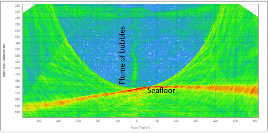
One of the first remotely operated vehicle (ROV) dives we had planned was to a site where past sonar data had indicated exciting wide-spread bubbling. The multibeam sonar is an acoustic tool, mounted to the ship’s hull, that allows researchers to map the seafloor and also detect methane seep bubble streams. As we came over the site, sitting about 1,000 meters (3,280 feet) below us, we were disappointed to find no trace of bubbles in our multibeam data. Would we descend and not be able to find the seep?
When Lila and the other scientists see bubble plumes like this, they know there will be methane leaking from the seafloor, but they never know what it is going to look like until the ROV actually gets down there. Image courtesy of Oregon State University, NOAA OER, NOAA OCNMS, Ocean Exploration Trust, NA-121.
First seep
We decided to dive anyway, and the risk paid off. Shortly after reaching the seafloor, we were surprised to come across massive piles of carbonate rock, looming above ROV Hercules like dark towers. This type of rock is formed by the methane-eating reaction of bacteria and archaea (single-celled organisms, often found in extreme conditions) that live at seeps. Carbonate rocks of this size could have taken hundreds or even thousands of years to form! Similar to an old growth forest with large trees, the existence of these massive towers told us that the seep must be at a later successional stage in its life. Although we came across living clam beds, often found at methane seeps, this impressive site was no longer the bubbling frenzy it may once have been during its younger days.
Carbonate rocks, created as a byproduct of methane being eaten by microbes, provide a home for many animals from octopods to mushroom corals. You can also see expansive microbial mats in the fissures between rocks; this fauna is living on a shallow dusting of mud overlying even more carbonate rock. Video courtesy of Oregon State University, NOAA OER, NOAA OCNMS, Ocean Exploration Trust, NA-121.
Unexpected discovery
Our next discovery was even more unexpected. On our way to the late successional stage seep site, our multibeam mapping team noticed a large bubble plume in the sonar data, again about 1,000 meters (3,280 feet) deep. Although we hadn’t initially planned on it, we decided to take a chance and investigate further. As the ROVs (Hercules and its stabilizing companion Argus) descended, we picked up the acoustic signals of bubbling from over 100 meters (328 feet) off the seafloor, using an ROV-mounted sonar. When we arrived at the bottom, we were greeted by one of the largest microbial mats any of us had ever seen.
The 50-meter (16-foot) diameter microbial mat the expedition found was incredibly soft and covered by both bacteria as well as thousands of tiny snails, some of which were even covered by bacteria themselves. Near the large mat were many thorny head rockfish (left) and black cod (sablefish) (right), two commercially harvested species which are often found near methane seeps. Images courtesy of Oregon State University, NOAA OER, NOAA OCNMS, Ocean Exploration Trust, NA-121.
Second seep
As we navigated around its edge to gain our bearings, we realized that the mat of dense, white and gray bacteria seemed to go on forever, covering at least 50 square meters. As we explored its interior, we found numerous bubble plumes on the northern edge of the mat, filled with small tube worms and surrounded by extensive clam beds. This was a textbook young seep, in an early successional stage and (to our delight!) still soft and perfect for taking sediment core samples. At older sites, taking cores can be difficult because of those carbonate rocks that form, blocking the core tube as we try to push it in.
The research team collecting sediment cores at the early successional stage seep site. This video is sped up four times. Video courtesy of Oregon State University, NOAA OER, NOAA OCNMS, Ocean Exploration Trust, NA-121.
Collecting sediment cores
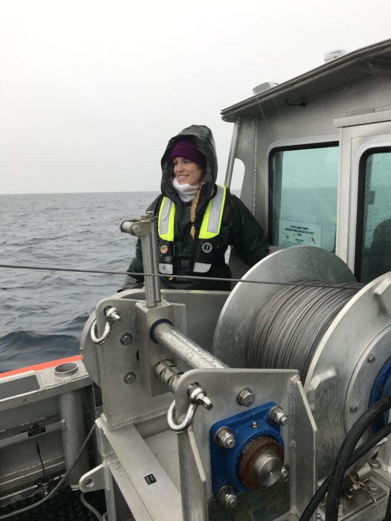
I should mention that, while the collection of sediment cores and other samples may seem like a simple task, each sample we collected was actually the collective achievement of a whole team. Our team was made up of the various specialists and scientists that ran each dive from within the “control van” aboard the ship, as well as those who joined us from land via satellite-enabled telepresence. While we (the science team and data loggers) dictated and recorded sampling, pilots manipulated ROVs and mechanical arms thousands of feet below them, navigators managed the position of the ship, and video engineers controlled the ROV cameras that we all used to see.
A peak inside the control van and an image of one of the E/V Nautilus ROVs (Hercules) being recovered after a dive. Image of Hercules courtesy of Marley Parker.
Processing samples
Each of the samples we collected on our dives was then processed as soon as the ROVs came back on deck. Because we ran 24/7 operations on the E/V Nautilus, both dives and sample processing could occur at any time of day. In the case of our “young” seep dive, processing our glorious cores and other samples took us over 7 hours. This was in addition to the 8 hours each of us spent on watch in the control van, in my case from 12 to 4 (both AM and PM). It was cold, it was muddy, and it was non-stop, but it was a whole lot of fun and all worth it. The samples we collected from these two diverse seeps, as well as the others we visited during our cruise, will now enable us to better understand these diverse seep habitats from various angles.
Lila processing cores for methane and microbial analyses with her advisor Dr. Andrew Thurber on the back deck. Images courtesy of Marley Parker.
Conclusions
Although studying individual seep sites really well can be very valuable, it’s also important to study a broad range of seeps when trying to gain a better understanding of them. As this tale of two seeps shows, even nearby seeps can be very different, each telling us part of a larger deep-sea story. Unexpected discoveries like this help us to shape our understanding of a seep’s lifetime, thereby providing valuable guidance for future research.
Lila’s advisor, Dr. Andrew Thurber, and Lila collecting biological and sediment core samples, including a glass sponge, from ROV Hercules. Images courtesy of Marley Parker.
Originally published on the NOAA Office of Exploration and Research website as a mission log for E/V Nautilus cruise NA-121: “Gradients of Blue Economic Seep Resources”.
By Kirsten Steinke, Ph.D. student in Ocean Ecology and Biogeochemistry
Kirsten Steinke
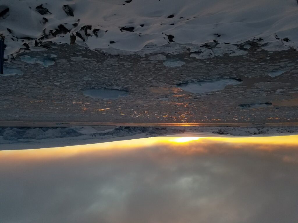
I wake up and rub my eyes as my 5:45 alarm goes off in the morning. Still pitch black out my window, I quickly throw on my workout clothes, grab my yoga mat and head to the lounge for 6 am group yoga. After spending thirty minutes waking up my muscles, I head to the gym for my morning workout routine with my buddy Ken: a three-mile run on the treadmill while watching an episode of Rick and Morty. Sufficiently sweaty, I head to the girl’s bathroom (which is way nicer than the one I have at home) and take a quick shower. Finally awake, I head back to my room and get my stuff together for the long day of work. I look out my window again and the sun is just starting to rise behind the glacier. I stop what I’m doing and take a minute to just watch. I can hardly believe that this is the view I get to start my day with every morning.
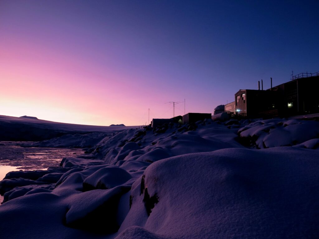
The sunrise at Palmer Station, Antarctica
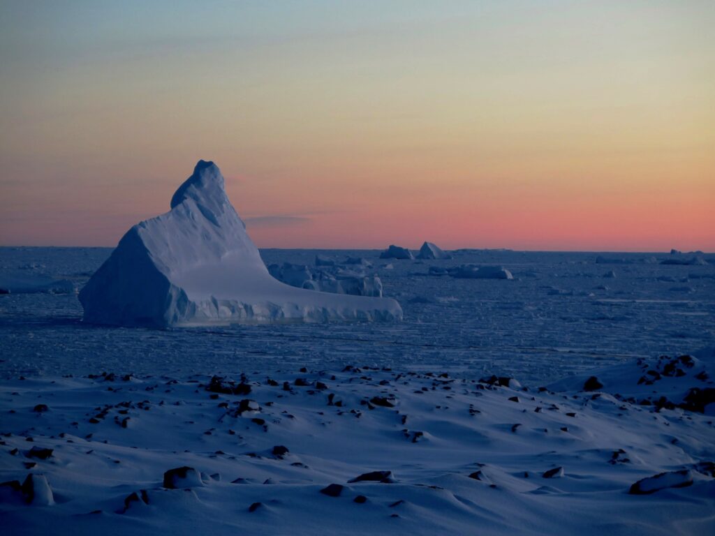
After the winter solstice on June 22, the sun started returning rapidly to our region of the Western Antarctic Peninsula (wAP). The sunrise is a welcome site as in the dead of winter we were only getting about 3-4 hours of sunlight every day. In total, our OSU research team spent about six months conducting research and living at one of the Antarctic research stations owned by the United States Antarctic Program (USAP): Palmer Station. Palmer is situated on Anvers Island in the northern part of the Western Antarctic Peninsula. The smallest of the three research stations run by USAP, Palmer looks out over the Southern Ocean and the vast mountain ranges that are typical of the Antarctic Peninsula. The setting is spectacular: We watch icebergs float in and out of the surrounding bays and listen to the earth-shattering eruptions of the glacier calving nearby. One iceberg, dubbed Old Faithful, got stuck in the bay and stays with us all season. It is comforting in a way to see it standing faithfully by each day as we begin our field work.
Old Faithful, our most loyal iceberg
“Why on Earth are you going to Antarctica in the middle of winter?” was a common question that I, and the rest of my research team, got asked. Believe it or not, the changes that occur in Antarctic ecosystems during the winter are poorly understood. Our team of krill researchers sought to fill some of these knowledge gaps as we conducted experiments on the overwintering of arguably the most important keystone species in Antarctic ecosystems: Antarctic krill. These tiny crustaceans, about as big as the length of your pinky as adults, support most of the top predators in the Antarctic ecosystem. Whales, penguins, seals, fish and other seabirds rely on krill as their primary food source.
Our research project was designed by my advisor, Dr. Kim Bernard. She’s interested in how the warming at the northern wAP affects the food available to krill throughout the autumn and winter. The northern wAP is warming quicker than most other places on Earth, which has altered the food web dynamics at the northern WAP. Krill feed primarily on diatoms (microscopic algae) and copepods (microscopic zooplankton). The warming temperatures have resulted in declines in diatoms but more copepods at the northern wAP. Winter is a critical life history stage for young krill as food availability decreases in response to lower light levels. We wanted to know how this climate-induced change in food availability, compounded by the overall lower levels of food availability, affects the physiology of young krill. Hence, six months of Antarctic research collecting, observing, and learning from our kriller friends.
Out collecting food for our krill
While these six months may have been the most demanding of my Ph.D. career, they were also some of the best months of my life. We worked long hours in the lab and out in the field six days a week, making sure we had enough resources to support our long-term feeding experiment and to carry out our physiological experiments. Similar to the krill, we learned how to adapt to the extreme winter conditions. We got used to working in complete darkness, learned which path to take to work when winds were blowing over 100 knots and discovered that the quickest way to warm our fingers and toes after a long day of field work was to hold them directly against the small space heater in our office.
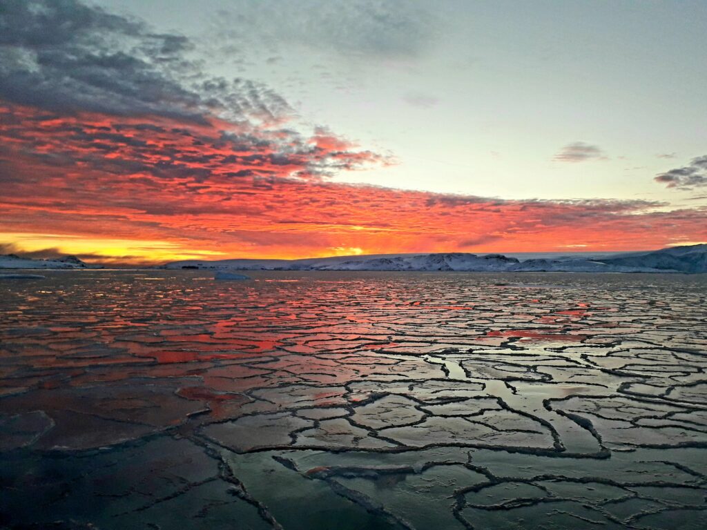
The sunset reflecting off the newly formed sea ice
Palmer Station welcoming the evening light
Our long field season at Palmer Station, Antarctica finally came to an end in the middle of October. In addition to the hundreds of samples that we successfully obtained from our research project, we left Palmer with new memories, incredible stories and 17 new friends that we were lucky enough to call our polar family. This experience was truly one of the greatest of my life and I cannot wait until our next field season starts in February 2021. It’s going to be kriller.
The 2019 Antarctic research team. OSU CEOAS graduate Julia Fontana(left), OSU CEOAS Associate Professor Dr. Kim Bernard(Center), OSU CEOAS PhD Student Kirsten Steinke (right)
On this website we share stories from some of our researchers in the College of Earth, Ocean and Atmospheric Sciences (CEOAS) at Oregon State University. We hope you enjoy them!