Hurry Up and Wait: A Delayed Start to Marbled Murrelet At-Sea Surveys and Our Attempt to Salvage the 2026 Season

By Will Kennerley
Faculty Research Assistant, OSU Seabird Oceanography Lab

A small, dark brown seabird rises from the waves and quickly takes flight, grasping a flashing, silver fish in its short bill. This is a breeding adult Marbled Murrelet getting ready to take fresh food to its young back at the nest site. But the murrelet doesn’t follow behind the murres that are flying nearby, similarly laden with fish for their young. Instead, the Marbled Murrelet flies not to rocky sea cliffs and islands like the murres and most other seabirds, but rather into the forested, coastal hills. Here, high up in a massive, old-growth tree, this Marbled Murrelet works with its partner to raise a single chick, perched in a depression on a wide, mossy branch.

The incredible nesting strategy of Marbled Murrelets has made them uniquely vulnerable (among seabirds) to the logging of the Pacific Northwest’s ancient old-growth forests. Like the more popularized Northern Spotted Owl, Marbled Murrelets have seen their populations fall with the old trees; the result is that both species are now the focus of critical population monitoring efforts as part of the Northwest Forest Plan. Both Northern Spotted Owls and Marbled Murrelets are listed as Threatened under the U.S. Endangered Species Act, and it is only through population monitoring surveys that we can learn how these species are faring.
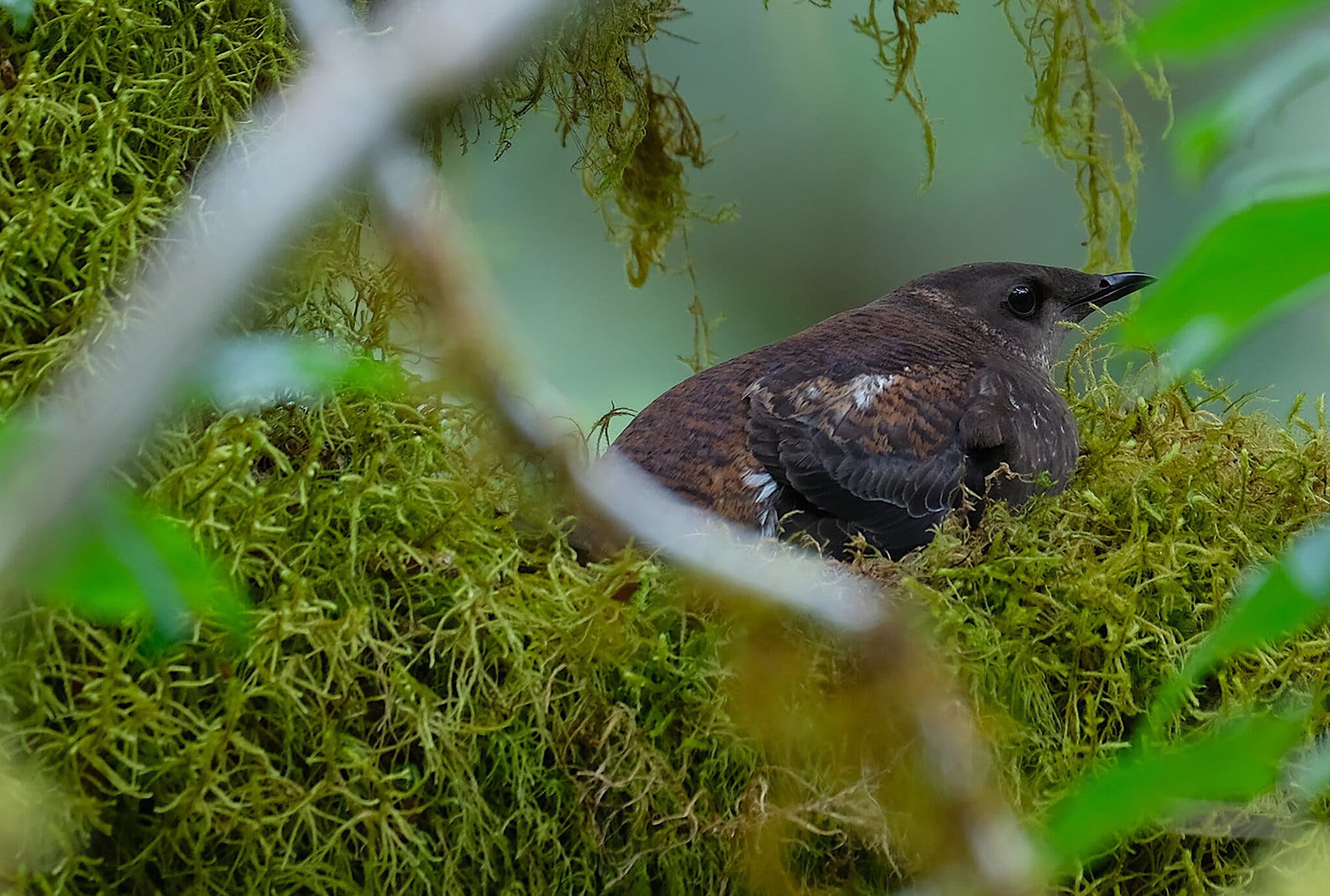
A brown bird with a long bill sits on a moss covered tree branch.
Figure 1. Marbled Murrelets forage for fish and marine invertebrates at sea but return to old-growth forests to raise their young on mossy branches high in old trees. Photograph by Brett Lovelace, Oregon State University

Some of these surveys for Marbled Murrelets occur via small boat work up and down the U.S. Northwest Coast, featuring a small team of researchers aboard to count and record murrelets observations. These at-sea surveys zigzag along the coast and collect the data necessary for informed estimates of Marbled Murrelet population sizes and distribution . This survey work has been conducted regularly since the mid-1990s, reliably providing an invaluable dataset documenting murrelet population changes while battles over old-growth forest cutting were waged on land and while coastal oil spills and marine heatwaves added new stressors to marine life.

This year, unfortunately, the survey’s annual start date of May 15th came and went without any word on when pending grant money would arrive from the US Fish & Wildlife Service. Primed and ready for work, our lab was forced to wait for the promised federal funds to arrive before we could begin; we knew the murrelets wouldn’t wait and no amount of money can bring this lost time back.

Fully halfway into our eleven week field season, funding suddenly came through – a delay without precedent in the nearly 30 years of this program. The lost time means that this year’s survey effort won’t be able to provide a proper population estimate in meeting with Northwest Forest Plan monitoring. However, with a potentially record-breaking El Nino developing, these data will still provide a valuable context for Marbled Murrelet populations in 2026. Following the confirmation of funding, a mad scramble arose to get out on the water and collect as much data as we could before the entire season was lost. Thanks to the hard work of our team and the support of the OSU Small Boat Program, it took only two weeks before we were on the road with our gear packed, boat on the trailer, heading out to our first port.
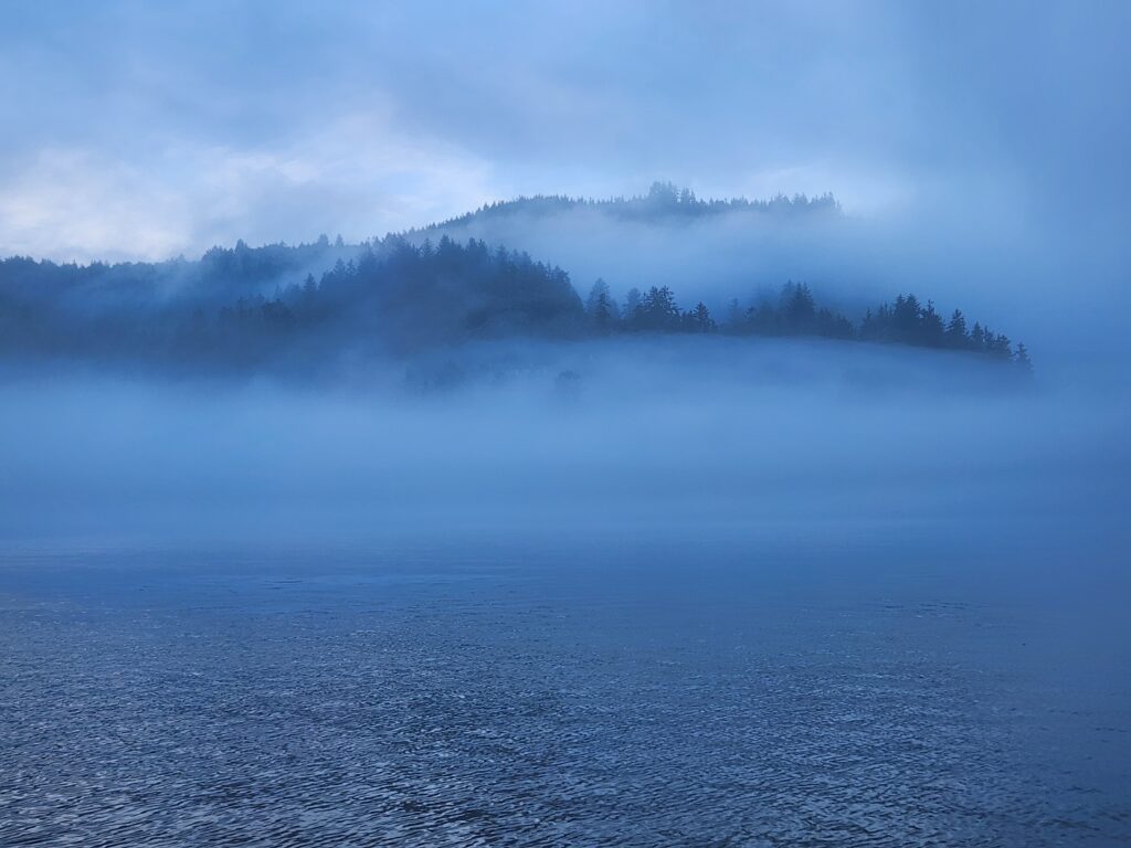
A view from on the ocean looking back towards fog rolling over the hills. Everything is blue.
Figure 2. Most Marbled Murrelet survey days began with cool, foggy mornings in one of Oregon’s small coastal towns. Here, fog clings to the hills behind Tillamook Bay, near Garibaldi, Oregon.

Surveying At-sea

A typical day began before dawn at a campsite in a small, coastal Oregon town (Figure 2). Damp fog hung coolly in the air as we packed up camp and launched our boat, a 27’ Boston Whaler named the Mishki (an indigenous Siletz word for ‘seabird’). Once the sun was up and the fog cleared (hopefully!), we were able to get to work, following a series of transect lines along the coastline in one of the 17 separate primary sampling units (PSUs; Figure 3) within this year’s survey zone.

While on survey, our team of three researchers divided up duties: one surveyed the port (left) side of the vessel, another surveyed the starboard (right) side, while a third drove the Mishki along a randomized transect line. To minimize observer bias, roles were rotated throughout the day. For this to work, each member of the team has to be both a skilled observer and boat operator.

In short, we followed a line transect protocol looking for Marbled Murrelets, aiming to count each and every murrelet we could see from the vessel as we moved along the coast. For each sighting, we recorded the number of murrelets seen, the age and molt class, the bird’s behavior, and an estimate of how far off the transect line the bird was located. Sometimes we got to observe murrelets at close-range on the surface and could fully appreciate the subtle beauty of their “marbled” plumage. As often as not, however, murrelets were detected at substantial distances, flying quickly on dark, rapidly-beating wings in a distinctive, bumblebee-like flight (Figure 4). Look away for just a moment and you could easily miss some of these challenging-to-survey seabirds!
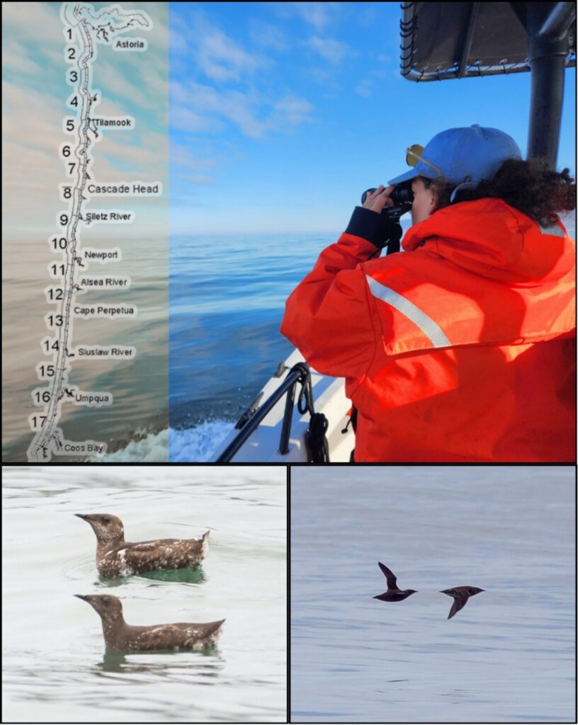
A four paneled figure with a map of Oregon, a person in orange looking out to sea holding binoculars, a pair of brown plumage marbled murrelets sitting on the water, and two marbled murrelet silhouettes flying by.
Figure 3. In 2026, we surveyed Murrelet Conservation Zone 3, covering 17 survey units from the Columbia River south to Coos Bay. Here, Cal Poly Humboldt graduate student Cheyenne Stephens uses binoculars to determine the age and molt class of a Marbled Murrelet off Waldport, Oregon (PSU 11). Below, an ideal view of two adult Marbled Murrelets (left) and a more typical view of murrelets far away and in flight (right). [Murrelet images courtesy of Ryan Mense (left) and Greg Harrington (right)].

Additionally, we counted all birds seen on the water within 50 meters of the vessel’s path as well as all marine mammals observed, regardless of distance. These data provide valuable insight into how the whole community of coastal marine life is faring, from Common Murres (Strong & Duarte 2023) to Gray Whales (Barlow et al. 2024). These data on the ecological community provide essential context for any changes observed in Marbled Murrelet population size or distribution.

Our team followed predetermined transect lines comprised of ~5 km segments at varying distances from shore, as well as a zigzagging transect line farther offshore. This variation helps biologists capture inshore-offshore gradients of murrelet distributions since murrelets may be found in different parts of Oregon’s coastal waters depending on the time, place, and conditions. In general, we noted the greatest concentrations of Marbled Murrelets along Oregon’s central coast (roughly from Depoe Bay to Florence), about 500 to 1200 m offshore of sandy beaches. This area has some of the state’s largest remaining tracts of coastal, old-growth forests for nesting and these shallow, sandy-bottomed waters shelter the schools of sandlances, herrings, and other small fishes that murrelets rely upon for food.
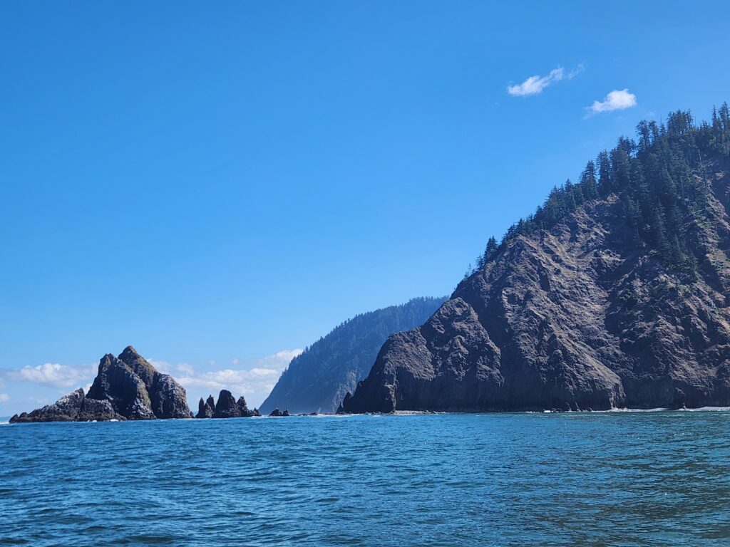
The view from the water of a series of two rocky headlands and some off-shore rocks.
Figure 4. Tillamook Head falls hundreds of feet into the sea on the northern Oregon Coast (PSU 2). Daily views of stunning coasts like this were one of the highlights of this survey work!

Each PSU comprises 40-50 km of total survey effort and takes about half a day to complete. Some days, the weather allowed us to complete two PSUs, although more often than not rising winds, incoming fog, bar closures, or other fast-changing conditions forced us to head back to shore in the afternoon. Once safely off the water, the boat was put on the trailer, the data was downloaded and backed up, and our team was back in the truck, driving down US-101 to our next port. We attempt to randomize our survey effort along the coast, which means we bounced back and forth, north to south and north again, completing PSUs one by one. We put a lot of miles on the truck and many hours on the Mishki’s engines, but we were rewarded with views of countless incredible seabirds and some of the country’s most spectacular coastline (Figure 4).

The evening of July 31st marked the end of this year’s abbreviated survey season. All told, we managed to complete 16 of 17 PSUs in this year’s target region – not bad for a 4 week survey season! During this time we surveyed 640 km of transect and observed more than 1,600 Marbled Murrelets, as well as thousands of other seabirds like Common Murres, Rhinoceros Auklets, and California Brown Pelicans. Our data are currently being reviewed and proofed with the hope that they’ll soon be able to provide a little more insight into how this unique seabird is surviving. Given the many challenges Marbled Murrelets face – unsustainable logging practices, marine heatwaves, El Niño events, and uncertainty in federal funding to support population monitoring – their outlook in the Northwest is far from certain. In any case, we hope to be out on the water on time next summer, collecting more data to help inform the management and conservation of this threatened species.
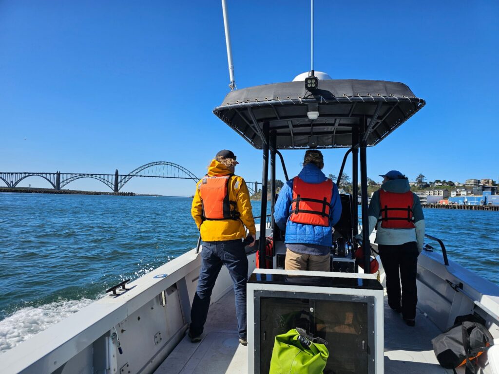
Three people in a row wearing life jackets on a boat with a center console heading towards a large arch bridge.
Figure 5. Some of the 2026 Marbled Murrelet survey crew aboard the Mishki on Yaquina Bay. From left to right: Adam Peck-Richardson (OSU), Will Kennerley (OSU), and Cheyenne Stephens (Cal Poly Humboldt). Experienced observer Craig Strong completed our observer team during the latter half of the season.

Yaquina Head Early Season Update, Summer 2026

By Will Kennerley, Faculty Research Assistant

On the morning of May 9th, I drove out to Yaquina Head and walked to the overlook at the base of the 93′ light tower. Thousands of murres were already on the rocks and buzzing around like so many bees, cormorants were flying back and forth with mouths full of nesting material, and oystercatchers chased one another across the intertidal rocks. This day was like so many others yet was notable for kicking off our 20th consecutive season of seabird monitoring at Yaquina Head (and 25th overall!).

Twenty years sure feels like a long time; after all, when monitoring was revived in 2007 under the direction of then-OSU Professor Rob Suryan, Rhianna’s “Umbrella” was dominating the airwaves, the very first iPhones were being released, and George W Bush was still in the White House. About 60% of murres that season reproduced successfully, a percentage we haven’t managed to reach in the last decade. Amazingly, given the relatively long lifespans of murres and other alcids, some of the chicks from that season are almost certainly still with us, breeding this very year at the colony!

Over this time we’ve seen a number of changing influences on Yaquina Head’s birds, most especially rising avian predator predation and the occurrence of several severe marine heatwaves. Yet, over all this time our methodology has remained essentially unchanged and many of the same rocks and subcolonies are still being monitored. This gives us the incredible ability to effectively document and quantify changes in seabird vital rates over a relatively long timespan, helping us learn how Oregon’s seabirds are adapting to a changing world.

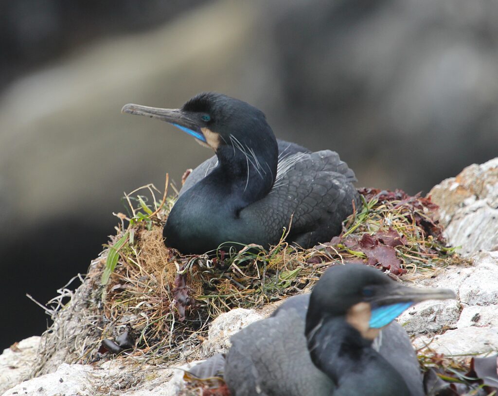
After a month of monitoring, it seems like it’s set to be an early year, particularly for cormorants. Brandt’s Cormorants were already starting to lay eggs by May 12th and Pelagics were doing so just a week later. Assuming standard incubation periods of 30 days for both species1,2, it’s likely we’ll start to see our first cormorant chicks hatching at the end of the week. In many years, median hatch dates for both species aren’t until early-mid July, suggesting we could be several weeks earlier than in a “typical” year!

Two Brandt's cormorants on nests
Brandt’s Cormorants seem poised to have an exceptionally early year, with the first nests being laid a week or two earlier than the norm. The first chicks at Yaquina Head may hatch within a few days.

However, there’s also evidence of two distinct waves of cormorant nesting this year at both the Yaquina Head and Pirate Cove colonies. Many early nesting attempts in mid-May (particularly at the more exposed sub-colonies) were subjected to extensive eagle disturbance and were kept empty while those at more protected sites nearby were already incubating. Eagle disturbance tends to decline over the course of the summer and cormorants established more widely by early June. Because of this, I suspect we’ll see some exceptionally early chicks but perhaps the median hatch date that we calculate every year won’t be quite so dramatically different from normal.

Although cormorants show great variation in the timing of nest initiation between years, we haven’t seen evidence of an obvious change towards earlier or later nesting. Murres, in contrast, have been nesting later and later in recent years at Yaquina Head; whereas chicks in the 1990s and early 2000s hatched mostly in late June, we typically don’t see our first chicks until mid July now. At present, murres are occupying nest sites at both Yaquina Head and Pirate Cove, yet only in the last week or so have eggs begun to appear.

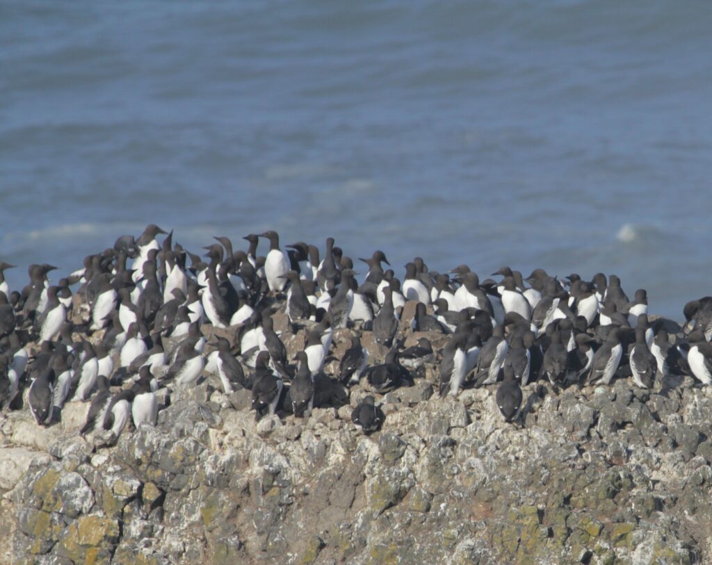
A large number of common murres standing on a rock.
Common Murres have been occupying the rocks at Yaquina Head on and off for several months now, but only recently have they begun to lay eggs. When Rob Suryan reinstated the Yaquina Head monitoring work in 2007, murres would have been well into the incubation period by now.

The timing of reproduction can be incredibly important when there are great seasonal differences in local productivity3. When breeding phenology more closely aligns with peaks in local productivity, animals may be more successful in raising young since the period of peak food demand will match the period of peak food abundance4. This is important as spring plankton blooms change, the timing of trees leafing out advances, and other climate change-induced phenological changes affect seemingly every ecosystem on earth.

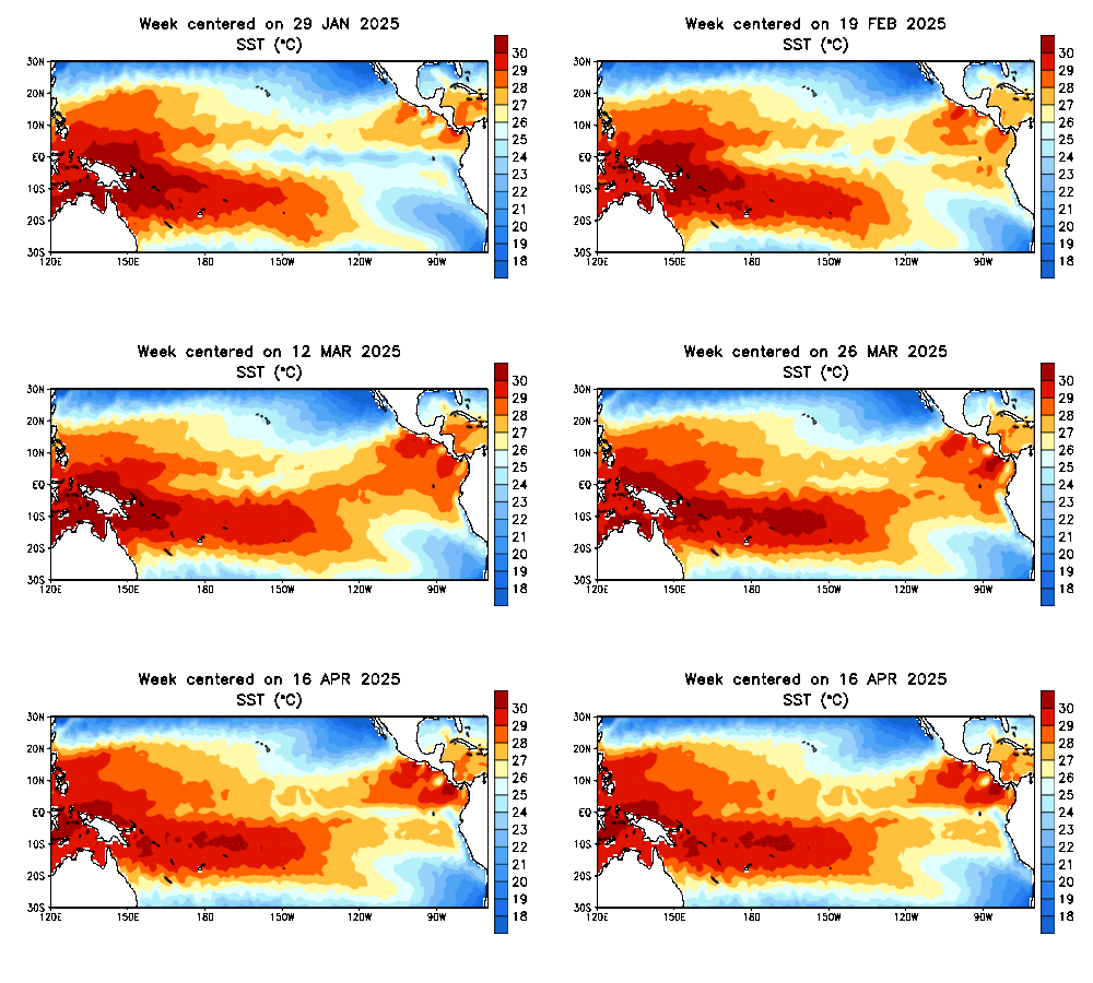
Less predictable changes to local productivity may also be mediated by the timing of reproduction. This year, I’m particularly intrigued to see how the early nesting of some of our cormorants will align/misalign with the impacts of the major El Niño event currently developing in the equatorial Pacific. The coastal upwelling that drives marine productivity in the California Current tends to be reduced during El Niño events, so that El Niño years tend to be marked by seabird breeding failures and reduced adult survival rates5. If cormorants can raise and fledge chicks before the impacts of El Niño are felt here in Oregon, they could still reproduce successfully. Alternatively, if waters warm and productivity is reduced while chicks are still nest-bound, they may be abandoned by starving adults and die in the nest.


Tropical Pacific Sea Surface Temperature Animation
Higher sea surface temperatures (oranges and reds) are covering increasing areas of the equatorial Pacific. Models predict an 82% probability of transition to ENSO positive (El Niño) conditions in the coming months. Graphic courtesy of NOAA’s Climate Prediction Center https://www.cpc.ncep.noaa.gov/products/precip/CWlink/MJO/enso.shtml).

Events like El Niño are constantly occurring throughout the world’s oceans and act as fascinating “natural experiments” for researchers to better understand how seabirds interact with, and are impacted by, their environments. The responses of birds may also vary in response to seemingly trivial differences in the timing, severity, geographic extent, or duration of these events, making it challenging to accurately predict their impacts. We never really know what kind of season we have ahead of us, but it’s this mystery that keeps us excited each spring to begin monitoring at Yaquina Head again, 20 long years in a row.

References

1 Hobson, K. A. (2021). Pelagic Cormorant (Urile pelagicus), version 1.1. In Birds of the World (Editor not available). Cornell Lab of Ornithology, Ithaca, NY, USA.

2 Wallace, E. A. and G. E. Wallace (2021). Brandt’s Cormorant (Urile penicillatus), version 1.1. In Birds of the World (A. F. Poole and F. B. Gill, Editors). Cornell Lab of Ornithology, Ithaca, NY, USA.

3 Lack, D. (1950). The breeding seasons of European birds. Ibis92(2), 288-316.

4 Thomas, D. W., Blondel, J., Perret, P., Lambrechts, M. M., & Speakman, J. R. (2001). Energetic and fitness costs of mismatching resource supply and demand in seasonally breeding birds. Science291(5513), 2598-2600.

5 Ainley & Boekelheide. 1990. Seabirds of the Farallon Islands: Ecology, Structure, and Dynamics of an Upwelling System Community. Stanford University Press, Stanford, CA, USA.

“Professional Puffin Paparazzi”: Photographing Tufted Puffins at Haystack Rock

By Eliza Wesemann, Summer 2024 Tufted Puffin Bill Load Photography Technician

Pacific Herring, sardine, larval fish, salmon, smelt, squid, and lamprey. What do these ocean creatures have in common? They were all on the Tufted Puffin’s menu this summer, and this season the puffins ate like kings. My name is Eliza Wesemann, and this summer I worked for OSU’s Seabird Oceanography Lab as a Tufted Puffin Bill Load Photographer at Oregon’s iconic Haystack Rock in Cannon Beach.

Eliza Wesemann, summer technician for the Seabird Oceanography Lab, photographs Tufted Puffins at Haystack Rock in Cannon Beach, Oregon

A little bit about me – I am a senior studying wildlife ecology and management at Utah State University. I am originally from Brookline, Massachusetts, and am pursuing a career focused on wildlife conservation and research. Over the years I have aided research projects on a variety of different species including Pinyon Jays, Greater Sage-Grouse, Mountain Goats, and American Pika, but Tufted Puffins hold a special place in my heart for their outrageously cute appearance and mannerisms.

Tufted Puffins are little black football-shaped birds with two long white/yellow eyebrow tufts, and a bright orange beak and webbed feet – in other words, a very silly looking bird! The Tufted Puffin population is thriving further north in Alaska, but they are struggling in the southern part of their range, from southern British Columbia to Northern California. Historically, Haystack Rock supported the second largest Tufted Puffin breeding colony in Oregon, with an estimate of 400 breeding birds in 1978. However, recent work by the U.S. Fish and Wildlife Service report, the Haystack Rock population has dropped to just 102 breeding birds in 20241.

The decline of Tufted Puffins at Haystack Rock over 1978 to 2024
(data from Naughton et al. 2007 and USFWS, unpublished)

Reflecting this decline, Tufted Puffins are listed as ‘Endangered’ in Washington state, ‘Sensitive’ in Oregon, and a ‘Species of Special Concern’ in California. Efforts to list the bird as federally Threatened or Endangered under the Endangered Species Act have unfortunately fallen short, as the Species Status Assessment came to the conclusion that the listing is “not warranted” despite the decline of coastal colonies throughout the southern range2.

Haystack Rock is 236 feet tall, with steep grassy slopes home to all sorts of species of seabird nesting and rearing young. Beyond Tufted Puffins, Pigeon Guillemots, Black Oystercatchers, Western Gulls, Brandt’s and Pelagic Cormorants, Common Murres, and Rhinoceros Auklets all call Haystack their home during the summer months. While most seabirds nest on the open slope, Tufted Puffins have earthen burrows hidden among the grass, making it difficult to keep track of active burrows and breeding pairs. In the recent Oregon Fish and Wildlife Monitoring Study, they found an estimated 51 occupied burrows with 102 breeding birds.

A Tufted Puffin returns to its burrow on Haystack Rock’s grassy slopes among nesting Common Murres

My goal was essentially to document the diet of Tufted Puffins by taking pictures (using a Sony A9 camera with 200-600mm lens) anytime I spotted a puffin with fish. I did the same for murres and pigeon guillemots with bill loads as well when the opportunity arose. Although the Tufted Puffins were generally the most active from sunrise to noon, their feeding schedules and Haystack appearances were elusive and inconsistent, often hard to predict. The puffins could be active and visible on the rock or in air flying laps, but not feeding; or completely hidden away in their burrows only leaving to collect fish, depending on the day. I made sure to be stationed at Haystack every morning to make sure to catch the puffins on their good eating days, as they were unpredictable.

My day-to-day schedule would be to wake up an hour before sunrise, prepare the camera and make my way down to the rock just as it was bright enough to shoot images. I would adjust the settings to the conditions of the day, stand as close as I could get to the rock given the tide, stare at the horizon, and wait until a puffin flew in towards the rock. In the time it took to spot a puffin, haul up my camera and zero in on the bird, they had often already disappeared into their burrows! Otherwise, they might fly an absurdly long lap around the rock, seemingly displaying their fish proudly! It was usually hard to tell if they had fish in their beak until after I had already taken the picture, so I would end the day sorting through hundreds of images of puffins in flight with only a small portion carrying bill loads of fish.

One of the more difficult skills I learned over the summer was distinguishing puffins approaching distantly from the sea from the other seabirds, which was even harder if the weather was overcast. Without the sun to illuminate the tell-tale white belly of the murre, the red feet of the Pigeon Guillemot and the orange glint of the puffin’s beak, the sky becomes a whirling mass of unidentifiable black flapping specks. In those moments, I would rely on the fact that puffins are slightly larger and darker against a gray sky, and hope for the best.

One of the most exciting highlights of the season was the feeding frenzy on July 23rd, where I captured a whopping 131 individual puffin bill loads on the camera. It was a very rare moment where the three variables of good puffin photos overlapped; low tide, partly cloudy but not overcast, and high puffin activity. I couldn’t put the camera down; the sky was filled with puffins with fish. Most puffins were bringing in multiple large smelt at a time, suggesting these fishes were just offshore, perhaps in a spawning aggregation. A few puffins were visibly rounder after that day – they evidently ate like kings!

A Tufted Puffin with a bill filled with smelt flies back to feed its chick during the July 23rd feeding frenzy

At Haystack, I had the opportunity to network with other wildlife photographers about “Birds with Fish”, a citizen science project exploring the diets of Oregon coastal birds using community-sourced, non-invasive photography. One of the highlights while working at Cannon Beach was engaging in side conversations with fellow photographers about puffins, conservation, and life in general. Helping visitors tourists identify puffins from Murres, introducing the ‘Birds with Fish’ initiative, and general wildlife public education were other valuable aspects of the position that I looked forward to during fieldwork.

Another highlight of the season was assisting Oregon Department of Fish and Wildlife biologists with their burrow counts of the puffins on Cannon Beach. Together, we tag-teamed the process: I pointed out puffins and tracked them into their burrows, then marked on a map the area of the rock the puffins flew into. It was exciting to be able to contribute the skills I learned over the season for research to uncover more about the Tufted Puffins at Haystack Rock.

Puffins have always held a special place in my heart, as I initially became passionate about wildlife conservation from photographing Atlantic Puffins during a trip in Iceland five years ago. So, this position was a perfect culmination of my interests–wildlife research and photography–an incredibly valuable ecological research experience, and all while experiencing the beautiful Oregon coast.

I would like to thank Dr. Rachael Orben and Will Kennerley at OSU’s Seabird Oceanography Lab for the amazing opportunity, as well as Friends of Haystack Rock and Oregon Department of Fish and Wildlife for the support at Haystack Rock. This was a dream job and an experience I’ll never forget.

Acknowledgments: The Oregon Wildlife Foundation provided funding to support field work in 2024. The Friends of Haystack Rock supported this project by providing housing in Cannon Beach. Thank you!

  1. Stephensen, S.W. 2024. Tufted Puffin monitoring study at Haystack Rock, Cannon Beach, Oregon 2010-2024. U.S. Fish and Wildlife Service Unpublished Report, Oregon Coast National Wildlife Refuge Complex, Newport, Oregon 97365. 35 pp. ↩︎
  2. U.S. Fish and Wildlife Service (Service). 2020. Species Status Assessment Report for the Tufted Puffin (Fratercula cirrhata), Version 1.0. Anchorage Fish and Wildlife Office, Anchorage, Alaska. ↩︎

Linking Rivers to the Sea(birds): Initial Surveys of River Otter Predation on Leach’s Storm-Petrels

By Eleanor Gnam, Seasonal Field Technician

The southern Oregon coast, between Port Orford to the north and Brookings to the south, hosts the largest colonies of Leach’s Storm-Petrels (Hydrobates leucorhous) in the lower-48. Goat Island, half a mile offshore from Harris Beach State Park, is estimated to host more than 100,000 of these small, dusky-colored seabirds. But looking at the island from the shore, you might never know that they’re there.

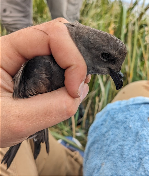
Leach’s Storm-Petrels

One of Goat Island’s many Leach’s Storm-Petrels.

Leach’s Storm-Petrels, which top out at just under 50 grams at the heaviest, return to their colonies only at night, and nest in underground burrows hidden beneath mats of long grass. Beachgoers who are in the know might be made aware of the colony from the distinctive, musky odor that petrels are famous for—which is strong enough to waft ashore—but otherwise, the colony is practically invisible from more than a few inches above the ground.

LHSPs feed on zooplankton and other planktonic creatures far out to sea, and only return to their colonies under the cover of darkness. During the breeding season, members of breeding pairs will take turns incubating their single egg or chick in the burrow, sometimes remaining underground for four or five days, while the other member of the pair forages. This cryptic, nocturnal behavior likely provides protection against diurnal avian predators. Southern Oregon’s LHSP colonies are close enough to shore, however, that nocturnal mammalian predators can pose a threat.

Project Goals

In collaboration with the U.S Fish and Wildlife Service, Luke Stuntz (MSc student, Seabird Oceanography Lab) and I (Eleanor Gnam, seasonal field tech) are investigating the impact of mammalian predators (mainly North American River Otters Lontra canadensis) on southern Oregon’s Leach’s Storm-Petrels.

We’re seeking to understand how, where, when, and to what extent these predators use petrels as a food source—knowledge that will help inform potential predator management in the future. River otters tend to operate either in loose social groups of unrelated males or in family units of a mother and her cubs. We’re hoping that our research will help us understand the social organizations of the river otters that are using these islands, as well.

Field Work (May-June)

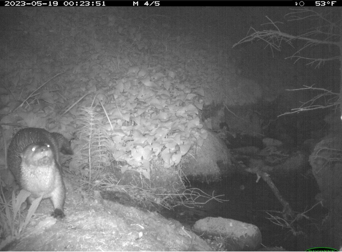
Luke began fieldwork for this project in May, with trips to our focal islands to survey for predator sign and set up motion-activated game cameras.  Two of the four islands showed definite signs of predator activity (trampling, scat, and prey remains). Cameras on Goat Island quickly revealed activity from multiple social groups of river otters, including a pair of adults and a female with cubs. Because river otters commute between these islands and the mainland, surveys along the coastline are also important for monitoring their activity.

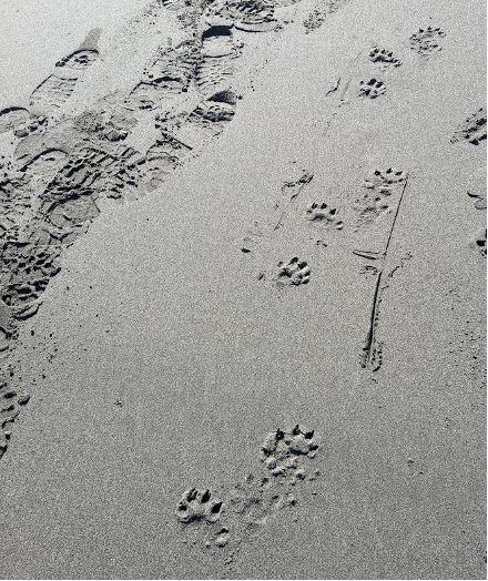
Luke’s initial surveys in May and early June revealed quite a bit of predator activity along the beaches and creeks near these colonies. River otters tend to deposit scat in shared, regularly-used locations called latrines, which aid territory marking and scent-based communication between individuals. They also need to return to freshwater sources frequently, especially after swimming in the ocean, both to drink and to groom their fur. The scat found in the latrines near our focal islands definitely contained digested storm-petrel remains—obvious from the distinct odor.

On June 15th, we moved into OSU’s Port Orford Field Station to commence full-time fieldwork on the project. Our first step was to revisit the coastline sites near our colony islands and to check out some new sites with the potential to be good river otter habitat. We were surprised by how little fresh river otter activity we found at some of our sites that were very active in May and early June. We’re also seeing them on our game cameras less often than before.

We found evidence of recent activity in several new locations, though, and we continue to see a lot of activity on the beach closest to Goat Island. This raises questions about how frequent and how seasonal these island-going behaviors might be. We’re also starting to wonder about the impact of Route 101 and its associated culverts on river otters’ use of coastal streams. Continuing predator sign surveys throughout the summer, both along the coast and on our colony islands, will help fill in our picture of this predator-prey dynamic and will help us understand how much of a problem it might be for these seabird colonies. We’re planning to expand our predator sign surveys up some of the larger creeks and rivers in the area, as well, using an inflatable sea kayak.