The SCAT and the Hat

Another update from me, Sarah, a Natural Resource Policy Fellow (NRPF) working for the Confederated Tribes of Coos, Lower Umpqua, and Siuslaw Indians (CTCLUSI) on their Tribal Spill Response Plan (TSRP). Last week I had the amazing opportunity to visit the places I had only seen on maps in person, with a tour of CTCLUSI’s water resources in Coos Bay and of their forestry lands. I also completed field training for oil spill response, along with members of Oregon Department of Environmental Quality, EPA, NOAA, and CTCLUSI. .

SCAT Training using the Shoreline
Assessment Manual at Kelly Point Park.

This SCAT (Shoreline Cleanup and Assessment Technique) training is run through NOAA’s Office of Response and Restoration and was developed for 1989 Exxon Valdez oil spill. This is a replicable method of recording the spill type, cover, any wildlife damage, and cleanup method suggestions. Completing this training in person helped me to envision what a real oil spill may look like (without the potential smells) and apply some of the oil spill response information I have been learning about through my work with the TSRP. It is critical that the SCATers identify both environmental and cultural sites of importance and record those for the cleanup operations. Ideally, there would be a SCAT representative from tribal, federal, state, local and any important stakeholder in the area.

If you are interested in signing up, consider registering with your organization!

After completing the training in Portland, I made my way to Florence, Oregon where I was shown the Lower Smith Tract of CTCLUSI’s Tribal Forest. This tract is in the Siuslaw National Forest and is adjacent to some land managed by Bureau of Land Management (BLM). This was a fantastic opportunity to see a natural resource of great importance to CTCLUSI, that is outside of my career focus in the marine sciences. Everything is connected – land and sea, environment and culture. I also saw some sites of importance in Coos Bay and surrounding areas, including Coal Bank Slough and a lookout north of Cape Arago State Park. This was an awesome opportunity to connect with the people from the Department of Natural Resources at CTCLUSI and to see the land that we’re working towards protecting.

Logging that occurs in the BLM land.
Forest in the Lower Smith Tract of CTCLUSI’s land.

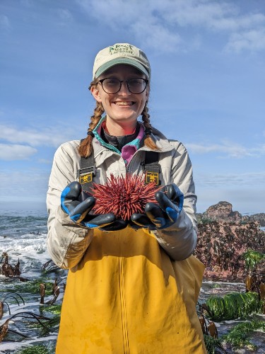
I was also gifted some CTCLUSI gear, including this hat with a logo created by Ashley Russel, the Assistant Director of the DNR. The logo art is based on a historical tale of a sea serpent that comes to shore to hunt for dear. Looking forward to wearing this the next time I’m out in the field!

Inking Science into Policy

Hello everyone!

I will start off with an introduction. My name is Megan Davis, and I am a second year Ph.D. student in the Menge Lubchenco Lab at Oregon State University. I am broadly interested in the science-policy interface as it relates to the ways in which humans use marine space, from marine protection to energy production to aquaculture. For the past few months, I have had the incredible opportunity to witness how science informs policy (and vice versa) at the state level as the 2022-2023 Oregon Sea Grant Legislative Fellow, working with the Coastal Caucus.

How I spend my time when I’m not in Salem.
Credit: Delaney Chabot

For those of you who have not interacted with this group before, the Coastal Caucus is a bipartisan, bicameral group of legislators that represent the Oregon coast. To put it a bit more plainly (because I certainly did not know what bicameral meant when I first applied for this position), that means that this group is composed of members from both parties from both the Senate and the House. This session, the Coastal Caucus is chaired by Representative David Gomberg (D, House District 10). The Caucus also consists of its Vice Chair, Senator Dick Anderson (R, Senate District 5), as well as Senator Brock Smith (R, Senate District 1), Senator Suzanne Weber (R, Senate District 16), Representative Boomer Wright (R, House District 9), Representative Cyrus Javadi (R, House District 32), and Representative Court Boice (R, House District 1). As the Oregon Sea Grant Legislative Fellow, I provide technical expertise on marine and coastal issues to the Caucus members and act as a resource for communication with coastal constituents and key stakeholder groups.

Together, the Coastal Caucus forms a powerful coalition that collectively ensures that marine and coastal issues receive adequate attention at the State level. Much of the strength of this group is derived from the bipartisan nature of the Caucus. When all these legislators come together to support an issue, it signals that it has broad support along the coast and, often, across Oregon. This is the case with Oregon’s marine reserves. This session, the Coastal Caucus put forth HB 2903, which is a fantastic example of how science can be harnessed to inform policy. This past week, I had the pleasure of joining Representative Gomberg and Charlie Plybon (a fixture in Oregon’s marine reserves community) to speak to this bill at the Marine Reserves Celebratory Summit (hosted by The Nature Conservancy and facilitated by Sea & Shore Solutions). I would like to share with you what we discussed at the Summit.

In 2012, Oregon completed the planning and designation of five marine reserves: Cape Falcon, Cascade Head, Otter Rock, Cape Perpetua, and Redfish Rocks. The implementation and management of these reserves is led by the Oregon Department of Fish and Wildlife (ODFW) based on standards established in HB 3013 (2009), SB 1510 (2012), and related administrative rules. As the state’s first long-term, nearshore ocean conservation and monitoring program, Oregon’s marine reserves system has been instrumental in tracking and understanding how our marine ecosystems are changing over time, informing policy and management decisions at the state level. It also represents the first comprehensive human dimensions research program focused on examining the economic, social, and cultural dynamics of the Oregon coast and coastal communities.

On top of establishing the reserves, SB 1510 required that an internal (ODFW) and external (Oregon State University) decadal assessment of the marine reserves be carried out in 2022. These rigorous scientific assessments resulted in a series of legislative and administrative recommendations:

  1. that appropriate funds be allocated to ODFW to continue the Marine Reserves program at the necessary capacity;
  2. that a mandate that supports the development of an Adaptive Management Plan for the ongoing management and evaluation of the program be provided; and
  3. that a detailed, collaborative process through which social monitoring data can be interpreted to affect policy decisions be defined.

For an extra layer of legitimacy, these recommendations were then endorsed by the Ocean Policy Advisory Council, the original stakeholder and government policy forum for marine reserves and protected areas in the State of Oregon. Those recommendations were then presented to the Coastal Caucus, who built HB 2903 around them. To paraphrase Charlie Plybon, that’s not just incorporating science into policy, that’s inking science into policy.

So where is HB 2903 now? The bill made its way out of its first Committee (the House Committee on Agriculture, Land Use, Natural Resources, and Water) and now sits in the Joint Committee on Ways and Means, which is essentially that State’s budgetary committee. Once the State’s revenue forecast is released in mid-May, the Joint Committee on Ways and Means will determine how funds will be distributed to bills with associated fiscal asks, like HB 2903. Available funds are anticipated to be a bit tight this session, but the Coastal Caucus has put their full weight behind this bill, even making HB 2903 one of their priority fiscal asks for this session.

I have been so inspired by the legislators working to take this science-based policy from bill to law, and by all of the scientists, decisionmakers, and advocates who have put in over a decade of work to make Oregon’s Marine Reserves Program the success it is today. I’m excited to continue to work on this topic, both in the context of my fellowship and my dissertation. I will be checking back in (hopefully with an HB 2903 update) at the end of June!

The view from the Marine Reserves Celebratory Summit
Credit: Duncan Berry

Working Together Towards Spill Response

Hello!  

Just a quick introduction – I’m Sarah, a recent master’s graduate of Oregon State University where I worked on a project on ghost shrimp in the Benthic Ecology lab.  I have had an interest in both science and policy throughout my education and the Natural Resource Policy Fellowship provided an excellent opportunity to engage in both!   

These past few months since I started my fellowship with Confederated Tribes of Coos, Lower Umpqua, and Siuslaw Indians (CTCLUSI) have been an exciting time in which I have learned a slew of information on environmental policy at various governmental levels and emergency response. My specific task is to edit the Tribal Estuary Response Plan which outlines policies and procedures related to hazardous materials spills. I recommend checking out the abundance story map available here, which goes over the history and culture of CTCLUSI. There are three separate languages of the people who inhabited the ancestral territory– Hanis Coos and  Miluk Coos (Coos Languages), Sha’yuushtl’a uhl Quuiich (Siuslaw and Lower Umpqua language). While updating the list of foodstuffs and ecological resources, I learned that the name for ghost shrimp of the scientific name Netorypaea californiensis is ‘wayaq’ in Hanis Coos and Miluk Coos and ‘chimws’ in Sha’yuushtl’a uhl Quuiich.  

At the end of February, I was able to virtually attend an annual meeting for the Region 10 Regional Response Team (RRT10) and the Northwest Area Committee (NWAC).   At this meeting, there were members from tribes, federal agencies, state agencies, local government as well as industry. This included people from the EPA, U.S. Coast Guard, U.S. Department of Interior, Washington State Department of Ecology, Oregon Department of Environmental Quality, NOAA, Northwest Indian Fisheries Commission, Makah Tribe, Yakama Nation, the Stillaguamish Tribe, and CTCLUSI. It was interesting to hear everyone’s input, updates, and perspectives on hazmat and emergency response.   

Key takeaways from that meeting include:  

  • The importance of overlap and consistency among regional response plans and local response plans. 
  • The array of spill response methods and opportunities – particularly in industry. 
  • Washington State Legislation SB 5344:  This requires certain vessels transiting in Juan de Fuca to fund an emergency response towing vessel in Neah Bay. I was unfamiliar with this legislation; vehicle towing could be an additional section in our own document.  
  • In the Tribal Subcommittee meeting, the objectives included tribal access, delivery of service to tribal groups, development of outreach and communications, and timely notification of issues and initiatives for tribal feedback. 

These were just a few out of many topics that I learned about from attending that meeting. It was interesting to hear updates from all of the agencies and partners and to see how many people come together to work towards emergency preparedness. I’m looking forward to updating you next time on participating in emergency response training and visiting CTCLUSI on the Oregon Coast! 

Just dune it: Field work on the Oregon Coast

Hello everyone! I’m Carly, a graduate student in the Marine Resource Management program at OSU, and a Malouf Scholar this year. I research Oregon’s coastal dunes, specifically in developed areas where dunes are managed/altered for human benefit. Before coming to OSU for graduate school, I didn’t know much about the Oregon coast or coastal management, so the last 1.5 years have been full of learning and new experiences! In this post, I just wanted to introduce my research and share some highlights from my field work. In future posts, I’ll share more results and implications of what we’re doing.

You can read the section below about Oregon’s dunes and how/why people manage them, but here’s the TLDR version: Over a century ago, invasive beachgrasses spread along the PNW and built dunes that stabilized the shifting sand environment. This allowed for development on and near the beach/dunes, which created the need to manage the dunes to preserve views of the ocean and prevent sand inundation. Now, property owners mechanically move sand to lower the height of dunes (called dune grading) and sometimes revegetate them. We don’t know how dune grading and revegetating affects dune morphology, especially compared to dunes that are not altered in the same way. Ok, now you can skip to the Fun field work section!

History of Oregon’s dunes and dune management

If you’ve ever been out to the Oregon coast, you’ve probably walked near, on, or through dunes. Dunes are really cool coastal features that have the potential to provide many benefits to the humans and the environment, like protection from storms and tsunamis, carbon storage, and habitat for diverse species. But did you know that the dunes we see today haven’t always been there? In the early 1900s, the Oregon coast (and the rest of the Pacific Northwest coast) was subject to a complete landscape transformation through the introduction of two invasive beachgrasses (European Beachgrass and American Beachgrass). Industries and developers planted these beachgrasses with the intent to stabilize the shifting sand environment and allow easier coastal development. Well, their stabilization experiments were successful and the beachgrasses spread up and down the coast, building parallel ridges of vegetated dunes that back many of Oregon’s sandy beaches.

This promoted coastal development and the subsequent need to manage the dunes! Even though the invasive beachgrasses stabilized the more variable sandy environment, there is still plenty of sand that impacts buildings and infrastructure. Dune management refers to methods of altering dunes to preserve views of the ocean or prevent sand inundation via mechanically moving sand to lower the height of the dune (also called dune grading).

In Oregon, dune management practices (specifically dune grading) are regulated at the state level and implemented locally through official dune management plans. There are six communities in Oregon with official plans, and view/preventative grading is only permitted on properties that are within one of these plan areas. Also, property owners are required to revegetate dunes that are graded, but the suggested plant species vary between the areas. Thanks to the great work of faculty and grad students at OSU, we know a lot about the biophysical feedbacks between vegetation and sand supply that affect dune building. What we don’t know much about, however, is how dune grading and revegetating impacts dune form and growth over time, in comparison to dunes that are not graded/revegetated. And that’s where I come in!

Fun field work!

To understand how managed (graded/replanted) dunes change compared to unmanaged dunes, we first have to collect data. From October 2020 to November 2022, we regularly visited all six dune management plan areas (Seaside, Cannon Beach, Manzanita, Nedonna Beach, Pacific City, and Bayshore), plus Nehalem Bay State Park that has a managed dune area (for Western Snowy Plover habitat restoration). At these beaches, we used GPS backpacks and collected topographic data on transects that are perpendicular to the shoreline. Once a year, we also did vegetation surveys to gather data on the present species and vegetation cover.

Everyone who has done any field work knows that it can be challenging, both physically and mentally. But with good snacks, a fun crew, and (hopefully) nice weather, the work goes quickly! Big shoutout to all my friends, classmates, and lab mates who have volunteered their time and energy to walk up and down the dunes with me. In another post, I’ll share what we’ve found from this field work, but for now I’ll just share some pictures from the last 1.5 years of visiting Oregon’s beaches!

Some highlights (and laughs) from my fieldwork:

seasidesurvey
Nice walks on the beach with a cool backpack (Seaside, OR)
lidar
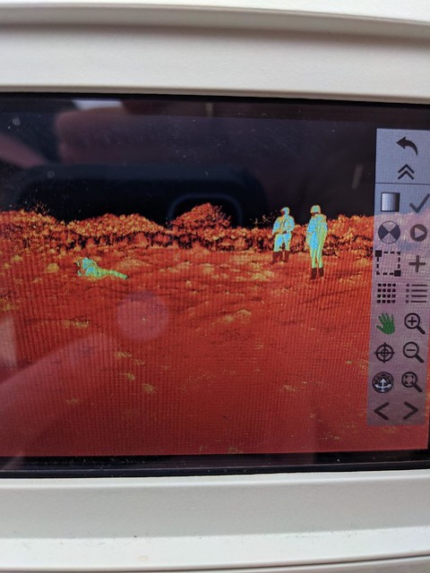
Tripping over nothing and being caught on the LiDAR scan (Nehalem Bay State Park, OR)
survey
Counting grass stems with a view! (Manzanita, OR)
NS_quadrats
Getting trapped in quadrats (Nehalem Bay State Park, OR)
NS_hail
Hail! On the Beach! (Nehalem Bay State Park, OR)
CB_sunrise
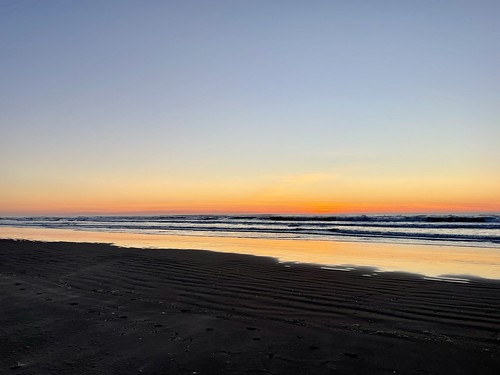
Beautiful sunrises (Cannon Beach, OR)
bayshore_sunset
And beautiful sunsets (Bayshore, OR)
plover
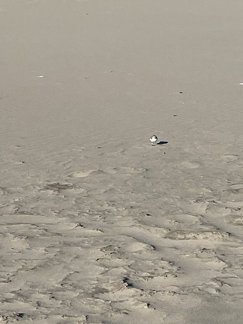
A tiny western snowy plover! (Bayshore, OR)
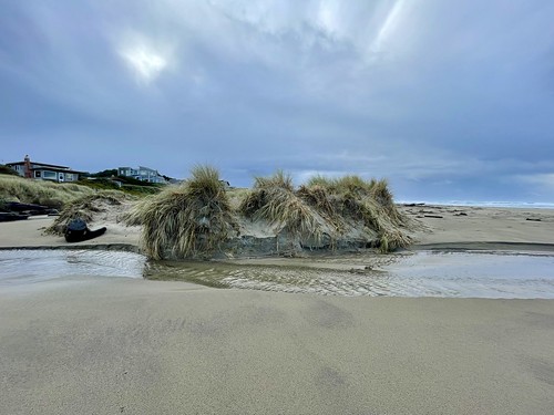
manzanitadune
And lastly, my favorite dune of all time (Manzanita, OR)

Ocean Acidification and Hypoxia Assessment

Hello Everyone!

Time has been flying by and I wanted to give an update on my Ocean Acidification and Hypoxia Fellowship experience. In my fellowship position (which began in December of 2021) I’ve been working with the water quality assessment program team at Oregon Department of Environmental Quality (DEQ). My primary task in this role is to support the development of water quality assessment methodologies for assessing biological impacts related to Ocean Acidification and Hypoxia (OAH) in Oregon’s marine waters. Once completed, DEQ will use these methodologies to interpret water quality data and report to the Environmental Protection Agency (EPA) on water quality status and trends in Oregon.

2022 was a packed year for me, mainly consisting of coordinating and working with a technical workgroup of OAH research and policy specialists that was convened to assist DEQ in the development of these OAH assessment methodologies. Much of the development process over the last year has been centered around a series of meetings with technical workgroup members to define science and policy questions relevant to this process and synthesize available research and information to help answer those questions. Through this process it has been a pleasure for me to work with such a wide range of leading OAH researchers and experts across the West Coast.

I’m also happy to report that my fellowship has been extended an additional year! So far 2023 has been very different than 2022. This year, the team at DEQ has shifted gears from coordinating and holding meetings with the technical workgroup to drafting the methodologies. We are currently working on two types of documents.

  1. The first is a technical paper that outlines the rationale, process, and approach DEQ is proposing to take to assess OAH impacts for water quality assessment.
  2. The second is a set of assessment procedures, these procedures outline the details of how DEQ will process and use data to determine whether impacts to aquatic life are taking place. We are drafting two assessment procedures, one based around understanding impacts related to Ocean Acidification (carbonate chemistry changes affecting shell forming marine species), and another based on impacts related to Hypoxia (changes in low dissolved oxygen conditions).

As these drafts are finalized, they will be going through a series of review processes, including a public comment period this spring, where the documents will be available for the public to review. I’ll be sure to provide updates on the process!

A Year of Blue Carbon

It’s hard to believe a year has passed already! I’ve been working with colleagues at The Nature Conservancy (TNC) to write a report exploring the state of the science for Oregon’s Blue Carbon ecosystems. The report gives a broad overview of existing science of blue carbon pathways in Oregon—including opportunities, limitations, and uncertainties—to a stakeholder audience who may not be familiar with the details of blue carbon as a natural climate solution. We found that extensive research has already been done within Oregon’s tidal wetland ecosystems to understand the dynamics of carbon sequestration and storage within estuaries. There are demonstrated benefits of conservation and restoration on maintaining and expanding Oregon’s natural carbon sinks. The remaining questions are focused on the magnitude of climate mitigation benefits at a site-scale and determining restoration opportunities. Nearshore blue carbon, on the other hand, needs more research. We know that our ocean ecosystems like kelp forests are highly productive, but it is critical to determine the likelihood and amount of carbon that ends up in stable ocean carbon sinks. More details can be found within this report, linked here.

Cover page for the blue carbon report. Top photo: Forest and marshland near Warrenton, Oregon. Photo by Browning (2016). Bottom photo: Harbor seal in bull kelp. Photo by Graner (2015).

I’ve had lovely opportunities to share what I’ve learned with several audiences over the last few months. I was invited to speak about the work of NGOs for a conservation biology class of undergraduates at the Oregon Institute of Marine Biology. It was a surreal feeling to be on the other side of the classroom since I had been in their seats just a few years prior. I also presented to TNC Oregon’s board about coastal blue carbon as part of the important work we do in Oregon’s estuaries. I felt fortunate as a fellow to be invited into that space to share my work and learn more about high-level functioning and priority setting of an organization like TNC. Lastly, I gave a (long!) talk at the Elakha Alliance’s Sea Otter Symposium where I discussed the details of our blue carbon report and learned about a ton of exciting kelp forest work on the coast.

I’m so excited to continue my fellowship for the next few months and continue sharing about Oregon’s coastal blue carbon and more!

Collaboration is key: Application of Biology to Conservation and Management

While coming to an end with my red abalone conservation and management project with Sea Grant and ODFW, I’ve come to appreciate the resources and reflections I’ve been fortunate enough to have throughout this experience.

In particular, through the collaboration of this fellowship between ODFW and Oregon Sea Grant, I was provided with a unique opportunity that allowed me to utilize my biological knowledge of marine species in the Oregon environment and apply that information in a real and effective way. Creating tangible change in the world of biological management can be difficult to achieve without understanding political boundaries, conservation constraints, and management collaboration. I was fortunate enough to be able to combine information I gathered in my master’s program at the Oregon Institute of Marine Biology with a key fisheries and conservation issue facing Oregon’s dynamic subtidal environment. Through guidance by fisheries management personnel, I drafted a conservation and fishery management plan for the recreational red abalone fishery in Oregon.

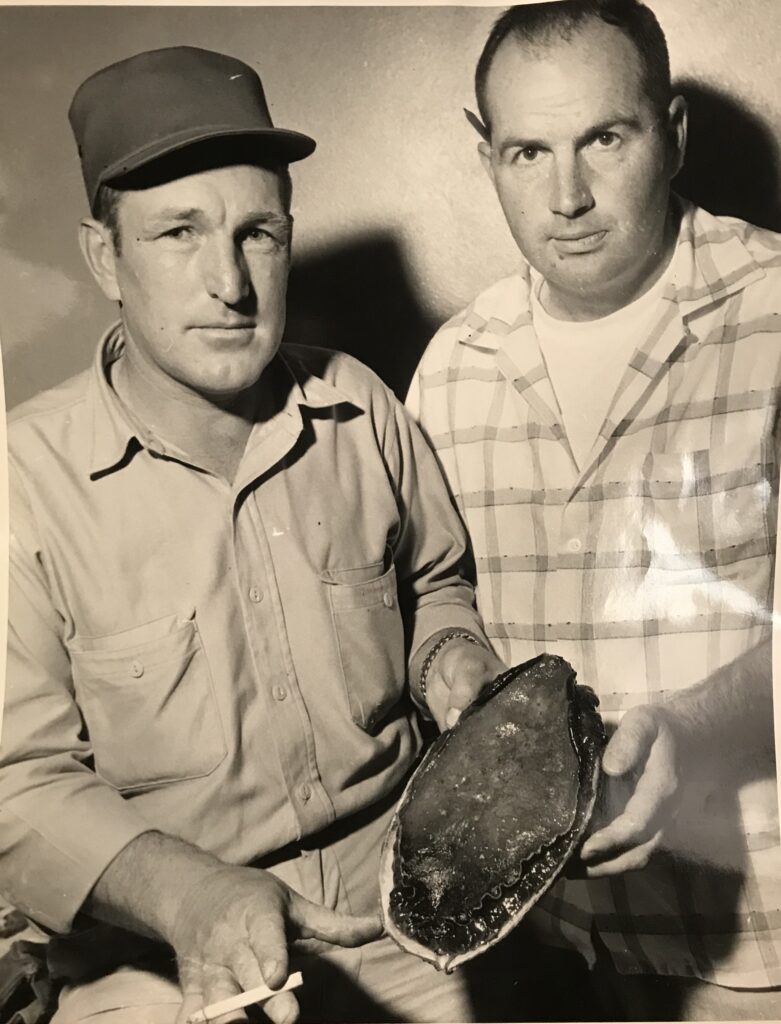
Working with complex and advanced networks of scientists, managers, and administrators came with it’s own set of advantages and complications. One of the most important lessons I learned throughout this process was that effective management can only be implemented through careful consideration of diverse stakeholders, scientific investigation, historical understanding, and contextualization through current socioeconomic factors. A breakdown of any one of these considerations will diminish the long-term application of scientific understanding to conservation and management policies. As an undergraduate at OIMB, I learned a wide variety of biological concepts and processes of marine invertebrates that were fascinating and exciting. However, I rarely considered what the application of these concepts could look like within a social, economic, or historical context. When I began working at ODFW following graduation at OIMB, it became clear that while understanding the biological processes of marine organisms was a vital component of managing resources, it was not useful without proper communication and implementation of this information. In particular, my master’s project focused on increasing the biological and ecological body of information available for a large marine snail that has garnered the attention of divers and fishery participants worldwide, the red abalone. Investigating the history of red abalone presence in Oregon was a particularly fun adventure, as I was able to create a timeline of agency biologists’ involvement with red abalone as a resource and through a changing environment. A favorite of mine was the documentation of an exploratory commercial fishery effort in the late 1950s, in which a series of photos of a biologist at the time, Dale Snow, pictured with a contracted SCUBA diver and a red abalone showed the staging of this particular moment, complete with a pencil behind the ear of the biologist, and a cigarette lit just for the picture in the hand of the diver (see below).

Oregon Fish Commission aquatic biologist Dale Snow (right) and contracted diver (left) posing for a picture with a red abalone (Haliotis rufescens) to document the investigative work of exploratory diving effort performed between 1958-1962 in southern Oregon. Used by permission from ODFW archives, published by Groth and Smith 2022.

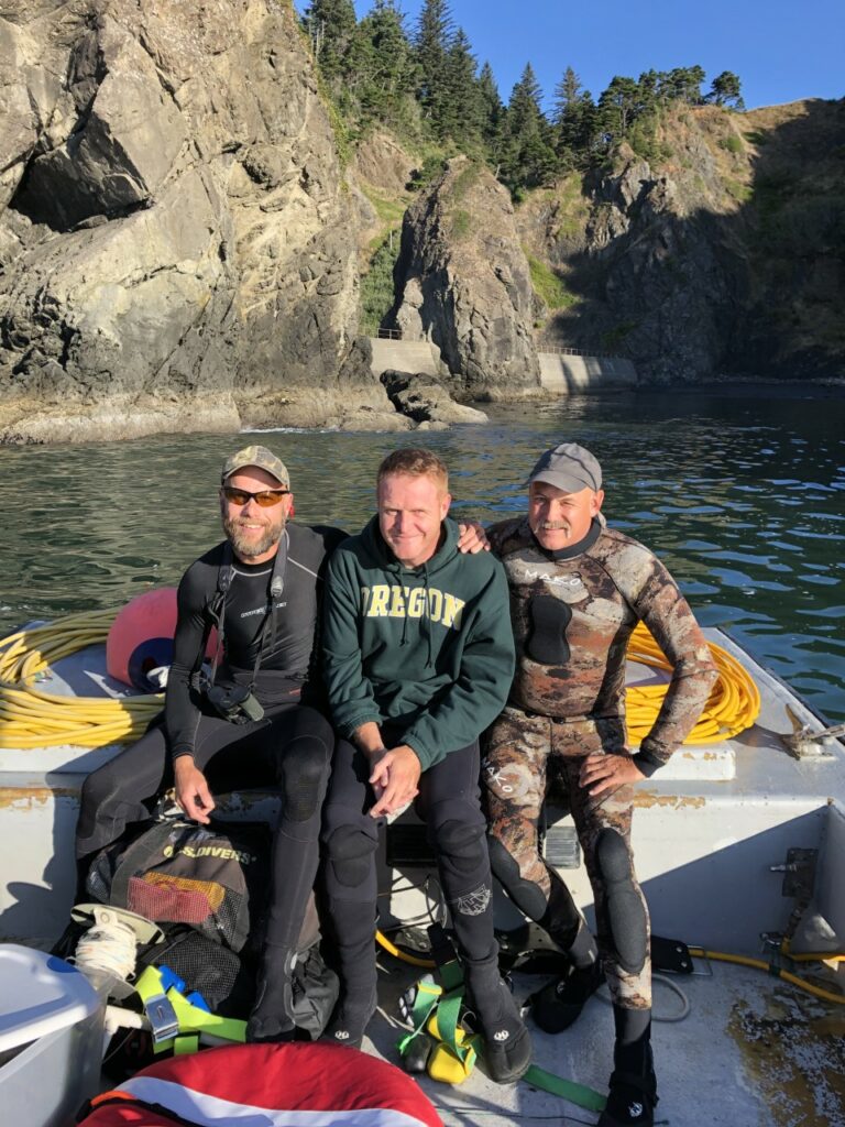
Having the ability to look back in time and see the history of work done by agency biologists allowed me to have a deep appreciation for each era of management and science. Moving towards a more ecosystem-based management strategy allows scientists and managers to work together to collaborate on advancing scientific understanding of marine resources and applying that knowledge directly to conservation and management. New technologies have allowed scientists to investigate data-deficient situations, such as the red abalone population in Oregon. I was able to collaborate with scientists at UC Davis in California to add to the body of information on red abalone populations throughout Oregon and California using genetic data. Collecting genetic samples in Oregon required further collaboration with academic researchers, commercial and recreational divers, and agency knowledge from previous biologists that detailed the habitat and presence of the elusive and cryptic red abalone in Oregon.

Utilizing historical understanding, agency management frameworks and advice, and application of modern data techniques allowed me to create a conservation and fishery management plan that relies on the strength of collaboration and inclusion. I have learned how vital positive communication techniques are to the scientific and management process through my Oregon Sea Grant Fellowship with ODFW. I hope to continue to grow and learn more about effective application of biological information through careful communication and informed policy throughout my career. I look forward to continuing to work with Oregon Sea Grant through my next role as a Marine Reserves Science Communications Fellow with ODFW beginning in 2023.

Thank you to all of the incredible collaborators, scientists, managers, and friends that have encouraged me and contributed to this project. And of course thank you to Oregon Sea Grant and ODFW for making this project possible, and the quirky and elusive red abalone in Oregon that I hope to positively affect through this work!

Signing off,

Kendall Smith

Wrapping up my fellowship

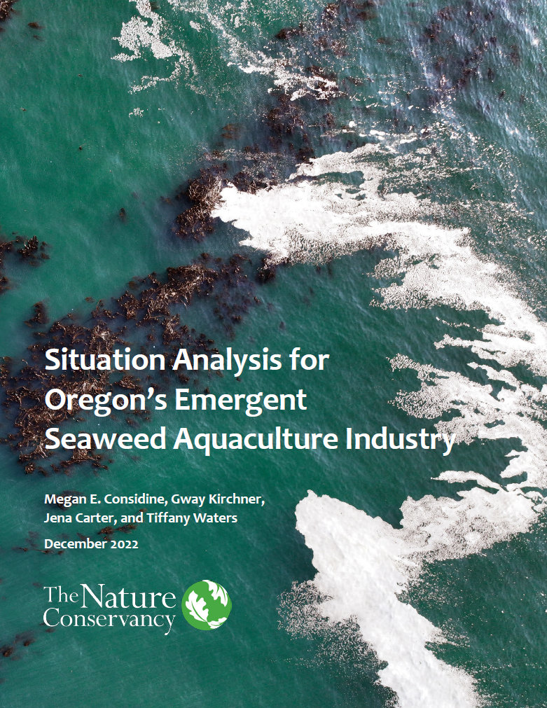
It’s hard to believe that I have less than two weeks left for my fellowship! I am currently wrapping up all final reports and there’s one in particular I am most excited to see finalized: A Situation Analysis for Oregon’s Emergent Seaweed Aquaculture Industry.

The report explores the restorative benefits seaweed aquaculture can provide, species options, production methods, high potential locations and co-location opportunities, market opportunities, and policy and regulatory considerations. The final stages of edits have involved working with a graphic designer to incorporate some images and a professional layout.

Cover page for the report. Cover photo courtesy of Sara Hamilton.

I have also been working with our graphic designer and OSG’s communications specialists to ensure that the public report meets federal accessibility requirements so that we may post it to the NOAA Central Library. This has largely involved making sure that the final PDF will be machine readable, which includes alt text for images that can be read aloud to users by screen reader software.

Overall I want to give a BIG thanks to all co-authors, reviewers, contributors, and our graphic designer for all the help and amazing work they’ve put towards the situation analysis. The report will be public on Oregon Sea Grant’s website in the coming weeks (I’ll follow up in the comments with a link)!

Farewell from the Tribal Federal Consistency Policy and Processes Fellow!

Hello all!  I am writing with the final update on my project to develop procedures for how the Oregon Coastal Management Program (OCMP) coordinates with tribes during federal consistency reviews, as I finished up my fellowship last week. 

To return to the cliffhanger of my last blog post, I am happy to report that our proposal to incorporate additional policies related to archaeological resource protection and Native American grave protection into the suite of policies considered during federal consistency reviews was approved by NOAA.  With this change, the OCMP will be able to further highlight and raise awareness of the state of Oregon’s commitment to the protection of these sites of significance to the tribes.  During a federal consistency review, the OCMP will provide applicants with information to help them learn more about these standards.  This includes resources about inadvertent discovery of human remains on the Legislative Commission on Indian Service’s website and guidance about the issuance of archaeological permits from the State Historic Preservation Office’s guidance on the issuance of archaeological permits.

I am also pleased to say the tribal coordination procedures were distributed to tribes via formal consultation letters at the beginning of October, marking a significant milestone in this fellowship project.  The OCMP’s goal in implementing these procedures is to bring the tribes to the table during federal consistency reviews and management decisions to ensure their voices are heard and their expertise is considered.  To ease implementation and sustainability, the procedures are designed to be simple and common sense, and nested naturally in existing processes.  They are built on a few commitments to standardize communication and coordination which we shared with the tribes: 

Do the “pre-work”

As federal consistency comes with a unique lingo and timelines established by federal regulations, it can be difficult to step into the federal consistency “world” without some orientation.  In February of 2022, the OCMP took an early step in the “pre-work,” to provide some background on federal consistency and how it “works.”  We also provided the tribes with summaries and graphics to describe the process with our formal consultation letters.  Those letters also requested specific information from the tribes to tailor the procedure as appropriate: 1) confirmation that the tribe wants to be informed of federal consistency reviews; 2) types of activities of interest, whether there is particular geographic extent or topic area; and 3) who should be the primary contacts the OCMP should include in our mailing lists.

Early notification

Upon initiation of a federal consistency review, the OCMP will provide notification to tribes.  This will be as early as possible in the process to ensure the tribe has enough time to review.  It will be separate from the public comment period, as the federally recognized tribes are not members of the public – they are sovereign nations.  This notification includes standard and clear information; templates have been developed to support.

Communication and coordination

The notification message specifically requests comments on the project, but we leave the door open for different levels of coordination.  This means that there could be informal staff-to-staff coordination and communication up to formal consultation between OCMP leadership and the Tribal Councils, whatever the tribe requests.  Any comments received would be acted on.  This might mean facilitating coordination between the federal agency issuing the permit or taking the action and the tribe. 

Follow-up

This last commitment is about “showing the work.”  The OCMP is maintaining records of communication with the tribes.  Any actionable comments will be documented in decision letters, though we will be mindful of not including potentially sensitive information.  Copies of decision letters will also be provided to tribes if they provided comment or upon their request.

As I wrap this up I want to say thank you to everyone at the Department of Land Conservation and Development and the Oregon Coastal Management Program for the opportunity to work on this project!  It has been a real privilege to be able to dig into these issues and develop some processes that will hopefully work in the long-term.  

Post Fieldwork Reflections: The Summer of Sharks

Well, after a whirlwind summer, I am officially finished with my first field season of shark sampling. All in all, I sampled from a whopping 71 sharks and tagged 20 of them with acoustic tags. I’ll have another field season next year, but until then I’ll be sorting through samples and thinking of ways to make my research go smoother and easier. One way I’ll be doing this is redesigning our shark sling — currently, it’s like a U shaped piece of fabric that is 8 feet long (we also like to call it the “shark taco” if that helps you picture it, but you can also watch a video of a shark release below). It does great at holding the shark in place but with the winds and currents in Willapa Bay, however, the sling often turns into an underwater sail, swinging out or pulling the boat around. So, with that in mind, I’ll be creating a “version 2” which will hopefully be able to restrain the shark AND stay solidly in place next to the side of the boat.

I also spent a lot of time talking with fishermen this summer, which is always one of my favorite parts of research. Walking the docks in Willapa Bay allows me to meet with people face-to-face and talk to them about the things they see on the water….particularly because they spend a lot more time out there than I do (unfortunately!). Some of my favorite interactions were with 2nd or 3rd generation fishermen who didn’t know that there were sharks in Willapa Bay at all. Most of these fishermen were oyster farmers and therefore never use gears to catch these large animals. Still, being able to talk about some of the top predators in their local waters is a great opportunity to spread awareness and understanding about the impact that sharks have, particularly in a positive light.

I wouldn’t have been able to conduct this research without the generous support of Oregon Sea Grant, and I just wanted to thank the amazing team of people there who answered questions, connected me with resources, and have continued to inspire me to make the greatest impact possible.

Jess Schulte and Dr. Taylor Chapple, head PI of the Big Fish Lab, release a broadnose sevengill shark back into the waters of Willapa Bay after collecting samples.
Jess Schulte holding a sevengill shark in place for sample collections.
Jess Schulte handlining for sevengill sharks in Willapa Bay, WA.