SOS: Save Our (mud) Shrimps

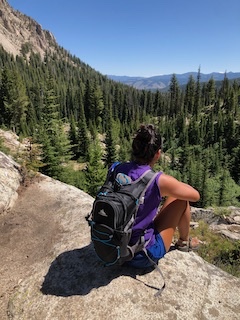
Moving out of your parent’s house for the first time is not an easy thing to do. Especially if you move all the way across the country! But two weeks into my OSG Summer Scholars internship and I know I’m doing the right thing for myself. I’m excited to work live and in person with the animals and people that I’ve been working with for over a year. This summer I’m working on another piece of the 10+ year project trying to understand the relationship between a native burrowing mud shrimp, Upogebia pugettensis, and it’s invasive parasitic isopod, Orthione griffenis. Upogebia pugettensis populations up and down the west coast have drastically declined, with some local extinctions in California. Collapses in mud shrimp populations have been associated with infestations of Orthione and former pesticide use from oyster farmers.

Looking for juvenile mud shrimp in the lab (May 2021)

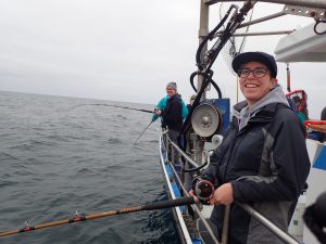
After taking a week to drive from North Georgia to the Oregon coast, I jumped right into my work duties. My lab partner, Joshua (an Oregon State REU intern), and I get the privilege of doing field and lab work this summer. Some of our field work includes trudging out onto the mudflats behind Hatfield Marine Science Center at low tides. On the mudflat, we take cores and sieve them down to collect the mud shrimp. We also get to bike out onto the fishing pier next to the Yaquina Bay Bridge after dark during high tides. On the pier, we are doing plankton tows, which are conical fine-mesh nets with a cod end that traps critters that are riding the incoming tides into the bay. Back in the lab, we sort and analyze the mud shrimp and the plankton tows. The mud shrimp are analyzed based on aspects like species, sex, carapace length, infested with Orthione, size of Orthione, and other important factors. The plankton tows get analyzed for juvenile mud shrimp (both Upogebia and Neotrypea) and Orthione cryptoniscans (one of the larval stages of Orthione).

Field sampling on the mudflat at low tide for Upogebia pugettensis (May 2021)

Through this project we are hoping to determine the life span and the settlement schedule of the cryptoniscans and to get large enough samples of mud shrimp to overcome sampling bias to ground truth the age/size relationship. Ultimately, accomplishing this project is putting another piece of the puzzle down into saving this mud shrimp from extinction. To do that, we need to know the relationship between the shrimp and the parasite better. That’s where my team and I come into play. With our work we can try and answer questions like: When do the shrimp become infested? Do the cryptoniscans settle on the shrimp or on other Orthione? Do cryptoniscans wait for a certain time to settle? What are they waiting for? Some kind of signal from the shrimp? Learning these answers will be one step closer to answering the big picture question “how can we turn this around or CAN we turn this around?”

Mud shrimp are native ecosystem engineers. They build permanent y-shaped burrows in the sediment that influence the estuarine benthic community by providing habitat and enhancing nutrient cycling. By saving these shrimp we are helping to advance OSG’s vision and mission to have thriving coastal communities & ecosystems. This research would also help to balance the forces of ecology and economy to inform oyster growers how to safely manage the burrowing mud shrimp populations without depleting them.

Getting Started

Hello!

My name is Jessica and I am majoring in marine biology at Oregon State University. This summer I will be working with the Human Dimensions Project within the Oregon Department of Fish and Wildlife. I will travel to Oregon’s marine reserves to survey visitors about their awareness and opinions of Oregon’s marine reserve system. I will also be going to tourist-oriented businesses in nearby towns to ask about their awareness of marine reserves as well as how they think the reserves have impacted their businesses. Later in the Summer I will enter the data collected into a database so that it can be analyzed and used in a report due to Oregon’s legislature in 2023.

When the marine reserve system started in Oregon, the legislation required a report be submitted ten years after implementation describing the affect marine reserves have had on coastal communities and ecosystems. Baseline data was collected for two years before any restrictions were put in place so that the state of the ecosystem and the opinions of local communities before the reserves were fully up and running would be known. The data collected this Summer will be compared to the baseline data, allowing the Oregon Department of Fish and Wildlife to determine the impact of marine reserves on local communities.  

One of the main goals of the Human Dimensions Project is to ensure conservation efforts are not negatively impacting coastal communities. Without community support ODFW would not be able to carry out its mission of, “protecting and enhancing Oregon’s fish and wildlife and their habitats for use and enjoyment by present and future generations.” The coastal community focus of the project also helps to further Oregon Sea Grant’s mission by supporting a management approach to marine resources that prioritizes thriving coastal communities as well as a healthy ecosystem.

The first day of surveying visitors to the Otter Rock Marine Reserve in Newport, Oregon.
Joe the sea Lion was not bad company between visitors to Cascade Head Marine Reserve.

Let the Summer Begin!!

Hello everyone!

My name is Phoenix A. McFarlane and I am a Doris Duke Conservation Scholar who is going to spend the summer right alongside Oregon SeaGrant’s Summer Scholars! I am a junior at the University of Idaho and am majoring in Environmental Science. Though I thoroughly enjoy the outdoor recreation and wilderness aspects of Idaho, I was ready for a change! Spending the summer on the Oregon Coast is going to be an unforgettable adventure!!! 

Fishing @ Lucky Peak Lake. Boise, ID.

For my summer internship, I am working with the Oregon Department of Fish and Wildlife (ODFW) within their Marine Reserves division. My summer will be spent conducting visitor surveys in hopes of assessing awareness of Oregon’s marine reserves amongst the visitor population. Also, I will be surveying coastal businesses and determining if they have faced any socioeconomic impacts from the implementation of the marine reserves. Though my summer will mostly consist of interactions amongst the public, I will also be tasked with the responsibilities of data entry and interpretation. So far I am realizing that it sounds easier said than done! However, I have no doubt I will overcome the obstacles and develop new skills that will help me in my future as a scientist. 

Day hike in the Sawtooth Wilderness. Stanley, ID.

Overall, the exploring I have accomplished up to this point has been a much needed change of scenery. Slowly in the process of getting familiar with the coastal species and their common names. I am so grateful for this opportunity and the connections I am making! Shoutout to my roomies Grace Roa and Lisette Perez for making this summer experience that much more meaningful!

More adventures to come!                          

  ~Phoenix

Summer Roles and Summer Goals at the South Slough: The Sequel!

I had a blast as an Oregon Sea Grant Summer Scholar last summer and was sad to see my time as an OSG intern end… If only I had known that I would get the opportunity again, I could have saved all my feelings of disappointment from last summer and waited to feel emotion until the end of this summer!

Collecting and recording data on invasive European green crabs last summer (2020) in Charleston, OR

Just a couple of weeks ago, I found out that extenuating circumstances left the South Slough National Estuarine Research Reserve (SSNERR) without an OSG intern for the summer and was offered the opportunity to repeat as an OSG intern this summer. Though I currently live in Corvallis and am conducting research here, I could not turn down the opportunity! I planned on driving down to Charleston a few times this summer to volunteer at the South Slough anyway, but now my role has been expanded.

As a Summer Scholar this summer, like last summer, one of my primary work duties will be to help organize, prepare for, and lead in-person summer science camps at the reserve. In addition to helping with the science camps, my big project this summer will be assisting in the creation of a new exhibit at the South Slough Interpretive Center, which will help to educate visitors about water quality throughout the slough and associated watersheds. This exhibit will allow visitors to have a greater appreciation and understanding for the important role that water quality has on the entire local ecosystem. Other tasks I will be taking on include assisting the science team in conducting fieldwork when they need extra hands, creating additional educational materials (like guides similar to the plant guide I created last summer or species-specific conservation posters), and assisting in the delivery of educational workshops or tours for the general public.

Ultimately, by assisting in the duties discussed above, I will be helping the education team at the South Slough to achieve its goal to improve public understanding of how estuarine systems work and why they are so important. I will also help advance SSNERR’s mission, which is to serve as a model for how to properly manage coastal communities on regional, national, and global levels. Management of national estuarine research reserves (NERRs) involves public outreach and education workshops, so through these avenues, I will be serving South Slough’s mission. As I discussed last summer too, these project goals will help advance Oregon Sea Grant’s mission for coastal communities to flourish. By educating citizens of coastal communities about how to best utilize and care for their natural environments, the number of people who value health of Oregon’s coastal ecosystems should see growth (even if that means one person at a time). Moreover, increasing the excitement and knowledge base in regards to coastal ecosystems amongst youth will hopefully encourage some members of our future generations to pursue careers in biology, ecology, conservation, and wilderness management.

Great blue heron in Coos Bay, OR

Though, I’m still in Corvallis and will be doing much of my OSG work virtually this summer, I am excited to be on the coast again soon working at the South Slough and enjoying wildlife – like the great blue heron seen above… (also the mascot for SSNERR!)

I am looking forward to working with Oregon Sea Grant and the South Slough Reserve again this summer. Thanks!

Start of the Summer with Eat Oregon Seafood

I am just one week into my Oregon Sea Grant Summer Scholar position and I am already starting to get a clearer idea about my role as a Summer Scholar! One thing I have started to figure out is how my work fits into the broader picture of Sea Grant. This summer I am working for Eat Oregon Seafood (EOS) which is an initiative created by Oregon Sea Grant. EOS was created after a survey asked individuals in the Oregon fishing community about the effects of COVID-19 on their income. The survey reported that 95% of respondents had suffered negative impacts due to the pandemic. In response, the EOS mission was created: “to give the coastal seafood economies a boost as they recover from restaurant closures and other issues related to COVID-19”. My goal this summer is to participate in smaller projects that help advance the larger EOS mission.

I have a few different projects I will be working on this summer. The first is creating a social media campaign to boost the reach of EOS content. Part of this campaign will include short videos to highlight different members of the fishing community. I will also be working on creating a way to analyze the effectiveness of the outreach program “Shop at the Docks”. Shop at the Docks provides tours of the Newport fishing docks every Friday. The goal of these tours is to show the public how to purchase seafood directly from fishers. All of these duties aim to increase the public’s awareness of issues facing coastal communities.

The project I am starting on right away is the social media campaign. I will post infographics and seafood recipes on a weekly basis on the EOS social media. Hopefully, this will increase the number of people these resources reach. If you’re interested in keeping up with our social media you can follow us on Twitter or Instagram @EatORSeafood! If we are able to reach more people and increase the number of people buying seafood from fishermen, then we may be able to slightly offset the other negative impacts these coastal communities are facing. Hopefully, these projects will help the community enough so individuals can bounce back from COVID-19 impacts and reach a pre-pandemic economy.

The EOS goal ties directly into the broader goals of Oregon Sea Grant. Oregon Sea Grant’s mission is to be “a catalyst that promotes discovery, understanding, and resilience for Oregon coastal communities and ecosystems”. EOS is directly impacting the resilience of Oregon coastal communities by increasing financial buy-in. EOS also increases interactions between fishers, scientists, policymakers, and the public. My hope for the summer is to use my projects to strengthen the connection of fishermen with other community members. Then fishers can use these connections to help build a more resilient fishing community. I am excited to see where this summer goes and will keep you all updated throughout my journey as a Summer Scholar!

GPTempDownload

Virtual museum study approach – my dissertation plan B under the Covid-19 2nd outburst

Things are changing quickly especially the impacts of Covid-19 on the research plan. Originally, I planned to start my pilot study in July in Taiwan. And I planned to start my Phase I and II study in early September or mid-December based on Taiwan’s cooperating school’s curriculum. Also, the study in the western U.S. will be conducted in August at Hatfield Marine Center and at cooperating schools after the school year starts (September). Schools in both Taiwan and the western U.S. will be those that cooperate with the National Museum of Marine Biology and Aquarium (Taiwan) and the Hatfield Marine Science Center (US). As for the phase III study, I decided to conduct the interview in December or early January of next year (both Taiwan and the western U.S.). However, the timeline above is under an ideal situation. Because of the pandemic worldwide, my research plan should be flexible to change so the research team has had several meetings to discuss a plan B for my research plan.

Overall, the contexts of the three-phase studies in plan B will stay the same. The only difference is that these studies will be done online. Specifically, we will set up a website consisting of links to the phase I survey, phase II PMM pre-test, local marine issues (e.g., outreach videos, interactive online activities, photos, etc.), and phase II PMM post-test. As for phase III in-depth interview, the selected subjects (the same selection methods in the original research plan) will receive an email asking whether they would be willing to participate in the last phase of the study – in-depth interview – through zoom. The link (or QR code) of the website will be sent to teachers (schools) who cooperate with the museums or aquariums to ask them to share with the potential subjects (i.e., early adolescents) who would like to participate in this research.

Since the mutate Covid-19 is happening now in Asia including Taiwan, I am now setting an online outreach website. I first constructed the website framework and asked the technical team to set it up for me. After the team sends me the sketch of the website, I will discuss it with aquarium curators and educators (especially environmental educators) to see what should be added or deleted on my website. It will be interesting to do an online PMM since the participants could choose different types of marine issues that they would like to learn more about. And this could be a precious opportunity to study cultural impacts on the public’s perceptions and interests on these issues even though some of the issues are not local.

Aquaculture Literacy

I can’t believe I’ve already been a fellow for six months! Time is really flying by. In the last quarter, I have distributed a needs assessment survey to stakeholders involved in Oregon aquaculture, continued working with West Coast Sea Grant partners to plan a seaweed symposium, served as a reviewer for two grant proposals, and started working on an aquaculture regulations report. In my next blog post, I plan to give a more thorough update on these projects, but for now, I am going to discuss a side topic that is frequently brought up in literature (and other media) and conversations about sustainable aquaculture development.

Every other week I participate in a regional meeting facilitated by the National Oceanic and Atmospheric Administration (NOAA) where all of the West Coast Sea Grant programs give an update on their aquaculture work. Sometimes we spend part of the meeting discussing a relevant topic, and we have recently been focusing on aquaculture literacy, which I am defining very generally as knowledge and understanding of aquaculture among the public. This has sparked some very interesting conversations about how the public perceives aquaculture, how these perspectives have changed (or not) over time, and how to address the myriad of misconceptions that persist. 

To give you some background, there is a general lack of awareness of current aquaculture practices among the public. Aquaculture is not something that most people knowingly interact with on a regular basis, and this is especially true for folks living in landlocked states – although these states grow a large number of freshwater aquaculture products. About half of consumed seafood is farmed (NOAA Fisheries 2020), so it is likely that most people who eat seafood regularly are consuming some aquaculture products. Despite this prevalence, negative perceptions of aquaculture are abundant and persistent, which can limit aquaculture development. Like any method of food production, farming of aquatic species comes with risks to the environment. For example, some forms of aquaculture can contribute to pollution and disease spread from farmed to wild species. But aquaculture also provides benefits such as jobs, food security, and ecosystem services. Additionally, scientific literature has refuted many of the associated risks that are commonly cited (Knapp and Rubino 2016), but since most people have limited engagement with updated information about aquaculture, negative perceptions can still present a barrier to expansion.

When addressing the issue of aquaculture literacy, I think it is really important to acknowledge that aquaculture is a diverse and growing industry that utilizes several farming methods to grow numerous aquatic and marine species (e.g., fish, shellfish, seaweed, etc.). This diversity means that blanket statements about the environmental impacts of aquaculture are rarely representative of the industry as a whole. The impacts and sustainability are very much dependent on the species, habitat, and method of farming, just like they are for any other type of food production. For example, raising fish in an offshore net pen in the open ocean will have very different risks than raising them in a recirculating tank system on land. The industry has grown significantly over the past 20 years, and has experienced a lot of pressure to increase the sustainability of their practices (Naylor et al. 2021). During this time, they have been working hard to implement improvements that greatly reduce risk. As a local example, longline oyster growers in Washington have developed tools to reduce the amount of marine debris (specifically yellow rope fragments) released into the environment, including a machine called the “cluster buster”.

Aquaculture is an important tool to meet increased demands for seafood products since the majority of wild caught fisheries have plateaued (see Figure 1). In order for the aquaculture industry to expand sustainably, there is a need to improve aquaculture literacy and address misinformation. The question is, what is the best way to do this? In our regional meeting discussions, some suggestions included focusing on the environmental and economic benefits of aquaculture (e.g., jobs, food security), reaching K-12th grade audiences, working with aquariums and other informal/formal environmental education facilities, and sharing success stories from the industry. These are all great ideas and I would add highlighting the diverse, sustainable forms of aquaculture and technological advances. Check out this article from NOAA that discusses some current technology and regulations. I also think it is helpful to frame the sustainability of aquaculture in comparison to other food production systems, which may assist consumers in making informed choices. For a good comparison with wild caught fisheries, plant-based meat and livestock, I recommend this article. Lastly, funding opportunities that prioritize aquaculture literacy are needed to provide resources to educational institutions. There was a recent call for proposals from NOAA and the North American Association for Environmental Education (NAAEE) to address aquaculture literacy by providing funding to partnerships among informal learning centers (i.e., aquariums), the aquaculture industry, and NOAA. I am excited to see these organizations creating opportunities to support effective science communication and look forward to continued discussions about ways to address this issue.

Graph comparing world fisheries and aquaculture production from 1950-2018.
Figure 1. Plot showing the amount of capture fisheries vs. aquaculture production from 1950-2018. Source: Food and Agricultural Organization of the United Nations (FAO) State of World Fisheries and Aquaculture report (2020).

References

FAO, 2020. The State of World Fisheries and Aquaculture. https://doi.org/10.4060/ca9229en

Knapp, G., Rubino, M.C., 2016. The Political Economics of Marine Aquaculture in the United States. Reviews in Fisheries Science & Aquaculture 24, 213–229. https://doi.org/10.1080/23308249.2015.1121202

Naylor, R.L., Hardy, R.W., Buschmann, A.H., Bush, S.R., Cao, L., Klinger, D.H., Little, D.C., Lubchenco, J., Shumway, S.E., Troell, M., 2021. A 20-year retrospective review of global aquaculture. Nature 591, 551–563. https://doi.org/10.1038/s41586-021-03308-6

NOAA Fisheries, 2020. U.S. Aquaculture. https://www.fisheries.noaa.gov/national/aquaculture/us-aquaculture

Coastal Hazards Resilience in Oregon

Hi! Like Hailey and Amy, I am new fellow. My name is Felicia Olmeta-Schult and I am the Resilience Fellow for Oregon Sea Grant (OSG). I am in this position since the end of January.

Before joining the OSG family, I was a Washington Sea Grant Hershman fellow with the Washington State Department of Ecology. This is where I started working on coastal hazards resilience issues. I helped improving the Washington Coastal Hazards Resilience Network (CHRN) website. I am grateful to be able to bring some of my experience to OSG and to continue to work on such an important issue. I also work on the side for Coastal News Today and the American Shoreline Podcast Network and I will have my own podcast soon!

Before describing my work at OSG, I would like to share a little more about my background. I am from Corsica, France, and I left my Mediterranean island to study oceanography in Hawaii, marine affairs in Rhode Island, and environmental and natural resource sciences in Washington. I received my PhD from Washington State University Vancouver in 2018. My dissertation investigated the North Coast of California Marine Life Protection Act Initiative by studying how Tribes and stakeholders (e.g., commercial fishermen, NGOs, recreational users) interacted and were involved during the marine protected area (MPA) planning process, and how they perceived socio-economic and ecological effects of MPAs.

As the Resilience Fellow, I work with staff at Oregon Sea Grant and other partners to increase the resilience of Oregon communities to the impacts of climate change and chronic (e.g., sea level rise, coastal erosion and flooding) and acute (e.g., earthquakes and tsunamis) coastal natural hazards .

Since the beginning of my position, I contacted and introduced myself to staff at several agencies and organizations (e.g., Oregon Department of Land Conservation and Development, Coos Watershed Association, Oregon Parks & Recreation, Oregon Partnership for Disaster Resilience, and Oregon Coast Visitors Association). This was a great way for me to have an overview of the work on coastal hazards happening at both the state and local level, and to identify potential work collaborations with these groups. I also had the opportunity to have a guided visit on the Lincoln County coast.

Jay Sennewald, with the Oregon Parks and Recreation Department (OPRD), showed me the damages of coastal erosion this past winter. If you go to Hailey Bond’s blog post, you will see more coastal erosion photos and have a very instructive background on coastal erosion control and policy in Oregon.

You will find below photos I took this April in the same area as Hailey in Lincoln County. I think these photos were taken a couple of months after Hailey took hers. You will notice changes at the landslide site in Gleneden Beach and on Salishan spit. This year, a total of 14 houses applied for emergency permits from the OPRD.

This brings me to my projects as a fellow. For one project, I will identify and create a list of coastal hazards mitigation and adaptation projects in Oregon. For example, one of these projects is the construction of a cobble berm and reinforced foredune to protect Cape Lookout State Park from erosion and flooding (see publication). Our goal is to create an interactive map (i.e., StoryMap) allowing users to see where these projects are localized and to learn more about them via short case studies providing information on adaptation strategies, lessons learned, partners, and grants for example. This effort will be similar to the Washington Coastal Hazards Risk Reduction Project Mapper. However, our case studies, in addition to physical projects, will also include programs, academic research, planning efforts, and local initiatives. We hope this resource will be useful to individuals, communities, and local governments to identify practical approaches to coastal hazards and learn from others facing similar issues in Oregon.

Another project I am working on involves tsunami education and preparedness for the hospitality industry. The Oregon Sea Grant Sustainable Coastal Tourism & Outdoor Recreation Program created the Practical Customer Service (PCS) Training to provide the hotel/lodging and coastal visitor-​industry with a short and free online training. In addition, on the coast, it is important to know the facts about tsunamis and how to communicate them to visitors. Therefore, this training integrates practical customer service with scientific information about tsunamis and the basic safety information we all need to know. At the end of the PCS training there is a link to the Oregon Emergency Management’s Tsunami Safe Training. For this project, we are interested in surveying hotel general managers and staff to have their feedback on the PCS and Tsunami Safe trainings. We also want to identify what hotel management cares about and needs to be successful while keeping their employees ready and resilient when a tsunami hits.

As the other OSG Scholars mentioned, it has been challenging to start a new position in the middle of a pandemic. Thanks to the vaccine, I hope that I will get to meet OSG colleagues and partners in-person soon. In the meantime, my two cats have been very happy with my remote working situation!

I will provide updates on my projects in my next blog. Do not hesitate leaving a comment below if you have any questions!

Thank you for reading!

Erosion Control on the Oregon Coast

Hi! My name is Hailey, and I am one of the new Natural Resource Policy Fellows. My fellowship is with the Oregon Coastal Management Program, which is administered by the Department of Land Conservation and Development. My entire education has been in engineering (I recently finished my Master’s degree in coastal engineering at OSU), but I’m excited to dip my toes into the policy world and make connections between the two fields.

Goal 18 is one of Oregon’s land use planning goals, and it governs the beaches and dunes of the Oregon coast. It limits the construction of hard, protective structures (riprap is the most common example on the OR coast), prevents excessive dune grading, and makes sure development does not occur on beaches or active dunes. The provisions of Goal 18 are relatively simple, but can be difficult to implement. For example, the goal doesn’t contain an explicit definition of “beachfront protective structures,” which are prohibited on properties developed after January 1, 1977. As engineers and scientists continue to study innovative strategies for erosion control, it is becoming less clear which erosion control options fall under the category of “beachfront protective structures.” This lack of clarity on what constitutes a structure is just one example of the need for more guidance on erosion control. For my fellowship, I’ll aim to close this knowledge gap by developing a comprehensive guidebook on Oregon coast erosion control practices for planners, engineers, homeowners, and any other interested parties.

20210113_100257
Riprap in Neskowin.

Part of the reasoning for the limitation on beachfront protective structures in Goal 18 dates back to the 1967 Beach Bill, which provided the public with uninterrupted access to Oregon beaches. The challenge of enforcing this bill is that the location of the beach can change through erosion or accretion without regard to tax lots, private property rights, and other human boundaries. The public is therefore granted an easement onto private property if that property extends onto the beach. This means that while portions of the beach can still be owned by private property owners, the public has a right to use them.

This system works well enough when changes in the location of the beach are small. But the situation becomes direr when erosion creeps towards homes, sewer systems, and other infrastructure. Naturally, property owners turn to engineering solutions like riprap or seawalls to stop the erosion and protect their home. However, these solutions can be problematic. Hard structures that fix the shoreline in place cause the beach in front of the structure to lower and trap sand from entering the beach system. As sea level rises, water levels will reach farther onto the beach, leading to reduced or no beach access over time.

For this reason, 10 years after the passage of the beach bill, Goal 18 included a provision to preserve the beach for the public by preventing the construction of beachfront protective structures and the subsequent reduction in beach width. However, any private development built before the goal was implemented was considered exempt from this rule. Goal 18 is short (only 5 pages, linked here), but has significant impacts because it determines what coastal development can be structurally protected from erosion.

It’s important to note that erosion is not inherently a bad thing. Erosion and accretion of the coast are completely natural processes that are caused by a huge range of factors including long-term weather patterns, creek migration, individual storms, and jetty construction. However, building as close to the beach as possible sets the dynamic nature of the coast in direct conflict with the protection of development.

This winter’s storms and associated erosion threatened coastal infrastructure in a few hotspots on the coast. While the storms didn’t have unusually high wave heights, they were long period (high energy) waves, and occurred during one of the highest tides of the year.

There were several hotspots of significant erosion. On the Salishan spit, a rip embayment caused the collapse of some old riprap, leaving houses unprotected. It was only through quick action by contractors and an emergency permit from the Oregon Parks and Recreation Department (OPRD) that the houses were saved.

20210330_SalishanSpit1
Looking south from the top of the emergency riprap on the Salishan spit. Rock from the failed riprap is visible on the sand, and the extent of the erosion is visible under the house on the left.

In Gleneden beach, a large landslide is threatening homes. Some homeowners have installed riprap at the toe (bottom) of the landslide to prevent further sliding.

20210330_GlenedenLandslide5
Rocks at the base of a landslide in Gleneden Beach. Part of a deck can be seen hanging over the edge at the top left of the photo.

In Lincoln Beach, another rip embayment caused the collapse of a retaining wall structure in front of a house. This property is not eligible for riprap according to Goal 18 rules, and erosion was significant enough to threaten the house. More information is available about this situation in an article by the Newport News times (here). The homeowners, the county, and OPRD have agreed to install a temporary support beam under the house for protection while debris is cleaned up, and to protect the house while the homeowners pursue an exception to their Goal 18 ineligibility. That local goal exception process is a public process that will ultimately be decided by Lincoln County’s Board of County Commissioners.

20210330_GrantHouse1
Support beam protecting the Lincoln Avenue house from damage due to erosion.

After a very erosive winter, erosion mitigation and Goal 18 are hot topics on the Oregon coast. My project feels exciting and timely, and I hope my final product will be useful in addressing some of these challenges on the coast. In a time when all my work is remote and I haven’t met anyone I’m working with in person, it is especially meaningful to see the relevance of my work. I’m looking forward to providing updates on my project and developments on the coast throughout the rest of my fellowship.

mypic
Me at the Oregon Dunes National recreation area.

What’s the plan?

I am currently a second year Master’s student studying Fisheries Science under Dr. Scott Heppell at Oregon State University. When it comes to my research project, I have not started collecting or analyzing data yet (a global pandemic did get a bit in the way in that regard). However, I have put together a research proposal and successfully completed my “research review” (which is a formal meeting that confirms the organization of your thesis committee and allows for everyone to review and sign off on your proposal) in December, which certainly has helped me to feel more accomplished and like progress is being made!

The idea behind the project…

Fisheries monitoring is an important aspect of fisheries management, used to assess populations and determine sustainable harvest. In the commercial fishery there are several means of collecting this data (fish tickets, at-sea fishery observers, electronic logbooks, and various electronic monitoring technologies). In Oregon, however, there is currently only one way that we collect data on the recreational fishery, port samplers. The Oregon Department of Fish and Wildlife (ODFW) conducts dockside interviews, counting landed catch (all fish caught) and interviewing anglers regarding discards (released fish) via the Ocean Recreational Boat Survey (ORBS). Of the recreational charter fishery alone, ORBS samples an impressive 30%. Yet, compared to the commercial fishery, there remains a significant lack of monitoring data.

Dockside sampling via ODFW’s Oregon Recreational Boat Survey
Photo credit: Oregon Department of Fish and Wildlife

Which is why I am proposing an alternative form of electronic monitoring of the recreational fishery on the Oregon Coast. In collaboration with Oregon Department of Fish and Wildlife (ODFW) and the California Collaborative Fisheries Research Program (CCFRP), my master’s project will test a stereo-video system onboard recreational charter vessels. Utilizing photogrammetry (the science of obtaining reliable measurements using photos and/or videos), I will identify and quantify recreational catch data off the Oregon coast and compare it to sampling data collected by state port samplers via standard sampling techniques. Both the ODFW Marine Reserves team and CCFRP conduct several hook-and-line surveys every year (targeting groundfish). These surveys are conducted both inside and outside of marine reserves and all fish caught are brought on board, identified, measured, and recorded by ODFW or CCFRP trained volunteers.

Volunteer anglers with the California Collaborative Fisheries Research Program (CCFRP) assist in conducting fishery-independent hook-and-line, catch and release surveys.
Photo credit: California Collaborative Fisheries Research Program

I will simultaneously collect stereo-video data on as many surveys as I can tag-along on in 2021. Which means I can then compare the length measurements I collect via stereo-video to the length measurements collected by hand during these surveys. Additionally, this is a unique opportunity to collect previously unobtainable data of the bycatch typically discarded on recreational charter boats. With this sampling design, I can make various comparisons that would shed light on whether electronic monitoring could be appropriate in recreational fisheries. Additionally, I will compare current reported data (collected via port samplers) to my own, with the ability to assess the accuracy of current reporting techniques and propose a cost effective, low maintenance alternative.

Given the current pandemic and potential for other disease outbreaks, I can imagine that in this new world of social distancing, an alternative form of port sampling may be necessary in the future. The stereo-video technology utilized in my project could be integrated into kiosks located at filet stations in all major Oregon ports. Thereby allowing the continued collection of recreational catch data without placing ODFW port samplers in danger or managing large absences in data.

Stereo-video systems are traditionally used in this manner (underwater) to identify and measure fish in a non-invasive way. I will be using this same technology and software ABOVE water and on the deck of a charter vessel.
Photo credit: Pilbara Marine Conservation Partnership

The second half of my research project, entails investigating further into the uncertainty associated with bycatch data in the recreational fishery. Retained catch can be measured directly at the dock, but accurate monitoring of bycatch requires (1) anglers accurately identify released species and (2) remember what they released. Due to event recall biases and variability in species ID skills, this can introduce a high degree of uncertainty in recreational fisheries data. The main source of bycatch data for the recreational fishery in Oregon are in-person interviews conducted by port samplers. To supplement this, three at-sea observers sample a portion of the sport charter vessels for species composition, discard rates and sizes, location, depth, and catch per angler as part of ODFW’s Sport Groundfish Onboard Sampling Program (SGOSP). My objective is to determine whether current average bycatch values are accurately represented in port sampler collected interviews. To assess this uncertainty, we will compare data currently being collected by ODFW via ORBS port samplers to data collected by at-sea observers via SGOSP. By comparing these data, I will determine if bycatch recall values reported by recreational charter boat captains are in line with the same data documented by at-sea fisheries observers.

That’s the plan anyway. As the sun starts to peak out from the clouds more frequently, plans begin to form and pressure begins to build for my upcoming field season. I have a few updates I would like to share soon, so stay posted!

California Collaborative Fisheries Research Program (CCFRP). Video put together by volunteer angler Matt Michie.