Riding the Waves

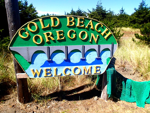
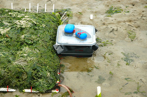
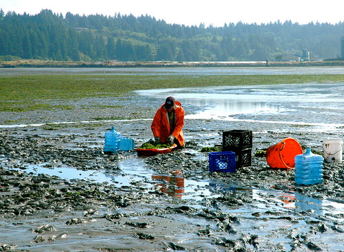
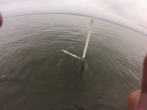
Another week has come and gone. Things are beginning to wrap up for my internship and I am already dreading leaving the beauty of the Oregon Coast, but there is still work to be done! I am still working on my fieldwork and laboratory experiments and this week we will be going to our plots to photograph the sediment cross sections and see whether the oxidation line has become apparent in our natural observation plots and our plots where we controlled the amounts of algae.

DSCN1403

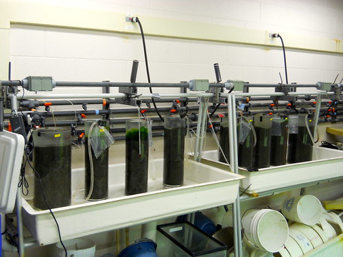
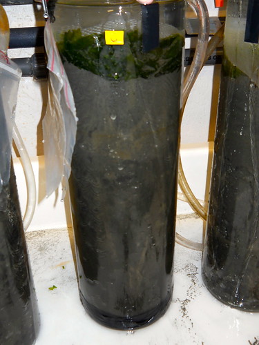
Our laboratory experiments are showing some interesting results. We believed that the tubes with high amounts of macro algae would show minimal oxidized sediment, like what happens naturally in the estuary. However, we have seen that the tubes with the high amounts of macro algae are showing the highest amount of oxidized sediment. One hypothesis is that the large amounts of algae are producing oxygen as a result of photosynthesis, which is adding oxygen to the sediment. We have now completely covered the tubes with aluminum foil and we hope that it will prevent any further photosynthesis and hopefully it will help the algae rot. When the algae rots, it begins to produce sulfides in the sediment and the amount of anoxic sediment increases greatly.

DSCN1360

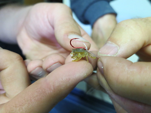
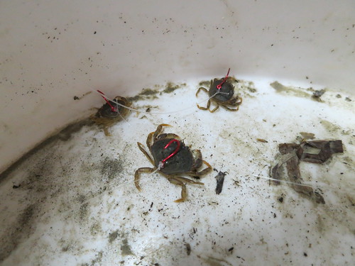
This week we will be starting to use a tool called IRIS tubes. IRIS tubes are pieces of PVC pipe coated in ferrous oxide. When the ferrous oxide, which is normally orange, reacts with sulfides in the sediment, the tube turns black. This allows us to see how much sulfides are in the sediment and also where they are found. Sulfides are important because they signal anoxic sediment. We are deploying the tubes in our algae plots to see if the amount of algae can be related to the amount of sulfides and we also will be putting them into our containers in the laboratory.  Hopefully we will see some great results!

DSCN1336

I have also began to work on my final presentation and have really enjoyed putting together the story of my project. I have always enjoyed public speaking and I am greatly looking forward to teaching others about my work and estuary ecology. I also attended a presentation about how to put together an effective PowerPoint and I learned a lot of tips and tricks that I can’t wait to use when I present!

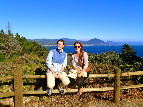
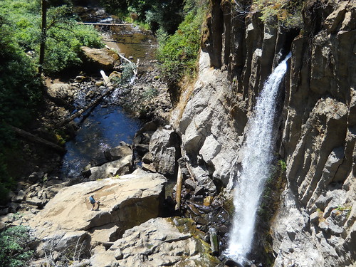
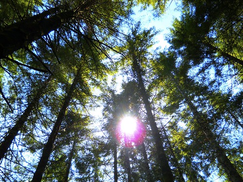
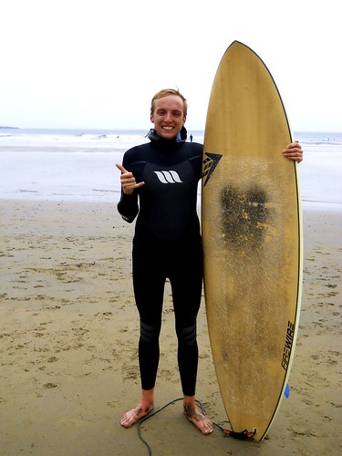
Aside from work, this past week has definitely been a great one. On Saturday, myself along with two other interns hiked Drift Creek Falls near Lincoln City.  It was beautiful to be walking through the forest and the waterfall at the end of the hike was incredible. That evening we made a delicious group dinner, and on Sunday I went surfing for the first time ever! I had no idea what to expect but I left the beach completely hooked.  I was able to stand up fully about 3 times, although I found myself falling over shortly there after! It was one of the most incredible feelings to be riding on the waves.  I was pretty surprised by how soon I was able to get up on my knees and I cannot wait to get back out there!

DSCN1483

This week and next will be dedicated to preparing my presentation and finishing up my field work. This coming weekend a group of interns from Hatfield will be taking a camping trip to Redwoods National Park in Northern California and I cannot wait to see them. Stay tuned!

To Road Trip or not to Road Trip: That is the question.

There are few things in this life more enjoyable than driving down Highway 101, taking in the stunning coastal views, and sipping on a delicious coffee!  Last week I had the chance to get out of the office for a few days to visit the towns of Port Orford, Gold Beach, and Brookings.  The purpose of this trip was to go over the asset list that I have amassed for each town, but more importantly to actually see all the attractions I’ve thus far only seen on a computer screen!  Coffee in hand I departed Bandon early Monday morning and headed South where I met with the following: Jodi Fritts (City Administrator) and Sandy Vieira (Executive Director of the Chamber of Commerce) of Gold Beach, Annette Klinefelter (assistant principal at Kalmiopsis Elementary School) of Brookings, Tyson Rasor (Coastal Tourism Liaison), and Jim and Karen Auburn (the Mayor and his wife) of Port Orford.

P7220068

Surprisingly the sentiments in each town towards coastal tourism were shockingly similar.  They all understood that changes would need to be made, and were more than willing to do what it takes to improve the South Coast!  But as eager as each city was, they were also cognizant of the possible push back from some community members towards an increase in tourism.  Since I’m here specifically to increase tourism, I was baffled as to why anyone wouldn’t be for it, especially if it meant their town would be more prosperous.  After discussing the problem at length I believe that I have a better understanding of where the locals are coming from.  One of their worries is that by better advertising the town’s “secret and local gems” (things such as the best swimming hole, or a really great campsite) the number of visitors will increase and they will lose ownership of their local treasure.  The second common concern I heard voiced was that people don’t want to add traditional tourist attractions that would change the character of their town (things such as a boardwalk with games and rides, or souvenir shops.)  Furthermore there are those who think their town is fine the way it is, and they don’t think tourism is useful.  The difficult question remains: how do you create more opportunities for tourism without changing the town?  Presently the main problem is that droves of people pass through these four towns on their way up or down the 101.  They will probably stop to get gas, use the restroom, buy a snack, and maybe even walk around for a while; but how do you get them to stay?  Like an onion this question has many layers and on a couple occasions has made my eyes water in my attempt to find an answer to this big picture problem!

P7270150

After determining that increasing ecotourism (something that the community members were interested in and something I feel is very tangible) would probably be the best way to increase coastal tourism, I was naturally faced with another slew of questions and drawbacks that were seriously messing up my plans!  Sadly that is the reality behind this whole project.  It is one thing to come up with ideas, research them, and find support, but it is another thing entirely to actually make it happen.  For example: I’ve heard that the coast of Oregon has some of the best kayaking around, however, in my research I found that there is only one place that will take you out on trips and nowhere on the South Coast can you rent a sea kayak!  Naturally my first thought was simply “Well, let’s put kayak rental stands out by the beach!”  Problem solved.  Case closed.  Sadly this was easier said than done as I realized that the reason why no one rents sea kayaks is that the insurance is too high and because of the coast’s characteristic howling winds, much too dangerous for many to take kayaks out on their own.  I ran into similar problems as I investigated similar ecotourism rental opportunities such as SCUBA, surfing, and snorkel gear rentals.  The end product of this has been that I simply have no idea what to do, and after being highly annoyed with this fact for a number of weeks, I’m becoming more accepting of it.

P7220096

The reality is that I am only on the South Coast for ten weeks, which is not nearly enough time to even scratch the surface of the tourism issue.  So in my remaining weeks here my projects and goals (or as I like to call them, recommendations to the future me) are thus: 1). Look into the pros and cons of ecotourism as well as new activities to promote, 2). Work to develop “Quest” projects in the area (free-choice learning adventures that use clues and hints to encourage participants to discover the natural, cultural, and historical treasures of each place and its community.), 3). Look into the development and implementation of marine and terrestrial education programs that increase the understanding of issues and resources that are pertinent to each community, and 4). Finish my ecological “summit to seastacks” summary for the area that will be covered by the upcoming scenic bike pathway in Port Orford.

P7270198

This past weekend I was visited by a couple of my friends from UC Santa Cruz!  With all the hiking, exploring, s’more eating, and wine tasting, it was truly a wonderful weekend on the South Coast!

Week 7: Yo Ho, Yo Ho, A Biologist’s Life For Me!

Another fantastic week in Charleston! This week we wrapped up the annual red rock crab tagging survey. We pulled our traps up at the end of the week and put them back into storage. It was crazy how at the beginning of the surveys we were catching on average 60 crabs per trap per day and by the end of the survey we were catching only four or five crabs per trap per day. Some of this was in part to our friendly neighborhood harbor seals that would ram our traps to get the bait and make it easier for crabs to escape. However, that is not the only reason behind the poor crabbing and that is the mystery we are now tasked with solving.

One of the last red rocks we marked.

The first part of the week was mainly data entry and analysis. Scott has been teaching me the magical world of Access and R throughout my time at the ODFW and this week put those skills to the test. Access is a Microsoft database program that allows us to better organize our data and create queries that can be used to table data in a form that is easier to analyze. We then use the program R to analyze all the data we’ve put into Access. R has a pretty steep learning curve and as someone with no experience with coding or programming I feel like what I’ve learned so far has been pretty extensive. It’s exciting to see data you’ve collected turn into readable and meaningful graphs.

Scott has also been putting my ArcGIS skills to good use. Scott is creating urchin harvest reports for the ODFW and has been using ArcGIS to analyze the data spatially. Between the two of us we were able to figure out some cool ways to map and analyze the urchin data.

On Thursday, Scott, Nick, and I felt we had enough of our share of office work for this week and decided it would be a perfect day to go fishing. I had never gone fishing in the open ocean before so to say I was excited was an understatement! Within an hour of being out to sea I had caught my first fish: a black rockfish. We were “bottom fishing” which is exactly what it sounds like: fishing along the ocean floor. The trick with bottom fishing is not catching on the bottom, which even experienced fishermen often have trouble with. Once you catch the sea bed there is a lot of organized chaos with unhooking yourself—jerking your line up hard in various directions and trying not to snap it—and an equal amount of shaking your fist at the ocean.

fishing

My mighty black rockfish!

Friday we took out the ODFW’s boat, Ophiodon, to release some basket stars the invertebrate biology professor wanted returned to sea, as well as to collect some spatial data on sport crabbing. When returning basket stars to sea you must first burp them by gently pressing on their disk. Air often gets trapped inside of basket stars which will cause them to float at the surface and will inevitably be eaten by gulls and other hungry sea birds; burping them ensures a (somewhat) safe journey to the ocean floor.

After returning the basket stars we began our data collection. We drove the Ophiodon throughout Coos Bay marking waypoints on the boat’s GPS where we found sport crab gear. We collect this data in order to be able to make informed decisions when companies want to alter the habitat, such as dredge it, so we can be aware of how much sport crabbing we would be affected.

And though only two days at sea isn’t really enough to determine whether I get seasick or not, I am happy to report that seasickness has not been an issue thus far! I’m so happy to finally to be getting my sea legs!

Returning basket stars to their deep sea home.

Saturday I went with a few students from OIMB to go hiking at Gold and Silver Falls. It was unbelievably beautiful. We first hiked to Silver Falls which was my favorite of the two because we were able to play under the waterfall! Gold Falls was also pretty amazing, as the trail leads you to the top of the waterfall and you can look over the edge, which was a surreal experience. We also took it upon ourselves to go off the beaten path and explore some unmarked areas; I definitely improved upon my climbing abilities during this hike! As always, with the end of this week I’ve been left exhausted but completely happy. Until next week!


Silver Falls

Playing underneath Silver Falls!

Week 7: Beginning the Analysis

So much has already happened this week that I’m going to get ahead on my next post before the weekend starts.

When I returned from Willapa Bay, I thought everything was going to get back into routine, but no! Now that my foot is (mostly) better, I can get back into field work! After looking at our data from the fish traps in Willapa, our lab tech thought that although the traps we were using looked pretty much the same as the set of traps they used a couple years ago, they might be different enough that we cannot compare data between the two. This week, we set out to determine if the trap data is similar between the old and new traps by putting out several replicates of pairs of each along the shore next to the HMSC Visitor’s Center. Unfortunately, so far we have not caught very many fish, so we may not be able to tell, but hopefully we will put more out next week in a different location and see what we get.

This week was also my 21st birthday! A small group of friends came over to my house and we had a wonderful time. Despite the fact that our oven is not currently working, one of my housemates managed to make me a no-bake cake, which turned out to be delicious.

IMG_0228

The no-bake cake my housemate made

I also managed to go diving with some friends off the South Jetty in Newport earlier this week. There was a good-sized group of us, so after a few issues with gear on multiple people, it was a short dive in which we kicked up a lot of sediment, but I still had a great time. For my birthday I got a new camera with underwater housing, so I was eager to try it out on the dive, but we couldn’t see much at the bottom. My best, but still not great, picture (below) was taken while we were still on the surface, in the shallows. I’m looking forward to another opportunity in which I can try out my camera.

IMG_0249

A sea star in the shallows in Newport

Last, but not least, I started analysis of the video we took with the GoPros in Willapa. I’ve gotten through one day’s worth of video so far (and seen about 200 fish), so it’s going to take me a long time. I hope we can finish the video analysis and start some statistics before my internship is over! I really want to see the data that I helped collect go through the process and come out with some results, in addition to getting some more practice using GIS and R.

I’m also taking a boat education course online so that I can drive the boat when we take more video here in Newport in Yaquina Bay, which should be happening next week. My workload is picking up quickly, but it’s all very exciting, and I can’t wait to see what these last couple weeks have in store for me.

field work, field work, and more field work

I have fallen a bit behind on this week’s blog post, due mainly because of my involvement in intensive field work projects. Although field work is what everyone is dreaming of when they are stuck in the office managing data, it does eventually wear you down physically and mentally. The first half of the week I embarked on the Ann Marie, a local fishing charter vessel, to conduct our first round of hook and line sampling in the Cape Perpetua area. The second half of the week I was down south along Port Orford where I was again performing hook and line surveys out of Red Fish Rocks Marine Reserve. I would wake up at a painful 4 am in order to get down to the docks on time and help load up the boat. Due to heavy winds that generally pick up in the afternoon, we aim for an early start in order to bypass the foul weather. Hook and line surveys are done according to a strict protocol that dictates the exact latitude and longitude, the duration, and the type of terminal gear rigged on each and every fishing rod.  This protocol is also used for hook and line sampling in both California and in Washington State, and with Oregon now on board, the methodology is now standardized across the entire west coast.

This protocol consists of delineating 500m2 cells within each marine reserve and comparison areas using ARC GIS. Local knowledge from fishermen is then incorporated into the GIS map, which highlight the best fishing reefs in each area. The areas are then stratified by depth and habitat type and all cells that are deeper than 24 fathoms or exhibit non rocky substrate are excluded from the GIS map. The 24 fathom mark was chosen in order to reduce fish mortality after release; rock fish mortality is compounded by the depth at which they are caught and brought to the surface. Non rocky habitat was excluded because as the name suggests, rock fish are generally only found in rocky habitat, so it is not worth the effort to fish in sandy bottom. Five cells are then randomly selected using a random number generator and each cell is fished for a total time of 45 minutes.

Now that you have an idea about the methodology, it may become apparent that this method is not one that is aimed at catching the most fish in the least amount of time.  The goal is to take a replicable and consistent approach that minimizes possible covariates, which can become a rather nuisance during analysis or create biases in the data. For example, if the duration of fishing in each cell (45 minutes) was not accounted for then our results would be skewed because, theoretically, more fish are caught the longer one is fishing for. However, like many ecological study designs, there are certain variables that can’t be controlled for.

Total catch in each cell varied widely, with some cells pulling in over 50 fish, while others had none. Differences in catch can be explained by a myriad of factors, most notably temperature, habitat, depth, and light. The ocean may exhibit slightly different conditions during any given day which cannot be easily controlled for. Light and temperatures sensors, however, are deployed at each cell which we can correlate during the analysis.

Most of my remaining time here will be spent helping in the hook and line surveys. These surveys will continue for another 2 months after my internship has ended, so unfortunately I won’t be involved in any of the analysis. These surveys are expected to continue every summer for the next 10 years.


Week Six

I cannot believe how quickly my summer here at Hatfield is passing. 

Since June I have distributed dozens of descending devices, I helped conduct interviews with charter boat captains and designed a survey that has been mailed to over 250 recreational anglers here in Oregon.  It’s been busy. 

For the past week or so I have been working on story boards that will eventually become a small video series on the issues surrounding rockfish conservation and how easy it is for all anglers to do their part by using a descending device. 

The “introduction” video describes why canary and yelloweye rockfish are sensitive to fishing pressure and how their bodies are affected by the sudden drop in pressure when they are reeled to the surface.   This video will then link up to “how-to” videos that offer more in depth information on how to operate the different types of descending devices and how by simply returning a fish at depth an angler can greatly increase its chances of long term survival. 

While the scripts are still in review, I have recruited the help of ODFW’s web developer to offer his expertise on formatting and planning the design of the final products so the videos are easy to use by our audience. Also he has offer his time and support all along the production process.  I know his help will be important for the process to go smoothly.  Thank you Bob!

Though, I am very excited that the videos are getting under way, I unfortunately will not be around for the filming and final editing as filming likely will not be able to take place until early September.  I am looking forward to seeing the finished products though and am grateful that I having the opportunity to work as a part of the team on such an important portion of the rockfish conservation project.

Another Muddy Week!

Yet another week has come and gone on the Oregon Coast; and it was a fantastic one at that!  Things started out at the EPA where I began transitioning from field studies to a laboratory experiment. In the field, we were observing the estuary sediment as it is naturally found and then with some added controls that we implemented last week.

DSC_0808

We are now further expanding our control in the lab by setting up 9 estuary like environments in clear tubes to provide more insight into sediment oxidation under varying conditions. Three of the tubes have sandy sediment, with no algae cover in one tube, low algae cover in the other tube, and high algae cover in the final tube. The remaining 6 tubes are filled with muddy sediment. Three of the mud tubes are set up exactly like the sand tubes, and the remaining three are the same except they have mud shrimp added into them.

DSCN1340

The tubes are tall, clear, glass cylinders that provide us with a large viewing area to see any sediment oxidation that may occur. The tubes are all connected to flowing seawater in order to replicate conditions in the estuary. The algae is held in place using netting, and the whole tube is covered in aluminum foil to prevent light from penetrating the sediment.

DSC_0856

Collecting the sediment was quite the treat! It involved a fellow intern and myself trudging across the mudflats with carts and sleds to move 6 very heavy buckets of fresh Yaquina Bay mud and sand. I can only imagine the joy onlookers might have had upon seeing myself slowly sink into the mud, while pulling a sled full of it behind me. Aside from the humorous struggle of the day I was presented with an opportunity for science outreach. After I came up from the mudflats, I spoke with two people about my project. I was able to share with them my knowledge about wetland sediments and told them about my research. It is always exciting to share science with others, and after da Vinci Days, I learned how to talk to people about science in an effective manner.

DSCN1212

Last weekend I began volunteering at the Hatfield Marine Science Center in the fish husbandry program.  I helped to clean tanks, and even got to play with the giant pacific octopus at the end. If you’ve never had an octopus wrap its tentacles around your fingers, I highly recommend it.  After volunteering, some fellow interns and myself made our way to Portland for the weekend. We spent our time exploring the city and all it has to offer.  We went to Powell’s Books, Voodoo Donuts, and I even was able to play a piano in Pioneer Square.

DSCN1296

I also started taking a class about the computer program, R.  R is a statistics program that allows scientists to view and work with their data in an efficient way. However, R requires some knowledge about the “language” it uses, and the class will be covering how to understand and use the program. Luckily for me it is similar to Matlab, which I have used this past year at school to make ecological models of Lake Michigan. Hopefully it won’t be too difficult to understand!

Next week looks to be filled with more laboratory experiments and going out into the field to check on our plots.  We are anxious to see what they look like and are hoping for good results!

Week 6: Windy Work in Willapa

I’m a bit behind on my blogging, but I intend to catch up in this post, as well as make up for the lack of pictures in my last two posts!
This week I was lucky enough to take a trip up to Willapa Bay in Long Beach, Washington, to finally do some serious fieldwork. I went with the Daniel Sund, the Masters student I’ve been working with, and Lee McCoy, our lab’s tech and general awesome go-to guy. We were out in the field for about 12 hours each day for a week, which was hard, but the work wasn’t too involved, and tons of fun!

GOPR0013

Me on our little but sturdy boat

While we were up there, we deployed our cameras using the mounts we made, leaving them out for four hours at a time in four different habitats: oyster, Zostera marina (the native seagrass), Zostera japonica (the invasive seagrass), and clam. My lab has done this before, but they used to leave them out for three days at a time, while our GoPros are limited by their four-hour battery life, despite the battery pac accessory we bought for them. The video is meant to record the fish and crabs that wander through the field of view. It had to be video, rather than time lapse, because often fish spend only a second or two in the frame, and you usually need to look at their behavior to determine the species. We are going to look at the number, species, size, and time that each organism appears in the video.

GOPR0028

The mount with a GoPro on the end when we went to pick it up- there was often a lot of seagrass caught on them

We put them out around high tide, which meant we had to go by boat. Since our trips were four hours apart, there was a lot of waiting around in which we often tried various restaurants, as well as a lot of time on the boat, since some of them were pretty far apart. Because of this, even when I was walking on dry land I still felt like I was swaying on the waves. It was pretty disorienting sometimes, but went away in a couple days. Deploying the cameras was pretty difficult sometimes, because of the wind and the waves. It was harder than we expected to slide our camera mount over the poles we placed in the mud, slide a bolt through holes we drilled in the poles, and screw on a wingnut, all from a boat that is moving up and down and drifting away.

In addition to putting out cameras, we also put out traps to catch fish, which we could use to compare the number and species of what we found in the traps to what we found in the video. We did this at low tide when we put out the poles the mounts would go on. We also wanted to look at juvenile Dungeness crab predation, so we (bear with me here) superglued small fishing hooks tied with fishing line attached to their carapaces. We tied them to a stake out in the same four habitats as the cameras, and left them out for a day. The hooks are supposed to catch whatever fish may try to eat the small crabs, and the fishing line keeps the crabs in one place so we can find them again the next day.

IMG_0156

One of our juvenile Dungeness, all ready to go!

I thought we were tying up the crabs and leaving them to their deaths, but most of them survived the whole day! The hooks also came off pretty easily at the end, and we let the crabs go. We never caught any fish, and always found the crabs burrowed in the sediment, well hidden.

IMG_0160

By the end, we had a little army of attack crabs on leashes

We had to go collect the crabs ourselves, so we went and sampled bags of oyster shells (which I have mentioned in previous posts), to try to find some for our tethering experiment. Most of them were across the bay, in deep mud, so because of my toe still being sensitive, I often supervised from the boat while the other two did all the work. However, I did try my first raw oyster while we were out there. Lee shucked it for me with a screwdriver, and it was probably still alive when I ate it (gross!), but I am proud to say I kept it down. Now that I have tried it, I never have to again.

IMG_0209

Some cool colonial tunicates we found on the boat when we pulled it out of the water at the end of the week

One day during our free time in the afternoon, we went up to the lighthouse at the top of the point on the Washington side of the mouth of the Columbia. It was a great view, and I never realized how large the mouth is! It was a beautiful view. Also, at the end of the trip we stopped in Astoria for lunch, and got to drive across the bridge and see a bit of the city.

Overall, it was a week of trying new things and spending a lot of time outside. In addition to the oyster, I also tried thimbleberries, pickleweed, raw cockle, elk, and probably several other things I can’t remember. I’m so glad I had the opportunity to go on the trip, and am looking forward to see what kind of fish show up in our video!

Week 6: My Personal Oregon Trail

Yet again, another fantastic week in Oregon! I say Oregon, instead of just Charleston, because this week was full of traveling! As per usual, we are still continuing our work with the annual red rock crab mark-recapture project. This, and working on our pink shrimp fishery project, took up the majority of our Monday. Tuesday through Thursday, however, was a totally unique experience!

Steve Rumrill, the managing shellfish biologist of Newport and former professor at the University of Oregon, had earlier in the month invited me to join him in Astoria to help the Astoria shellfish biologist, Matt Hunter, with his razor clam stock assessment. And so, Tuesday morning I set out on Highway 101 to Astoria. Driving up the 101 was like driving through a postcard: ocean view from the top of cliff faces and lush forests. It was a long drive (eight and a half hours because traffic was terrible!) but it didn’t feel that way one bit because of the beautiful scenery!

Driving Highway 101 is simply a dream.


Wednesday and Thursday mornings were dedicated entirely to razor clam surveying. On Wednesday we headed out early—5:30am—to the transect site in Warrenton. The reasoning behind the early times is to ensure we are working as the tide is going out, in order to sample a larger portion of the beach and the razor clam stock.

Surveying razor clams is quite different from surveying cockles. We took an approximately meter sized basket and placed it along different elevations on the beach. We started at elevation zero—which is determined as the elevation in which no razor clams are found—so that we could ensure that we were not missing any clams higher up on the beach. We then moved down the beach, towards the water, in 50 meter increments.

At each elevation the basket is placed and a hydraulic pump is used to liquefy the sand. Razor clams are neutral buoyant and if they are within our sampling area (the basket), once the area liquefies, razor clams will float to the top. We pump water into the area for three minutes per basket, six times per elevation. The baskets, depending on the elevation, are moved either north or south to ensure we are sampling as much of the stock as possible.

An excellent razor clam specimen we retrieved during our stock assessment.
(Note: Clam measures to approximately 110mm.)

The hydraulic aspect of the sampling is quite interesting. A pump is placed in a “crab hole”—an area of pooling water on the beach—and a gasoline powered generator is used to power the pump. A hose sucks up the water from the crab hole and then pushes the water into a separate, longer hose which is attached to a wand at the end. The wand is made of PVC pipe with two openings: one to connect to the hose and one to project the water. This wand is used to liquefy the sand in the basket. The water comes out of the wand at nearly 8 gallons a minute and handling the wand can be tricky to maneuver, not to mention heavy. As with many things involving field work, there is a definite learning curve for good technique.

Blasting away at the sand, looking for razor clams.

The same process of razor clam surveying was repeated on Thursday at a gracious 6:00a.m. After finishing up with the stock assessment—and a yummy breakfast at Bagels by the Sea—I headed back to Charleston. Luckily, traffic was substantially better this time around and I made it home in just a little over 5 hours. After being up so early and having such a long drive you can bet I was ready for a good night’s sleep!

Friday, Scott and I headed out in the morning to Valino Island to recover cockles that had been marked and placed there in February. We wanted to retrieve as many as possible in order to meaningfully assess the cockles’ growth over time. Fortunately, we managed to find 33; approximately 100 were placed but only 30 are needed for meaningful statistical analysis. The cockles that we found had some cool annuli (growth rings) and crunching the data is going to yield some fascinating results that I will be sure to update you all on!

Valino_Cockle_2013

A cockle we recovered with some fascinating annuli!

Friday was also the day that Scott decided it’d be a good time to teach me how to back up a boat trailer. If you’ve ever watched somebody experienced in this matter back up a boat trailer you may have been deceived into thinking that it is a simple and easy task. You would be very wrong, as was I. Backing up a boat trailer requires an immense amount of directional multitasking. In order to successfully back up a boat trailer you must keep in mind that the truck and the boat are always going to be pushing and pulling in opposite directions and keeping track of what does what can be very dizzying. The boat docks are always filled with tons of seasoned boaters; no pressure when you have 50 professionals watching you, right? I didn’t do terribly and it’s all about practicing. I wouldn’t call me for all your trailering needs just yet.

It was nice to have some time to relax and catch up on rest this weekend after such a long, busy week. Of course, my idea of relaxation always seems to involve being active. This week my newest experience was slack lining. The concept of a slack line is quite simple: Tie said slack line in between two trees and try to keep your balance. The actuality of slack lining is quite difficult and there is a lot of falling off involved. Let’s just say you will learn how to fall with grace and not on your face. When walking on a slack line it is important to look straight ahead and not at your feet. Doing this, keeping a good center of gravity and a lot of practice and you’ll be a pro in no time; or you at least won’t be falling off as much!

The face of utter concentration.

Sunday was also particularly eventful. A few good friends of mine from OIMB—Theresa and Payton— and I spent the day laying out at Sunset Bay and playing some beach volleyball. In the evening the three of us asked one of the COSEE interns staying at OIMB, Zac, for some skim boarding lessons and he was happy to oblige. Though I had skim boarded before I was by no means an expert on the subject; as you can imagine there isn’t an abundance of surf in Indiana. However, we all picked up on it pretty quickly and had a ton of fun. Definitely a hobby I wish I could take back to Indiana with me, but all the more reason to revisit the coasts!

Skim boarding at Sunset Bay!

After such an exciting week, I’m interested to see where these final following weeks take me. Stay tuned, until next time!


Previously on Bandon by the Sea…

Greetings readers!  I must admit that I have fallen a bit behind in my blog posts, but never fear because I have many new stories to tell, as well as some new adventures in my future!  A couple weeks ago I was fortunate enough to sit in on a call between my two mentors and some of the people who work in NOAA’s fisheries management department; the hot topic of discussion, Coho Salmon restoration on the South coast of Oregon.  More specifically the call was a discussion of how to go about creating a “universal salmon calculator” that would detail the benefits of restoration as well as identifying the permanent economic benefits such as number of jobs created.  While most of the conversation went over my head, I managed to understand the key points as well as the bottom line.  In order to get people to donate money to the cause, there has to be a way to determine the salmon’s value when populations return that is universal across all areas.  Currently there are many different ways to calculate this, each more confusing than the other.  One proposed idea was to look at the return in terms of its landscape value; i.e. how many total acres of salmon habitat have been restored or how many miles of stream have opened up.

13-1998-07-12

In addition to the calculator conundrum is the lack of money to fund post-restoration monitoring.  This is very unfortunate since examining any kind of project after the fact is the most important step in conservation and restoration!  Without any kind of follow up there is no way to know if what you have done is sustainable, if it actually did what it was supposed to do, and if it is worth continuing.  Furthermore, this post restoration analysis makes it possible to create a metric of success that will interest funders.   Since money seems to be the issue, I think it would be a great idea to train community member volunteers to gather this post-restoration data.  Not only would this be relatively free of charge (besides the time it would take to train people), but I believe it would also be a great chance to educate local residents on a conservation issue that’s right in their backyard and create pride and enthusiasm for protecting their environment.  When dealing with any kind of conservation/restoration issue, the two main questions that I feel are most important are: 1. What are the benefits associated with restoration and 2. What are the values lost when harm comes to the environment?

P7200052

As has been the case with other aspects of my internship, this phone call really exemplified the point that there needs to be better communication between the scientific and non-scientific community.  Issues and topics need to be presented in a way that makes them seem approachable and like something that the general public could take part in.

In other news, I have finished my research for Travel Oregon!  For the past four weeks I have been doing an online footprint analysis of each city’s webpages as well as collecting information on lodging, shops, food, places to go, things to do, and events and festivals.  Eventually this will all be fed into Travel Oregon’s orb so it can populate the site and beef up the information on the South Coast (since it is currently lacking basically all areas of information).  My next step will be to meet with people involved in the communities who are on our “Rural Tourism Steering Committee” to run all the information by them, and just get a general feel for each town as well as the possible pros and cons of increasing tourism in the area.  My hope is that the end product of this project will be two-fold: 1. A community calendar will be uploaded to the Travel Oregon site so that local events can be better publicized and visitors can plan trips around them. 2. That an interactive map will be available for each town’s asset such that when you search for something, a map with its location as well as the locations of things to do around it pops up.

da-vinci-days-mona-lisa-pop-art

My internship has reached the halfway mark!  This was celebrated at the Da Vinci Days festival in Corvallis where I got a chance to catch up with all the other interns and hear updates on their projects, work Sea Grant’s both at the festival, and explore Corvallis further.  Although the morning started off slowly, by the time noon came around (and the awesome all bike parade!) the festival was bustling and the Sea Grant booth had more visitors than we could handle.  While the occasional passerby was interested in our summer projects, the majority were fixated with the green turtle shell display and Bubbles our live and invasive red-eared slider.  As much as I would have loved to talk about my project (and believe me I could go on for hours…) I was more excited that there were so many people who were curious about marine biology and were actually asking questions.  Yay for the future generations of marine biologists!  Another highlight of this wonderful weekend was getting the chance to hear the awe-inspiring Jane Lubchenco speak.  To be in the presence of such a strong woman who has not only been an integral part in bridging the gap between the scientific and public communities, but is the first woman to serve as a NOAA administrator, gave me such hope for the future (not to mention many goose bumps)!  I was however saddened to see that with the exception of my fellow scholars, there was basically no one else around our age in attendance.  Just more proof that strengthening communication and involvement in science in paramount!

P7190040

One trip down, one to go!  This next week I will be leaving Bandon and venturing down to coast to the towns of Port Orford, Gold Beach, and Brookings!  I’m so excited to get to visit the places that up till now have only researched on the Internet.  Curry County here I come!