
Hello Everyone!
With summer coming to a close I wanted to share a great experience I had earlier this month tagging along with researchers from OSU for the deployment of an Autonomous Underwater Vehicle Glider (“glider” for short) off the coast of Washington. Not only was it good to get out of the office a bit, but it was also a wonderful opportunity to learn first-hand about some of the advanced oceanographic monitoring and research that is being done off the coast. It was also great to meet Dr. Jack Barth in person, he is the director of the Marine Studies Initiative and professor of Oceanography at Oregon State University, and someone who I’ve been meeting with (virtually) over the last 9 months in the OAH technical workgroup.
Glider Basics
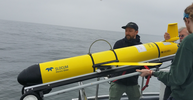
Underwater gliders, which look like small rockets with wings, use pumps to transfer seawater in and out of a holding chamber in the nose, causing the glider’s density to change (either sink or rise). With the help of the attached wings this vertical movement in water is translated to forward motion. What results is a series of dives, where optical, CTD (conductivity, temp, salinity), and oxygen sensors collect data at one second intervals. Numerous dives are strung together into segments and punctuated by trips to the surface to transmit data back to the lab. Gliders can be deployed for weeks at time and can be used for a wide variety of research and monitoring applications. Glider research has evolved dramatically over the last couple of decades and is now considered a foundational piece of modern oceanographic observation systems. More information on the integration of glider monitoring into the national Integrated Ocean Observing Network (IOOS) can be found here.
Glider Deployment Trip
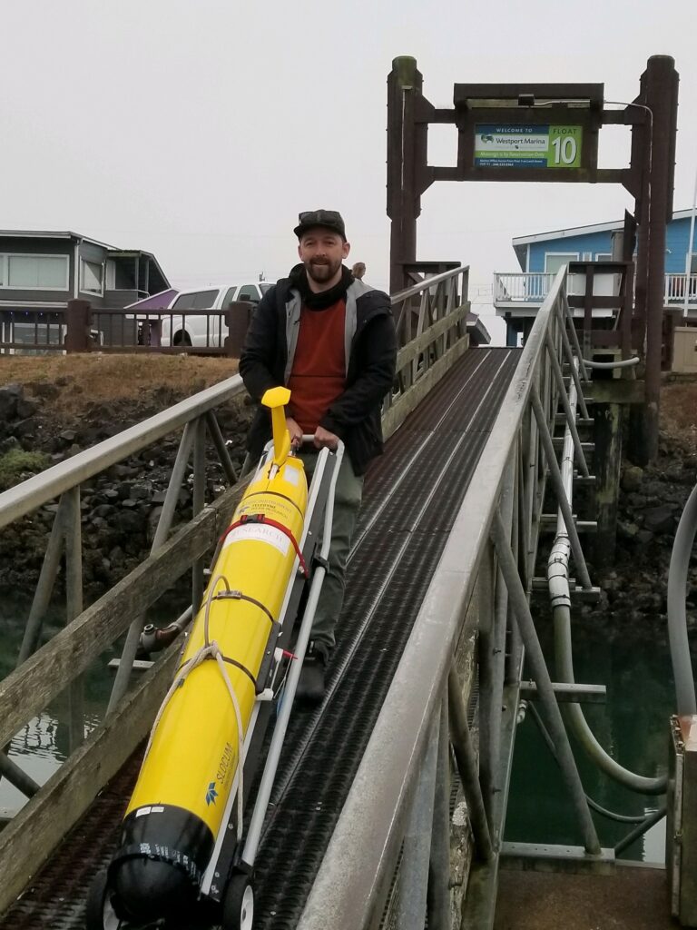
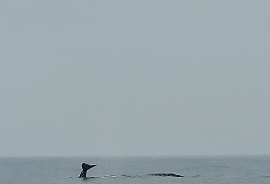
Our outing began at the bayfront in Westport Washington, where I met up with Dr. Barth and Dr. Steve Pierce, as well as an OSU student assisting with the deployment. After loading the glider onto the charter boat, we motored offshore for a little over an hour. Once we reached the deployment coordinates Dr. Pierce conducted some tests to make sure the glider was communicating properly with the lab before it was launched. Once in the water the glider performed a test dive to make sure everything was functioning correctly before it was sent it on its 2-week deployment. As a special bonus, two grey whales decided to pay us a surprise visit at the deployment location, it was an excellent sighting and we saw some great fluking before each dive!
Glider Data and DEQ Water Quality Assessment
As gliders collect continuous data while moving across a large spatial area, they generate datasets that are fundamentally different than most continuous monitoring data currently assessed from Oregon’s water quality monitoring network, which is generally collected at fixed locations. This difference complicates the use of raw glider measurements in the existing data processing/assessment framework at DEQ. There is some guidance on the state and federal levels outlining protocols for using and assimilating this type of data into water quality assessments to identify impaired waters required by Clean Water Act. For example, New Jersey Department of Environmental Protection (DEQ equivalent in that state) implemented a glider monitoring program and developed quality assurance procedures to monitor and assess hypoxia in the state’s marine waters. Going forward it will be interesting to explore ways to integrate glider data into nearshore OAH water quality assessment protocols to help identify impaired waters.