The CIFA Conference was a success! Josh Bruce, Kent Yu, and Larry Eaton led a great plenary session, and Renee Loveland and Bruce Brown led us on an awesome tour of Portland’s sustainable infrastructure. See some pictures below!


The CIFA Conference was a success! Josh Bruce, Kent Yu, and Larry Eaton led a great plenary session, and Renee Loveland and Bruce Brown led us on an awesome tour of Portland’s sustainable infrastructure. See some pictures below!
The deadline for the SRGP has closed, and we received a ton of applications. On December 11 and 12, we will be holding SRGP Committee meetings to discuss which projects will be funded. We will discuss schools on the 11th and emergency services buildings on the 12th. For more information about the SRGP, check out the new IFA website: http://www.orinfrastructure.org/Infrastructure-Programs/Seismic-Rehab/
Climate change-driven shifts in ocean conditions and growing coastal populations are two of the many factors raising uncertainty in coastal and marine resource management. Fortunately, there is a growing understanding of the opportunity to improve policies and decisions on these issues by drawing on and infusing scientific data into policy and management decisions in order to promote healthy coastal economies and ecosystems. My graduate degree research focused on this intersection between science and policy and how to imbue scientific data into the policy process. In my past few months with the Governor’s Natural Resources Office I have seen two regionally focused efforts in the eastern Pacific Ocean that speak directly to this interface.
The first of these is the establishment of a West Coast Ocean Acidification and Hypoxia Science Panel (OAH Panel). The OAH Panel, consisting of 20 esteemed scientists representing California, Oregon, Washington, and British Columbia, was tasked with advancing decision makers’ understanding of drivers and impacts of ocean acidification and hypoxia. Ocean acidification poses a particular threat to the west coastal waters of the United States and Canada, where naturally upwelling waters bring deep water with a low pH to the surface, where it mixes with low pH waters caused by atmospheric deposition of carbon dioxide. Successive upwelling events also increase the occurrence of seasonally hypoxic (low oxygen) areas of the ocean. Acknowledging the specific threat that ocean acidification and hypoxia bring to the west coast, the OAH Panel is intended to identify the research and monitoring needed to answer practical questions faced by policy makers and managers about ocean acidification and hypoxia. While biological impacts have been seen from ocean acidification and hypoxia, there are still many questions to answer for the purpose of decision making. On my very first day on the job, I was fortunate to attend a meeting between Oregon natural resource agency managers and Oregon-based OAH Panel scientists convened to set an agenda for ways to advance science-informed decision making in Oregon waters. They agreed to work collaboratively to develop accurate and accessible outreach materials to inform policy makers and the public, establish ongoing information sharing and coordination forums on OAH, and identify ways to ensure the science products being developed by the OAH Panel are used by decision makers.
The second effort endeavoring to infuse scientific data into policy and management practices in the eastern Pacific Ocean is the West Coast Ocean Data Portal (WCODP). The WCODP is a project of the West Coast Governors Alliance on Ocean Health that provides access to ocean and coastal data to inform regional resource management, policy development, and ocean planning. I was able to help at the WCODP’s annual Network meeting in early November to unveil a new feature of the Portal that creates a geographic visual of data, specifically data relating to marine debris. This new feature, the Data Viewer, provides coastal decision makers with a tool to track marine debris and help prioritize clean ups and advocate for policies to reduce the impact of trash on our beaches. As the WCODP charts its strategic plan moving forward, it seeks to continue to be a rich data resource and tool to visualize and map that information, so that ocean and coastal managers can make sound decisions to improve ocean health.
Both of these efforts have established a significant opportunity to sustain and continue to build cross-sector cooperation between decision making and scientific sectors in coastal Oregon. The state is thus poised to more efficiently and effectively protect and preserve the ocean’s critical natural resources. Both the scientific community and decision making community are working to improve ocean health. Combining forces is helping scientists ask the questions managers need to answer to understand how ecosystem services that people value will be affected, and what steps people might take to try to mitigate and adapt to those changes in coastal Oregon now and in the future.
It’s finally here! This November 11-12, the Council of Infrastructure Finance Authorities (CIFA) is holding their annual national conference in Portland, and the Oregon Infrastructure Finance Authority is doing their best to support this effort. Specifically, I am helping to organize an Oregon-focused plenary session for the conference, as well as a tour of some of the sustainable infrastructure that exists around Portland.
For the plenary session that will take place on Wednesday November 12 at 9 am, we will be bringing together a number of excellent speakers to present the work they’ve been involved with in regards to Oregon’s natural hazards resiliency. Dr. Kent Yu (Former Chair of the Oregon Seismic Safety Policy Advisory Committee), Josh Bruce (Director of the Oregon Partnership for Disaster Resilience), and Larry Eaton (GSI Water Solutions, Inc.) will talk about the infrastructure issues associated with natural hazards and discuss what lessons other infrastructure professionals from around the country can learn from the work taking place in Oregon.
For the sustainable infrastructure tour taking place immediately after the plenary from 10 am – 1 pm, the entire tour will take place within the Pearl District’s Brewery Blocks. We will get a tour from Gerdling Edlen, the firm that designed this Eco-district, as well as a presentation from the Portland Water Bureau about some of the reservoir projects they are working on. On top of getting to see the nation’s first condominium to receive LEED Gold Certification and explore some of the most innovative storm water management strategies to date, tour attendees will also get to experience some local Portland culture by getting to explore the Brewery Blocks. Click here for more information about the tour.
The 2014 CIFA Conference is being held at the Hilton Double Tree. Click here for more information about the conference.
Greetings Readers!
I can’t believe it’s week eight already! I feel like the less time I have left here at Wild Rivers Coast Alliance the more things I have to do. Thankfully every now and then I catch a glimpse of one of my alma mater’s glorious mascots and I am encouraged to march onward.
Tomorrow I will be going back to Port Orford to help some members of the Port Orford Ocean Resource Team work on the “Quest” project I had mentioned in my last post. This is very exciting because there are few Quest activities on the South Coast! I hope that after tomorrow I will have a better idea of how I can construct my own Quest activity so I can create a couple for Bandon before I leave. Presently, the Quest begins at the Visitor Center (and the future site of a new interactive Marine Education Center), ends at the Port of Port Orford (unique because it is one of only six “dolly docks” in the world – where gigantic hoists lift the vessels in and out of the water each day), and covers historic and scientific topics such as: low tide, intertidal organisms, the history of Battle Rock, Red Fish Rocks Marine Reserve, and cannery history. Not only are Quests fun, outdoor learning adventures that are great for all ages, but they have the potential to increase and renew a sense of community pride in the town and its assets. Referred to as “community treasure hunts” each Quest requires a closer look at the environment and is centered around a specific topic such as sustainability or invasive species. I think this will be a great way to build each communities’ interest in the natural wonders they have on the South Coast, and maybe even act as a gateway to some new education programs.
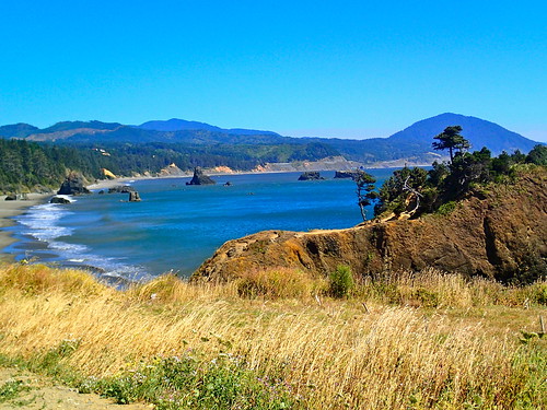
A view of Battle Rock Park and the Red Fish Rocks Marine Preserve
Education programs are a challenge in and of themselves. In order to create any kind of sustainable ecotourism, there needs to be interest in and knowledge of the environment since all tourism depends on the environment. The top obstacles to implementing education programs in schools are a lack of money and time to either: a). Fund teachers to receive the training to teach various marine and terrestrial science classes (assuming the teachers have the time to go through the training and find spots where the aforementioned programs would fit into their lesson plans) or b). Find someone who already had the necessary knowledge and is willing to give up their time (and probably any hope of getting paid). It is important to teach future generations that if the environment isn’t properly taken care of, lots of money and time will eventually need to go into fixing it. One problem whose solution I believe lies in marine education programs, is inspiring younger generations to return to fishing; but the problem is that getting them interested in fishing isn’t even the biggest obstacle to overcome. It’s extremely difficult for young fishermen to enter the industry because of limited entry and the high cost of permits, boats, and the necessary equipment. But if you can’t younger generations to join the cause, then how do you create non-fishery related business in communities who have fished for hundreds of years?
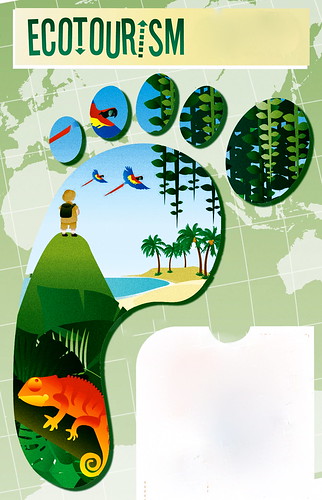
Ecotourism to the rescue! Now while this is yet another topic that an infinite list of possible setbacks and issues, as I said in my previous post, I believe (along with my mentors and some of the community members) that it is truly the way to increase tourism. However, before you create new ecosystem services, you need to get more people to stop and stay in each town. In Port Orford one way they’re trying to solve this problem is with a new visually stunning interactive Marine Center that would be located in the hub of the city at Battle Rock Park. The proposed center will have research facilities that can be seen by guests, a near water research facility, a deep ocean research laboratory, live fishery and fish buying , docent tours, touch tanks, and a seafood research facility. Since this would truly be a building unlike any other on the South Coast, it would be a great chance to link future research and programs with ongoing ones in Coos Bay and on the North Coast. Hopefully it will not only attract people who might want to work in the center or research labs, but educate residents and guests as well. It would be wonderful if the new center could facilitate educational programs for local schools; this would introduce science as something that’s interesting and going on right in their backyard!
For the rest of the week I will be getting ready for our Summer Scholars Symposium that’s this Friday at the Hatfield Marine Center. Next week is my last week in Oregon! Besides working on a couple Quest projects for Bandon, I’m not sure what else is in store for me, but I can imagine I’ll find something to keep myself busy.
This past week has been very interesting for me because it was mainly vacation time. Yet, before my vacation time occurred I did do a lot of work at the VC. First of all, at the beginning of the week I had some of the same duties as I usually do. I did Ocean Quest for Sunday and Monday and I’m starting to feel more and more comfortable with it. I’m starting to get a groove with a 25-30 min presentation and have a pretty good feel for each crowd. That way I can tailor the presentation to them, such as whether there are many adults, children, or young adults/ college students. The VC was normal as usual and Aurora seems to be doing much better in the tank. Then, on Tuesday we had a real project day which was amazing to have. I got to change the water out of my shore erosion tank as well as make completely new signs for the tank. This is the third sign change, and each sign has evolved. Now the shore erosion tank has 2 signs. One says “The Erosion Problem” and this is where we talk about making a beach, move the paddle steady and see the erosion occurring. Then, the second sign says “The Erosion Solution” and this is where I give three examples of shore erosion solutions and say to try ONE of them. We were already seeing great progress with the Beach Erosion Challenge, hopefully more progress will occur with these new signs. In addition, these new signs are made of much thicker laminent, thus they stand up much better than the flimsy beach erosion challenge signs.
The main things I did this week was……..VACATION! I was on vacation from Wednesday to Sunday and it was amazing. I went to Vancouver, BC, Seattle, Portland, and Tillamook. In Vancouver, BC I stayed at a hostel in a tiny room with 4 other girls (2 from England, 2 from Germany), but it was cheap. My hostel was also really close to public transport to get to Stanley park where the Vancouver Aquarium is located and Science World was right down the street. I spent a LONG time at the Vancouver Aquarium and once I mentioned I volunteered at the Baltimore Aquarium and working at Hatfield for the summer the special treatment started to roll in instantly. I got to see the dolphins up close and even get a kiss from willow the sea lion. I also got to see some behind the scenes aquarist workshops and lastly I got some business cards to be an intern there or for a job interview. Thus, an amazing experience and one that doesn’t come very often. At Science World I got to see an IMAX movie about the Rocky Mountains and building the transcontinental Canadian Pacific train through those mountains. Yet, the main reason I went to this place was to see the DaVinci exhibit where I got to see his journal entries, his machines from the journal entries built, hands on exhibits about his inventions, his original art pieces and a whole exhibit on the Mona Lisa. This exhibit to an art historian (or art history minor like myself) was spectacular. The rest of Science world was cool as well with many hands on exhibits about physical science as well as biology and chemistry. Needless to say it was a long day, but totally worth it. I left the next day for Seattle and that was a crazy trip as well.
Seattle brought me the Seattle Aquarium, Pike’s Place, Ferry rides, many hills, and Seattle Center with the Pacific Science center, concerts at the mural and MOD pizza! My day of exploring alone brought me to the Pacific Science Center where I did see another IMAX on mummies in Egypt and all the other exhibits, but the real deal was King Tut! That was worth the whole trip, because not only did I get to see so much ancient Egyptian history that I studied at my college, but it was all in 1 place. I ended up leading my own tour because I was explaining to a middle ages couple about the sculptures that were around them. Before I knew it, 4 families and a security guard were listening to me as I answered many questions and explained the history and art behind each piece. It was spectacular to see all of this history in real perspective compared to on a screen in a classroom. Then, when I was done there, I came out and there was concert at the murals randomly and I got to see 3 Seattle bands as well as get lots of free stuff. Then, Hillary;s family was lovely and let us all (Maryna, Kate and I) stay at their house. They also fed us delicious food all the time and we caught up on all our Olympic games we have been missing. Then, after a day with my housemates at Pike’s place, Ferries, Seattle Aquarium and a fantastic dinner, we slept and left for Newport. On the way home, we went to Portland to Powell’s books (got 3 books for under $10), a Sunday market, Tillamook cheese factory to drop off Maryna for field work and even saw some whales on our way to Newport.
Now that my vacation is over, work is about to begin. I need to not only work on my VC project and my regular duties as an education intern, I also need to work on my final presentation. This will mostly likely be the largest challenge since it has to be done in 11 days, but I’m always up for a challenge. Working days here I come :)
Monday would mark the first day that we opened the Tsunami wave tank to the public. When I arrived for work on Tuesday it was decided that we would keep the wave tank open to the public on that day as well. The Tsunami tank seemed to draw peoples attention the second that we opened it to the public. The only thing that kids apparently love more that Legos is knocking them over with a powerful wave device. The max parameter that we had calculated for our “Tsunamis” had to be rethought when it was discovered that a patron will use these settings about 99.9% of the time. Once we ran out of Wet Floor signs, it was decided that perhaps we should limit how strong people are allowed to make waves. After being open to the public for only a few hours, we were forced to shut down one of the two sides of the wave tank when a piece of foam backing came undone. Rather than closing the entire exhibit so that we could disassemble the tank, we decided to simple cut the power on that one side. We also discovered a phenomenon that occurs when you let people build with Legos at the same time as they are allowed to play with the controls; people tend to think it is funny to splash family members that are obliviously working on their Lego structures. This joke did not seem to get old any time soon either. We were finally forced to close up the exhibit when half of our Legos had fallen beneath the tank. The “public test” of the tsunami tank proved to be better than I expected and will defiantly be a hot activity when we are finally read to open it permanently.
On a more negative note, we discovered (after 4 weeks) that Lego is apparently back ordered on all of the pieces that we had ordered. As a result, none of the pieces will arrive before the end of August. Fortunately, I was able to find some of the pieces that we needed from my own private Lego connection. This week also marks the end of an era in Newport, the Japanese dock that had washed ashore has now been completely broken up and is on its way to a salvage yard. Aurora, our octopus was far more active this week than she has been for a while. We were able to touch her late in the day on Saturday. We also nearly got soaked with a jet of water from the mischievous cephalopod.
This week I changed sites from Cape Perpetua to the future marine reserve location at Cascade Head. On Tuesday, Melissa and I drove around area to scout out the best locations to do pressure counts. We figured out that the reserve basically spans the entirety of Lincoln City and around the Salmon River and Cascade Head. This site isso different from Cape Perpetua, because it is located in one of the most urban areas on the coast rather than in the middle of a forest.
I quickly noticed that giving surveys in this area was much different than Cape Perpetua as well. I started giving surveys in the parking lot of a huge beach in the heart of Lincoln City called “DRiver” and I was disappointed to find that more people refused to take the survey that day than perhaps the entirety of people I asked at Cape Perpetua. I think this crowd was headed straight to the beach and not interested in hanging out in the parking lot. On the bright side, hundreds of people pass through that area in an hour, so I still had no problem finding people to interview. The surveys showed that visitors to Lincoln City tended to include more families, locals, and day-travelers than Cape Perpetua. When I explained this to Melissa, she recognized that there might be some bias in our survey in this area due to the fact that I was only interviewing people coming from a parking lot and would therefore never sample people who had simply walked out to the beach from their rental houses/hotels. This would make the survey more biased towards locals and people on day-trips rather than multi-day visitors. To fix this bias, I started interviewing people on the beach, which actually turned out to be very efficient, because people were stationary, relaxed, and much more willing to take the survey so I could just jump from group to group.
The part of the Cascade Head reserve that is the most contentious is the area of the ocean directly beyond the Salmon River Estuary. Fishermen claim that they travel out beyond the large sandbar that marks the boundary between the estuary and ocean, so therefore a marine reserve in this area would affect them greatly. People at the ODFW are skeptical that they travel to this area often, because the bar is very difficult to navigate. I am helping to answer this question by observing whether or not there are boats beyond the bar at the mouth of the estuary. Also, I ask all fishermen that I at Knight Park (the boat launch area for the estuary) whether they fished in the ocean or stayed in the estuary. I can see that questioning these fishermen has the possibility of being a little tricky, but so far it has gone well!
I finally got my head to stop spinning long enough to write this post, so here it goes.
The workshop.
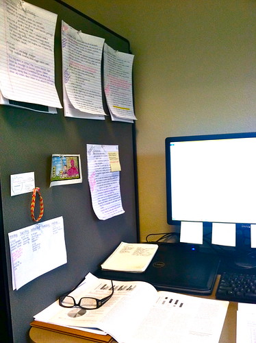
The days leading up to and after the workshop have been some of the most exciting and nerve-wracking yet. I also think that I could not have learned more in such a short amount of time. We’ll start from the beginning of the madness; approximately one week before the event, at this time all parties involved started to get a little anxious, with the pre-workshop groups still working vigorously on straw documents on communications and management protocols, workshop participants started turning to me to inquire about the status of things. This was in addition to the regular logistics emails from everyone from workshop participants to steering committee members, so before I knew it I was inundated with so many conversations and tasks my usual hand-scrawled to-do list couldn’t quite handle the level of organization I needed to get everything done. Half-way through the week things seemed to settle down, I was as caught up as I could be while waiting on a final agenda, straw documents, and travel reimbursement documents. and, then BOOM, everything I was waiting for and more came in, including the seemingly innocuous task of creating name tags.
A very important lesson I learned through this process is not to defer any decision to only one cook. I made the task of creating name tags infinitely more difficult when I didn’t let every cook in the workshop kitchen put in their two cents about name tags. Some (including myself) believed a stack of blank stick-on tags would be quite sufficient so that information about name, title, affiliation would be correct given the amount of time left to verify and generate name tag information. However, others believed at least the steering committee and organizers should have pretty printed name tags, and once I approved this plan and sent out a list of names, titles and affiliations to be approved by the rest of the steering committee the plan for name tags was forced to change several more times. Apparently there is a lot of ways to make name tags: in color, with affiliation and title, with affiliation only, with affiliation and the workshop title, in hanging plastic holders, in clip-on tags, on stickys, printed professionally, printed in our office, and so forth. I’m pretty sure each possible combination was considered given the amount of supplies and time at our disposal. Eventually, we figured out a way to keep everyone happy and also was within our means to produce, and it only took 4 hours to figure out. Next step was to go to the list and make sure (checked and double-checked) that names and affiliations were accurate. Once this was done, I happily accepted to help of my coworker Linda Larsen to type and print name tags. This was actually very fortuitous as other last-minute and off-the radar tasks came in.
The surge of activity continued into Monday morning as I tried to tie up as many loose ends as possible before heading up to Portland for one last meeting before the workshop Tuesday morning. Loaded down with a box of name tags, flip charts, pens, and registration list I eventually made it to Portland. The event probably wasn’t nearly as stressful as I think it was, but I think it seems that way mostly because of the daily nightmare that constituted my travel in and out of downtown Portland and Portland State University’s campus. Of the 3 times I had to get my way downtown each time I had a printed set of directions, once I immediately got off track and ended up lost, another time my directions lead me in an endless circle of one-way streets to nowhere, and Finally the very last time I made it back to he PSU parking garage where I paid exorbitant prices for all-day parking without any trouble. I think I can attribute much of the stress I felt those days to these hair-pulling adventures. And then there was the actual workshop, after I scrambled to get a registration table in order, name-tags packed away in their holders I actually got to sit back and watch the days unfold.
Because the 90-some participants came from a variety of different backgrounds and familiarity of Aquatic Nuisance Species and Tsunami debris issues, the first part of day 1 was spent giving introductions to the topics and updates from representatives from each state or province involved. States involved included Alaska, Hawai’i, Oregon, Washington, and California and there also a representative from Canada. This piece in particular was pretty interesting, because despite my efforts to keep up-to-date with all the goings-on in the different states, the ultimately is a big difference in the organization and structure of each state’s responding/involved agencies and this translates in a lot of ways in how apparent their efforts are. It was also interesting to think about how the geographic configuration of each state/province’s coasts has a large impact on any response and monitoring protocol agreed on regionally.
The rest of day one consisted of breakout groups, where different groups were assigned different pieces of the straw communications protocol document or the management straw document to discuss and offer suggestions for clarification or improvement. I served as a note-taker for one of these breakout groups and though that too, was a very interesting role where I had to be quick and efficient, but also be able to synthesize along the way so that my notes were coherent and representative of flow the discussion.
After many more talks and summaries of the breakout group discussions, I was pleasantly surprised and refreshed by a very detailed talk from phycologist, Gayle Hansen, who worked on identifying over 20 different algal species from the dock in Newport and a boat in Cape Disappointment. Her talk was very detailed, as she went into many of the different taxonomic tools and methodologies she used to identify species, some she was at first convinced were novel! This talk in particular, was useful to demonstrate the range of professionals present at this meeting, we had representatives from a range of NGOs, tribes, congressional staffers, and state and federal agencies. In the end, I think this truly was one of the major successes of the workshop, to bring all these people across the region together in one room to discuss these issues, but also more simply, to make each other all aware of who and where people are working on these issues, and how to get in contact with them. Silly for sure, but in my survey of logistics tasks to take care of I never thought about sending the detailed participant list that I have been working on for weeks out to everyone who attended the workshop. After having several people inquiring and request it though, the list went out during the workshop.
In the end, it is just the beginning however, and just as I thought my work here was done, there is still much to be done. Now the pre-workshop groups are post-workshop groups and they and the steering committee will begin re-drafting documents and deliberating over the next steps to implement a viable regional response protocol. Only more exciting news on the JTMD-AIS front to come!
This week I finished up pressure counts and interviews at Cape Perpetua. I am honestly going to miss spending time in this area, I have witnessed so many amazing and strange things here over the past month. Highlights from this week include trying to give surveys while grey whales spout in the background. At first I tried to use the whales as an excuse to talk to visitors…”hey do you see the whales out there, oh by the way would you be willing to take a quick survey…” This worked well until I had to start taking 2 minute breaks in the middle of the survey while we gawked at the whales. Whales have a strange power over people, I saw a family of 4 resting in their car until one of them spotted the whale and at first I thought there was an emergency the way all 4 of them immediately burst out of the car and sprinted to the nearest lookout.
This week I found several people to survey with a lot of interest and stake in marine reserves decisions. One man I talked to comes up to the central coast every summer to fish and he had helped out with previous ODFW marine reserves research at Redfish Rocks in Port Orford. Another man owned his own commercial fishing guide service in the area. I keep thinking that after 125 surveys I should be able to predict peoples’ answers based on their demographics and what they tell me about themselves, but people catch me off guard all the time. I was definitely expecting the fishermen to be against marine reserves, several of them have seen them successfully implemented in their home states and see benefits of them if they are implemented correctly.
Outside of work I have been watching as much of the Olympics as I can squeeze into my day. One of my former teammates at OSU and dear friend, Patricia Obee is racing in the lightweight double (Rowing) for Canada in London and another one of my best friends is also there cheering her on. It definitely makes the Olympics seem more real when I have raced both with and against many of the women competing!