Finding the Conservation-Management Balance

Hello everyone!

My name is Kendall and I am a new Sea Grant scholar, a 2021-2022 Natural Resource Policy Fellow, stationed in Charleston on the south coast. I was matched with the Oregon Department of Fish and Wildlife at the south coast field office to work with management to develop a conservation and fishery management plan for a currently closed recreational fishery.

It has been a hectic and rewarding start to my fellowship so far! I have been researching conservation and fishery management plans and working with my fellowship host to build the framework for the imperiled red abalone (Haliotis rufescens) fishery. I already had a background in fisheries and particularly with the history of the red abalone fishery in Oregon, due to my position at ODFW as a shellfish biological aide prior to graduate school. What I did not have was a familiarity with the difficulties in creating a new type of management plan that considers multiple objectives and viewpoints that might counteract one another.

The most interesting revelation I have had so far during this process is that writing a conservation and fishery management plan is not common for fisheries, and is quite different from a typical fisheries management plan. The most imperative way it differs has to do with the concept that this management plan does not mean that there will be a fishery. Instead, there are two simultaneous objectives that could naturally be seen as opposites. The first objective is to protect and conserve the species in question, and the other objective is to develop a fishery for that same species. Working through this process so far has been a unique exercise in recognizing, appreciating and applying different stakeholder perspectives. Often it seems that agencies, organizations and individuals view these objectives as contrary to one another, and further, that one objective and perspective nullifies the other. My main task is to take each perspective and goal and find ways to merge the two together to benefit the red abalone population in Oregon, as well as honor the cultural, social and economic importance of the resource. I look forward to learning more about each perspective and working towards a common goal to create a sustainable, socially and biologically conscious fishery while continuing to explore the specifics of conserving an elusive and fascinating invertebrate species.

thanks for the memories!

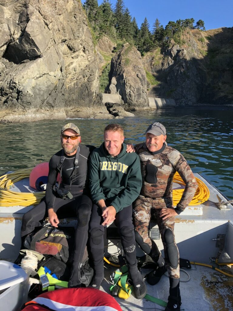
Well, I guess this is it…

It’s hard to believe this is the end of my fellowship. It all happened so quickly, but I am extremely grateful for the experience, opportunities, and friendships made in the process. Since this project will take several years to complete, I am satisfied with the progress we have made so far. Overall, Oregon and Washington are closer to Geographic Location Descriptions (GLDs) for seabed mining, seafood processing discharge, and offshore aquaculture. While some are closer than others, I believe each coastal program is equipped with the tools necessary to finish the product. We also were able to complete a Guidance Document for other Coastal Programs who wish to pursue GLDs in the future.

Geographic Location Descriptions are one of the many tools available to Coastal Programs, including the Oregon and Washington Coastal Management Programs. These documents allow the Coastal Program to review activities outside of the coastal zone for reasonably foreseeable effects to coastal resources. These resources span from recreation and tourism, to fishing practices in state waters. Each of these uses/resources must be balanced with the authorization of an activity in federal waters that is shown to have those effects.

 Seabed Mining

Seabed mining is something most Coastal Programs should plan for, as it is likely to become an emerging use in the future. Scientists have estimated that it is only a matter of time before mining activities shift their focus on the mineral resources found in the ocean. As technology evolves, and the resources found on land become more finite, it can be inferred that seabed mining will be an emerging use. To best prepare for these activities and the reasonably foreseeable effects to coastal resources, both Oregon and Washinton have begun to prepare a GLD for offshore seabed mining. This GLD will ensure each Coastal Program has a seat at the table, as it coordinates with the relevant federal agencies. Under the Coastal Zone Management Act, and its implementing regulations, federal agencies are tasked with coordinating with State Coastal Management Programs to ensure that those federal actions are consistent with enforceable policies located in the coastal zone. In this case, there still needs to be more information known about the technology, but the reasonably foreseeable effects are well delineated. Some of these effects include permanent changes to benthic habitat, water quality degradation, and other natural resource management concerns. This work has been critical to each Coastal Program as they find more information, so much so, that the Washington State Legislature and Governor placed a moratorium on seabed mining activities in the coastal zone. This moratorium is encouraged because it has been put in place before political concerns are taken into account.

 Offshore Aquaculture

As of today, the US has remained focused on developing aquaculture facilities in both the nearshore and offshore. The main goal is to decrease the amount of imported seafood that the US relies upon each year. For this reason, the federal government has remained focused on siting facilities in US waters every four years. A GLD will ensure that concerns for natural resources will be discussed prior to authorization. Some of these things include excess nutrient

input, HABs, OAH, competition with the fishing industry, and other relevant/valid issues with an offshore aquaculture facility. The three main types of aquaculture were considered in developing the analysis of reasonably foreseeable effects of aquaculture siting on natural resources. The three main types of aquaculture are: finfish, marine vegetation, and shellfish. Each of these types of aquaculture have impacts to coastal resources and uses, so the Coastal Program remains focused on coordinating with the relevant agencies on developing the framework for siting these facilities in the future. These impacts will be helpful in starting the conversation, in the same way the BOEM Wind Energy Task Force uses the information in the Marine Renewable GLD to determine what the reasonably foreseeable effects could be.

 Offshore Seafood Processing Discharge

This is probably the activity I spent the most time on. Starting in 2015, the State of Oregon and the EPA began coordinating on a permit for offshore seafood processing discharge on the Oregon and Washington continental shelves. Unfortunately, the two agencies were unable to reach an agreement on the coastal effects of the authorization of the activity. One of the primary points of disagreement was that each agency needed to know a lot more information about the oceanographic currents, where the material is going, what the respiration rate is of the material, etc. During my fellowship, I was able to bring this permit to the EPA’s enforcement division along with creating a coordination process with the Quileute Tribe, Quinault Tribe, the State of Washington, the State of Oregon, and the EPA. This coordination group meets quarterly to discuss the complexities of permit enforcement and how to ensure the reporting information can be used to inform the next iteration of the permit in 2024.

 GLD Guidance Document

Due to the gray area involved in drafting GLDs, I was able to help draft a Guidance Document for GLDs. This document discusses the complexities that come with undertaking these projects, especially when the technology is so new. For example, seabed mining is not a practice in the US, so it is difficult to ascertain the types of impacts to key coastal resources without further research. This document should be in publication within the next year.

Final Note

This has been a fantastic opportunity, and I wouldn’t trade it for the world. I feel better equipped to take on a career in coastal management, and am incredibly excited to see what’s next. In the meantime, I was able to participate in a podcast with Felicia Olmeta-Schult to discuss lessons learned from my fellowship, and other information about coastal management.

Differences I observed going from academia to government

As I transitioned from academia to a government agency, I noticed some similarities between the two. In both places I have worked with an incredible lab/team that are always willing to help figure out why some R code isn’t working or review a paper. Also, in both places I have been constantly learning new things and testing my skills. On the other hand, I have noticed many differences between my experience as a graduate student at the University of Florida and as a fellow with the Marine Reserves Program at the Oregon Department of Fish and Wildlife (ODFW).

One major difference between the two places is how I speak about my research. As a student I was allowed to be an advocate. I could speak about wanting to expand protected areas and conserve all species to my heart’s content. It was practically expected of me to have these strong opinions about conservation and discuss them openly. Working for a state agency, the expectation is exactly the opposite. I now must be impartial in my word choice both in person and in writing. Though I work for the Marine Reserves Program, I am not an advocate for marine reserves. I am simply studying how the marine reserves may have impacted communities and presenting these results in a straightforward manner. If I take a strong position on marine reserves, the public may lose trust in my ability to conduct unbiased research. If the public loses this trust, they are less likely to support the agency and follow agency regulations. This trust is crucial, but also fragile.

Another difference between academia and government is the type of research being conducted. In academia, the focus is more on what is interesting and would advance the field. In government, the focus is on achieving the mandate. Therefore, our research options are limited and must be strictly applied research rather than theoretical. We also must be transparent about our research and where funds are going since we are a largely tax-funded agency. This is another important component of building that trust.

Government agencies typically work on projects with larger scale timeframes than what graduate students are involved in. While long-term monitoring projects are typically considered boring and unpublishable in academia, these types of data are the bread and butter of ODFW reports. We are constantly monitoring fish stocks, commercial fishing pressure, license sales, oceanographic conditions, etc. Most of these data are written up in annual reports and used to inform management. While long-term monitoring is generally not considered “sexy” research, it is extremely useful to have these historical datasets to understand how things have changed over time. I am using many of these historical datasets in my current work looking at how marine reserves may have impacted factors like recreational anglers’ Catch Per Unit Effort (CPUE), commercial fishing employment, and coastal communities’ socioeconomic conditions.

Lastly, one of the best changes I experienced when going from academia to government was an increased focus on having a work-life balance. In graduate school I was applauded for staying in the lab late and working on weekends. In my current position, I am expected to only be working 40-hour weeks and taking weekends off. We spend time in our weekly meetings discussing general life announcements that aren’t marine reserves related in the slightest. We even share good places to hike, mountain bike, snowshoe, camp, etc. because we know we will all have time to do these fun hobbies.

These are some of the major differences I observed in my life going from academia to government. These are solely based on my personal experience and are likely not applicable to everyone that made this transition.

How do we know if marine reserves influence recreational fishing communities?

We’ve almost made it! The year 2020 is just about to end and 2021 is right around the corner. Though many issues that were highlighted in 2020 won’t be going away in 2021 and need to continue to be addressed, there are some things to look forward to. Just this month, healthcare workers started receiving the first round of the COVID-19 vaccine. As more and more people get vaccinated, we will hopefully see the end of strict quarantine measures in the near future. Maybe we will even be able to spend the 2021 holidays with family without a mask in sight! 2021 will also bring a new administration with climate change as a top priority, which will likely influence ocean policies and management. So, while 2020 was an important year and we should not forget what we learned in it, here’s to hoping that 2021 doesn’t throw us any detrimental curveballs.

Now that you’re up to date on some of what’s happening in the USA, let me update you on what I’ve been working on. In my last blog post I outlined how I’m using the Oregon Department of Fish and Wildlife’s (ODFW) daily angling license sale data to determine if marine reserves have influenced recreational fishing. Since people are no longer able to fish in the marine reserve sites, we might expect this to result in fewer licenses purchased in towns near the reserves post implementation. This might also be observed by an increase in licenses purchased in towns further from the reserves.

However, whether or not people decide to go fishing is just one aspect of measuring a potential reserve effect on recreational fishing communities. For those that do decide to go fishing, how much they catch and over what time period is another crucial component. This metric is referred to as Catch Per Unit Effort (CPUE). For our analysis, we calculate CPUE by dividing the total number of fish caught by the number of anglers aboard the vessel and by the number of hours fished. This creates a standardized metric whereby we can compare fishing trips with varying numbers of anglers and hours fished. Specifically, we can compare CPUE reported at docks near marine reserves pre- and post-marine reserve implementation. We might expect that marine reserve site closures could increase effort, thereby decreasing CPUE, by forcing anglers to spend more time traveling further to avoid the reserves. On the other hand, we might expect site closures to increase catch, thereby increasing CPUE, due to spillover effects whereby a greater abundance of fish inside the reserves leads to a greater abundance of fish outside the reserves.

Lucky for me, ODFW has been collecting the information I need to calculate CPUE through the Ocean Recreational Boat Survey (ORBS).  This is an annual survey of Oregon’s marine recreational fishery that estimates both catch and effort at the top 10-11 ocean access points. This survey was first developed in 1979, but the original focus was on generating accurate salmon estimates in a timely manner. The ORBS survey has since expanded and provides valuable data on stock abundance and health for many species, which is used for management purposes.

By looking at both daily angling license sales as well as CPUE on charter boats, we should be able to uncover any potential marine reserve effects on the recreational fishing community. Of course, there are many covariates to take into account that could influence CPUE, such as catch regulations and environmental variables. I won’t dive into this right now, but maybe another blog post detailing the difficulties of finding downloadable historical buoy data without huge gaps is in order. Signing off for now, happy New Year!

Working with the data you have

Amid the chaotic nature of this summer with COVID-19, protests, wildfires, and an upcoming election, I have managed to seamlessly transition into my second year as a Natural Resource Policy Fellow with the Oregon Department of Fish and Wildlife (ODFW). Over the next year, I will continue to evaluate the impacts of marine reserves on coastal communities, communities of interest (e.g. commercial fishers), and ocean users (e.g. tourists).

Over the last year working on this mandate I have discovered that there are no perfect data sources to answer this question. Data often have errors associated with insufficient sampling in small communities, issues with changes in methodology, or are simply not available for the years or communities of interest. However, we can’t let these issues stop us. Therefore, we are gathering and analyzing relevant data from as many sources as possible while documenting the limitations of the data.

One source of data we have used are ODFW’s one- through seven-day fishing and shellfishing license sales. Implementing marine reserves closes off any extractive activities within that area. Therefore, we might expect that daily fishing and shellfishing license sales in communities located near marine reserves would decrease following reserve implementation. However, we also need to control for the historical trend in license sales on the coast. If license sales are decreasing in towns located near reserves, but also decreasing across the entire coast, then this reduction may be caused by something other than the reserves, such as a change in culture.

License sales are just one example of the data we are using to analyze marine reserve impacts. While we don’t always have perfect data to work with, using the best data available from multiple sources should be sufficient to understand if and how marine reserves have impacted communities.

Update on Current Research and Reflections on the 2020 Census

While I had hoped that this summer would be full of trips to sunny, salty, sea lion filled Newport to mentor ODFW’s Summer Scholars, unfortunately everyone is still working remotely. Though I have heard from my Newport-based coworkers that this pandemic is not stopping the hordes of tourists from flocking to the coast for celebrations such as the recent 4th of July.

One of the main projects that I’ve been working on this summer while stuck in Bend (there are worse places to be stuck!) is understanding if marine reserves have influenced socioeconomic conditions in communities located near them. To investigate this, I first had to gather information on the socioeconomic conditions of coastal communities over time. I used the Census Bureau’s American Community Survey 5-year estimates from 2010 to 2018. While accessing data prior to 2010 would be ideal, the first 5-year estimate summary tables were only released in 2010, so we work with what we got.

After collecting all of these data, the exploratory analyses began, as did the true test of what I can remember from those statistics courses long ago and how far my R coding skills can take me. These exploratory analyses include tests and visualizations such as correlation plots, non-metric multidimensional scaling plots, bubble plots, vector analyses, principal component analyses, PERMANOVAs, the list goes on. When working with complicated multivariate data, I have learned that exploration is key to understanding what is really shaping your data.

I have also been trying to figure out what my control and treatment communities should be. With this first approach, I am considering treatment communities as those that are located <15km from a marine reserve. Control communities are therefore all coastal communities located >15km from a marine reserve. Since the marine reserves were phased in over time, I have three separate treatment groups. The 2012 group includes communities located near Redfish Rocks Marine Reserve and Otter Rock Marine Reserve, the 2014 group near Cape Perpetua Marine Reserve and Cascade Head Marine Reserve, and the 2016 group near Cape Falcon Marine Reserve. While this approach is a good first step, I will likely need to consider if other groupings or controls would be more appropriate. One method I am currently researching is creating a synthetic control by weighting non-treatment communities based on socioeconomic similarities to treatment communities prior to marine reserve implementation. But I won’t get too into the weeds with that statistical discussion here for everyone’s sake!

As I’ve been working with these census data, I’ve been thinking about the unfortunate timing of the decennial census this year. The Census Bureau conducts a survey every ten years with the goal to obtain a comprehensive snapshot of households in the United States. Unfortunately, the census this year coincided with a massive pandemic leading to significant economic loss and unemployment and the consequences that follow that loss. When future researchers use the decennial census to look at change over time, they are going to see data from 2020 that is not representative of the previous ten years, which will likely impact their analyses. I’m assuming that this data issue will lead to many footnotes in future papers. Luckily I will only be using data through 2019 (once it is made available) since the 2020 data will not be made available until after the marine reserve synthesis report is due.

A Data Scavenger Hunt for a Geographic Location Description

Wow! I can’t believe I am already 8 months into my Fellowship with DLCD, it really has flown by! As I look back, I think one of the main things that have stuck out to me is how close-knit this community really is. It takes several different entities to have a coastal “blue economy” up and running, including resource managers, fishermen, hotel and recreational employees, etc. Each of these people give a unique perspective to coastal management, and I am very excited to continue to grow these relationships in the final 4 months of my fellowship!

My main project has involved looking at the reasonable coastal effects of offshore seafood processing discharge, and writing a document known as a Geographic Location Description (GLD). This GLD will allow the state to review federal activities or federally authorized activities listed in the document, and approved by NOAA. Over the course of my fellowship, I have been able to gather a majority of the data necessary for the state to begin to understand these effects, and map areas of concern. For example, we are aware that land-based processing facilities discharge high impact wastewater; meaning this wastewater has a high Biological Oxygen Demand (BOD). Research has shown that certain areas that are being discharged into have also seen a recurrence of low dissolved oxygen waters. One of the concerns is that these waters mix with state waters resulting in larger hypoxic events along the shelf. While these discharge events are not the sole cause of the hypoxia, we can infer that it most likely cannot help. Issues like these have been at the heart of my project, and it has been very interesting collaborating with resource managers, academic professionals, industry officials, and others to help gather the information necessary for the GLD. (I like to think of it as a scavenger hunt!)

Due to the pandemic response, I am also blessed to be working from home on my project. It was definitely an adjustment at first, but I feel like I am more used to working from my living room now! As I am rounding the corner of my fellowship, I hope to have a GLD ready to turn into NOAA. If not, I hope to have DLCD much closer to having one, than when I began!

Working through a pandemic

Times have certainly changed since my last blog post. With all of the COVID-19 health measures in place, the agency I work for (Oregon Department of Fish and Wildlife [ODFW]) has moved to primarily telecommuting. For me, this isn’t a huge difference since I was already working mostly remotely and have developed a routine to maintain productivity and minimize distractions throughout the day. However, I imagine that it is quite a big change for most of my coworkers that are used to working in the Newport office.

One measure my team, the Marine Reserves Program, has taken to ensure connectivity during these social distancing times is weekly virtual meetings. We start the meeting by each sharing a tip we have learned to improve this isolating experience or a suggestion we’ve heard for how to help out our community during this difficult time. Given the active nature of my team, tips often include taking the dogs on long early morning walks, setting up virtual exercise classes with friends, and making time for lunchtime yoga to keep routine and movement in your day. Suggestions for helping the community include purchasing food from local businesses and getting involved with volunteering where possible (e.g. helping distribute meals or groceries to those unable to leave their house).

Starting our weekly meetings on a positive, team-focused note makes me look forward to these Wednesday afternoon get-togethers. We’ve even started adding in silly components to distract from the seriousness of the real world and allow for us all to have a laugh. Last week we donned silly hats for our meeting, which allowed me to see my boss (Tommy) wearing his daughter’s bunny ear beanie with wire cat ears on top. Quite a sight!

While these meetings are used to keep us informed of any ODFW COVID-related changes, their primary purpose is really to keep our team connected. During this time of social isolation, staying intentionally connected is more important than ever for our mental health. I feel very lucky to be part of a team that takes the time to check in with their coworkers in both a personal and professional manner.

Oregon marine reserves evaluation – what about the people?

These past three months I have been serving as the Natural Resource Policy Fellow (NRPF) with the Oregon Department of Fish and Wildlife’s (ODFW) Marine Reserve Program. My position is focused on understanding the effects marine reserves may be having on coastal communities and visitors.

First, a little background on the marine reserves. Oregon’s five marine reserves were phased in from 2012 to 2016 and they currently make up 9% of the territorial sea. The territorial sea just means Oregon’s state waters, which are less than three nautical miles from the shore. There are no extractive activities or development allowed in the marine reserves. However, each marine reserve has adjacent Marine Protected Areas where some extractive activities are allowed. These marine reserves can be thought of as being in a trial phase. The Marine Reserves Program, including the management, scientific monitoring, outreach, community engagement, compliance, enforcement, and funding for the marine reserves, is up for evaluation beginning in the year 2022. The Scientific and Technical Advisory Committee (STAC) will choose an Oregon public university to prepare a report on the Marine Reserves Program for the Oregon Legislative Assembly.

One of the primary marine reserve goals was to “avoid significant adverse social and economic impacts on ocean users and coastal communities”. This goal was set in 2008 in the Oregon Marine Reserve Policy Recommendations document developed by the Oregon Ocean Policy Advisory Council (OPAC). This is where my position as an NRPF comes in. To determine if there have been any marine reserve impacts, we must compare socioeconomic data prior to marine reserve implementation and after marine reserve implementation. There are many different approaches we are using to achieve this goal both in house and with academic and professional collaborators. For example, we are comparing changes in socioeconomic indicators (e.g. per capita income) in communities near and far the reserves using census data. We are also looking at the potential economic loss to fishers with benthic species mapping, fish ticket data, and logbooks. We are also assessing whether there are any changes to visitor use at the shoreline adjacent to marine reserves with visitor surveys and observation counts. These are just a few of the many examples I could provide.

During this brief time that I have been a NRPF, I have already learned a great deal. I was even tasked with writing a literature review on stakeholder engagement and creating literature-based definitions for the terms stakeholder engagement (in general), informal stakeholder engagement, formal stakeholder engagement, stakeholder, and outreach. This literature review will be used to help evaluate the communications side of the Marine Reserves Program. I am looking forward to continuing to grow in this position while contributing to a project that I consider an important tool for natural resource management. Now, I will leave you with a picture of my dog (Moose – she’s from Alaska, hence the name) enjoying Newport’s South Beach.

Moose the golden retriever at South Beach, Newport

Natural Resource Policy Fellowship with the Department of Land Conservation and Development

Posted on Behalf of Nick Tealer

I have truly enjoyed my experience at DLCD so far. We have been extremely busy with public engagement meetings, Commission meetings, state agency collaboration, and so much more! It is encouraging to see this many people passionate about conserving our oceans and protecting vital habitat for threatened/vulnerable species.

While there have been many highlights in my 4 months here, I can say that my experience in Florence was the pinnacle. Every fall and spring, the OCMP Team meets with Coastal City/County Planners to help inform them about legislative developments, agency developments, and other information helpful to urban planning in the coastal zone. The amount of enthusiasm and ingenuity at those engagement hearings were great to see, and be a part of. In that same trip, the OCMP team was able to explore the Heceta Head Lighthouse, and the Florence Dunes. While I have been in Oregon for three years, this was one of my first trips to the south coast, and I truly enjoyed learning about this region’s history.

Blue and purple morning sky above the Florence, Oregon dunes.
Florence Dunes in the morning. Photo by Nick Tealer

The relationships I have made throughout this experience have been fantastic. The staff has been extremely accommodating and welcoming to me, as well as other state agency officials that I have had the pleasure of contacting. Ranging from DEQ to ODFW, my experience in coordinating with other state officials has been rewarding. I hope that this trend will continue as I become more experienced in the field of marine policy and habitat conservation.

View of the sunset over the ocean. Heceta Head sea stacks in the foreground.
Beach next to Heceta Head where we had burritos on the beach. Photo by Nick Tealer