
The Buzz: Trask River Dam Removal & Netarts Bay UAV Flights
Finding a Takeoff/Landing Site at a Trask River Dam
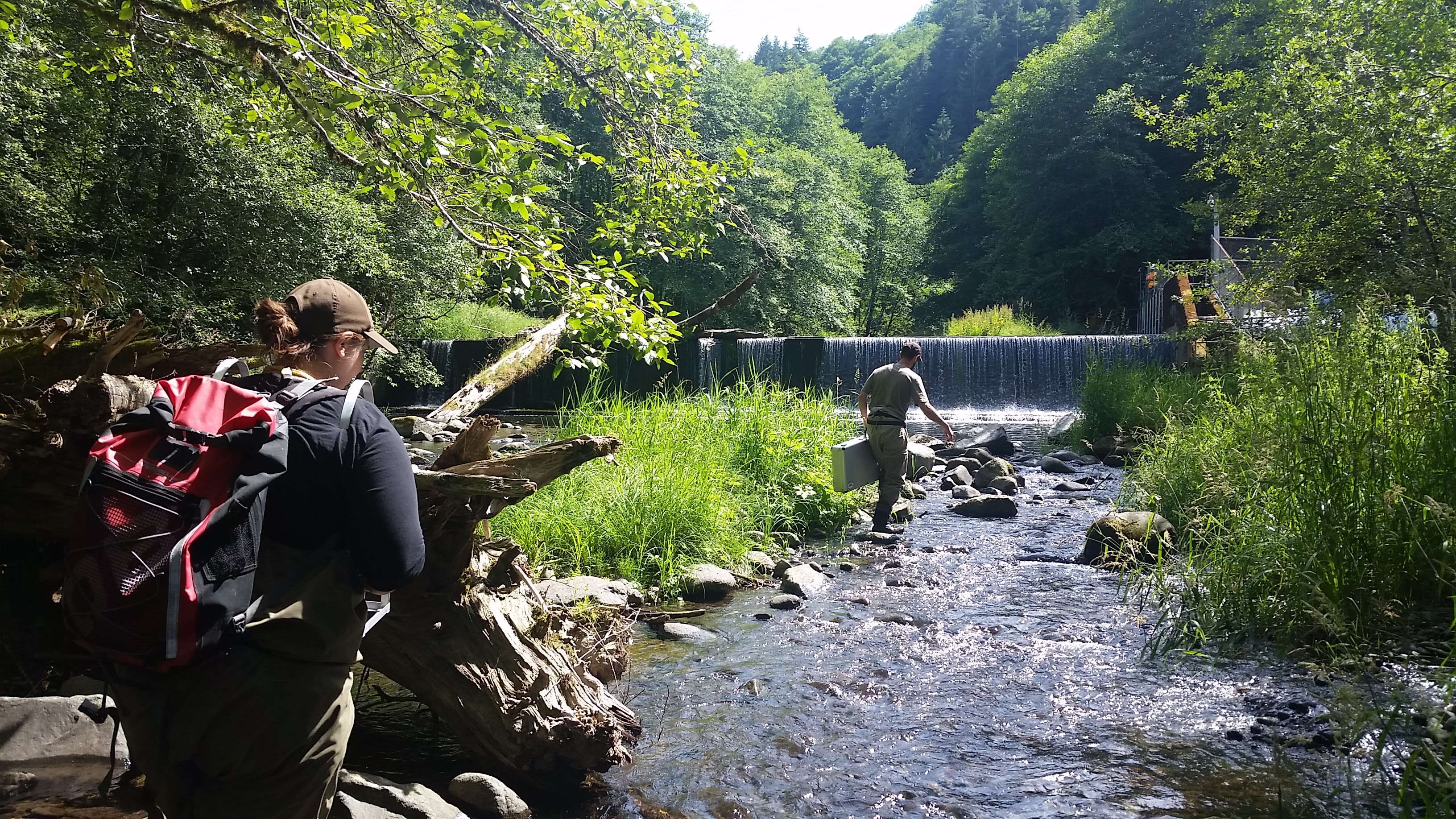
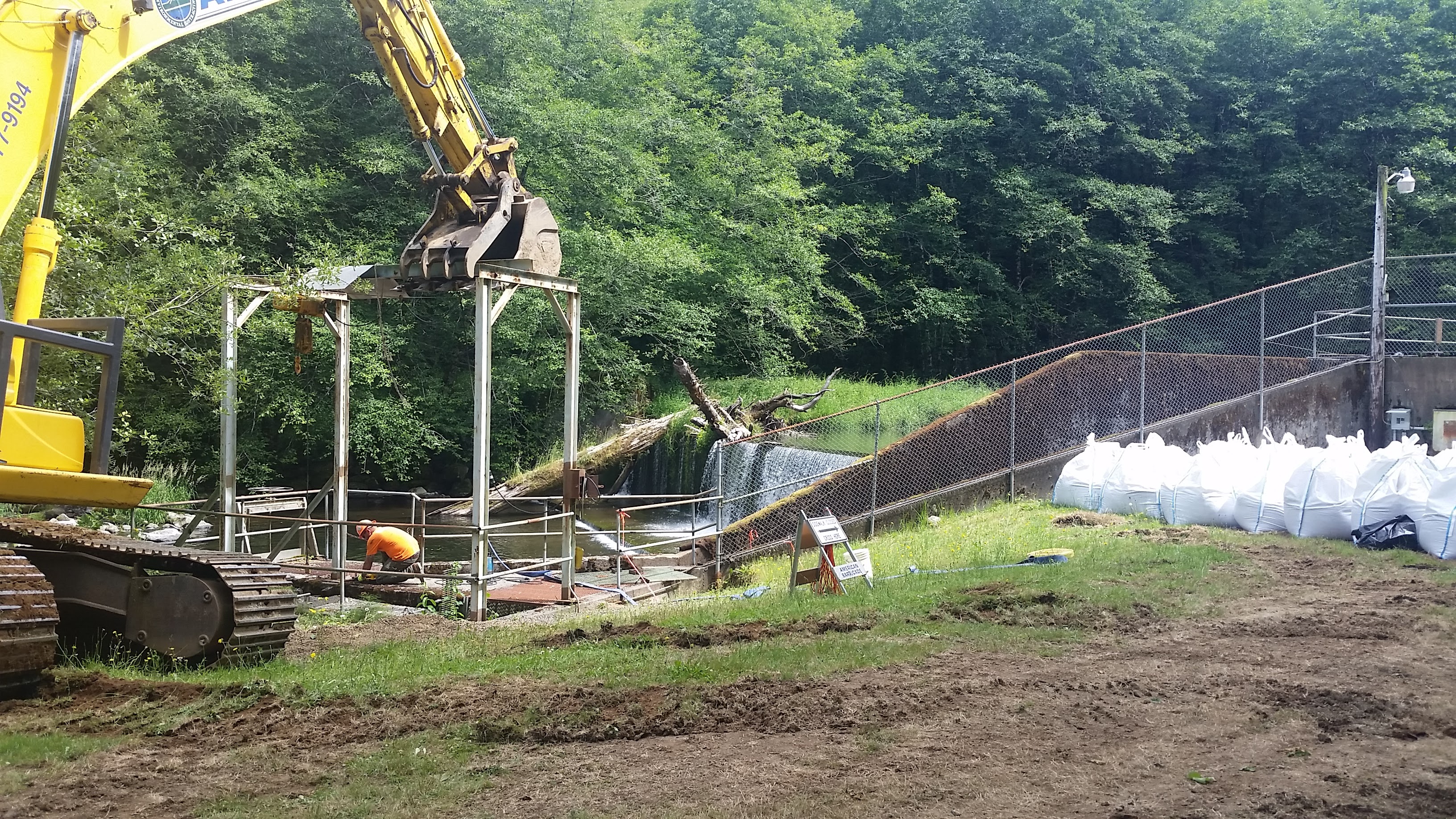
Trask River Dam Removal: 18 Miles East of Tillamook lies a small fork of the Trask River and the remnants of a very small dam. One day prior to the removal of the dam wall, I had the opportunity to tag along with Erik Suring (Project Lead for Salmonid Life-Cycle Monitoring, Western Oregon Fish Research and Monitoring Program and ODFW UAV pilot) as well as SEACOR’s resident UAV expert, Liz Perotti, to capture pre-removal aerial photography with UAVs. The dam was originally built in the 1970’s to support the operations of a hatchery/rearing pond co-located with the dam. Following recent studies on dams, fish ladders, culverts, and other barriers’ impact on fish passage (particularly anadromous fish or those that travel from salt to fresh water to spawn such as salmon and steelhead), dams across the country have been targeted for removal by State governments. Ideally, we will be able to return to aerially observe the “after” effects of the dam removal such as the movement of 40 years of built up sediment. Check back soon for a view of the final product!
Dam Removal In Progress

Makeshift Plywood Landing Pad
Netarts Bay UAV Flights: It is easy to imagine flying UAVs being quite simple: you can automate their flight paths, algorithms keeps them stable in the air, and just about anyone can afford one these days. Now throw in a camera you have to stabilize and calibrate, prepare a specific mission to capture aerial photographs, work in a narrow low-tide window, anticipate daily weather, troubleshoot technical problems, ensure there are no people under your flight path, file a Notification to Airmen with the FAA, plan your landing/takeoff area, and… well, it gets complicated quickly to say the least. Camera settings need to be set: focus, ISO, shutter speed, aperture. Time of day has a massive impact on the quality of photos and unfortunately, opportune weather and good lighting rarely align with low tides. While our UAV is rated to fly in up to 40 mph winds and maintaining smooth video, flying in gusts while taking stills is much more difficult. During the UAV flights, we have several other concurrent tasks needing completion to ensure our UAV aerial imagery can be used for measuring: our GPS RTK ground-truth survey of the GCPs which are evenly distributed over our project area (~1km2) and the evaluation of randomly distributed quadrats for eelgrass, macroalgae, and clam shows. Each of these tasks have their own set of challenges. With each flight we conduct, I realize that the need for near-perfect conditions becomes more of a necessity than a hopeful wish. We shall see how our efforts panned out soon. In the meantime, I have plenty of computer processing tasks to be completed.

Autopilot Takeoffs, Manual Landings…
Next Week: Orthomosaics, Bathymetry RTK Surveys
Week 4 might be renamed “comfortable with acronyms week” – RTK / GCPs? I’m curious about your methodology – what will the photos help you measure, and what are the broader ecosystem ramifications? Might other optical techniques (such as infrared imagery, or Light Detection and Ranging (aka LIDAR)) give you additional information beyond still photos?
It’s always shocking to me how relatively easy a research project seems when you first think of the idea, but then when you are actually implementing the work there are billions of tasks and procedures to plow through in order to have a successful project. SEACOR is lucky to have you this year!
Hi Sarah, I hope my previous posts exposed people to the majority of the acronyms I’ll be using from here on out. Now that the terms are out there, I can delve into the really ridiculous acronyms such as the acronyms inside acronyms! Currently, we have hopes that these UAV missions will consistently show the same information i.e. visible clam shows, shrimp burrows, eelgrass and macroalgae, as well as other key habitat identifiers and health indicators. If the information we collect is indeed consistent, we can explore how we might use it for shellfish management, habitat assessments (particularly for the invasive eelgrass, Zostera japonica) and population assessments of various crustaceans and shellfish. If that is in our future, we will explore automated categorization of the unique pixel signatures each feature we are looking for reflects (also called spectral signatures). Multi-spectral imagery would expand our capabilities by as many wavelengths of light we could collect. Near Infra-red and Infra-red wavelengths in particular would allow us to investigate/assess chlorophyll and other vegetative qualities. Even if we did not use the data, that information could potentially benefit other researchers. Unfortunately, acquiring multi-spectral sensors is not within our budget at this time. Maybe someday in the future? Or perhaps a team budget or arrangement can be made with spectral scientists/environmental scientists. I’m not entirely sure what the utility of LiDAR would be in our application, but its ability to penetrate shallow water could be useful for creating more accurate 3D models of the estuaries we are working in. But again, unfortunately LiDAR sensors are too expensive for us to play around with at this time.