OSU unveils new maps of Oregon ocean

Map of sea floor off Cape AragoCORVALLIS – After more than two years of intense field work and digital cartography, researchers have unveiled new maps of the seafloor off Oregon that cover more than half of the state’s territorial waters – a collaborative project that will provide new data for scientists, marine spatial planners, and the fishing industry.

The most immediate benefit will be improved tsunami inundation modeling for the Oregon coast, according to Chris Goldfinger, director of the Active Tectonics and Seafloor Mapping Laboratory at Oregon State University, who led much of the field work.

“Understanding the nature of Oregon’s Territorial Sea is critical to sustaining sport and commercial fisheries, coastal tourism, the future of wave energy, and a range of other ocean-derived ecosystem services valued by Oregonians,” Goldfinger said. “The most immediate focus, though, is the threat posed by a major tsunami.

“Knowing what lies beneath the surface of coastal waters will allow much more accurate predictions of how a tsunami will propagate as it comes ashore,” he added. “We’ve also found and mapped a number of unknown reefs and other new features we’re just starting to investigate, now that the processing work is done.”

The mapping project was a collaborative effort of the National Oceanic and Atmospheric Administration, OSU’s College of Earth, Ocean, and Atmospheric Sciences, David Evans and Associations, and Fugro. It was funded by NOAA and the Oregon Department of State Lands.

The primary mapping platform was the vessel Pacific Storm, operated by the OSU Marine Mammal Institute. Oregon-based fishing vessels taking part in Oregon Sea Grant’s Scientist and Fisherman Exchange program – the F/V Michelle Ann, the F/V Delma Ann, and the F/V Miss Linda – assisted with ground truth sampling and video surveys.

NOAA, FEMA urge “Be a Force of Nature”

Be a Force of Nature - Pledge to Prepare“Be a Force of Nature” is the theme of the first-ever National Severe Weather Preparedness Week, starting this Sunday (Earth Day) and continuing through April 28.

The campaign is a joint effort by the National Oceanic and Atmospheric Administration (NOAA) and the Federal Emergency Management Agency (FEMA).

Daily themes will  target public awareness about severe weather hazards and encourage people to get prepared:

  • Monday: Know Your Risk
  • Tuesday: Make a Plan
  • Wednesday: Build a Kit
  • Thursday: Get a NOAA Weather Radio
  • Friday: Be an example for others to follow

Full details – including downloadable posters, media PSAs and emergency preparedness kit checklists – can be found on NOAA’s Weather-Ready Nation Website.

While the effort focuses on hurricanes, tornadoes and other catastrophic storms less common in the Pacific Northwest, Oregonians can still learn from the campaign, according to Patrick Corcoran, Oregon Sea Grant’s coastal hazards specialist.

In this region, coastal storms generally occur from November to March – but recent trends have shown earlier dates for the first storm and later dates for the last storm of the season. And offshore buoys have measured increasingly higher waves during winter storms over the past 30 years. A result has been more impacts by storms on people and infrastructure, from homes to highways.

“Some homes on cliff-backed beaches have found themselves precariously closer to the edge,” said Corcoran. “A few have fallen into the sea. Other properties in lower areas with dune-backed beaches are experiencing larger storm waves, overtopping of shore protection structures, and an overall increase in erosion.”

Corcoran pointed out that although the Northwest is generally spared from tornadoes and hurricane-strength storms, they can happen – and the region is also prone to seismic disasters including earthquakes and tsunamis.

“The steps NOAA recommends to prepare for catastrophic storms make good sense for the types of disasters we in the Northwest face, too,” he said.

Learn more:

Netcasts – Pat Corcoran, Coastal Hazards Specialist

In this episode of Netcasts, we travel to Astoria to visit Pat Corcoran, coastal hazards specialist for Oregon Sea Grant Extension.   Corcoran works with coastal community members and researchers around the world to prepare coastal residents for natural hazards, such as erosion and tsunamis.  Corcoran talks about his experiences bringing the findings of research conducted by OSU’s Peter Ruggiero to the community of Neskowin, where residents are exploring strategies to mitigate shoreline retreat.  Corcoran also shares some photographs and wisdom from his recent visit to Japan, where he was able to view the aftermath of the March 2011 tsunami.  Stay tuned to Sea Grant’s YouTube channel for more Netcasts.


Sea Grant’s Pat Corcoran on PBS News Hour tonight

Patrick Corcoran, Oregon Sea Grant’s coastal hazards specialist and an expert on coastal earthquake and tsunami preparedness in the Pacific Northwest, appears on tonight’s edition of the PBS Newshour as part of a piece titled “Risky Business in the Pacific Northwest.”

The report, by Newshour’s Tom Bearden reports on efforts to better understand liquefaction, a phenomenon that causes sandy soils to turn to liquid when a powerful earthquake strikes.  Liquefaction can cause untold damage and devastation, and Bearden talks about how Oregon scientists are trying to learn more about what causes it, and what happens:

Miss it on TV? Here’s the video:

Watch Risky Business in the Northwest on PBS. See more from PBS NewsHour.


OSU research finds “definitive” link between acidification and oyster collapse

Researchers at Oregon State University have definitively linked an increase in ocean acidification to the collapse of oyster seed production at a commercial oyster hatchery in Oregon, where larval growth had declined to a level considered by the owners to be “non-economically viable.”

A study published in the journal Limnology and Oceanography found that elevated seawater carbon dioxide (CO2) levels, resulting in more corrosive ocean water, inhibited the larval oysters from developing shells and growing at a pace that would make commercial production cost-effective.

As atmospheric CO2 levels continue to rise, the scientists say, this may serve as the proverbial canary in the coal mine for other ocean acidification impacts on shellfish.

“This is one of the first times that we have been able to show how ocean acidification affects oyster larval development at a critical life stage,” said Burke Hales, an OSU chemical oceanographer and co-author on the study. “The predicted rise of atmospheric CO2 in the next two to three decades may push oyster larval growth past the break-even point in terms of production.”

The owners of Whiskey Creek Shellfish Hatchery at Oregon’s Netarts Bay began experiencing a decline in oyster seed production several years ago, and looked at potential causes including low oxygen and pathogenic bacteria. Alan Barton, who works at the hatchery and is an author on the journal article, was able to eliminate those potential causes and shifted his focus to acidification.

Barton sent samples to OSU and the National Oceanic and Atmospheric Administration’s Pacific Marine Environmental Laboratory for analysis. Their ensuing study clearly linked the production failures to the CO2 levels in the water in which the larval oysters are spawned and spend the first 24 hours of their lives, the critical time when they develop from fertilized eggs to swimming larvae, and build their initial shells.

“The early growth stage for oysters is particularly sensitive to the carbonate chemistry of the water,” said George Waldbusser, a benthic ecologist in OSU’s College of Earth, Ocean, and Atmospheric Sciences. “As the water becomes more acidified, it affects the formation of calcium carbonate, the mineral of which the shell material consists. As the CO2 goes up, the mineral stability goes down, ultimately leading to reduced growth or mortality.”

Oregon Sea Grant, which has long supported research into shellfish propagation and health,  is currently  investing $175,000 in further research by Waldbrusser, Hales and OSU shellfish scientist Chris Langdon to develop Web-based tools shellfish growers, resource managers and others can use to better understand whether acidification is threatening specific shellfish stocks.

Oregon Sea Grant video – NOAA’s Richard Feely explains the basics of ocean acidification:

(Part 1 of 3; view  part 2 and part 3 on our Website.)

Free choice learning on tap in Newport

Shawn Rowe NEWPORT –  Dr. Shawn Rowe, Oregon Sea Grant’s marine education learning specialist, is the scientist on tap at Rogue Ales’ Brewer’s on the Bay this Friday evening, talking about how people learn science outside the conventional classroom.

The event, part of the Science on Tap series sponsored by the brewpub and OSU’s Hatfield Marine Science Center, is free and family-friendly. Doors open at 5:30 pm; food and beverages are available for purchase.

Rowe heads the Free-Choice Learning Lab at the HMSC Visitor Center, where he is working under a $2.6 million National Science Foundation grant to create  a state-of-the-art laboratory to study how people learn about science in aquariums, museums and other venues. The grant is the largest single research award to Oregon Sea Grant in its 40-year history and among the largest ever made to a Sea Grant program nationwide.

Dr. Shawn Rowe’s team is exploring the use of networked computers, face-recognition , real-time evaluation tools and other emerging technologies to get a deeper understanding of  what and how visitors learn in places like the HMSC.

Speaking with Rowe will be Nancy Steinberg, a biologist and longtime public outreach specialist who is currently involved in the Yaquina Bay Ocean Observing Initiative, an effort to make Newport a hub for ocean observing science in the Pacific Northwest.


Task force calls for forage fish harvest cuts

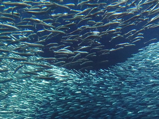
Sardines at the Monterey Bay AquariumCORVALLIS, Ore. – A task force that conducted one of the most comprehensive analyses of global “forage fish” populations is strongly recommending that world governments tighten catch limits on sardines, anchovies and other crucial prey species.

The Lenfest Forage Fish Task Force calls for restricting harvest of such forage fish so that they can continue to serve as critical prey for larger species, including salmon, cod and tuna, as well as for dolphins, whales, penguins and seabirds.

The report concludes that the fish are “twice as valuable in the water as in a net.”

“Forage fish are essential components of marine ecosystems,” said Selina Heppell, an Oregon State University fisheries ecologist and one of the authors on the report.  “The status and importance of each species can be difficult to evaluate because many of them migrate long distances and they can fluctuate dramatically in abundance.

“There also are regional differences in how the fisheries are managed and the relative health of the population,” added Heppell, an associate professor in OSU’s Department of Fisheries and Wildlife and past recipient of Oregon Sea Grant research support. “The West Coast sardine fishery, for example, is carefully monitored. They have a ‘harvest control rule’ that sets the harvest at about 10 percent of the overall stock, and when the population gets below a certain level, they stop fishing.

Read the complete news release from OSU News & Communications

Coastal workshops to address tsunami debris questions

Local organizations on the Oregon coast are partnering with NOAA, Oregon Sea Grant Extension, state and local agencies and conservation groups on a series of community meetings to share current information and science about the marine debris left by the 2011 Japanese tsunami.

The meetings will take place between April 11 and 20 in coastal communities from Port Orford to Seaside, and inland in Portland and Eugene.

Debris pulled out to sea by the Japanese tsunami last March is gradually riding the Pacific currents toward the US west coast, raising public questions about everything from derelict “ghost” ships to what to expect while beachcombing. Oceanographers predict that the bulk of the debris could arrive on U.S. shores next year, but no one can yet predict when – or how much.

“Right now, as a result of the tragic tsunami disaster, Brookings, Oregon, is rebuilding, Japan is reeling and the West Coast states are preparing to clean up an unprecedented amount of debris being carried to our coast on the ocean currents. Our oceans connect us and are essential to a healthy environment and economy,” said Cylvia Hayes, First Lady of Oregon. “These workshops are important to helping us effectively deal with the tsunami debris and better protect the health of oceans and coastal communities.”

Non-profit organizations that specialize in caring for Oregon’s shoreline and coping with litter report an overwhelming volume of requests and questions from their volunteers and the public about the possible arrival of tsunami-related debris. These organizations (SOLV, Surfrider Foundation, the CoastWatch program of the Oregon Shores Conservation Coalition, the Washed Ashore Project) are partnering with Oregon Sea Grant Extension to sponsor information sessions featuring staff from the National Oceanic and Atmospheric Administration’s Marine Debris Program.

Key speaker will be Nir Barnea, the NOAA program’s West Coast regional coordinator, who will describe what is known about the contents and trajectory of the debris, and what is being done across the Pacific to prepare to deal with it.

The NOAA speaker will be joined by speakers from the U.S. Coast Guard, Oregon Parks and Recreation Department, Oregon Health Authority Public Health Division, County Emergency Managers, and Oregon Department of Environmental Quality. Local waste managers and coastal haulers have also been invited for their experience in handling marine debris.

All events are free and open to the public. Audience members will have a chance to ask questions about everything from public health to returning any personal valuables that may be found amid the debris.

Tentative list of times and locations:

  • April 11th, Seaside 2-3:30 pm, Seaside Community Center
  • April 11, Bay City 6-7:30 pm, Bay City Arts Center
  • April 12, Pacific City 10-11:30 am, Kiwanda Community Center
  • April 12, Newport 6-7:30 pm, Newport City Hall
  • April 13, Florence 10-11:30 am, Florence Fire Station
  • April 13, North Bend 2-3:30 pm, North Bend Public Library
  • April 13, Bandon 6-7:30 pm, City Council Chamber/City Hall
  • April 14, Port Orford 10-11:00 am, American Legion Hall
  • April 14, Eugene 3:00-4:30 pm, EWEB Training Center, 500 East 4th Ave N Bldg
  • April 15, Portland 3:30-5:00 pm, Ecotrust Natural Capital Center, 721 NW 9th Ave
  • April 20, Cannon Beach, time and location TBD

Updated information about meeting dates and locations will be available from www.solv.org

Participating groups expect to conduct organizing and education efforts later this year to strengthen their citizen response networks before the expected arrival of the bulk of the debris.

For more information about the meetings, contact Jamie Doyle, Oregon Sea Grant Extension, agent for the south coast

For more information about the Japanese tsunami debris, see NOAA’s Japan Tsunami Debris FAQ