Digital Mapping Tools: Part 1, the Basics

By Norma Kline, OSU Extension Forester for Coos and Curry Counties and Alicia Christiansen, OSU Extension Forester for Douglas County
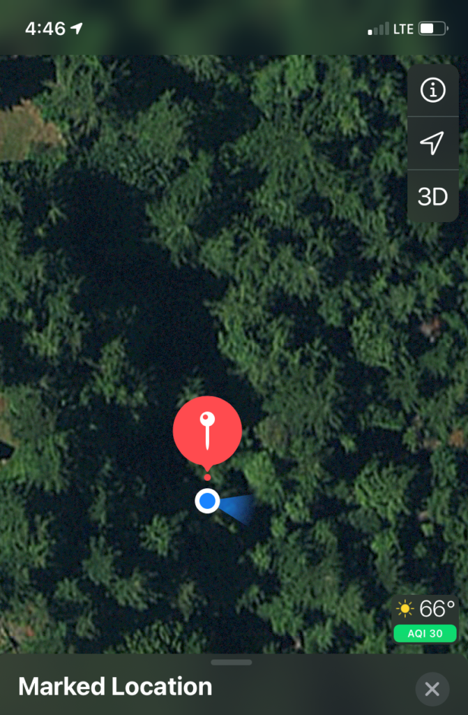
Are you interested in digital mapping tools for your smart phone or tablet? Here are a few resources to help you get started or improve your skills. First, let’s make sure you are getting the most out of the map app that came with your smart phone or tablet. When you open your map app you will see a dot showing your present location, which is determined using a combination of GPS satellites and cell phone towers (this technology is called Assisted GPS). This location dot shows up on a basic map layer displaying roads and waterways.

You also have the option of switching the base layer to satellite imagery by using the small icon in the top right of the screen. In Apple Maps this is an “i” symbol and in Google Maps it is a little box-like symbol. Satellite imagery is a great tool for looking at landscape features on your property. Zoom in to see the difference between conifers and hardwoods and even different sizes of trees.

Continue reading

What kind of forest do you live in?

By Norma Kline, Oregon State University Extension Forester for Coos and Curry Counties

Have you encountered the various terms used to characterize the vegetation on your woodland? You might have read about ecoregions, forest types or stand types and wondered how they relate to your ownership. Or perhaps these terms seem confusing because your property is classified within the Douglas-fir forest type but your trees consist of bigleaf maple and western redcedar. Foresters, ecologists and land managers group vegetation into units so they can describe and understand how forests develop and grow in a given area. One of the broadest classification approaches is the ecoregion which is used to describe portions of the state with similar climate and vegetation. Oregon only has eight terrestrial ecoregions, so these are pretty broad and expansive ways to describe vegetation areas. For the most part, our coastal counties fall entirely within the Coast Range ecoregion, an important exception is Curry County, which also includes the Klamath Mountains ecoregion. If you live in Curry County I bet you already know that your forests are pretty unique! The other nearby ecoregions are the Willamette Valley and West Cascades. Figure 1 shows the eight terrestrial ecoregions in Oregon. There is also a ninth ecoregion, the nearshore marine area.

Continue reading

Temple Grandin on Low Stress Cattle Handling

Is Acting Like a Predator Low Stress Cattle Handling?

Progressive ranchers and feedlot operators work hard to reduce stress on cattle during handling. They may wonder how mimicking the initial stalking movements of a predator can be a low stress way to gather cattle on large pastures. The methods are described in my article “Low Stress Methods for Moving and Herding Cattle on Pastures” that appears on my webpage at http://www.grandin.com (GREAT article!). What people don’t realize is that the animal common low stress cattle handling principles such as entering the flight zone to make an animal move and using the point of balance to control the animal’s direction of movement are all based on instinctual behavior patterns that the animals use to escape from predators.

Continue reading –>

Weaning management of beef calves

Weaning is considered one of the most stressful periods in the productive life of a beef calf. During the weening process, calves are exposed to various stressors that include removal from their dam, physiological changes (actively developing lean tissue or muscle), castration, vaccination, dehorning, exposure to novel pen or pasture environments, possible changes in feed and water sources, and for many spring-born calves, exposure to season climate changes.

Continue reading –>

Join Oregon Season Tracker: Contributing to Community-based Science

Do you like being outdoors and the idea of contributing to scientific research? If so, become a community-based citizen scientist volunteer with the OSU Extension Oregon Season Tracker Program that connects local community volunteers with state and national researchers studying weather and the effects on native plant vegetation. 

Continue reading

New forest health websites and resources

Oregon Sudden Oak Death Website The new Oregon Sudden Oak Death Website provides general Sudden Oak Death information including signs and symptoms, how the disease spreads, how to report potential infestations and management options. Take a look at the Task Force tab in the top menu bar to read more about the missions and goals of the Sudden Oak Death task force and all of the organizations that have been collaborating on this difficult issue. The website was made possible by funding by the Wild Rivers Coast Alliance and can be viewed here: https://www.oregonsod.org/

Continue reading

A New Meat School Coming to a Town or Computer Near You!

In October of last year, 50 farmers and ranchers attended the first ever Meat School, hosted in person and online by Colorado State University (CSU) and the Niche Meat Processor Assistance Network (NMPAN). The school included 6 classes, covering marketing, production, and processing topics considered critical for direct marketing high-quality meat. Inspired by the format and topics of the OSU Grassfed Meat School held in Central Point, OR in 2018, NMPAN and CSU adapted the school to serve a wider audience and be available online.

Continue reading

Farmers: Consider Individual Development Accounts to help you build your farm business

Dreams and goals are powerful things to have. They allow us to act today in support of becoming our best and higher selves tomorrow. For many Oregonians, there is not a clear and direct path to reaching their dreams or achieving future life goals. What if there were a program that could help create a plan, map out the steps and provide some financial support to get you closer to your goals?

Continue reading