Fat tire bikes are perfect transportation device for exploring the Oregon Coast. These bikes were developed for riding on unstable terrain, such as sand, snow, bogs, dirt, mud, gravel, etc.  

Bikes Re-imagined

Fat tire bikes are not new. Having a wide variety of places to ride adventure bike give modern day explorer an amazing opportunity along the Oregon Coast.

Early prototypes were designed for deserts, such as the Sahara, and snow races in Alaska. Some design modifications started as rim and tire upgrades to normal mountain bikes.

Fat tire bikes on the Oregon Coast (image royalty free, Unsplash.com)

The low-pressure designs needed honing to makes bikes smoothly ride over rough, often unstable, ground and obstacles. Changes included wider tire forks and rims, wheel size options, and frame structure improvements. 

One of the challenges this design had was to create the greatest amount of tire surface contact. This need generated a number of prototypes that were both two- and three-tire bike designs.  

Desert Bike Tours

Ray Molino, New Mexico, wanted bikes for his guided tour business. He wanted a bike that could traverse the soft sands of the Mexican and Southwestern U.S. arroyos and dunes.

Molina met Mark Gronewald, owner of Wildfire Designs Bicycles, met Moline at the 1999 Interbike convention in Las Vegas. Gronewald road one of Molina bikes and agreed to build several bikes.

Fat Bikes Extreme

Snow biking (royalty free image, Unsplash.com)

In 2001, Gronewald coined the trademarked name “Fat Bike” and used it when naming his bike designs. He continued selling these original fatbikes until 2011.

To see these bike race, along with skiing and snowshoe tournaments, visit the Alaskan Iditasport (previously Iditarod, scheduled for January 16, 2021 in Willow, Alaska). The 100 kilometer (64 mile) course traverses the Susitna Valley from Willow to Yentna Station Lodge and back, finishing at the EagleQuest Lodge (https://eaglequestalaska.com/).

This grueling race follows the Iditarod Trail that was used for millennia as the main trade and migration route by Alaska’s first people. Who knows, you may come home with a fat tire bike on your Christmas list.

Fat Bikes on the Oregon Coast

No need to walk a Fat Tire Bike in sand (image royalty free Unsplash.com)

Late summer and early fall offer some of the best biking weather along the Oregon Coast. Traffic on the Oregon Coast typically drops off along with competition for lodging and food.

The Coast offers cooler summer days compared to three-digit temperatures elsewhere with summer breezes and sunshine.   

Oregon Coast Bike Route

The Oregon Coast Bike Route (OCBR) spans 370-miles from border to border and includes several spectacular shorter rides. Route ridership is estimated to be between 6,000 and 10,000 people annually (2018).

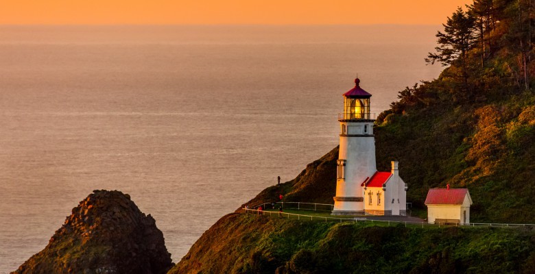
The route includes a 60-mile (all options) Wild Rivers Coast Scenic Bikeway anchored in Port Orford, Oregon. This route includes historic lighthouses, ocean views, towering basalt sea stacks, cranberry bogs, and amazing wildlife.

There are many choices some are challenging, some are not—your choice! A fat tire bike may be just the right tool to traverse these areas in comfort.

Opportunities

To find out more about these opportunities at:

Oregon Department of Transportation (https://www.oregon.gov/odot/programs/pages/bikeped.aspx) offers a wealth of products (maps, newsletters, etc.) including:

People for Bikes shows elevations from Reedsport to Gold Beach (https://peopleforbikes.org/blog/dozen-bucket-list-rides-2020/)

Travel Oregon has a wealth of information on bike riding, bikeways, and tips for making your visit more enjoyable (https://traveloregon.com/things-to-do/outdoor-recreation/bicycling/wild-rivers-coast-scenic-bikeway/) and (https://traveloregon.com/things-to-do/outdoor-recreation/bicycling/ride-oregon-coast/)

REFERENCES:
–Iditasport (https://www.iditasport.com/)
–Wikipedia, Fat tire bikes (https://en.wikipedia.org/wiki/Fatbike)
–The best fat tire bikes you can get [2020] (https://www.bicycle-guider.com/best-fat-tire-bikes/)

Florence, Oregon is a town of art. On the left, there is a photo of one of the latest murals. Spectacular.

The city contains a lot of artistic murals, displays, statues (of seal lions). Bunches.

Florence is located at the mouth of the Siuslaw River about midway between Newport and Coos Bay. It has a population of approximately 8,466 people.

Florence is a historic riverfront town that provides a diverse array of activities for locals and visitors.

Heceta Head Lighthouse. Image Source.

While logging, commercial fishing, and agricultural industries have served as the historical pillars of Florence’s economy, tourism is becoming increasingly significant. There are a variety of businesses, points of interests, and parks in and around Florence that offer unique experiences and outdoor recreation.

Entertainment

One can enjoy headliner entertainment at the Florence Events Center or Three Rivers Casino Resort after exploring the Heceta Head Lighthouse State Scenic Viewpoint, and the Heceta Head Assistant Keeper’s House. The park features a seven-mile network of hiking paths that join the short hike to the lighthouse.

The Keeper’s House functions as both an interpretive center and a bed and breakfast. Guided tours are offered by knowledgeable docents during the summer to educate visitor’s about the iconic lighthouse and its rich history.

The Sea Lion Caves. Image Source .

Sea Cave

A ‘must see’ attraction located 15 minutes from the Florence city center is North America’s largest sea cave. This amazing cave is a privately owned wildlife preserve and bird sanctuary.

As many as 200 Stellar sea lions reside in the cave. The Sea Lion Caves are part of the Oregon/Cape Perpetua Marine Reserve.

Visitors can take an elevator ride descending 200 feet down into the Sea Lion Caves, which is as tall as a 12-story building and as wide as a football field.

The Caves are not a zoo. The wild animals are protected and come and go as they please and follow their normal routines.

The cave is alive with sound, roars, bird calls, and crashing waves. This sea cave is the only known mainland home of wild sea lions in the world and is a must see for visitors of Florence.

During the summer, sea lions lounge in the rookery areas (along the rock ledges outside) with their young. In the fall and winter, they can be found inside the cave’s natural amphitheater.

How did people get around on the coast before roads and rail networks? By water and inland steamboats.

The term ‘steamboat’ refers to smaller, steam-powered boats that often worked the lakes and rivers. River steamboats had flat bottoms and rear engines, and were particularly effective in still waters.

Larger ocean-going steam powered boats were called steamships, stearnwheelers, or propeller boats. These larger ships were also used for larger rivers like the Columbia.

Royalty free shipwreck from Unsplash.com

Bays and Rivers

Many coastal towns have relatively shallow protected bays with access to rivers. These bays were perfect for small steamboat services such as delivering mail, parcels, products, and people.

Smaller ships were quite numerous in many communities and often referred to as the “mosquito fleet.”

Rogue River

For instance, in mid 1800s R.D. Hume, a pioneering businessman, established a fish cannery and several other businesses in southern Oregon. In 1881, he built a stem schooner, the Mary D. Hume, to support his business endeavors and conducted steamboat operations on the Rogue River as late as 1939.  

Hume continued his interest in steamboats and built more during his lifetime. In 1908, he commissioned two small gasoline-powered schooners, the Enterprise and Osprey which were built on the Coquille River.

In 1938, the Mary D. Hume was still operating on the Rogue River. She was considered to be the oldest commercial vessel still in service at that time.

Coquille River

Many communities thrived with the steamboat trade, labor requirements, building, and maintenance. The Coquille River was a major trade route between Bandon and the town of Coquille and supported a number of sawmills, canneries, a woolen mill, and match factory. Other products often transported included coal and milk.

Once the two jetties built at the mouth of the Coquille River were complete, the City of Bandon bustled economically. These jetties facilitated ocean-going ships to dock at Bandon. From 1905 to 1910, Bandon expanded to have five sawmills, two shipyards, and a population of 1,800.

Coos Bay

Coos Bay had a similar story. In 1869, mule-hauled portages were created at Coos Bay (on the southern arm) and at the Beaver Slough (north-extending branch of the Coquille River) to support the steamboat traffic.

In 1873, two steamboat captains began steamboat operations on Coos Bay. These two captains had previously worked on the Columbia River and understood the difficulties of river bar crossings.

The mule-portages were replaced in 1874 with a steam portage railroad and railroad services grew. These connections created a convenient link between steamboat and rail operations in Coos Bay and Coquille.

Mosquito fleet operations on the Coquille and Coos Bay continued up to the 1930s. A small gasoline-propeller ship, Welcome, built in 1919 continued running up the Marshfield to Allegany until 1948.

‘Mosquito’ fleet wrecks in the sunset(Royalty free Unsplash.com)

Gardiner

Gardiner, near Reedsport built several river steamers and continues that key role today. In 1870, Gardiner merchants were eager to demonstrate the navigability of the Umpqua River.

Steamboat operations on the Umpqua were pursued by Captain Godfrey Seymore who developed a small fleet of ships including one named ‘Swan.’ The Swan was a unique ship and the only steamboat to travel the Umpqua to Roseburg.

It took the Swan 11 days to get to Roseburg which is 85 miles from the mouth of the Umpqua River. No other steamboat ever made this trip. The trip was not in vain. It helped persuade Congress to allocate monies to clear the Umpqua channel and set the stage for a greater future.

Transition

By 1849 there was a dramatic transition in boat building and use. Builders moved from wood to metal, from small to large, from slow to fast, to take advantage of ocean trade routes and tourism.

As steamboat services came to a close, several ships were beached along the coast, rivers and towns. The Mary D. Hume lies on the shore at Gold Beach and is on the National Register of Historic Places.  At least three steamers were beached near Bandon, and the steam ferry Roosevelt was photographed abandoned near Marshfield in 1941.

There are many stories about steamboats on the Oregon Coast. To learn more about them, visit this list of references and check their references for more stories, lists of vessels, and history.

Royalty free Unsplash.com

REFERENCES:
–Wikipedia (https://en.wikipedia.org/wiki/… Steamboats of the Oregon Coast (…Steamboats_of_the_Oregon_Coast), Steamboats of Coquille River (…Steamboats_of_the_Coquille_River), Columbia River (…Columbia_River)
–Wikipedia, Steamboats (https://en.wikipedia.org/steamboats)