By Max Bennett, Extension Forestry and Natural Resources Program, OSU Extension, Central Point.  

Note: The Collins Demonstration Forest was first announced in January 2019 but many have not heard much about it yet. Here’s the story and an update on current activities.

BIll and Marion (2019)

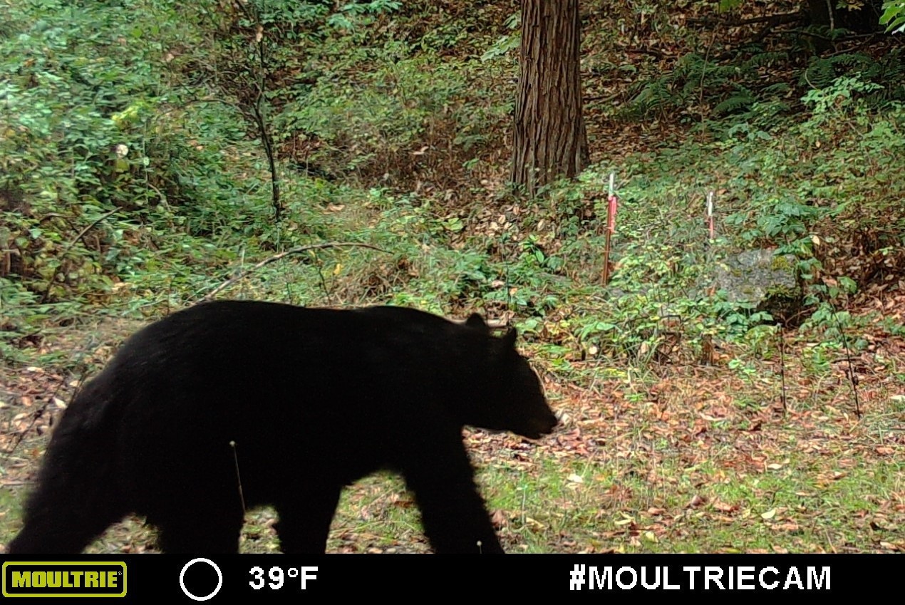
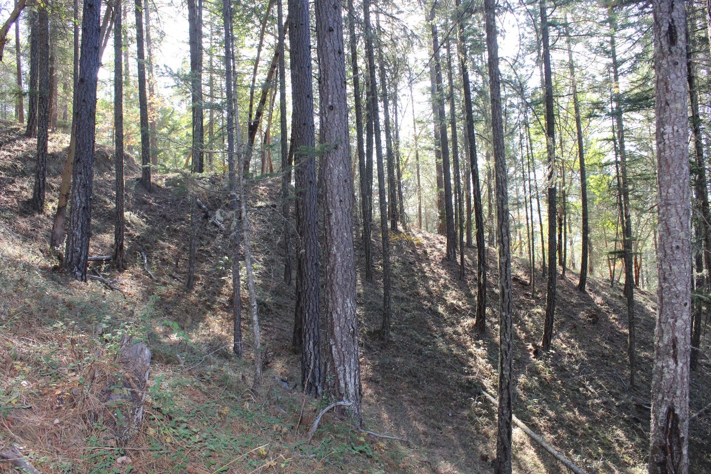
I’m thrilled to announce the creation of the new 167 acre Collins Demonstration Forest, thanks to an incredibly generous donation from Bill and Marion Collins to the OSU College of Forestry.  Many local woodland owners know Bill and Marion and have visited their lovely property near Gold Hill.  If you haven’t been there, this is a remarkably diverse woodland that contains many of the features of SW Oregon forests in a microcosm: Cool, productive Douglas-fir stands on north slopes and hot and dry pine and oak stands on south slopes.  Seasonal creeks, lush riparian areas, oak savannah, ceanothus brushfields, large sugar pines – it’s a 167 acre tract that has a bit of everything.  This includes lots of wildlife such as deer, foxes, quail, mountain lions and plenty of black bears.  Oh yeah, and a bit of poison oak.

Bill talking to a group of woodland owners. Note the all-important donuts in the foreground.

As Bill tells it, it all started with a visit to the Josephine County fair almost 40 years ago.  Bill and Marion had purchased 160 acres on the Right Fork of Sardine Creek in 1969 and dabbled in ranching for a few years, without too much attention to the surrounding forestland.  At the fair Bill met Extension Forester Allan Campbell and a local landowner and roadbuilder, Orville Camp.  The idea of managing a woodland for fun and profit came into being.  Bill hired Orville to build an extensive network of roads throughout the property, paid for by the timber harvested in the right of way.  This provided access  and allowed trees to be removed with a tractor and farmi winch without ever leaving the road.

With the help of pioneering woodland owner and manager John Sherck, Bill carefully tended his stands with an eye for improving forest health.  Defective trees or those with poor growth were removed, and the healthiest and best growers were left.  Some large trees with insect or disease problems, or that were growing poorly, were selectively removed.  Logs were carefully merchandized, with a few loads going to the mill in most years and smaller material converted to posts and poles and firewood.  Over time, this approach maintained what Bill calls an “all-aged, all species” forest with a steady stream of products, revenue, and forest benefits.   He also took advantage of cost share programs and completed various non-commercial thinning and fuel hazard reduction projects which helped reduce the risk of high severity wildfire.

Today, the forest is healthy, diverse, and productive.  Bill and Marion’s sustained and careful stewardship has been recognized with a Jackson County Tree Farmer of the Year award and a John Black Lifetime Achievement award.  

One corner of the property is a bear highway, with dozens of cam sightings, often in broad daylight. Other creatures captured on camera include mountain lions, gray foxes, quail, a pileated woodpeckers, opossum, squirrels, deer, turkeys, and a house cat.

To be sure, there are challenges.  Several years of drought have increased populations of bark beetles and wood borers, and the steep ground poses difficulties for forest operations.  High intensity wildfire is an ever-present threat. But it’s the same for most forest properties in this region.

About 18 months ago, Bill and Marion approached me with the idea of donating the property to OSU for the benefit of the local Forestry and Natural Resource Extension program.  Needless to say, I was extremely excited!   I have seen how much demonstration forests have benefitted other local Extension programs.  These are sites for real world, hands-on education via classes, tours, demonstrations, and applied research.  And in many ways this would be a continuation of what was already happening at the Collins forest, as Bill and Marion have hosted countless tours and classes there over the years.

Going from an idea to execution proved to be lengthy and sometimes challenging process.  As Bill said, “I never knew it was so hard to give stuff away!”

The property is now part of the OSU Research Forest system.  The intent is to hold on to and manage it as a working forest, much as OSU has done with the Obertueffer tract in eastern Oregon for more than 20 years and counting.  I’ll be actively involved in management, in collaboration with OSU Research Forest staff.

To date we have installed 50 permanent plots to monitor forest conditions and have updated the forest management plan. A bark beetle infestation demanded immediate attention last winter (see this article). Road maintenance and thinning projects are on-going. We’ve had high school students out collecting data as part of our Student Watershed Assessment Teams (SWAT) program.   I’m excited about establishing some pollinator plantings and monitoring use of the forest by native bees, and planting some blister rust-resistant sugar pine.  I expect there will be many opportunities down the road for active involvement in projects by volunteers, ranging from students to woodland owners.

My hope is that this Demonstration Forest will be a resource for the whole SW Oregon woodland owner community.  Stay tuned for updates and opportunities to get involved.

What climate trends have we observed locally over the past century? And what do we have to look forward to in the next 50-100 years? The following is a very quick summary of regional climate trends, based partly on information presented at the recent “Rogue Basin Climate Summit” and partly on other published information. Of course, any errors of interpretation and understanding are my own.

What have we seen? Trends 1895-present

Simply put, it’s gotten warmer in the Rogue valley over the past 100+ years. Since 1895 the average temperature has increased by 2.6 F in Ashland and 4.3 F in Grants Pass (see figure below). Medford average temperatures have likewise increased, with the biggest gains occurring since the 1980s.

Source: Office of the Washington State Climatologist. http://www.climate.washington.edu/trendanalysis/


What about precipitation? Again, there is a lot of year to year variation, but in this case there is no real upward or downward trend.   We have seen major droughts, such as in the 1930s and 1980s, as well as individual very wet and very dry years and longer periods of wetter and cooler climate. At least some of this variability can be attributed to phenomena like El Nino and the Pacific Decadal Oscillation.

Source: Office of the Washington State Climatologist. http://www.climate.washington.edu/trendanalysis/


Old timers in the Rogue Valley talk about days of heavy snows in the valley and those aren’t simply romantic memories. In the early 1900s, Medford averaged 9” of snowfall annually; not much, but with occasional storms dumping a foot or more. Since the 1980s there have been few such large storms and the annual average has decreased to under 4”. Crater Lake snowfall shows huge annual variations but the overall trend has been downward since the 1930s.

So, in sum: it’s gotten warmer, there hasn’t been much change in rainfall, and snowfall has decreased.   Of course, these changes in average values can be hard to discern, because there is so much variability.

If you want to take a look at the data yourself, the University of Washington has a great online tool that allows you to look at temperature and precipitation trends over the past 100 or so years at weather stations all around the northwest. Curious about temperatures in Prospect, or rainfall in Brookings? Snowfall in Bend or Baker? This tool shows a chart of the year to year data and the overall trend. I had a lot of fun playing with it.

What does the future hold?

Probably more of the same: hotter, less snow, not much change in overall precipitation. Average temperatures are predicted to increase 5-9 F by 2100 in the Rogue Valley, depending on the level of greenhouse gas emissions and other factors. Right now we’re on track to hit the higher end of that prediction. So what does that mean? A climate a lot more like Redding’s, according to Phil Mote, Director of the Oregon Climate Service. 2015 is on track to be the warmest year ever in the Rogue Valley (and worldwide, for that matter). And this year will be more like norm in the future.

Another way to look at it is to consider how temperature changes with elevation. Typically for every 1,000 foot gain or loss in elevation we see a 3.5 F change in temperature. So a 7 degree increase (midway between a low and high prediction) is roughly equivalent to a 2,000 foot loss in elevation.   Sites at 3,500 feet would have temperatures like those of the valley floor, all other things equal.

In terms of precipitation, Canada is expected to get wetter, according to Mote, and the SW will be drier. We’re in the middle, so predictions of precipitation are “a wash”, he said. Another speaker stated that the average of current models shows no big change in Rogue valley precipitation, but there may be more winter rainfall and less in the summer.

Snowfall is predicted to decrease, dramatically so at lower elevation sites. The average snow level will likely increase 1,000-2,000’ feet. 2015, with 11% of the historical average snowpack, may be a typical year several decades from now.

Feb 7, 2015. Hoodoo Ski Bowl. While not every year will be as sparse as 2015, mountain snowpacks are on the decline regionally. (Photo Joe Kline, AP)


With less snow and earlier melt outs we’re looking at earlier peak flows and lower summer flows, resulting in higher stream temperatures and other water quality issues.

Increases in fire are an obvious concern. Fire season length is on an upward trend in the US west and that trend is likely to continue.   In recent decades we’ve seen an increase in the acres burned and in fire severity in many areas of the US west (due to fuels buildups as well as climate); the predictions for the Rogue Basin are for a 300-400% increase in the area burned by 2100. It’s not good.

Oregon Gulch Fire, 2014


Higher temperatures and less summer rain also translate into increases in tree stress and potential losses to insects and abiotic diseases. We’ve seen a large uptick in tree mortality in SW Oregon recently with the dry and hot temperatures but this pales in comparison to the situation in California with its exceptional, extreme drought.

Douglas-fir mortality, SW Oregon


It’s a daunting picture, but there are plenty of things land managers can do to prepare for and adapt to climate changes. For forest owners, the good news is that many of the practices that lead to increased resistance to fire and insect attack, such as thinning, fuels reduction, and promoting drought resistant species, are also practices that will help with climate adaptation. For more information about forests, climate change, and woodland owner strategies, see the OSU Extension Climate and Forests blog.

By Tristan Huff, Forestry Extension, Coos County

For those of you using Google Earth in your day-to-day, the “pro” version is now available for free (previously $400/yr.).  The pro version is very similar to the free version but allows for direct area measurements and also includes some other data layers such as property boundaries and county demographic data.


If you’re new to GE and want to try it, here’s a walk-through tutorial I use for my workshops.  It hasn’t been updated yet to incorporate difference in the pro version but is still a good place to start.


PDF walkthrough:

http://extension.oregonstate.edu/coos/sites/default/files/google_earth_walkthrough.3.27.13.pdf


Download GE Pro:

http://www.google.com/earth/download/gep/agree.html


By Kara Baylog, CFA Coordinator

After the hard work developing Citizen’s Fire Academy, CFA coordinator Rhianna Simes has stepped down and newcomer Kara Baylog has taken on the challenge of continuing and growing this practical course in fire preparedness. Kara comes to OSU Extension and the Citizen’s Fire Academy from just over the state line in Siskiyou County, California, where she worked with the Shasta Valley Resource Conservation District in developing and running forestry and fire educational programs for landowners and the public.

KaraBaylog

RB CFACitizen’s Fire Academy Volunteer Robert Briggs brings together his neighbors and the local fire department to discuss how his community can work together and prepare for wildfire.

CFA volunteers from the 2014 program are out and about, engaging their neighborhoods and communities to educate people on how to improve fire resiliency on homes and properties and plug into local resources and fire-fighting agencies. CFA Volunteers serve as sparkplugs to motivate their communities into action.

Do you want to be a sparkplug in your community? Do you want to get informed on how to become more fire resilient and jump-start your neighborhood to prepare for fire season? Over the next couple of months, we will be gauging interest in bringing the program back in the future, perhaps in 2016. If you are interested in participating in the next round of engaging and informative classes, field trips, conversations and service, please contact Kara at 541-776-7371 ext 213 or Kara.Baylog@oregonstate.edu.

The phone has been ringing a lot lately and my office is filled with samples of dead branches and partially eaten leaves. Spring is my favorite time of year, but it’s also the season when many “sick tree” problems become evident, from moisture stress to bark beetles, to defoliating insects. And this year is no exception.

At the top of the list are Douglas-fir branch and top dieback and outright mortality, followed by an apparent outbreak of the fruit tree leafroller in oaks. But there is plenty of other action to go around, including bark beetles in pines and white fir, among others.


It’s mostly about the weather

In the big picture, many trees are likely still suffering from the effects of 2013, the driest year on record here in the Rogue Valley. Medford received 8.97 inches of precipitation over the year, less than half the average value. To put this figure into perspective, areas that average less than 10” of precipitation in eastern Oregon typically don’t support tree cover at all!

 Driest year

2013 was the driest on record in Medford

2013 precip graph

Alvord desertEastern Oregon’s Alvord desert gets less than 10 inches of rain per year on average.

December 2013 was notable in having a few days of extremely cold temperatures, which killed some trees and shrubs outright, and injured others. Very cold temperatures can injure sapwood and impede water transport, and damage may not show up until later in the season when water needs increase with warmer temperatures.

In 2014, we had slightly above normal precipitation, but it was the warmest year on record in the Rogue Valley, in terms of average temperature. We also experienced the hottest summer on record.   Warmer temperatures increased evapotranspiration from trees, which resulted in increased moisture stress, compounding the moisture deficit from 2013.

2014’s snowpack was about 50% of average in the Cascades, and this year of course was even worse. Thus, despite increased rainfall from last fall through this winter, we are still in the grips of a moderate to severe drought.

Drought monitor graph

In a nutshell, it’s been very dry and hot over the past 2 years and many trees have been and continue to suffer from moisture stress. A chronic lack of water results in reduced growth and reduced production of defensive compounds that can ward off pests. That’s why drought-stressed trees are more vulnerable to “secondary” insects and diseases that wouldn’t affect more vigorous trees. Severe drought may also reduce tree water below critical levels, resulting in the death of branches or even whole trees. This ODF pest note does a great job of explaining the interactions of water stress and insects and diseases.


The culprits

Given our stressed, vulnerable trees, which specific insect and disease pests are doing trees in?  For Douglas-fir, the flatheaded fir borer is probably responsible killing many trees on marginal sites while various other insect pests may be responsible for branch dieback and top kill, especially on smaller, younger trees.  The Phomopsis canker is also likely implicated in top kill and mortality of smaller trees.


Too many trees in the wrong places

Most people in the woodlands and forestry worlds are familiar with the notion that fire exclusion over 50-100+ years has likely resulted in greater density of trees on many sites, leading to increased competition and stress for a limited supply of soil moisture. That makes trees a lot less resilient to drought when it inevitably occurs.

Along with increased density is the probable encroachment of Douglas-fir on marginal, lower elevation sites where it was probably much less common historically. Pines and oaks often do better on these sites and Douglas-fir can really struggle.

Dead and dying psmeDead and dying Douglas-fir on the slopes of Johns Peak, just went of Central Point. Not a great DF site.

What to do?

The above-mentioned ODF pest note summarizes it well, and I quote from that document below (I’ve made a few additions):

Most tree damage occurs on disturbed sites and is due to a combination of factors including soil conditions, tree species, and weather patterns. It is unlikely that stress will be alleviated by simply altering a single factor. Rather, improvement will come from an accumulation of many moderate changes to relieve stress and increase vigor.

  • Prevent soil compaction caused by vehicle or animal traffic near trees. Livestock can compact surface soils and damage fine roots, most of which lie within a foot of the soil surface . Clay soils are especially vulnerable.
  • Avoid direct damage to trees and roots by grazing animals or by machinery.
  • Reduce competing vegetation via thinning and brushing. Favor trees that are more drought resistant. The research is clear that thinning in pine stands can improve tree resistance to bark beetle attack. It’s less clear if the same if true for Douglas-fir and the flatheaded fir borer, but the basic principle of improving tree vigor to increase pest resistance still holds.
  • Apply mulch to maintain soil moisture (1-3 inches is usually sufficient).
  • Irrigate landscape trees during dry weather. Apply water slowly over many hours so it penetrates to tree roots or use drip irrigation lines.
  • Do not alter drainage patterns (ditches, ponds, etc.) near established trees.
  • Plant trees that are well suited for the site; use local seed sources and species that are adapted to your soil types. On sites where Douglas-fir mortality is occurring it may be advisable to plant ponderosa pine or hardwoods.
  • If insect larvae or branch/stem cankers are evident, prune and destroy affected branches to reduce the spread of these agents.


What about the oaks?

 Landowners have been calling in with reports about moth-eaten oak leaves and “dying trees.” The culprit has not yet been positively identified, but may be the fruit tree leafroller (Archips argyrospila).  The larvae of this small moth feed in spring on new leaves, resulting in leaves that are distorted and ragged in appearance.  Young leaves are rolled and tied with silk.  There is one generation per year.  If you are walking under oak trees you may run into small wiggling larvae dangling from threads.    There have been reports from Jackson and Josephine County this year, so the problem appears widespread.

chewed oak leaves

In outbreak years trees may appear partly or completed defoliated, resulting in fears that “My oaks are dying!”

However, as alarming as it may look, tree mortality seldom if ever occurs from this pest.  If the pest turns out not to be the fruit tree leafroller, it is likely something similar, with similar effects.

Action needed: None.  Birds and other natural enemies of the insect will deplete its population and the infestation will run its course.  Trees will likely leaf out again.  Those who absolutely must do something could spray BT but in addition to being expensive and logistically challenging, is very unlikely to dampen population levels with such a widespread outbreak.

Reference: PP 16-19 in “A Field Guide to Insects and Diseases of California Oaks.”

http://www.suddenoakdeath.org/pdf/psw_gtr197.pdf


Quick quiz: What percentage of Oregon forest owners are under 45? 30%? 20%? 10%? The actual figure is just 6%, according to a 2005 OFRI survey. That won’t come as a big surprise to anyone who has attended a recent small woodlands gathering and noted the abundance of gray hair. More than half of Oregon’s family forest owners are over 65, and the national figure is very similar. Over the next two decades or so, many thousands of acres in the state – and millions of acres nationally – will change hands.

graph


From: http://www.invw.org/article/oregon-family-forests-1539

What will happen to these lands? Will they continue to be managed as working forests? Will the owners’ hard work and dedicated stewardship over many years be maintained? Or will the land be cutover, subdivided, and developed, or simply taken over by a new owner who neglects or takes poor care of the property? In a nutshell, this is the concern many owners have as they look to the future. And it’s a very real issue, given the challenges of passing land on intact to heirs, or devising a strategy that will help maintain past stewardship practices with a new set of owners.

forest-subdivision-featured0

OSU’s award-winning Ties to the Land program is designed to help families work through the challenges of passing the land on from one generation in the family to the next.

However, the reality is that some forest owners don’t have children or other heirs who are interested in, available, or capable of taking over their property. As stated by one local woodland owner, “Neither of our adult daughters are candidates to live and care for our timber property.  At 70 and 71, our years are numbered as active caretakers, so we’d like to explore how feasible it is to find a younger couple/family who is interested …”

Recently, Marty Main and I convened a small group of woodland owners to discuss options for owners who want to maintain their property legacy, but don’t anticipate passing the land on to heirs. If this situation applies to you, you may be asking yourself some of these questions: Do I want to stay on it as long as I can or until my death, or am I ready to sell/transition now? Do I want to sell the land, or lease it, or donate it? What about a conservation easement? Where can I find owners who share my values and management approach? How can I provide an inheritance for my children or other heirs or beneficiaries, even if they aren’t willing or able to take over the property?

Since individual owner goals, needs and situations are so variable, there are no universal solutions, but we are starting to address some of these questions and brainstorm possible answers. If you are interested in learning more or participating, please contact:

Max Bennett

OSU Extension Forestry and Natural Resources

Max.bennett@oregonstate.edu

(541) 776-7371 x221


Marty Main

Small Woodland Service, Inc.

mmain3@mind.net

(541) 778-4545


OSU Extension’s Student Watershed Assessment Teams gather science for today while building scientists for tomorrow.”

by Rachel Werling, Extension Natural Resources Instructor

There is a lot of work being done in the Rogue River watershed these days to improve salmon habitat and water quality. Documenting the effectiveness of those efforts takes a lot of time and technical expertise. The Student Watershed Assessment Team (SWAT) program of OSU Jackson County Extension is training students to be a part of this process.   The goal of the SWAT program is to provide a quality scientific data for natural resource management efforts. At the same time, it gives young people exposure to careers and skills for their future. Jackson County has two student teams patrolling local riparian areas.

SWAT 1Central High School Students set permanent photo points at a Lomakatsi Restoration project on Lone Pine Creek near Table Rock Road.


Swat 2Rachel and the Logos Charter School Student SWAT collect vegetation data at Denman Wildlife Area on Little Butte Creek.

 
The program is serious hands-on science, not worksheets or research papers. The student scientists are tracking the progress of stream restoration.   The teams go out for a full field day once a month. They learn technical field protocols, specific methods for the collection of data. The focus this year has been on photo point monitoring that visually captures changes at a site, and vegetation monitoring to track how well native plants are doing and whether invasive weeds are making inroads. Students learn the gear and skills of field scientists, including plant ID, setting transects, using compasses, GPS units, and iPads for data collection.

Local agencies and organizations are excited about the prospect of more hands on deck for data collection provided by the SWAT program and are helping out. The Freshwater Trust has provided valuable technical assistance, and helped the teams incorporate iPads and online apps for data collection. The Jackson County Soil & Water District helped fund the StreamWise SWAT program and may incorporate teams into their land owner project monitoring. The Butte Falls SWAT program is partnering with Southern Oregon University students, Bureau of Land Management and OSU Extension forestry program on a riparian shade study. The LOGOS charter school team is helping to document restoration progress along Crooked Creek, Bear Creek, and Little Butte Creek.

SWAT 3Logos High School team members set permanent photo points and document pre-restoration conditions at Crooked Creek in Bear Creek Park.

In some cases the SWAT students are helping to fill a gap where lack of time and resources have limited the information collected. This is the case at the ODFW Denman Wildlife Area restoration along Little Butte Creek. In other cases, the teams are helping lighten the load for organizations by picking up part of their monitoring process. The data gathered by the teams are delivered to the restoration host organizations such as Lomakatsi Restoration Project and the Rogue Valley Council of Governments. Around our watersheds, these student teams are gathering science for today, while building scientist for tomorrow.

I admit it: I’m an unabashed proponent of the use of wood as a building material. “Wood is good.” From an environmental standpoint, there’s a lot to like: wood is renewable, has a low carbon footprint, and markets for wood products provide an incentive to grow and maintain forests, a fact that’s not often considered in forestry debates. Research on the production, manufacture, and disposal of wood products – so-called life cycle analysis – suggests that compared to steel and concrete, wood-based construction requires a lot less energy and results in significantly lower CO2 emissions. Read an article about Forest Products Life Cycle Analysis here (see page 5).

CLT
woodusematrix.com

So when I hear about the potential for developing multi-story apartment complexes and other tall buildings with wood, I get pretty excited. The reason for all this excitement is cross-laminated timber (CLT). CLT is an engineered wood product, basically a wooden panel made of boards that are placed cross-wise to each other, which increases strength and stability. Hence the moniker “plywood on steroids.” CLT was actually developed in the 1990s in Switzerland, but has recently gained traction in both Europe and North America with changes in building codes permitting wooden structures taller than 4 or 6 stories.

Potential advantages of CLT in high rise construction include lower costs, faster build times, and improved environmental performance, including much lower embedded carbon emissions compared to steel or concrete. Of interest to folks in the Pacific Northwest, the material is made from softwood structural lumber, and we do a good job of producing that. Naturally, the public will be very concerned about how these structures would do in a fire or an earthquake. Perhaps surprisingly, the answer may be: pretty darn well.

I don’t know if CLT is a blip on the radar or a long term trend, but it’s an interesting story.

Some links:
Michael Green’s TED talk: Why we should build wooden skyscrapers

Six story wood buildings a game changer

Why these stunning wood skyscrapers could dominate the skylines of the future

Tall Tinder: Are wooden skyscrapers really firesafe?

white pine snagThanks to Ron Kilby, who was hiking near Howard Prairie recently and brought in this photo and a question about what in the heck caused those odd patterns. Honestly, I was stumped. And thanks to Ellen Goheen, who circulated it to her USFS colleagues, one of whom, Eric Watrud, compiled this list of intriguing possibilities:

-wire or chain link fence
-aliens
-photoshop
-Christmas tree
-Vexar
-Coriolis Effect
-multiple lightning strikes
-plantation netting
-popular bear marking spot
-crazy tree that couldn’t decide if it was xylem or phloem
-rare and elusive Scottish argyle barkless fir
-muscular tree that went to the gym regularly
-scoring from boundary marking
-no rational explanation
-sasquatch using nunchucks
*ribbing/reinforcing to address wind shear – please see below for further explanation.

Eventually, a plausible explanation emerged from Barb Lachenbruch, professor of Wood Science, at OSU:

“Western white pine, especially near treeline, does that. We call them ‘argyle pines’. The best guess is that they are ribbing/reinforcing that help the tree in sheer in the wind.

If you stand with your arms out and twist them but keep your feet in place, you’ll feel the angle where the tension is. These ribs are at the right angle to help deal with the extra force. Another way would be to make spiral grain, which does the same thing–spiral grain puts the highest strength (which is in the axial direction of the cells) at an angle to the stem, but helps with the torsion when the tree twists from the wind.

This is all arm waving (ha-ha) but it make sense. Bob Leichti was the first to explain it to me and now I tell people his explanation.”
Apparently this pattern is not uncommon in white pine. Thanks, Barb, and I am once again amazed by those products of evolutionary bioengineering called trees.

Guest contribution by the Natural Resources Conservation Service, Jackson & Josephine Counties (September 2014)

The Natural Resources Conservation Service (NRCS) in Jackson and Josephine County has technical and financial assistance available for landowners on private non-industrial forestlands. They are accepting applications for the  Environmental Quality Incentives Program (EQIP) for forest health and fuels reduction projects in the Applegate and Seven Basins Community Wildfire Protection Plan (CWPP) areas. Cost-share is available for eligible practices including thinning, pruning, and slash treatments. Program incentives are also available for development of a Forest Management Plan. Priority will be given to applications within the Pleasant Creek, Foots Creek, Wards Creek, and Lower Evans Creek Watersheds in the Seven Basin’s CWPP, and Thompson Creek in the Applegate CWPP. If you have questions regarding the program or the location of your property, or would like to apply, please contact:

Erin Kurtz, District Conservationist, Central Point, OR erin.kurtz@or.usda.gov  (541) 664-1070 ext. 408 or

Peter Winnick, Soil Conservationist, Central Point, OR peter.winnick@or.usda.gov (541) 664-1070 ext. 409

******

Also, assistance may be available from the Oregon Department of Forestry for development of Forest Stewardship plans.  Contact Lee Winslow, ODF Stewardship Forester, (541) 664-3328.