GIScience I: Introduction to Geographic Information Science (GEOG 560)
Annotated Bibliography By: Jared Hedges
Chambers, S., Villarreal, M.L., Duane, O. et al. Conflict of energies: spatially modeling mule deer caloric expenditure in response to oil and gas development. Landsc Ecol 37, 2947–2961 (2022). https://doi-org.oregonstate.idm.oclc.org/10.1007/s10980-022-01521-w
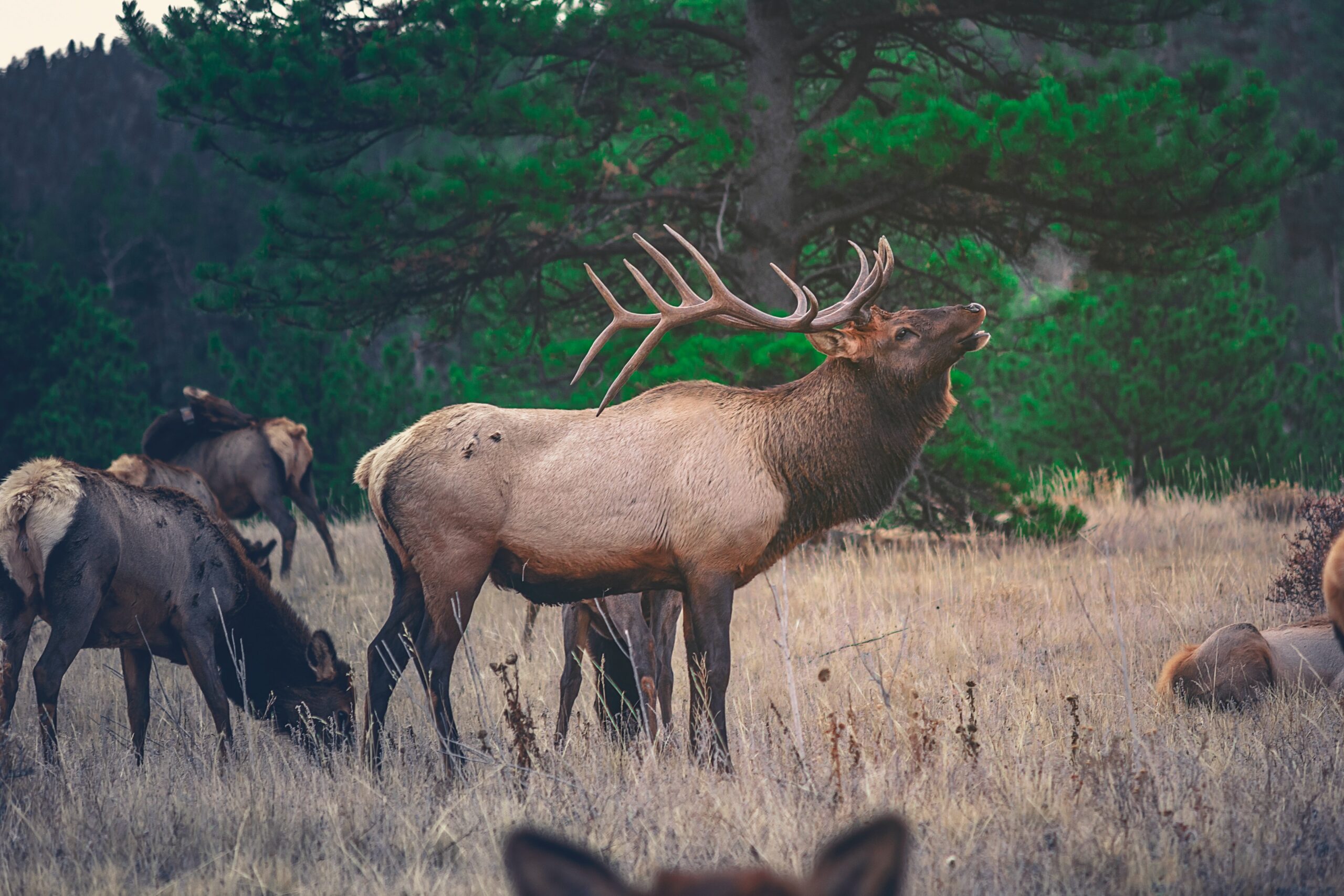
Wildlife avoid human development and are often displaced by it. While many studies have examined this question, few have incorporated physiological data (heart rate and oxygen uptake) into modeling of the costs of this avoidance behavior. The purpose of this study was to incorporate this physiological data into the decision-making process of where to locate potential development. The authors developed a spatiotemporal model that included energy expenditure of mule deer, anthropogenic disturbance factors, and physical terrain elements. Energy expenditure was compared across 12 study sites in Utah with various levels of oil and gas development. The mapping component was completed by using a USGS dataset that previously mapped the locations of Colorado Plateau and coupling that with USDA National Agriculture Imagery Program (NAIP) aerial imagery to map the footprints of the oil and gas well pads. Only a small portion of the oil and gas access roads were mapped using the U.S. Census Bureau’s TIGER (topologically integrated geographic encoding and referencing) roads database, while others were digitized using ArcGIS Pro. The researchers found that the increased avoidance behavior of mule deer in response to the increasing footprint of energy development has likely significantly increased the energy expenditure of mule deer, regardless of terrain features, and points to the outsized effect of development density as a major driver of avoidance behavior and subsequent energy expenditure. This article demonstrates a more nuanced and complete evaluation of the effects of oil and gas development on mule deer, and does so through the use of two distinct scientific disciplines: Geographic Information Science (GIS) and physiology.
Shanley, Colin S., Daniel R. Eacker, Conor P. Reynolds, Bonnie M. B. Bennetsen, and Sophie L. Gilbert. “Using LiDAR and Random Forest to Improve Deer Habitat Models in a Managed Forest Landscape.” Forest Ecology and Management 499 (2021): 119580. https://doi.org/10.1016/j.foreco.2021.119580.
Vegetation maps used for deer habitat modeling in the Tongass National Forest (TNF), Alaska, are currently derived from modeled plot data and air-photo interpreted polygons that were originally developed for commercial timber harvest, not wildlife values. The purpose of this study was to develop a habitat suitability model using LiDAR (light detection and ranging) remote-sensing data and compare it to deer GPS collar data for accuracy. The authors tested the model against the available habitat models to see which was a better predictor of habitat use. They found that the integration of LiDAR improved the habitat models in the TNF and showed that deer habitat selection patterns were nonlinear across the predictive variables. The results of this study demonstrated how LiDAR remote-sensing data is a valuable technological advancement that can be used to better predict deer habitat selection.
Hughey, Lacey F., Kevin T. Shoemaker, Kelley M. Stewart, Douglas J. McCauley, and J. Hall Cushman. “Effects of Human-Altered Landscapes on a Reintroduced Ungulate: Patterns of Habitat Selection at the Rangeland-Wildland Interface.” Biological Conservation 257 (2021): 109086. https://doi.org/10.1016/j.biocon.2021.109086.
Species reintroductions have become an integral and well-supported part of conservation efforts globally. When native species are reintroduced at the rangeland-wildland interface, wildlife-livestock interactions are common and present suite of challenges, including increased competition for food, increased risk of disease transmission, and increased avoidance behavior. The purpose of this study was to examine the interactions between native tule elk (Cervus canadensis nannodes) and domestic cattle (Bos taurus) at the rangeland-wildland interface in northern California. The researchers used a combination of data derived from long-term visual surveys, GPS telemetry, and satellite remote sensing (SRS) technology to quantify habitat use patterns and elk-cattle interactions in their study area. The methods for SRS animal detections included georeferencing the locations of animals using the software ‘BisQue,’ which is an open-source bioimage analysis platform. The Normalized Difference Vegetation Index (NDVI) was another GIS used to define the spatial extent of habitat characteristics in the study area. The results indicate that at large scales and across all seasons, elk occurrence was negatively associated with cattle density. At finer scales, however, there was little evidence of avoidance of cattle by elk. The researchers used 3 distinct GIS methods to bolster their lines of evidence and provided a superb example of how to combine multiple GIS applications towards one research objective.
Kramer, David W., Thomas J. Prebyl, Nathan P. Nibbelink, Karl V. Miller, Alejandro A. Royo, and Jacqueline L. Frair. “Managing Moose from Home: Determining Landscape Carrying Capacity for Alces Alces Using Remote Sensing.” Forests 13, no. 2 (2022): 150. https://doi.org/10.3390/f13020150.
Carrying capacity is generally defined as the maximum number of individuals of a species a region can support without environmental degradation. Accurately estimating this number is a critical component of managing moose (Alces alces) and their habitat. The purpose of this study was to develop a method to estimate carrying capacity by deriving forest cover class from remotely-sensed data and combining that with standard forage abundance estimates from existing literature. The researchers used Landsat imagery and NDVI to classify the landscape into three forest cover classes and then applied cover-type-specific crude protein values from the literature to these cover classes. Carrying capacity was then calculated and compared to a previous density estimate to test the method for accuracy. The results indicated that the carrying capacity determined from remotely-sensed data accurately identified forest cover type across different spatial and temporal scales, providing an alternative and less invasive method of estimating landscape-scale carrying capacity. This study demonstrates that remote sensing technology can provide a more time efficient approach to estimating carrying capacity over traditional methods relying on post-hoc impacts of hunter harvest. Managers could allocate hunting tags accordingly, which would allow for a more accurate assessment based on more current information on the moose population and habitat conditions.
Kaminski, Dan J., Christopher E. Comer, Nathan P. Garner, I-Kuai Hung, and Gary E. Calkins. “Using GIS-Based, Regional Extent Habitat Suitability Modeling to Identify Conservation Priority Areas: A Case Study of the Louisiana Black Bear in East Texas: Modeling Habitat Suitability for Bears.” The Journal of Wildlife Management 77, no. 8 (November 2013): 1639–49. https://doi.org/10.1002/jwmg.611.
The technological advancement of geographic information systems (GIS) in recent decades has allowed for the development of more advanced habitat suitability index (HSI) modeling. The purpose of this study was to develop an HSI model using a GIS for the Louisiana black bear (Ursus americanus luteolus) throughout its historical range in east Texas and thereby identify priority conservation areas for the species. The researchers built their HSI model from an existing GIS model that quantified black bear habitat characteristics such as mast production, vegetation density, tree den availability, and human-bear conflict zones. To update the model, they developed models for summer and fall food availability, diversity, and productivity, as well as distance to roads and human development zones. They then calculated HSI scores for each pixel (10-m resolution) in a raster dataset. HSI scores in the study area ranged from 0.00 – 0.76, indicating that 84% of the area was either unsuitable or marginal habitat for black bears, <1% was highly suitable, and 16% was moderately suitable. These results led to the identification of 4 potential recovery units in the south Louisiana black bear recovery zone (SRZ) and displayed the power of GIS-powered spatial analysis and modeling in wildlife research.
Keefe, Lisa M., Manuel H. Moro, Javier Vinasco, Catherine Hill, Ching C. Wu, and Eran A. Raizman. “The Use of Harvested White-Tailed Deer (Odocoileus Virginianus) and Geographic Information System (GIS) Methods to Characterize Distribution and Locate Spatial Clusters of Borrelia Burgdorferi and Its Vector Ixodes Scapularis in Indiana.” Vector-Borne and Zoonotic Diseases 9, no. 6 (December 2009): 671-680.
The deer tick (Ixodes scapularis) and one if its hosts, the white-tailed deer (Odocoileus virginianus) are vectors of Lyme disease, therefore mapping the locations of deer acting as tick hosts could prove helpful in preventing the spread of Lyme disease. Using GIS and spatial analysis, this study aimed to identify areas at increased risk of Lyme disease transmission by mapping hunter-harvested deer and the presence or absence of ticks on the deer. Researchers collected ticks from 3,412 hunter-harvested deer, determined if they carried Bb using laboratory DNA PCR methods, and then digitized the location where the deer were harvested into a GIS database. The results revealed multiple clusters of tick-infested deer and one cluster of Borrelia burgdorferi (Bb)-infected ticks in western Indiana. Based on these mapped cluster areas, wildlife managers and medical advisors are now equipped with more knowledge on tick distribution and expansion in Indiana and can identify areas at increased risk of Lyme disease transmission. This study represents a successful collaboration with the public and state wildlife management agencies and demonstrates a simple yet elegant method of using GIS to benefit public health.
Lewis, Dale M. “Importance of GIS to Community-Based Management of Wildlife: Lessons from Zambia.” Ecological Applications 5, no. 4 (1995): 861–71. https://doi.org/10.2307/2269337.
Successful implementation of wildlife management programs can support and sustain wildlife populations under the care of skilled managers. While this professional-level management has taken hold in many countries and communities across the globe, many rural communities in Africa lack this level of management due to land use policies focused elsewhere. Zambia is a notable exception, where local engagement with wildlife management and conservation is implemented through the administrative management design (ADMADE) for game management areas. Researchers conducting this study hypothesized that the implementation of a geographic information system (GIS) and associated deliverables could significantly improve the capacity of local communities to manage their wildlife resources more effectively. Researchers worked with the community to build a GIS and produce a series of maps pertaining to the natural resources in the study area. These maps and the GIS were then used by different chieftaincies to manage their natural resources. Results indicated that through the implementation of a GIS, wildlife management became more effective, improved communication, and allowed communities to build consensus regarding resolutions to resource conflicts. This study demonstrates how a GIS can significantly bolster a rural communities’ ability to care for their wildlife resources.
Broseth, Henrik, and Hans Chr. Pedersen. “Hunting Effort and Game Vulnerability Studies on a Small Scale: A New Technique Combining Radio-Telemetry, GPS and GIS.” Journal of Applied Ecology 37, no. 1 (2000): 182–90.
Hunting, now largely considered a conservation tool, has an exploitative past. Today, harvest management helps alleviate these effects and contributes to the sustainability of game species populations. Until recent decades, hunter effort was a difficult to measure parameter that was known to affect populations. In fact, harvest management and estimates of hunter effort largely excluded the use of GPS and GIS technology. The purpose of this study was to implement these technologies to predict hunter effort and survival probability of game species more accurately. Researchers outfitted both hunters (9) and willow ptarmigan (Lagopus lagopus) (28) with GPS transmitters in central Norway and monitored their locations with radio-telemetry. Survival probability of the birds was calculated in relation to hunting pressure and distance from the cabin (where all hunters started the hunt) with logistic regression. The results showed that the best predictor of ptarmigan survival was distance from the cabin, with birds having a higher probability of being harvested closer to the cabin when compared to those further out. This study demonstrates an early (published in 2000) implementation of GIS and was an early example of how to use GIS and GPS data to assess hunter effort more accurately, which is an important metric that goes into formulating harvest management protocols.
Jensen, William F., Jason R. Smith, Michelle Carstensen, Colin E. Penner, Brian M. Hosek, and Jr James J. Maskey. “Expanding GIS Analysis to Monitor and Assess North American Moose Distribution and Density.” Alces 54 (January 1, 2018): 45–55.
Long-term datasets spanning several decades can help inform wildlife managers by revealing long-term trends in the data that may be missed with shorter-term datasets. Important data that these datasets can elucidate include climate change impacts, effects of fire suppression, and habitat fragmentation, to name a few. They can also reveal patterns and processes related to a particular species that were previously unknown. The purpose of this study was to develop a long-term GIS database that summarized three decades of North American moose (Alces alces) population and harvest data from the years 1980 – 2010 at a continental scale. Researchers contacted wildlife professionals from each state and province in North America to obtain the data and digitized data where it was unavailable. The results indicated that moose density increased along the northern range boundary (e.g., Yukon Territory, Newfoundland) likely due to increased shrub habitat via climate change. Moose distribution also expanded along the southern range boundary (e.g., Alberta and Saskatchewan) which has provided more hunting opportunities in these provinces and select states such as North Dakota and Idaho. This study demonstrated the ability to use a GIS to monitor long-term population trends of wildlife with minimal time investment and monetary expenditure.
Zlonis, Edmund J., Ram Deo, and James B. Berdeen. “LiDAR and Multispectral Imagery Predict the Occurrence of Tree Cavities Suitable for a Cavity-Nesting Duck.” Remote Sensing in Ecology and Conservation 8, no. 2 (2022): 191–207. https://doi.org/10.1002/rse2.236.
Tree cavities are a vital habitat component for many species of wildlife. Identifying the spatial distribution of these cavities has proved challenging, however. While technological advancement and applications of remote sensing data has drastically improved our ability to predict habitat components (e.g., tree snags, tree species, forest cover type), tree cavity detection has been largely unattainable. The purpose of this study was to determine if cavity nesting locations could be accurately identified via remotely sensed data, assess the effectiveness of several types of data (LiDAR, multispectral imagery, and Synthetic Aperture Radar (SAR)), and to compare accuracy across four spatial scales (5, 10, 20, and 40-m pixels). The results indicated that the model that combined LiDAR and multispectral imagery at the 20-m scale predicted tree cavity presence with an accuracy of 80% compared to known locations cavities. While 80% is not perfect, this study and its resulting model can help managers predict habitat suitability for cavity-dwelling wildlife. It also demonstrated that modern advancements in remote sensing can elucidate even the toughest of conservation mapping challenges.
Chrétien, Louis-Philippe, Jérôme Théau, and Patrick Ménard. “Visible and Thermal Infrared Remote Sensing for the Detection of White-Tailed Deer Using an Unmanned Aerial System.” Wildlife Society Bulletin (2011-) 40, no. 1 (2016): 181–91.
Obtaining population estimates of wildlife populations is an integral part of quality wildlife management. Traditional methods for deer management use population parameters (e.g., winter mortality rates, male:female ratio) or habitat quality indicators (e.g., weight of deer fawns, browsing indices) to manage populations. Estimation of population density is usually conducted via aerial surveys that rely on human visual detection, though this method tends to under-represent population density due to low detection probability. The purpose of this study was to assess the efficacy of remote sensing technologies (Unmanned Aerial Vehicles (UAVs), multispectral imagery, and image processing) to accurately estimate white-tailed deer (Odocoileus virginianus) population density. Researchers tested three approaches (supervised pixel-based image classification (SPB), unsupervised pixel-based image classification (UPB), and object-based image analysis (OBIA)) with different combinations of spectral bands and at different spatial resolutions. The pixel-based approaches (SPB and UPB) were ineffective for detecting deer and the OBIA approach had a detection rate of 0.5, which is similar to traditional human-based aerial survey methods. Researchers determined that the presence of forest canopies that block thermal and infrared signals are largely responsible for the relatively low detection rate. This study provides an example of the limitations of remote sensing technology and highlights the fact that a full suite of approaches (both technology-based and otherwise) are necessary for proper management of wildlife.
Edmunds, David R., Matthew J. Kauffman, Brant A. Schumaker, Frederick G. Lindzey, Walter E. Cook, Terry J. Kreeger, Ronald G. Grogan, and Todd E. Cornish. “Chronic Wasting Disease Drives Population Decline of White-Tailed Deer.” PLoS ONE 11, no. 8 (August 30, 2016): e0161127. https://doi.org/10.1371/journal.pone.0161127.
Chronic wasting disease (CWD) is a 100% fatal and highly transmissible spongiform encephalopathy of moose, elk, white-tailed deer, and mule deer. Few studies have examined the population-level effects of CWD on cervid populations. This study tested the null hypothesis that high rates of CWD in a population had no effect on the long-term viability of that population. Researchers used GPS collars to monitor two populations of white-tailed deer (Odocoileus virginianus), recording their demographic and disease indices, population growth rate, and annual survival. The population declined at an annual rate of 10.4%, which led researchers to reject the null hypothesis and conclude that CWD can have strong negative effects at the population-level and that if this disease persists and continues to spread, impacts to broad-scale cervid populations are likely to be significant. The use of GPS collars allowed the researchers to monitor both CWD-positive and CWD-negative deer throughout their lifespan and therefore determine the deer’s cause of death, pregnancy rates, and date of death, which allowed this entire study to be conducted. Without GPS and GIS technology, this study would not have been possible.
Reed, Samuel P., Alejandro A. Royo, Alexander T. Fotis, Kathleen S. Knight, Charles E. Flower, and Peter S. Curtis. “The Long-Term Impacts of Deer Herbivory in Determining Temperate Forest Stand and Canopy Structural Complexity.” Journal of Applied Ecology 59, no. 3 (2022): 812–21. https://doi.org/10.1111/1365-2664.14095.
While the consumptive effects of deer browsing on forest vegetation have been well studied, little is known about the legacy effects of browsing on the mature forest canopy. This study capitalized on a long-term deer enclosure experiment to examine the effects of different deer densities (4, 8, 15, and 25 deer/) on forest stand development. Deer were kept at these densities for 10 years following stand initiation and the stands were 36 years old at the time the study was conducted. Researchers used a portable canopy LiDAR system to investigate tree density, species diversity, and basal area on the Allegheny Plateau, USA. The results indicated that enclosures with the highest deer densities experienced a dramatic reduction in diversity, density, and basal area, which made the canopy taller and less dense than enclosures with lower deer density. The opposite was true with low deer density enclosures, with those areas experiencing respectively higher diversity, density, and basal area, as well as lower overall canopy height and higher vegetation density. Using a portable canopy LiDAR system, this research team demonstrated a creative application of remote sensing technology via a handheld device that could be applicable to future studies attempting to monitor forest canopy characteristics from the ground rather than the air.
Stewart, Kelley M., R. Terry Bowyer, John G. Kie, and Mark A. Hurley. “Spatial Distributions of Mule Deer and North American Elk: Resource Partitioning in a Sage-Steppe Environment.” The American Midland Naturalist 163, no. 2 (2010): 400–412.
Understanding interactions between different wildlife species can yield insights into their resource needs that can lead to better management of each species. Two commonly assessed metrics when examining interspecific interactions are spatial distribution and resource partitioning. The purpose of this study was to reveal insights into seasonal distributions and resource partitioning between female mule deer (Odocoileus hemionus) and female North American elk (Cervus elaphus) in a sage-steppe ecosystem in southeastern Idaho, USA. Researchers predicted that spatial distribution of the two species would be more variable in the summer months when spatial overlap is less likely and visa versa for the winter months. They used a multi-response permutation and compared locations with random locations on a GIS-habitat map to elucidate habitat selection. Researchers also used a digital elevation model (DEM) and a spatial analyst extension in ArcGIS to determine slope and aspect of the study area. Distance from roads and streams was also determined using ArcGIS. The results showed that, as predicted, mule deer and elk were more widely distributed in summer months than winter months. Habitat selection did not differ between species, but they did exhibit strong spatial partitioning of habitat use. Mule deer tended to stay closer to roads and occupy more east-facing slopes when compared to elk, who preferred west-facing slopes and distances further from roads. This study demonstrated the ability to incorporate multiple GIS applications into the study of interspecific interactions between two of North America’s most popular game species.
Austin, Z., S. Cinderby, J. C. R. Smart, D. Raffaelli, P. C. L. White, Z. Austin, S. Cinderby, J. C. R. Smart, D. Raffaelli, and P. C. L. White. “Mapping Wildlife: Integrating Stakeholder Knowledge with Modelled Patterns of Deer Abundance by Using Participatory GIS.” Wildlife Research 36, no. 7 (October 28, 2009): 553–64. https://doi.org/10.1071/WR08153.
Incorporating stakeholder opinion and citizen science is an often neglected but useful tool in the field of wildlife research and management. In this study, researchers implemented participatory GIS to modify existing models of deer density based on deer-vehicle collisions throughout the East of England. Participatory GIS involves inviting stakeholders (in this case, organizations such as the British Deer Society, Central Science Laboratory, Forest Enterprise, and English Nature) to update or modify existing GIS datasets. In this study, researchers conducted interviews with stakeholders where they gave them a current map of deer densities in the study area and asked them to update the map based on their professional and/or personal knowledge of deer densities in the study area. The results indicated that while minor, stakeholder assessments of deer densities were consistent and showed an increase in density compared to the original assessment. This study demonstrates the successful inclusion of stakeholder opinion into the scientific process that could act as a model to help increase cooperation between scientists and stakeholders in the future.

Leave a Reply