 A developing El Niño pattern is likely to bring higher temperatures – and less snow – to Oregon and the Pacific Northwest this winter, according to scientists at the OSU-based Oregon Climate Service.
Kathie Dello, the OCC’s deputy director said this year’s El Niño will likely be “moderate.”
“Where we really see the signal is in the temperature,” Dello said. “So, that’s bad for skiers because the temperature needs to be cool enough for the precipitation to fall as snow.”
The past two winters were categorized as La Niñas (lower temperatures, more precipitation) in the Northwest, and the Cascades received a significant amount of snow, setting winter snowfall records at popular mountain ski slopes. Mount Bachelor was hit with so much snow at one pointthis past January that the ski area had to shut down for a day.
Dello said it 2012 saw one of the driest Decembers on record for the Northwest. “December was rough last year because everyone expected all this snow – skiers love La Niña,” Dello said. “It was happening, it just wasn’t happening the way we like it in the Northwest.”
The El Niño predicted for this year is expected to be in effect for the next three months, said Dello, citing forecasts from the National Oceanic and Atmospheric Administration’s Climate Prediction Center. That means the weather could change later in the winter.
Learn more:
- Read the entire story from The Missoulian
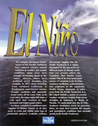
- Curious about El Niño? Check out Oregon Sea Grant’s free publication explaining the cyclic phenomenon, available as a full-color, illustrated booklet by mail or download.

