
*Please click on photos throughout to view associated captions*
Week 1:
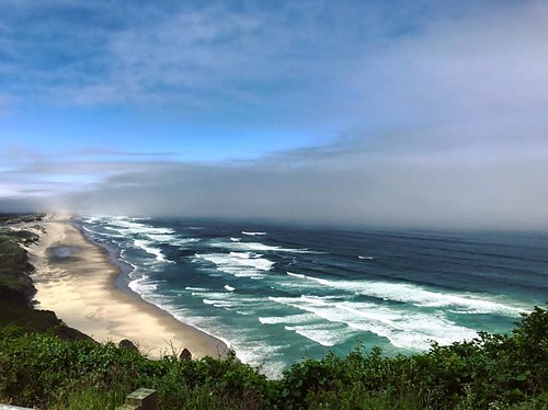
After a long day of exceptionally smooth travel (still thankful for that) I arrived in Corvallis, OR at the Oregon State University campus ready for orientation the next morning. On Monday we met up for a small, informal breakfast to finally meet the program coordinators face-to-face rather than via email, as well as the other Summer Scholars. The lax atmosphere continued throughout the day as we played (dare I say) fun ice breakers and listened to presentations on what to expect from our summers/ what Oregon Sea Grant is all about. We even went to lunch at a great little café for Mexican food before heading out to Newport to the Hatfield Marine Science Station (OSU’s marine campus). There, I got my first glimpse of Oregon coastline and met my mentor for the first time; Tony D’Andrea, project leader/supervisor for Oregon Dept. of Fish and Wildlife’s Shellfish and Estuarine Habitat Assessment of Coastal Oregon (SEACOR) project through the Marine Resources Program. I got to spend the night there and hang out with my fellow scholars and other students staying in the housing on campus, which was a very fun way to relax after a day of information overload and recovering from jetlag.
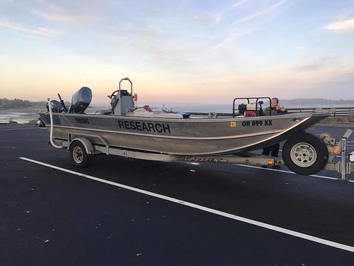
Day 2 began with a riveting session of paperwork and reading of lengthy protocols to learn just what it means/takes to be part of ODFW. We took the forms mobile as we started the drive from Newport to my final destination of Charleston- I signed many a form to indicate my understanding of safety procedures and agency policies (the scenic ocean views from the pacific highway were a frequent and welcomed distraction throughout). I felt very official and excited to be an employee of a state agency that does so much. Once we got to Charleston, a town on Coos Bay where I would be living and working, I checked into my room at the Oregon Institute of Marine Biology (The University of Oregon equivalent of OSU’s Hatfield campus) and unpacked a little bit before meeting back up with Tony. We toured the lab we’d be using which is shared with researchers from the South Slough estuary, the garage where all our equipment is stored, the boat, and the ODFW office where I got to meet more members of the agency. Everyone was very nice and answered my barrage of questions (I feel like my first week was essentially me asking everyone a million questions). I learned that my position would be aiding in field work for the shellfish assessments of Coos Bay, which would help with informing fishery regulations for the area. I would also be an extra set of hands for whichever ODFW project needed me, and I expressed a desire to be part of their community outreach and education programs, as I have a growing interest in science communication.
Wednesday morning was a 5 AM start time for field work on the boat, using a sampling method called megacoring (more on that later, when I can use photos to accompany the description: a picture’s worth a thousand words, right?). It was a brisk day, with a LOT of wind. Common for these parts, but not what I’m used to calling “summer”. The water tends to stay in the 50’s so we donned dry suits paired with fleece onesies underneath, many base layers, extra socks, boots, and our ODFW hats (which I’m still stoked about) to stay warm. After a few hours in the field, we returned to land to rinse off the boat and sampling materials. I discovered there’d been a tear in my suit and I ended up soaked from the waist down- just my luck, but a good reintroduction to the joys of field work. Thursday (day two of 5 AM start time) was originally going to be like Wednesday, with more work from the boat and some new stuff (for me) surveying low tide habitat. However, mother nature had her own plan of very high wind speeds, so we opted to stay close to land and conduct the surveys at a nearby tidal flat site- Charleston Triangle.

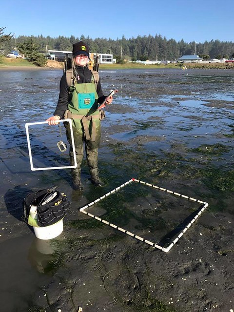
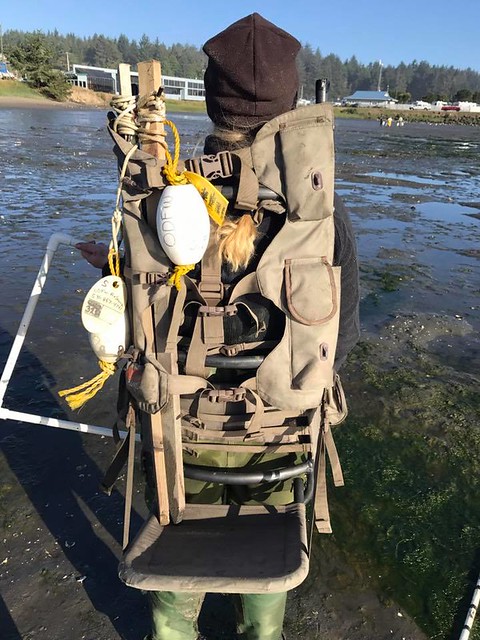
Methods: The sampling strategy used for these surveys is called the Rapid Assessment Method (RAM). Previous bathymetry data is used to map tidal levels across the study area, ensuring that samples were taken across all tidal elevations. A handheld GPS is programmed with randomly generated waypoints displayed both as a grid and as points spread intermittently between rows.
At each waypoint designated “grid” a 1 m2 quadrat is placed, and before any disturbance occurs, a photo is taken with the site location and waypoint number for identification purposes. Within the quadrat environmental data such as sediment temperature, anoxic layer depth, and sediment type are taken. Biological data including percent of algal or eelgrass cover on surface, shrimp borrow density, clam “show” density, and physical presence of clams living below the surface are taken. This is done by using a hand rake to disturb the top ~15 cm of sediment. Species observations are also made for a 2 m radius surrounding the quadrat, which can be used to dub the area a clam/shrimp bed, even in the absence of those organisms within the quadrat.
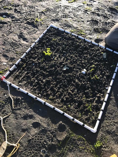
For the “random” waypoints the Detailed Assessment Method (DAM) is employed in addition to RAM. The supplementary data includes collecting above-ground eelgrass blades and sediment samples for total organic carbon and grain size analyses. The eelgrass samples were collected in a 0.25 m2 quadrat within the larger quadrat. The placement is determined by a random number generator. The same goes for sediment samples within the larger quadrat. These waypoints are also marked with a stake and attached buoy for future megacoring sampling.
By Thursday afternoon I was pretty much exhausted from traipsing in the mud (sorry for all the yawning, Tony) as we went over ODFW’s payroll system and I was given my employee computer login, with access to project files and agency documents.
5 AM Friday came all too soon, but as we had accomplished so much the day before, and Charleston Triangle is a fairly small site, we were able to finish the rest of the waypoints quickly, resulting in an early end to the day. J I used that time to take a sizeable nap, start this blog post, and spend some time in the nearby Marine Life Center (which I know I’ll be returning to since it’s free, interesting, and the volunteers are super nice!).
I also took time throughout the evenings/weekend to make friends with other interns living in my hallway and their friends from the South Slough Estuary Research Reserve. We lit off sparklers, took many a trip to Walmart, and hiked out to waterfalls at Golden and Silver Falls State Natural Area. The beauty of Oregon is absolutely awe-inspiring, and I am so glad I get to experience it.