OSU unveils new maps of Oregon ocean

Map of sea floor off Cape Arago
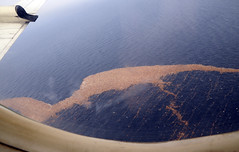
CORVALLIS – After more than two years of intense field work and digital cartography, researchers have unveiled new maps of the seafloor off Oregon that cover more than half of the state’s territorial waters – a collaborative project that will provide new data for scientists, marine spatial planners, and the fishing industry.

The most immediate benefit will be improved tsunami inundation modeling for the Oregon coast, according to Chris Goldfinger, director of the Active Tectonics and Seafloor Mapping Laboratory at Oregon State University, who led much of the field work.

“Understanding the nature of Oregon’s Territorial Sea is critical to sustaining sport and commercial fisheries, coastal tourism, the future of wave energy, and a range of other ocean-derived ecosystem services valued by Oregonians,” Goldfinger said. “The most immediate focus, though, is the threat posed by a major tsunami.

“Knowing what lies beneath the surface of coastal waters will allow much more accurate predictions of how a tsunami will propagate as it comes ashore,” he added. “We’ve also found and mapped a number of unknown reefs and other new features we’re just starting to investigate, now that the processing work is done.”

The mapping project was a collaborative effort of the National Oceanic and Atmospheric Administration, OSU’s College of Earth, Ocean, and Atmospheric Sciences, David Evans and Associations, and Fugro. It was funded by NOAA and the Oregon Department of State Lands.

The primary mapping platform was the vessel Pacific Storm, operated by the OSU Marine Mammal Institute. Oregon-based fishing vessels taking part in Oregon Sea Grant’s Scientist and Fisherman Exchange program – the F/V Michelle Ann, the F/V Delma Ann, and the F/V Miss Linda – assisted with ground truth sampling and video surveys.

Sea Grant teams with state agencies to prepare for Japanese quake debris

Model of possible debris dispersal - image courtesy of NOAA

Model of possible debris dispersal (image courtesy of NOAA)

As the one-year anniversary of Japan’s devastating earthquake and tsunami nears, Oregon Sea Grant is teaming with state and local agencies, non-governmental groups and marine scientists to prepare for the possible arrival of earthquake debris on Oregon shores.

In a conference call this week, the group heard that state and county leaders, OSU Extension and the Hatfield Marine Science Center are receiving growing numbers of  questions about the debris currently floating toward US coastlines, and began charting a communication strategy to help answer those questions.

OSU oceanographer Jack Barth, an expert in ocean currents, said the debris is still months away from making West Coast landfall, although  occasional buoyant items might move more quickly.  In October, a Russian ship discovered a small Japanese fishing boat in the waters north of Hawaii, and it was definitively tied to the tsunami, Barth said. “It was about where we thought it should be, given the currents.”

Many questions about the debris have to do with concerns that it might be radioactive, given the the incidents at Japan’s Dai-ichi nuclear plant that followed the earthquake. Kathryn Higley, professor and head of the Department of Nuclear Engineering and Radiation Health Physics at OSU, said the lag time between the tsunami and the nuclear incident, coupled with the vastness of the ocean, makes it unlikely that the debris will pose any radioactive risk. The material has been tossed by wind and sea for months now, Higley said, and most traces of radioactive elements will have washed into the sea. “While we may be able to detect trace amounts of radioactive material on this debris, it’s really unlikely that there will be any substantial radiation risk,” she said.

Meanwhile, Oregon Sea Grant’s marine Extension specialists on the coast have been working with multiple public and private partners, from state and local governments to conservation and fishing industry groups, to map out a communication strategy for the debris landing.

Jamie Doyle, Sea Grant Extension specialist in in Coos and Curry counties, said one concern is what happens to personal effects that survive the ocean crossing and wind up on Oregon shores, where they may be found by beachcombers.

“A lot of people lost their lives, and many people still have family members who are missing,” Doyle said. “We need to be sensitive to the possibility of finding something that may be of personal significance to someone in Japan.”

The Seattle office of the Consulate General of Japan has asked that those who find something that could  be considered a personal keepsake or artifact report it to local authorities, or to  the consulate in Seattle at 206-682-9107.

Patrick Corcoran, Sea Grant’s Astoria-based Coastal Hazards specialist, said Oregon’s focus thus far has been on research and “building the capacity to respond” to the arrival of the debris. Specific information will be forthcoming, he said.

Learn more:


Goodbye, Wecoma; hello, Oceanus

R/V WecomaNEWPORT – The Research Vessel Wecoma, which has been serving Oregon State University marine scientists for more than 35 years, is being retired from service and replaced with a somewhat smaller ship from the University National Oceanographic Laboratory System fleet.

The 184-foot Wecoma made her last cruise in November; her replacement, the Oceanus, is expected to dock in Newport in February, after making the long voyage from her former port at the Woods Hole National Oceanographic Institute on the East Coast, down through the Panama Canal and up the Pacific Coast to Oregon. A retirement celebration for the Wecoma will be held at the Hatfield Marine Science Center in Newport in March.

Both vessels are owned by the National Science Foundation, and operated by the University National Oceanographic Laboratory System, a consortium of 60 academic research institutions that operate 16 vessels around the country.

Mark Abbott, dean of the College of Earth, Ocean, and Atmospheric Sciences at OSU, had approached the National Science Foundation for  a rapid analysis of the two ships to see which one would be more cost-effective to operate over the next several years.  A team of technicians returned the verdict – a strong recommendation for the 177-foot Oceanus – after discovering some problems with corrosion and other issues with the Wecoma.

R/V Oceanus“There are a few differences in science capabilities,” Abbott said, “but Oceanus is very capable and will be more cost-effective to operate over the next five to 10 years, at which point we hope to have a new ship.’

Read the full story from OSU News & Research Information

OSU merges ocean, geoscience programs to create new Earth, Ocean and Atmospheric Sciences college

CORVALLIS – A new College of Earth, Ocean and Atmospheric Sciences has been formed with the merger of Oregon State University’s College of Oceanic and Atmospheric Sciences and Department of Geosciences.

The new college, dubbed CEOAS, will focus on the basic sciences of the Earth system. “The new name captures both the existing strengths of Geo and COAS and opens the door for new programs in research and education regarding our home planet,” wrote Rebecca Warner, Senior Vice Provost for Academic Affairs, in an email formally announcing the merger to the campus community on Friday.

CEOAS will house OSU undergraduate programs in Earth Science, Geography, Geology, and Environmental Sciences, as well as a new BS in Earth Sciences  with options in Earth Systems, Geology, and Geography, replacing the existing degrees in Earth Science, Geology and Geography.

Remaining unchanged are graduate programs in oceanic, earth and atmospheric sciences, geology, geography, and Marine Resource Management, as well as bachelor’s degree programs in environmental sciences.

Several Oregon Sea Grant faculty are affiliated with oceanic and atmospheric sciences, and Extension Sea Grant  Community Outreach specialist Flaxen Conway was recently named director of the Marine Resource Management program.

Debris from Japanese tsunami slowly making its way toward West Coast

Debris from Japanese tsunami floats in Pacific in mid MarchA massive trail of debris from the devastating tsunami that struck Japan on March 11 is slowly making its way across the Pacific Ocean en route to the West Coast of the United States, where scientists are predicting it will arrive in the next two to three years – right on schedule.

The mass of debris, weighing millions of tons and forming a trail a thousand miles long, will likely strike Oregon and Washington, according to models based on winds and currents.

But new accounts of where the trail has progressed suggest that at least some of that debris may peel off and enter the infamous “Garbage Patch,” a huge gyre in the Pacific where plastic and other debris has accumulated over the years, according to Jack Barth, an Oregon State University oceanographer and an expert on Pacific Ocean currents and winds.

“Recent reports of debris are from farther south than the axis of the main ocean currents sweeping across the north Pacific toward Oregon,” said Barth, a professor in OSU’s College of Oceanic and Atmospheric Sciences. “This means a fair amount of debris may enter the patch. We should still see some of the effects in Oregon and Washington, but between some of the materials sinking, and others joining the garbage patch, it might not be as bad as was originally thought.”

Read more from OSU News & Research Communications

(Photo courtesy of  US Pacific Fleet gallery on Flickr)

Marine educator blogs from shipboard

Bill Hanshumaker, Sea Grant’s marine educator at the Hatfield Marine Science Center, is blogging from sea off the Pacific coast this week as he travels with scientists seeking to learn more about seafloor geology and earthquakes.

The team is traveling aboard OSU’s R/V Wecoma with a crew from the Cascadia Initiative, an onshore/offshore seismic and geodetic experiment that studies questions ranging from megathrust earthquakes to volcanic arc structure to the formation, deformation and hydration of the Juan De Fuca and Gorda plates.

The team takes advantage of an Amphibious Array of 60 ocean-bottom sensors installed with funding from the 2009 US Recovery Act to improve undersea earthquake monitoring and advance our understanding of geologic processes in the seismically active region off the coasts of Oregon, Washington and Northern California. The system also includes onshore GPS stations and earthquake monitoring instruments. Participating institutions include Columbia University, IRIS, Scripps Institution of Oceanography, Woods Hole Oceanographic Institution and UNAVCO, a nonprofit consortium of universities supporting geoscience research and education.

This is the third major research cruise over the past decade for Dr. Hanshumaker, who has been educating the public about science for 16 years at the HMSC Visitor Center, and before that, at the Oregon Museum of Science and Industry.  In 2005 and 2006, he joined  the Sounds From the Southern Ocean cruises with a team led by NOAA/OSU researcher Bob Dziak, who is also one of the principle investigators on the current project.

As he’s done on previous research voyages, Bill is blogging about the voyage, the research and the research team, this time from http://blogs.oregonstate.edu/billgoestosea.

Shipboard blogging can be a challenge, thanks to a hectic research schedule and unpredictable Internet access, but Bill is posting as time and conditions permit, and also plans to share the experience with Visitor Center audiences on his return to Newport.

Volcanic vents offer peek at acidic future

The underwater volcanoes off a tiny Italian island are helping scientists peer into the future of a world altered by increasing amounts of carbon dioxide emitted into the air and absorbed into the oceans.

The waters just off the island of Ischia mirror the projected conditions of the Earth’s oceans at the beginning of the next century because the volcanic vents found there infuse the water with large helpings of carbon dioxide, or CO2, which turns seawater acidic.

Research has shown that the growing acidic conditions are harmful to some sea creatures — those that build their protective shells with calcium are increasingly prevented from doing so the more acidic waters become.

The fates of these creatures and the stability of the ocean food chain are a major concern over the next century and beyond because of the carbon dioxide being released into the atmosphere by humans, as the oceans absorb about 30 percent of this carbon dioxide.

“One part of climate change that is indisputable is that CO2 is rising in the atmosphere — it’s easy to measure,” said Bill Chadwick, an Oregon State University geologist. “And it’s indisputable that it is making the oceans more acidic — we can measure it.”

(Oregon Sea Grant has supported previous deep-sea research projects by Dr. Chadwick).

Annie and Michael: Back to sea

Michael and Annie aboard the Wecoma, 2010Michael Courtney and Annie Thorp, “intrepid volunteers” at OSU’s Hatfield Marine Science Center, are heading back out to sea  to assist on not one, but two research cruises. And they’re reviving their blog,  Buoy Tales, to chronicle their experiences.

The Salem couple launched the blog (with help from Oregon Sea Grant) in 2010  to record their participation in a five-week cruise aboard OSU’s R/V Wecoma, servicing NOAA buoys along the equator that gather and transmit valuable data about ocean conditions. It was their second cruise as research volunteers.

Recently, Michael writes, they were asked on the same day to take part in two more cruises “so of course we said yes.”

They’ll depart Seattle this Friday (Aug. 29) aboard the Thompson, a research vessel operated by the University of Washington’s School of Oceanography. The ship’s mission is to recover an acoustic device sitting on Pioneer Mount, an undersea range off Half Moon Bay, Calif. The recovery cruise is expected to last until Aug. 9.

On Oct. 3, Annie and Michael ship out again on the R/V Wecoma for a cruise expected to last through Oct. 11.

To follow their adventures, visit the blog and  subscribe to its RSS feed or sign up for email notification when new posts are published.


NOAA Day at HMSC June 11

NOAA ship Bell ShimadaNEWPORT –  This Saturday, June 11, is NOAA Day at the Hatfield Marine Science Center,  and a great time to learn more about the marine research conducted by the federal government’s Pacific Research Fleet, which is in the process of relocating to Newport.

The new Newport Marine Operations Center – Pacific will complement the activities of  NOAA researchers who have been based at the HMSC for decades.  On Saturday, visitors will have opportunities to learn about the scientists who rely on the NOAA ships to conduct their fisheries and oceanographic research as well as the NOAA Corps, whose officers and staff operate the ships and manage the fleet.

Scheduled activities include:

  • 11:00am – 11:45am – Dr. Stephen Hammond, Chief Scientist, NOAA Office of Ocean Exploration and Research will present “Exploring the Ocean – New Discoveries”. The short video clips and PowerPoint presentation will include information about coming activities at the cabled observatory offshore at the Axial Volcano.
  • 12:00pm – 12:45pm – “Using Long-term Ocean Observations to Forecast Salmon Returns” presented by Dr. Bill Peterson, Senior Scientist, NOAA Fisheries, Northwest Fisheries Science Center
  • 1:00pm – 1:30pm -“Giant Pacific Octopus Feeding” presented by Dr. Bill Hanshumaker, Public Marine Education Specialist, Oregon Sea Grant
  • 1:30pm – 2:30pm – “The Power of Art and Narrative to Make Fisheries Issues Easier to Understand”. Award winning author/illustrator of ten books, Taylor Morrison, will give a brief presentation about the creation of his latest book A Good Catch. Original paintings, sketchbooks, and storyboards will be on display. Following the presentation Taylor will be signing copies of the book made available for free, courtesy of NOAA.
  • 2:30pm – 3:30pm – “Science and Service in the NOAA Fleet”. Learn about the NOAA fleet’s upcoming missions. Presented by NOAA Corps officer Russell G. Haner of the Northwest Fisheries Science Center.

NOAA researchers in Newport record sounds of March 11 earthquake

NEWPORT – Earthquakes are felt more often than heard, but Oregon scientists say the sound of the March 11 Japan earthquake alone could help improve our ability to detect earthquakes and volcanic eruptions in the deep ocean.

Image of NOAA/PMEL sound recording

Scientists with the NOAA Vents Program at Pacific Marine Environmental Laboratory captured the sounds of the earthquake using an underwater microphone near the Aleutian Islands – 900 miles from the quake epicenter.

“The Japan earthquake was the largest source of ocean sound ever recorded on our hydrophone arrays. This unique record gives us insight into the physics behind how sound is transmitted from the Earth’s crust into the ocean and then propagates through the Pacific Ocean basin,” says Robert Dziak, Ph.D., a scientist with the NOAA Cooperative Institute for Marine Resource Studies (CIMRS). CIMRS is a partnership between NOAA and Oregon State University. Dziak is also the principal investigator of the Ocean Acoustic Project in the NOAA Vents Program, based in Newport.

Dziak’s team is one of many research projects taking advantage of a vast network of underwater acoustic devices (developed by the US Navy for surveillance purposes) to listen in on what’s going on deep beneath the surface of the sea. OSU’s Marine Mammal Institute has used the system, for instance, to record the voices of migrating whales as they travel around the Pacific.

Read more from NOAA and listen to the earthquake recording